
Today was a good example of how you can have a great experience while travelling even when the plans go totally pear-shaped.
Our intention today was to drive north to Nazareth and Capernaum through the territory of the West Bank, returning along the Jordan River Valley. We knew that Israelis never normally entered the West Bank and would therefore have driven to Nazareth via a long toll road that skirted around the West Bank to its west. However, as holders of non-Israeli passports we knew could enter the area controlled by the Palestinian Authority, so we set out at about 9 am for the 120 kilometre drive north.
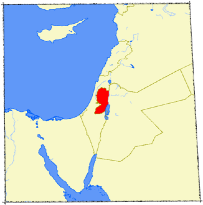
The West Bank is one of the two areas within Israel that is under the jurisdiction of the Palestinian Authority. Before the Six Day War in 1967, it was part of Jordan. Since that time it has been part of Israel (or, as some would assert, it has been under Israeli occupation). It is the larger and eastern part of the two Palestinian territories, the smaller and western part of Palestine being the very troubled Hamas-controlled area of Gaza. A large part of the West Bank area north of Jerusalem that we visited today was known in Biblical times as Samaria; it is where the ‘Good Samaritan’ of Jesus’ parable would have lived. Historically, most of the West Bank north of Jerusalem comprised Judah and Samaria, although both of these terms tend to be ‘politically incorrect’ these days because they imply Israel’s historical right to sovereignty over the territories.
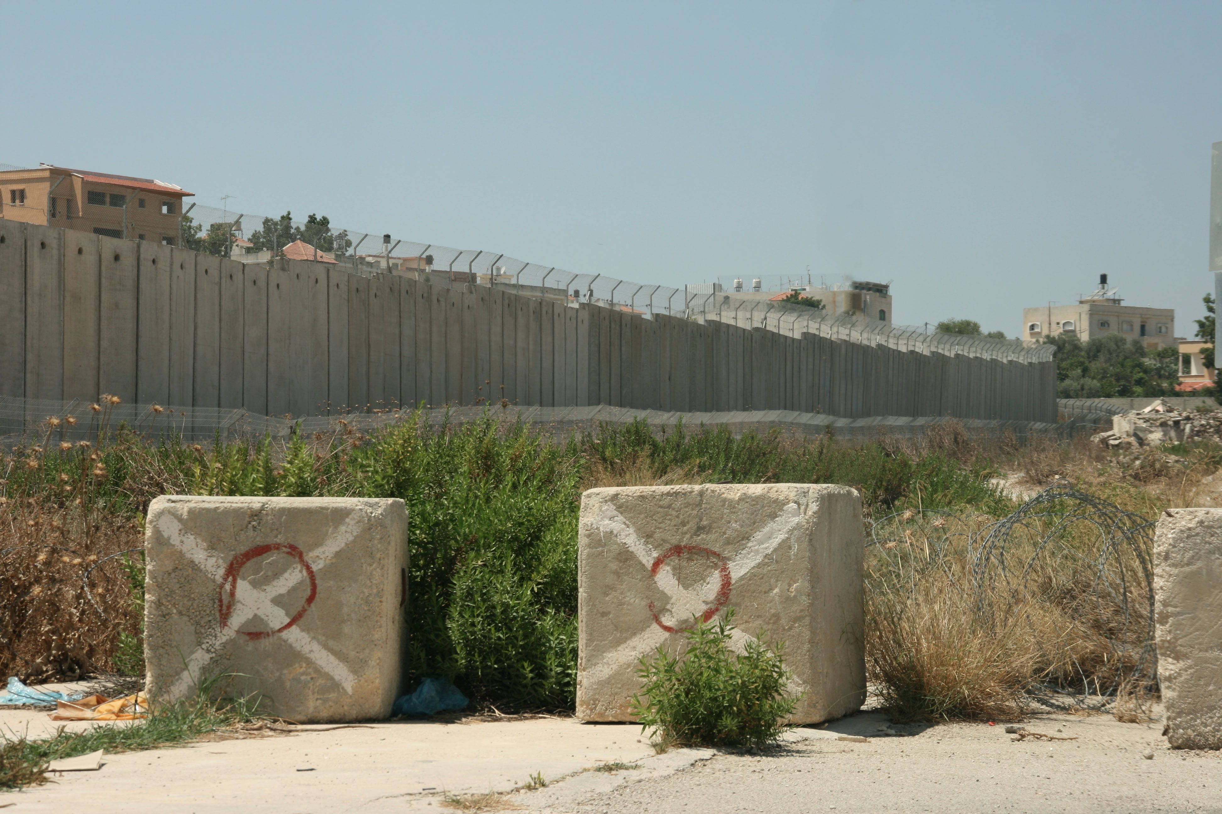
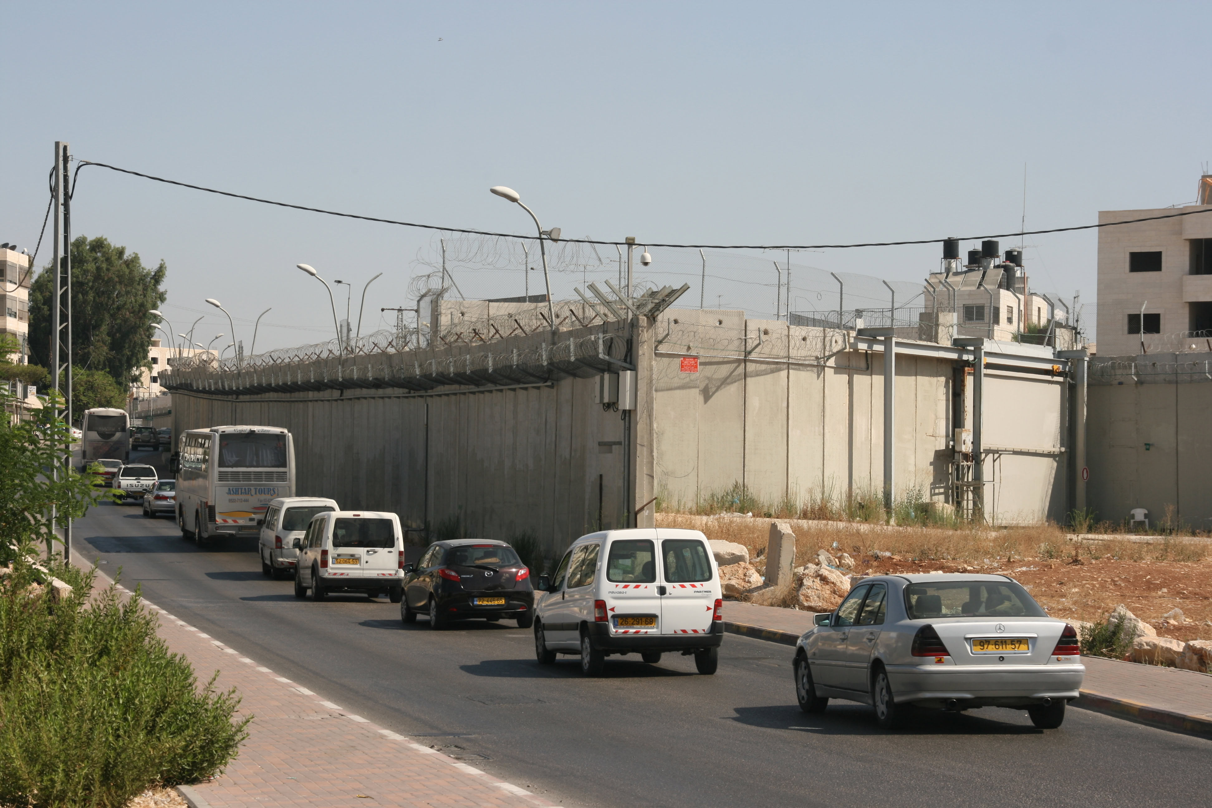
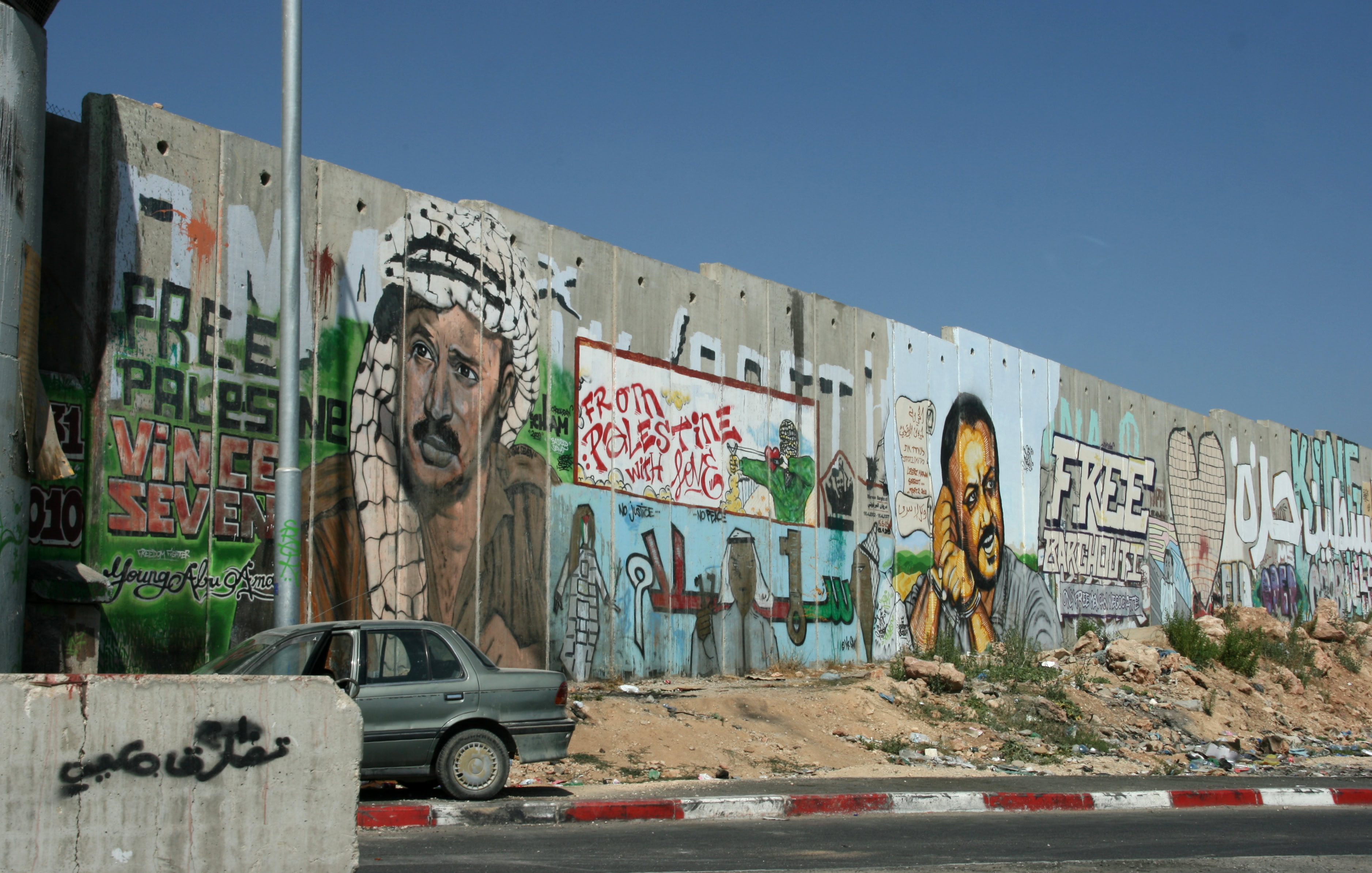
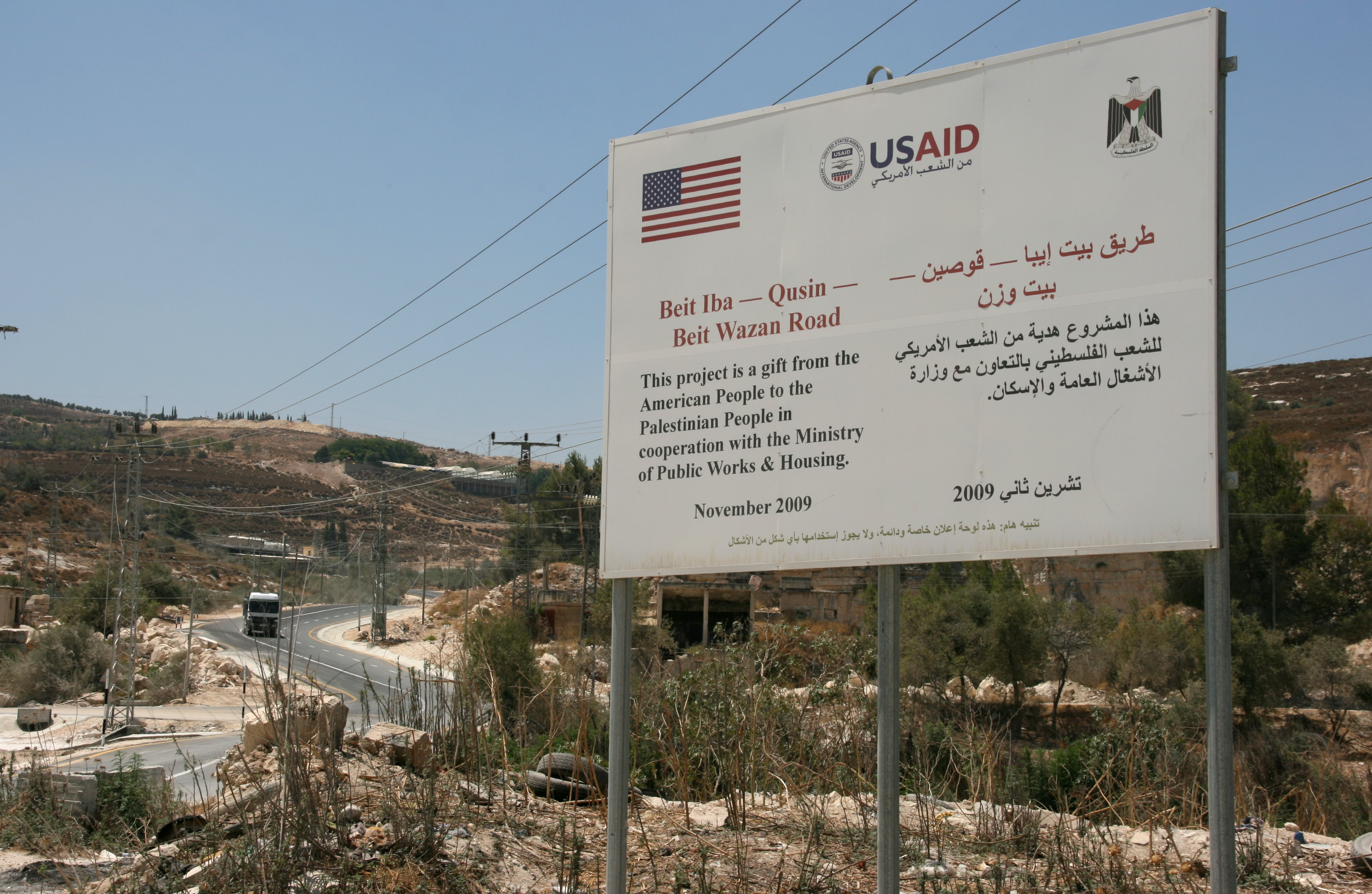
The area that is under the jurisdiction of the Palestinian Authority is defined by a large, and growing, security wall erected by the Israelis. It has been labelled the “Iron Wall”, the “Apartheid Wall” and the “New Berlin Wall” by Palestinians, but according to the Israeli government, it is officially “a separation barrier”. Construction of the “fence” (for want of a neutral term!) began in 2002, and it is still continuing. Roughly twice as high as the (original) Berlin Wall, the “fence” extends for some 650 kilometres.
We entered the Palestinian territory just a few kilometres north of Jerusalem through a very hi-tech and heavily armed security gate, which for obvious reasons I chose not to photograph. Although the “fence” is pristine on the Israeli side, parts of it are extensively decorated with politically-inspired graffiti on the Palestinian side.
Shortly after entering Palestine, we drove through Ramallah, which houses the headquarters of the PLO (Palestine Liberation Organisation). I had often heard of Ramallah in the news, and was somewhat surprised to find it located so close to (just 25 kilometres from) the centre of Jerusalem.
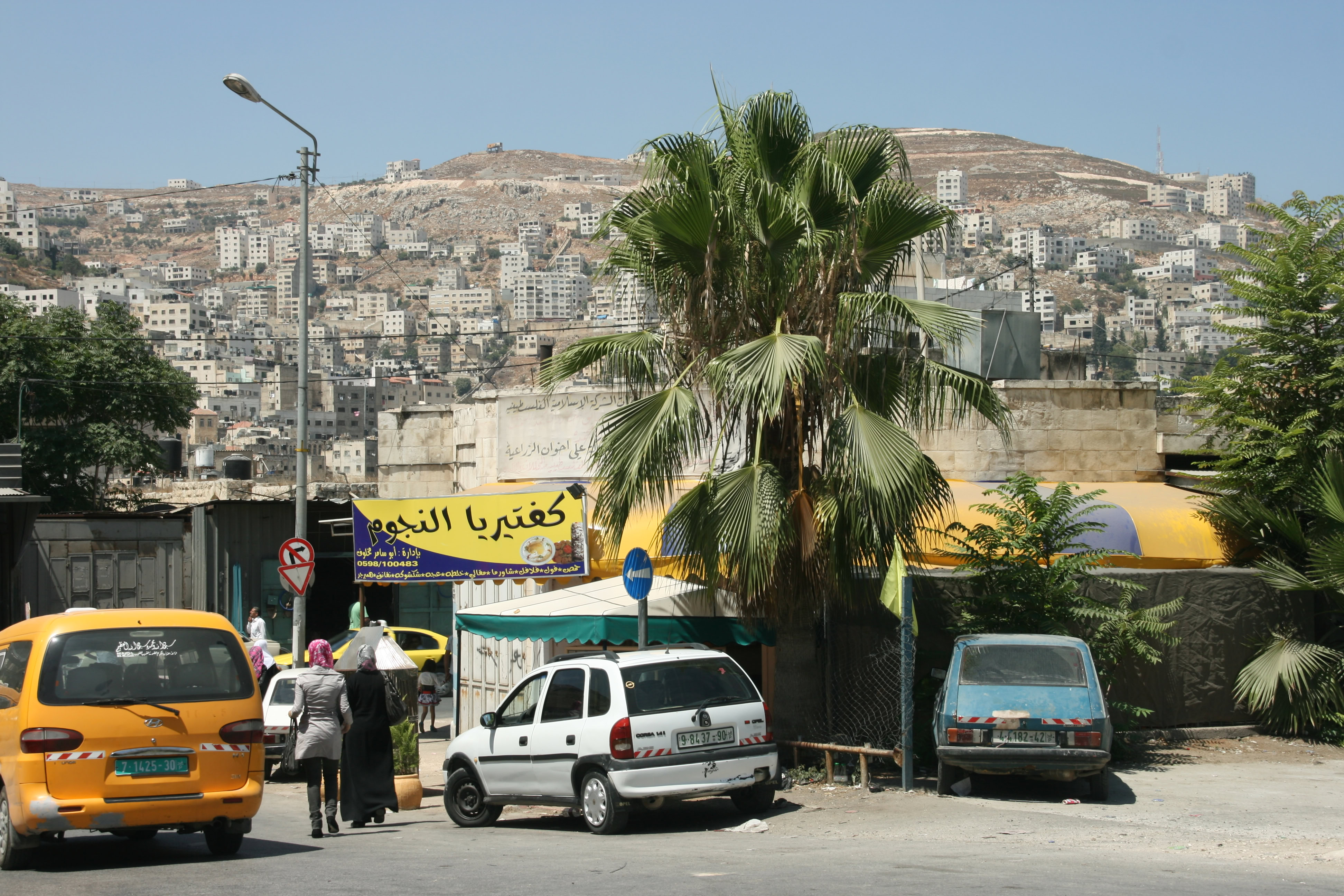
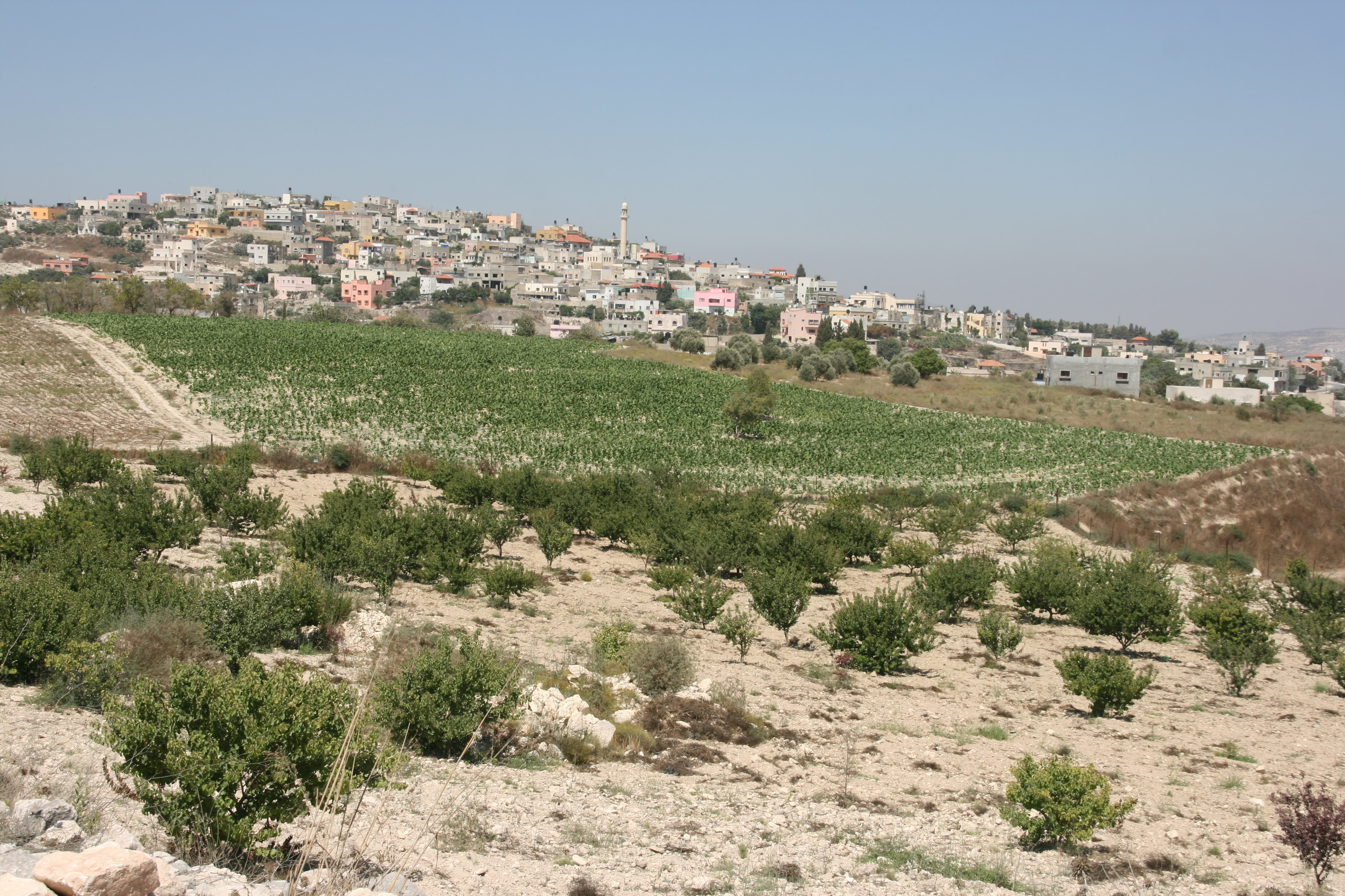
It was immediately obvious upon entering Palestine that it was indeed a nation within a nation. No Hebrew writing (and almost no English) could be found; this was very clearly an Arabic speaking area with a Middle Eastern character. Palestinian flags flew in many areas, and the only Israeli flags seen were on security check points or above some of the heavy protected new settlements of Israelis that are being established within Palestine, mainly close to Jerusalem. The cars had completely different license plates from Israel, and the level of economic development was markedly lower than that in Israel. I felt that the West Bank resembled an older and poorer version of Jordan rather than the affluent and economically advanced situation across the “fence” in Israel.
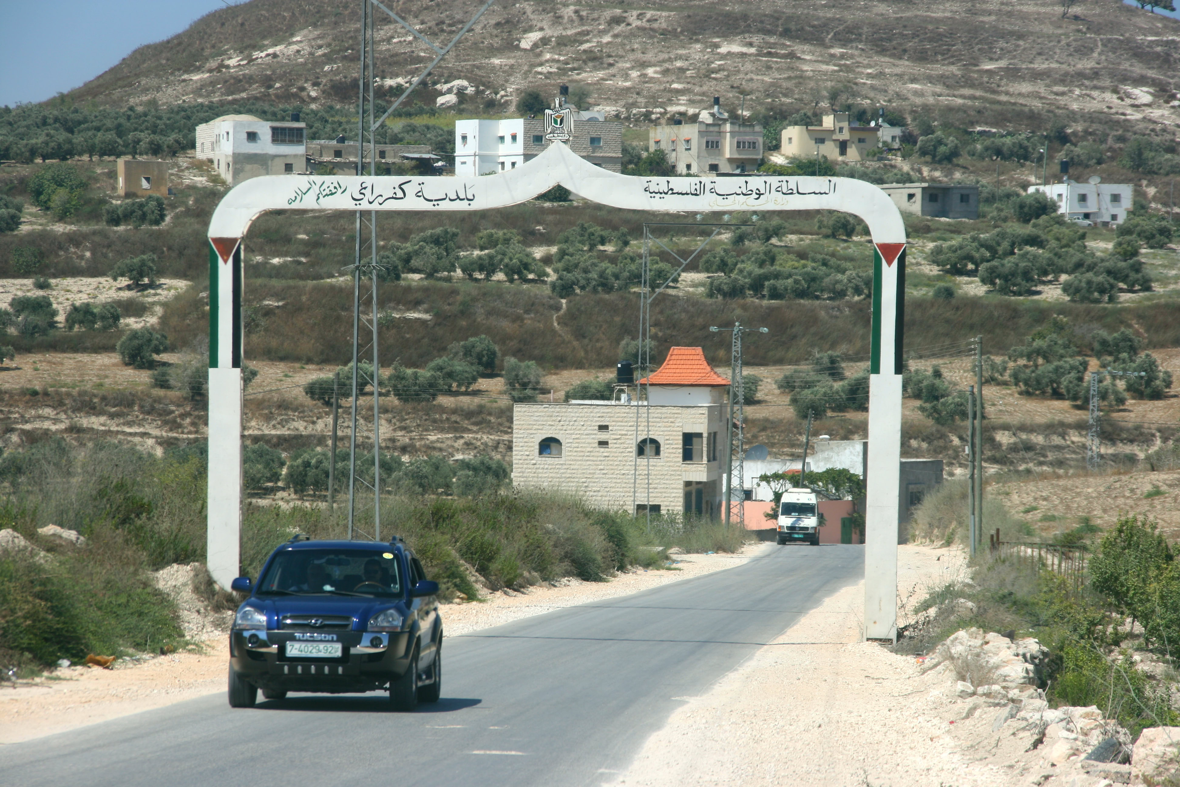
From Ramallah we drove northwards, following a twisting ensemble of back roads, through Nablus and beyond. Our planned route was to take us through a city named Jenin. Unfortunately, all roads in and out of Jenin seemed to be closed, presumably for security reasons as the city has been the site of violent clashes recently between Palestinian residents and Israeli forces. Therefore, we took and even more esoteric collection of back roads to try and find our way around Jenin, none of which was sign posted. Fortunately, the sun was shining brightly so we were able to get our general bearings using the shadows.
Eventually, we reached a large army check-point near the town of Rumana, near the northern boundary of the West Bank. The duty officer took our passports and made some long phone calls, and eventually returned with the disappointing news that for security reasons we could not proceed, and we should try another check-point about 10 kilometres to the south-west. We drove to that check-point at Barta’a, where a small, heavy-armed gate, overseen by a tall watchtower and masses of barbed wire, provided an exit point from Palestine into Israeli territory.
While Di and Andrew waited in the car, I took our passports into the processing room and negotiated with the army officers through the triple-glazed bullet-proof glass window. Unfortunately, my mellifluous words were no match for the three semi- automatic machine guns facing me, and the soldiers explained that this crossing point could be used only by a handful of local people who had legitimate business to cross the border. So even though ‘real’ Israel was just a few steps away, we were denied access, and the soldiers suggested I try the Rumana check-point about 10 kilometres away.
When I explained that we had just come from there, the soldiers were very apologetic and, without really making Palestine sound like a huge prison, they explained that the only sure way of getting out was to take the long road south through Ramallah to Jerusalem. And so we did, passing by beautiful villages, through interlocking hills and steep valleys with dry slopes vegetated by scattered olive trees, much as they would have looked in Jesus’ day when he walked through these same valleys on his way from Jerusalem to Galilee.
The top photo in the column of images on this page shows the farthest limit of our journey today, the “fence” at Barta’a as seen from the Palestinian side, which was (as you will now understand) the only perspective we were able to get. The buildings that can be seen on the other side of the fence show how close we were to Israeli territory.
Our plan for tomorrow is to try again to get to Nazareth and Galilee, and we have already decided to take the toll road that skirts around the “fence”.