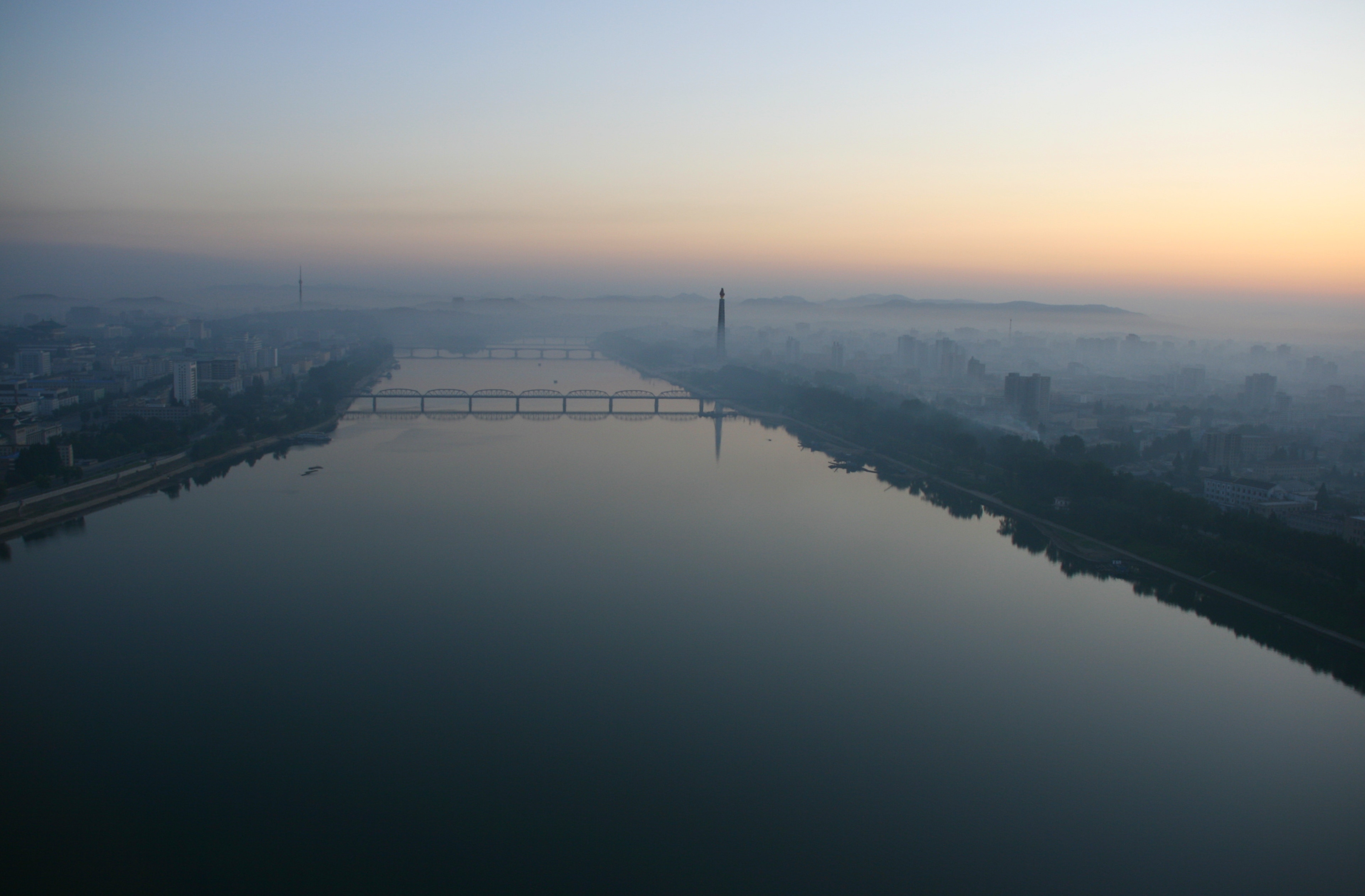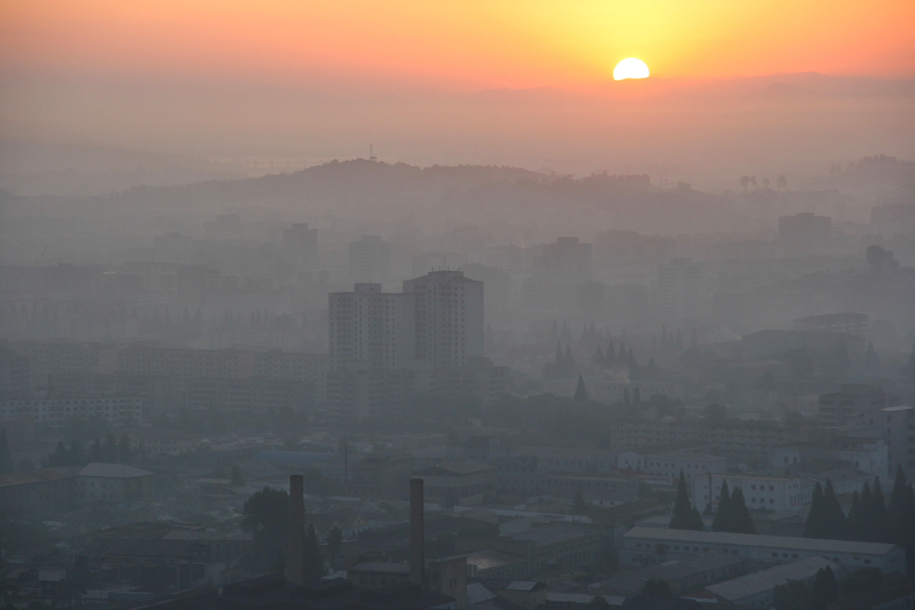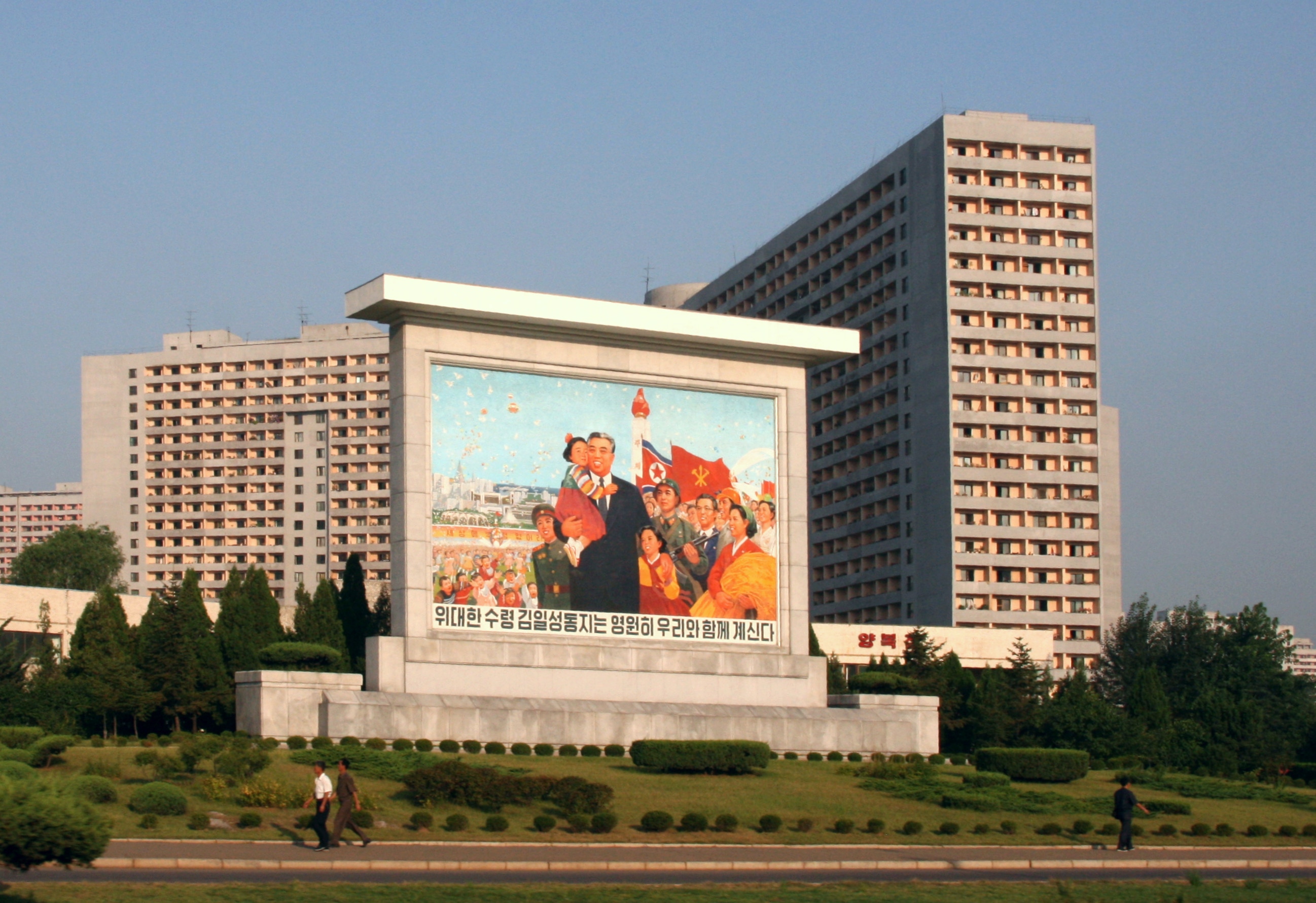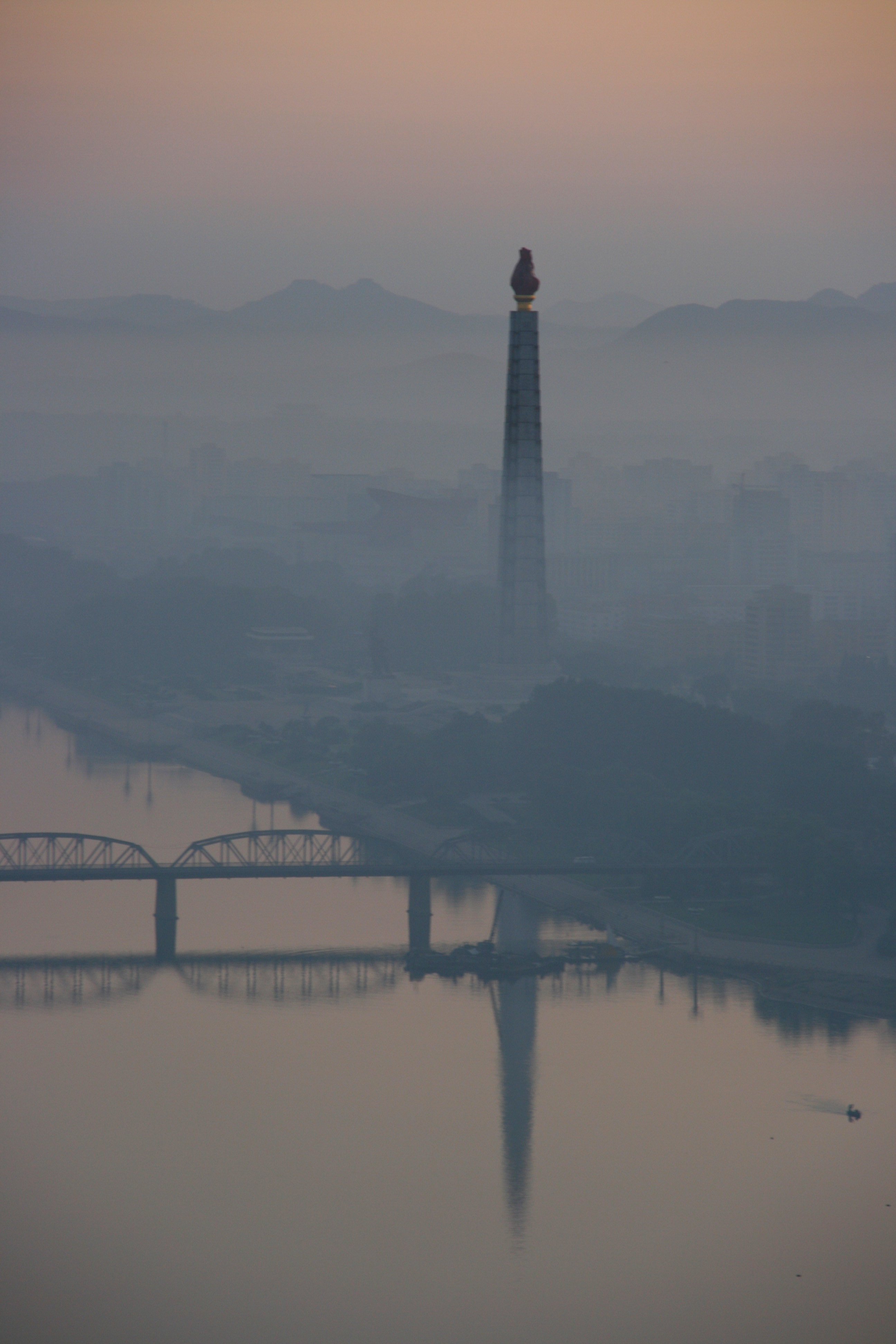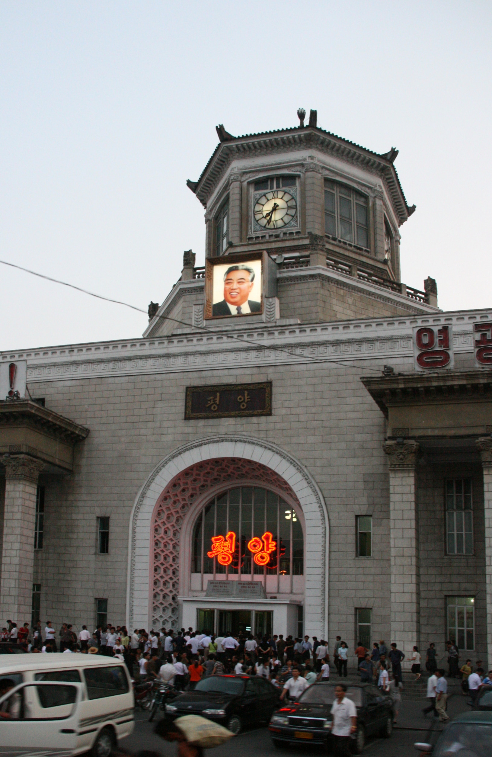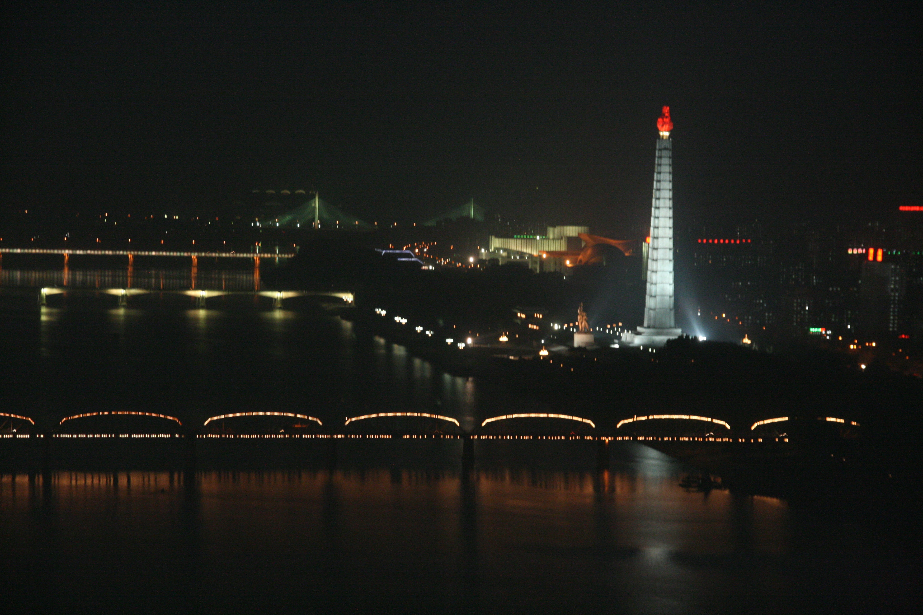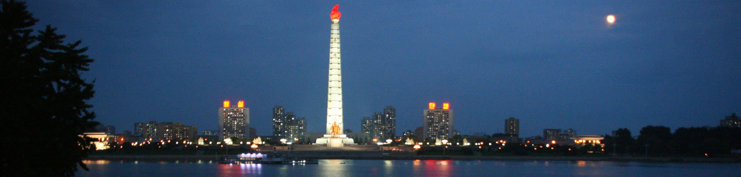

This morning’s wake up call came at 5:45 am, a perfect time to see the sun rising over eastern Pyongyang from the window of my room. It was a magnificent sight as the huge orange ball of light illuminated the city, with swirling morning mists over the Taedong River and the tall Tower of the Juche Idea, with its red flame-shaped top, rising through the mists into the skies overhead.
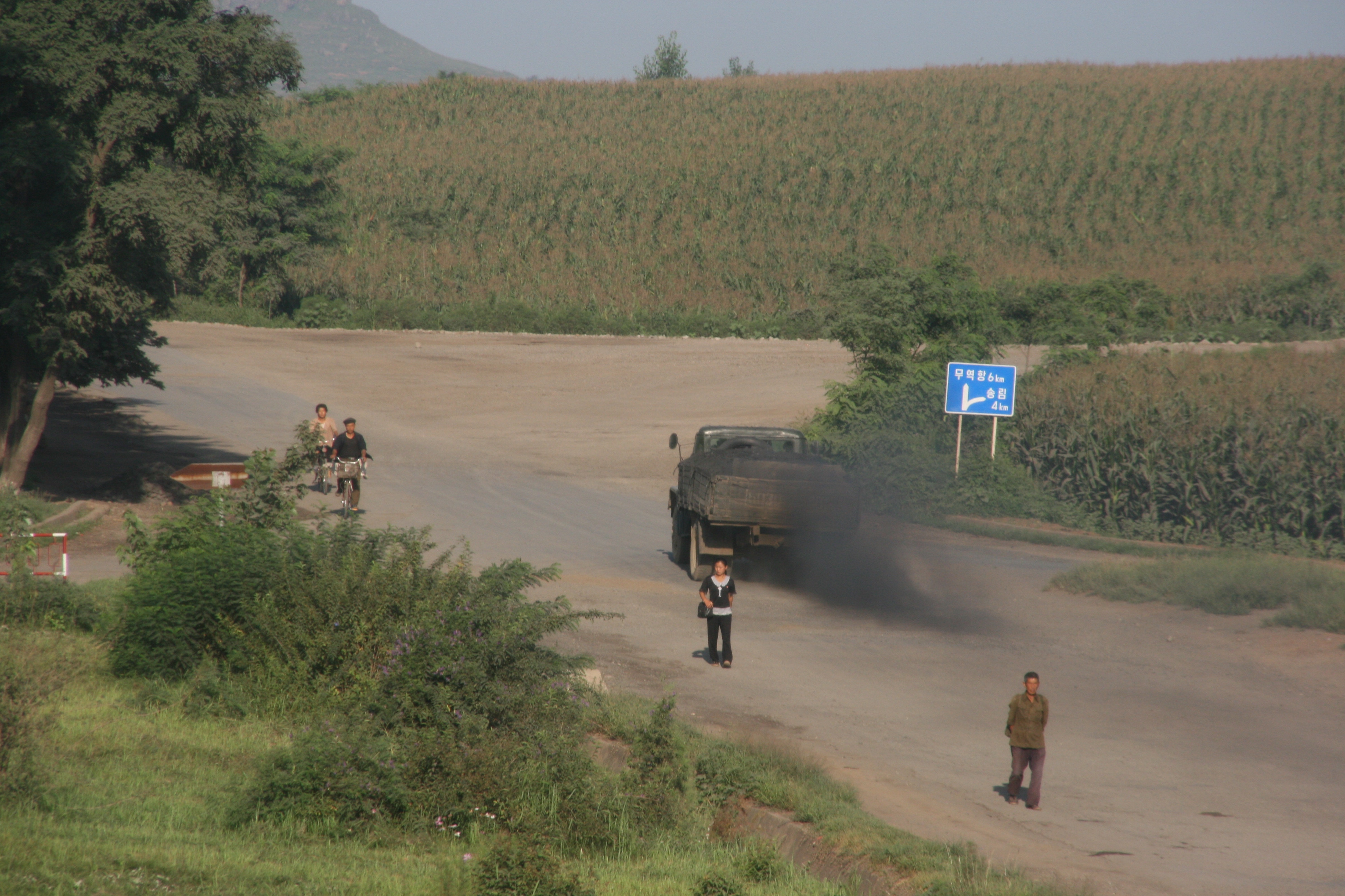
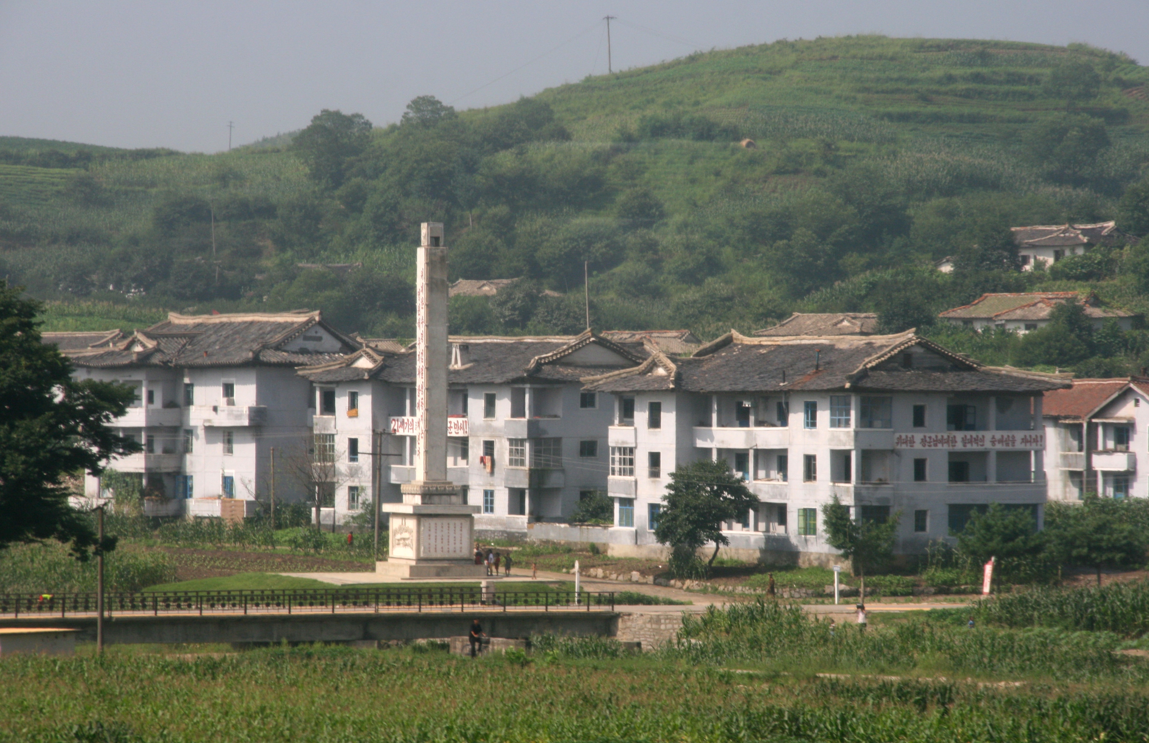
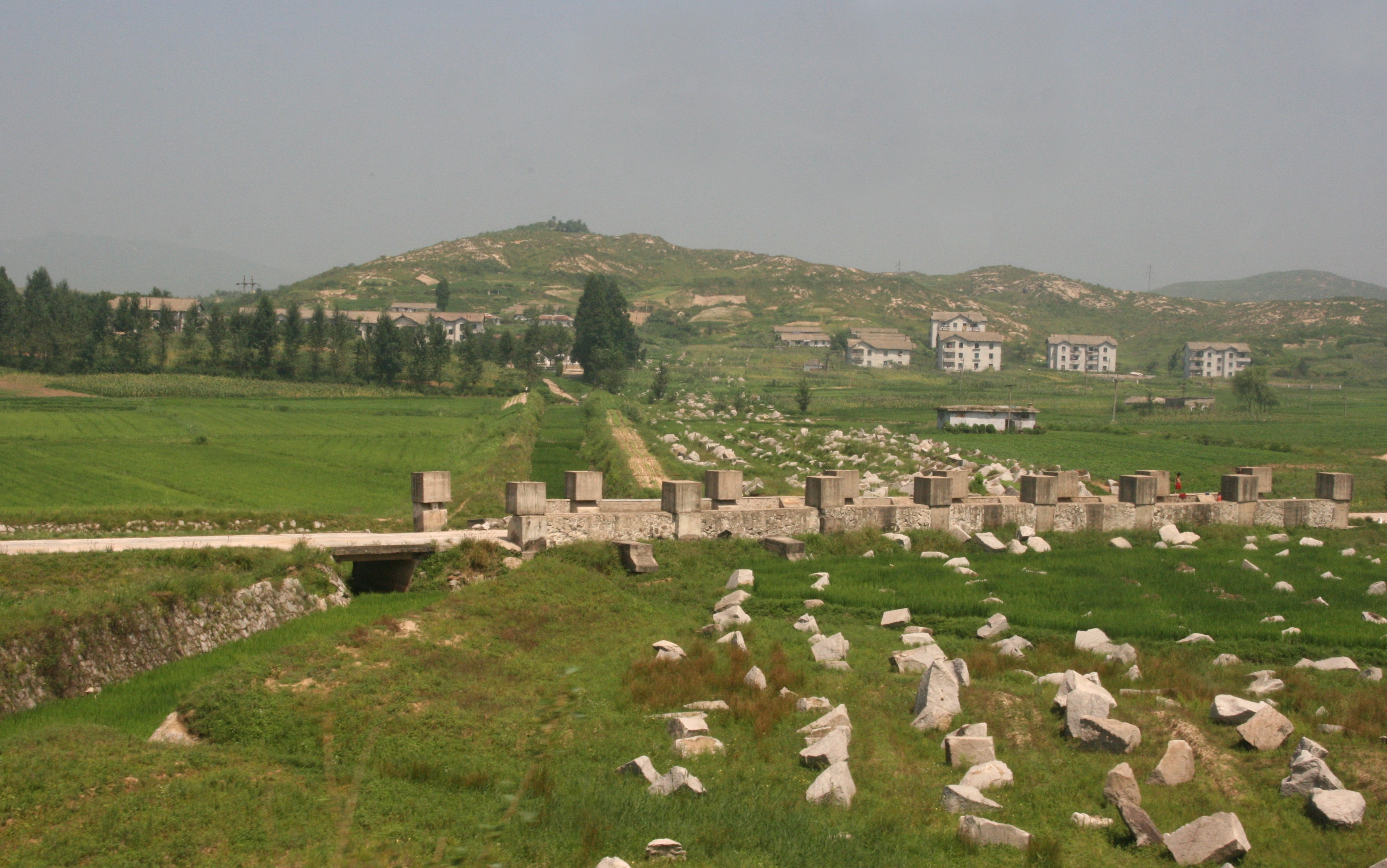
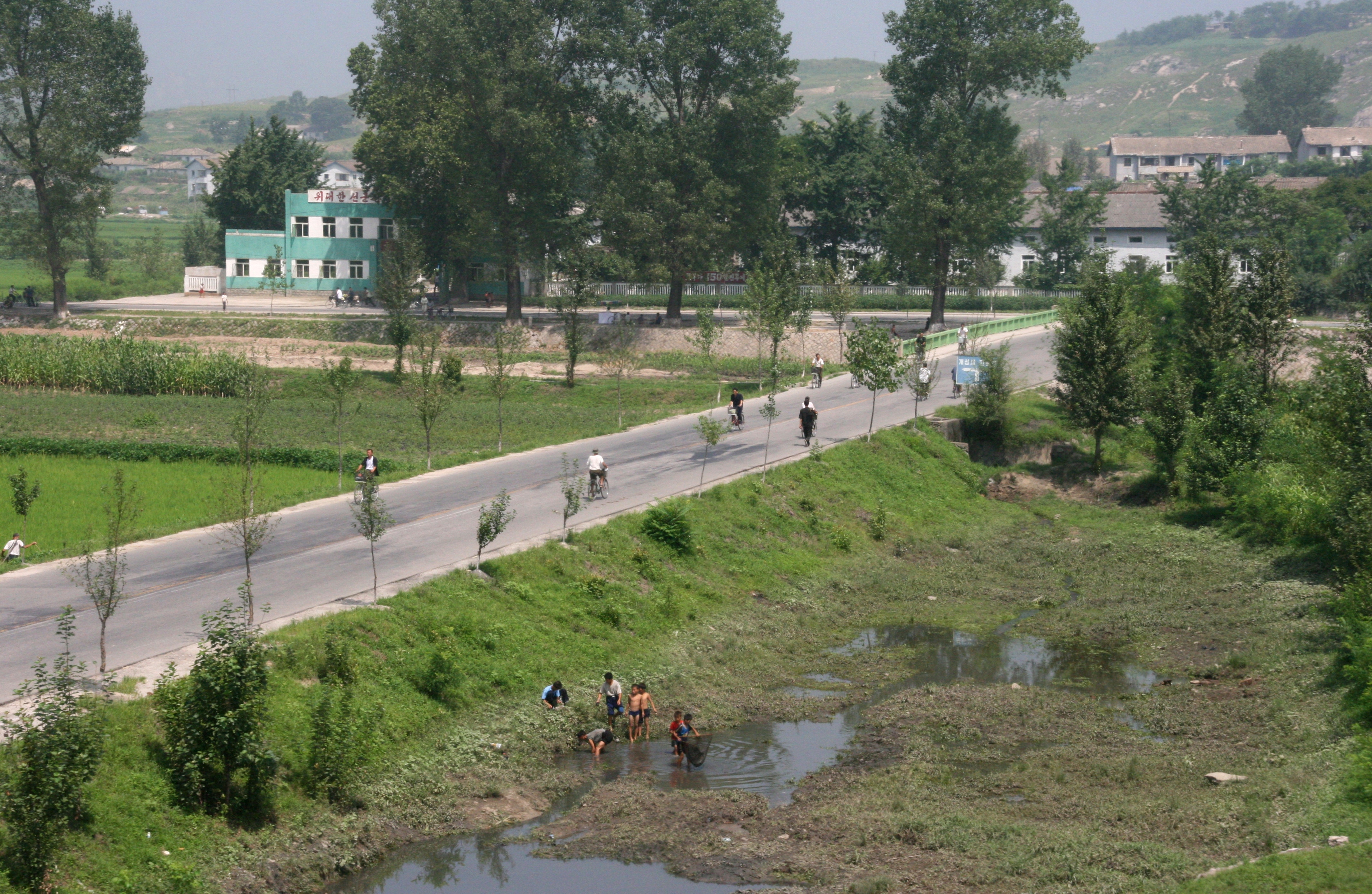
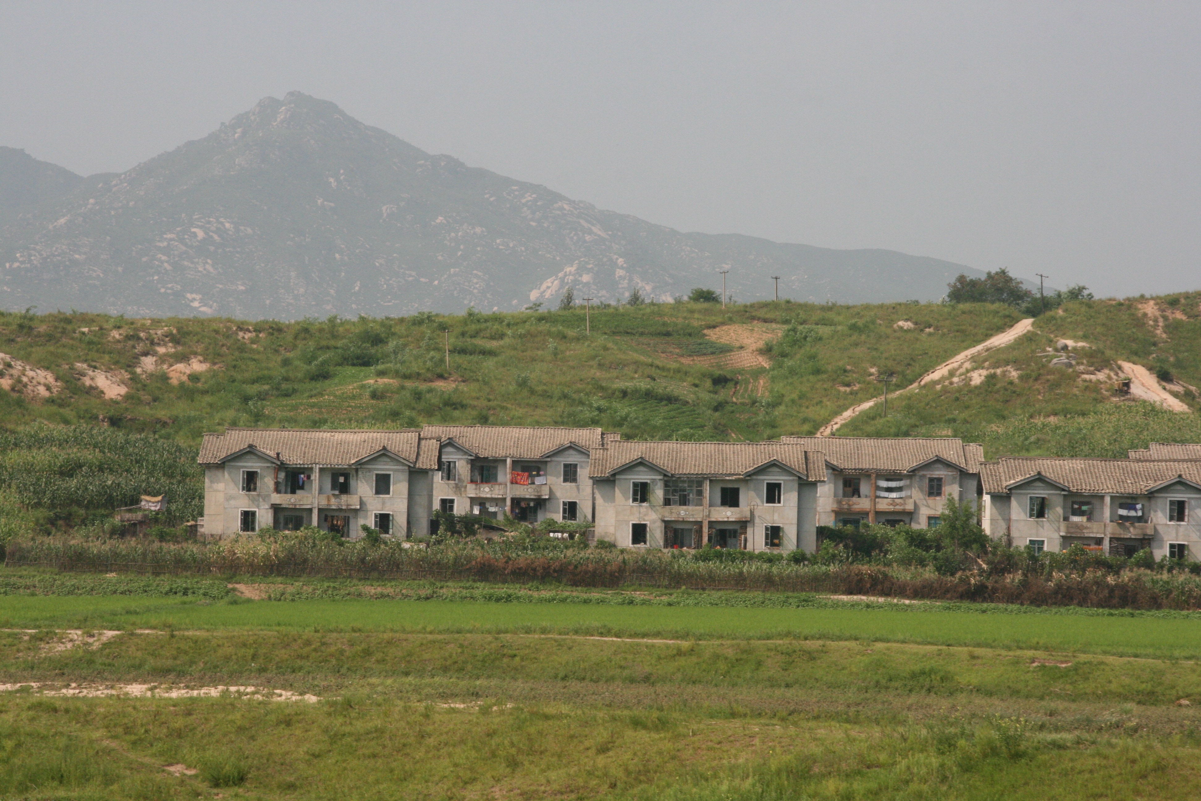
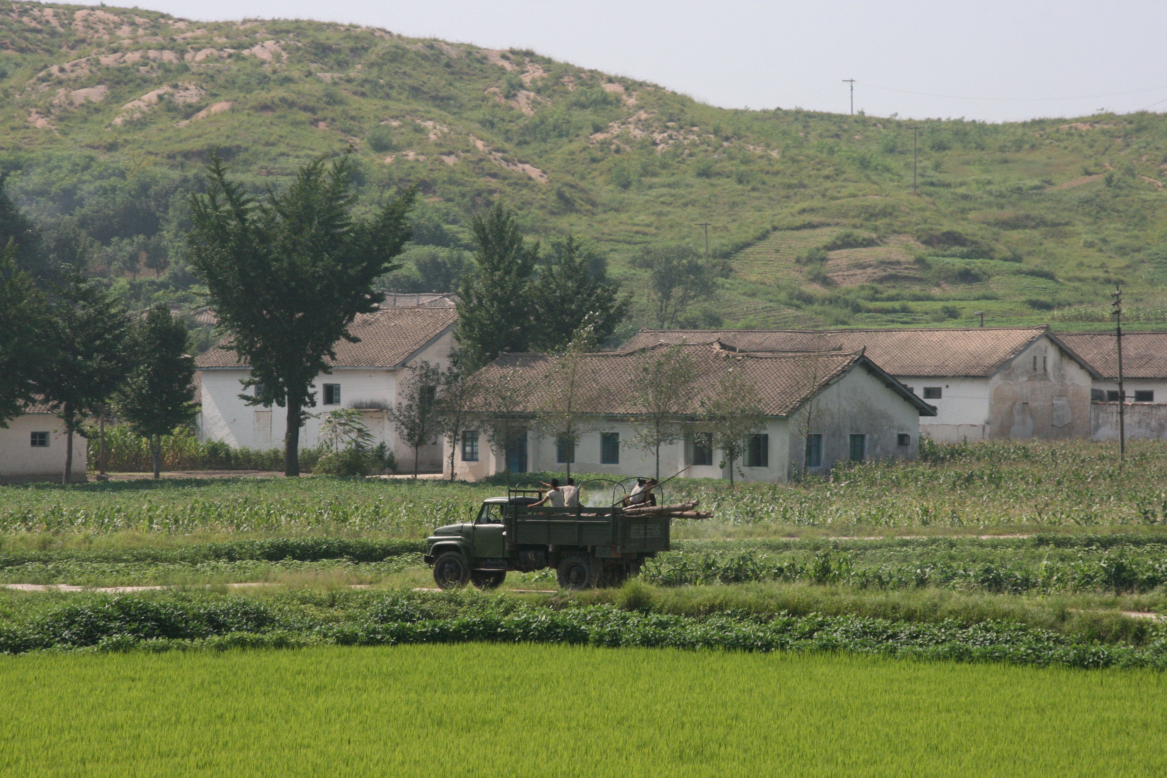
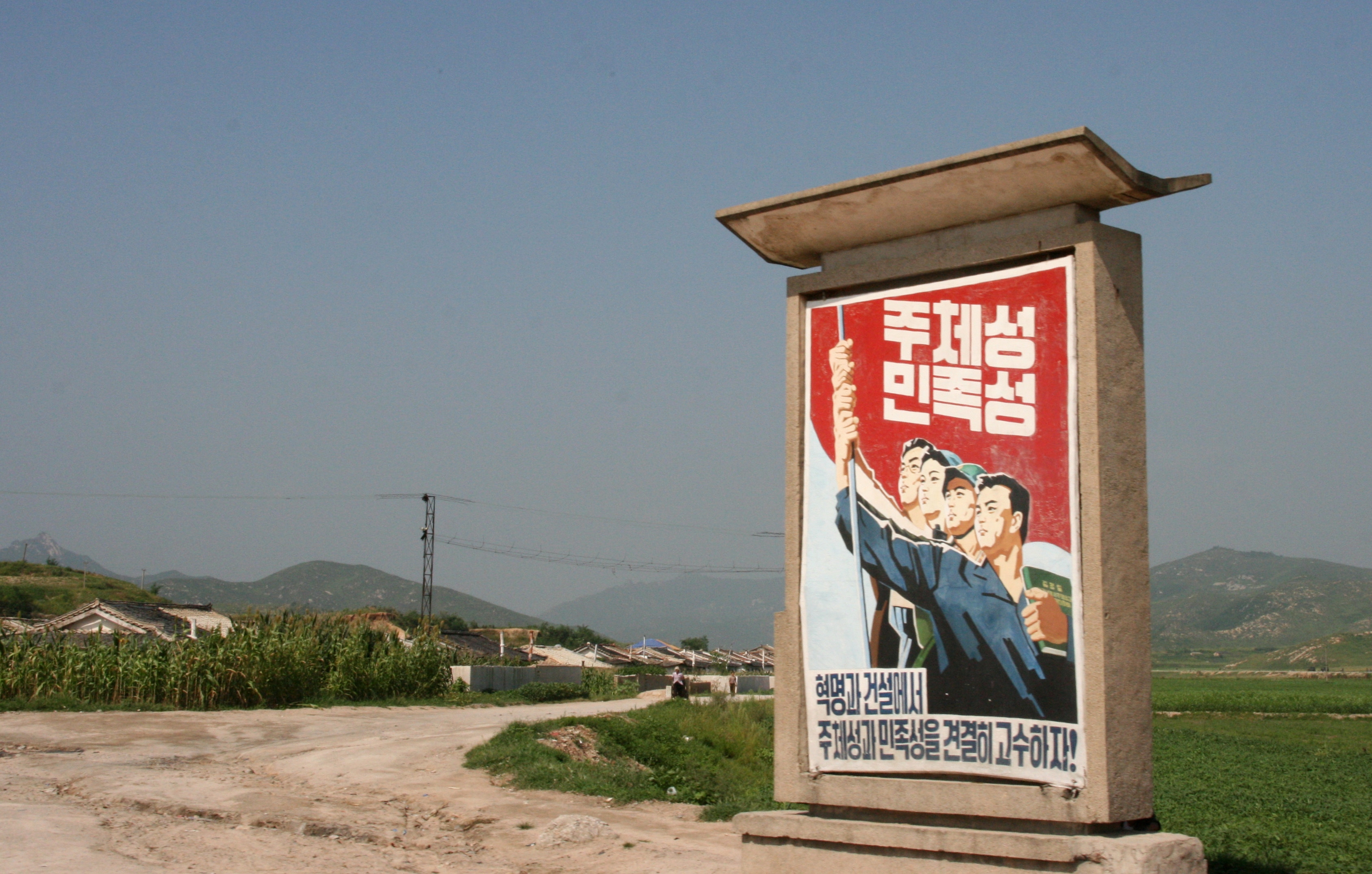
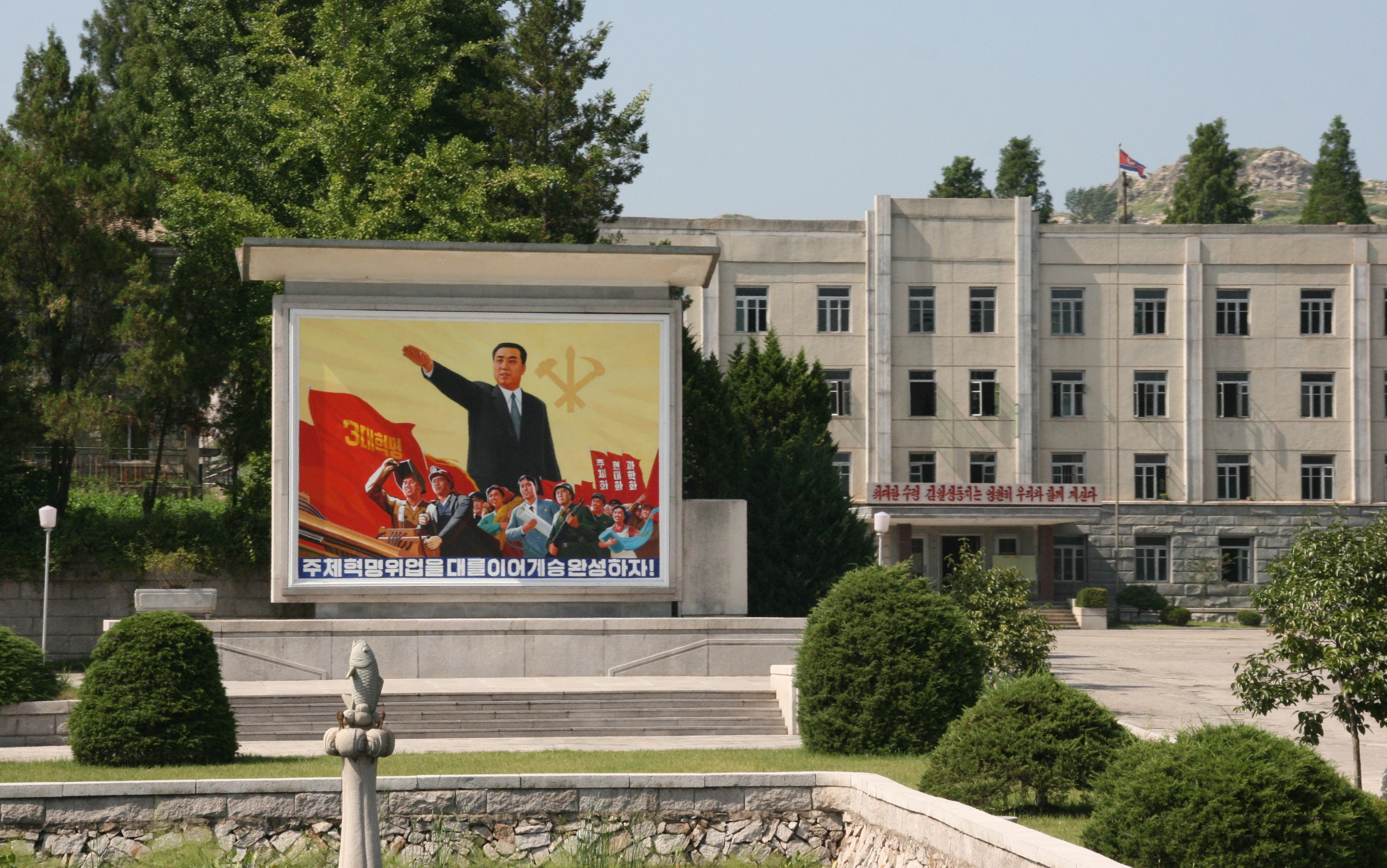
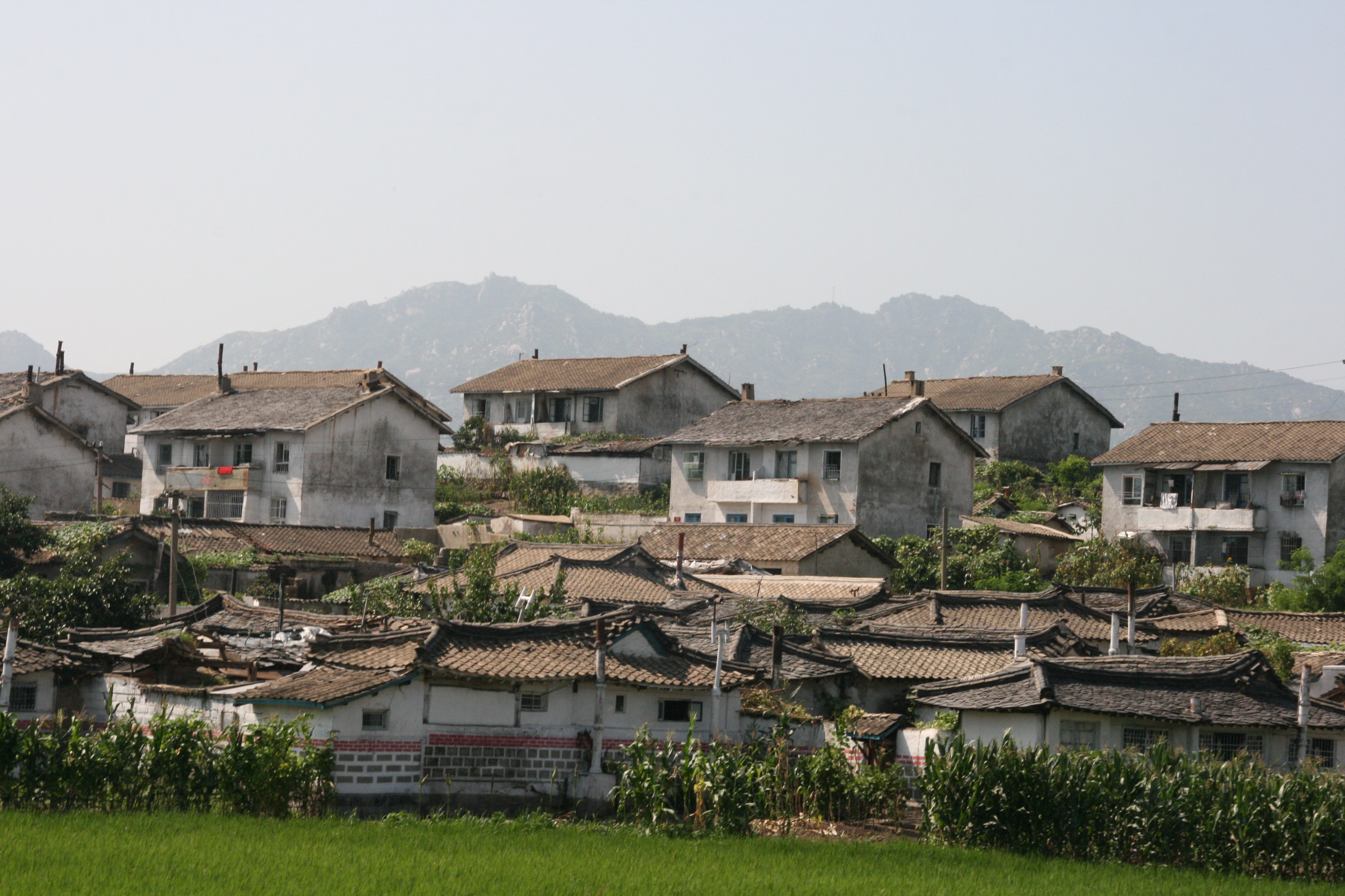
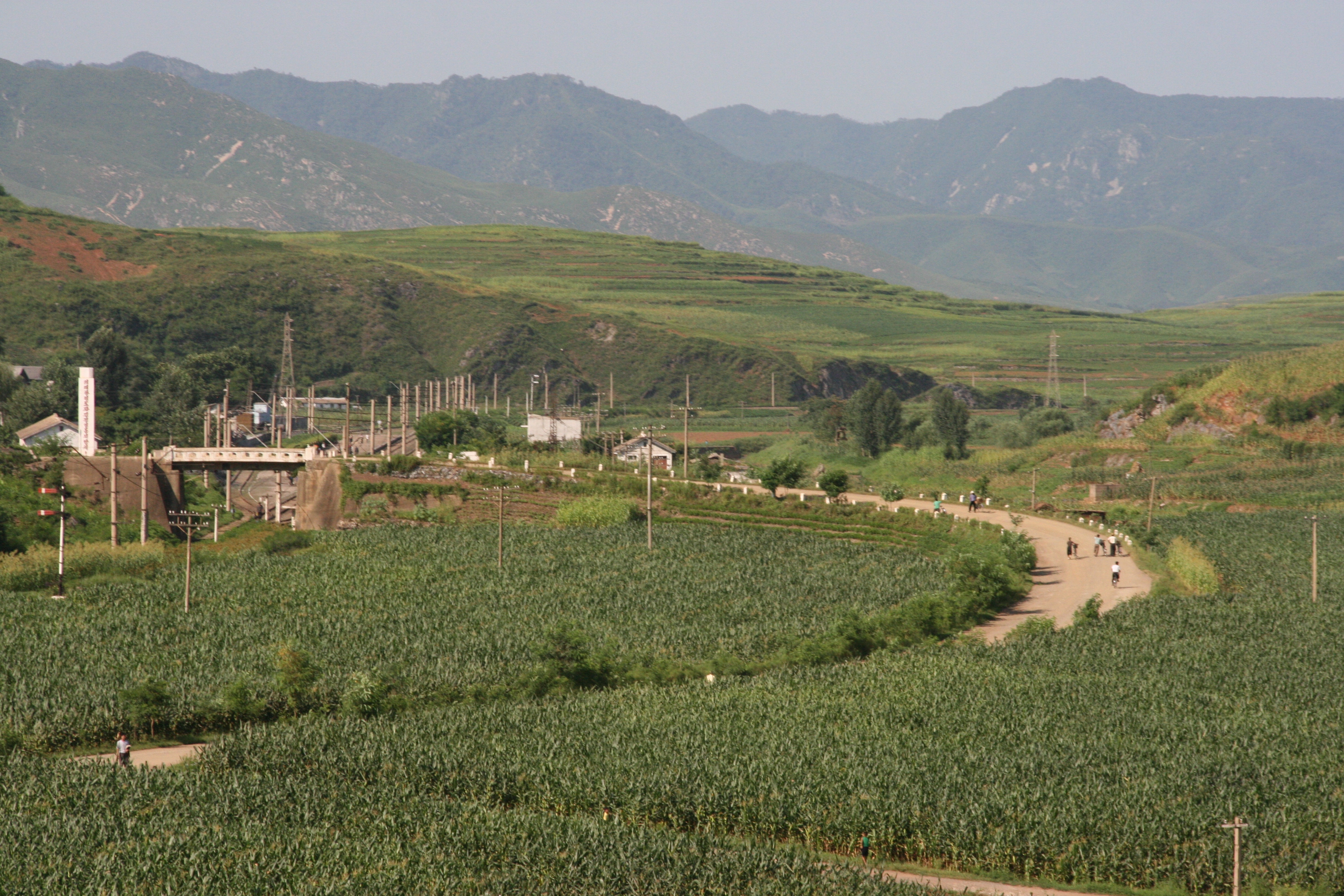
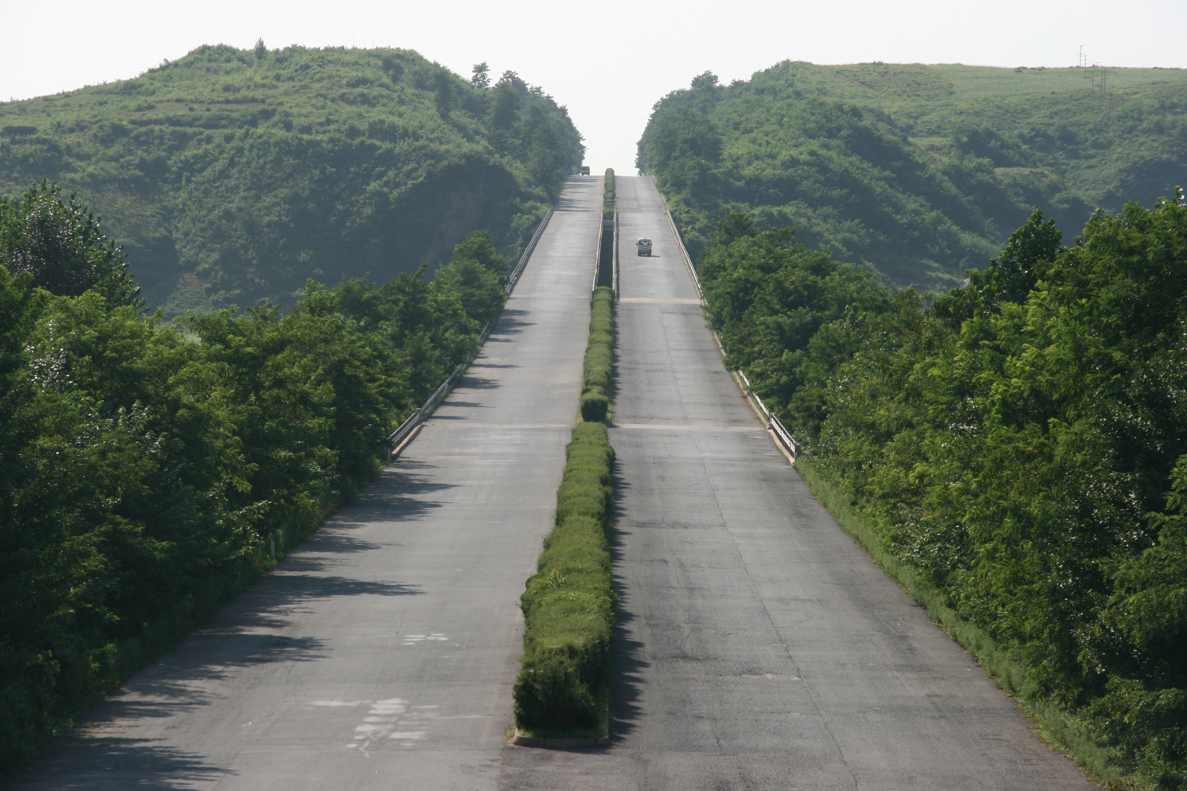
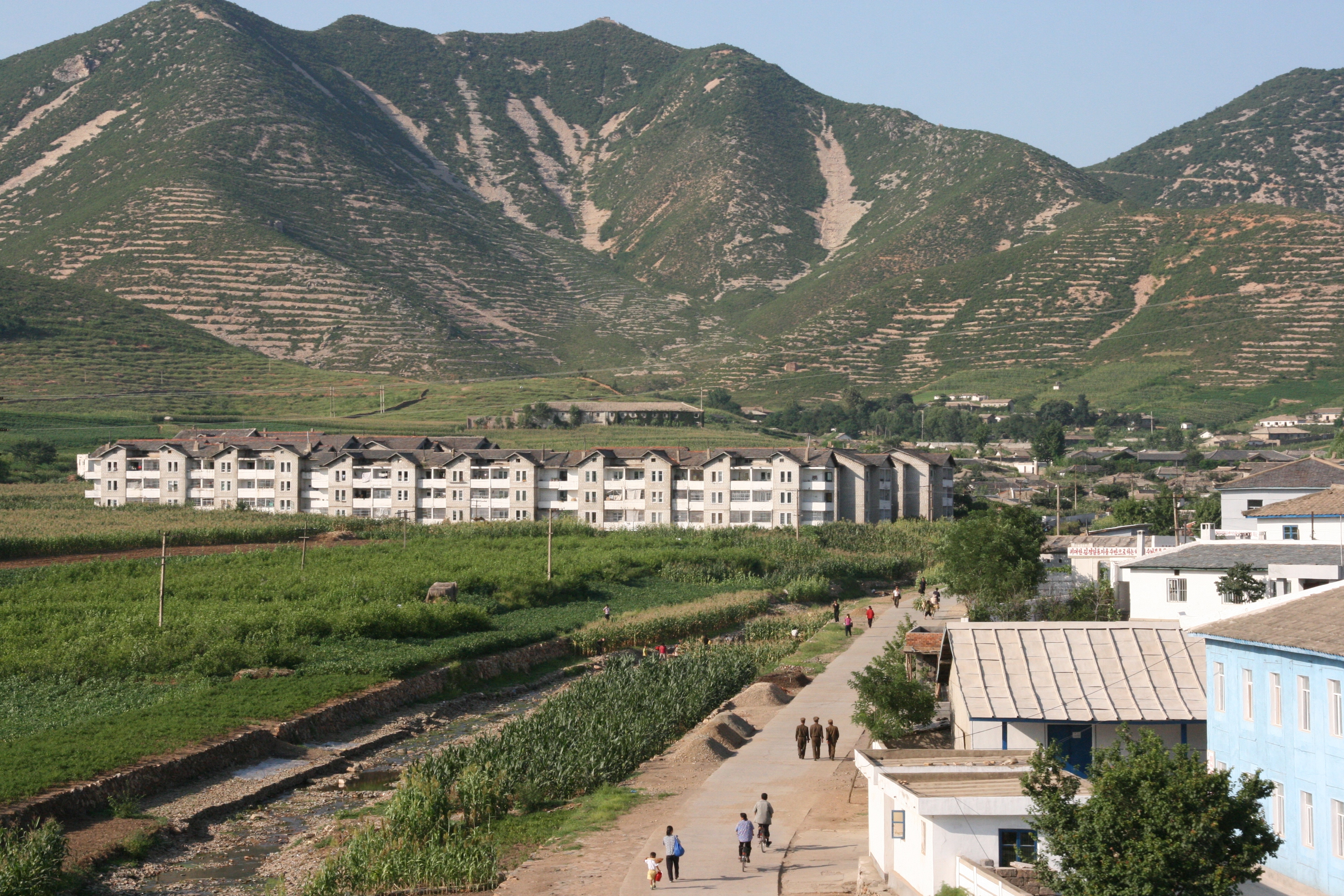
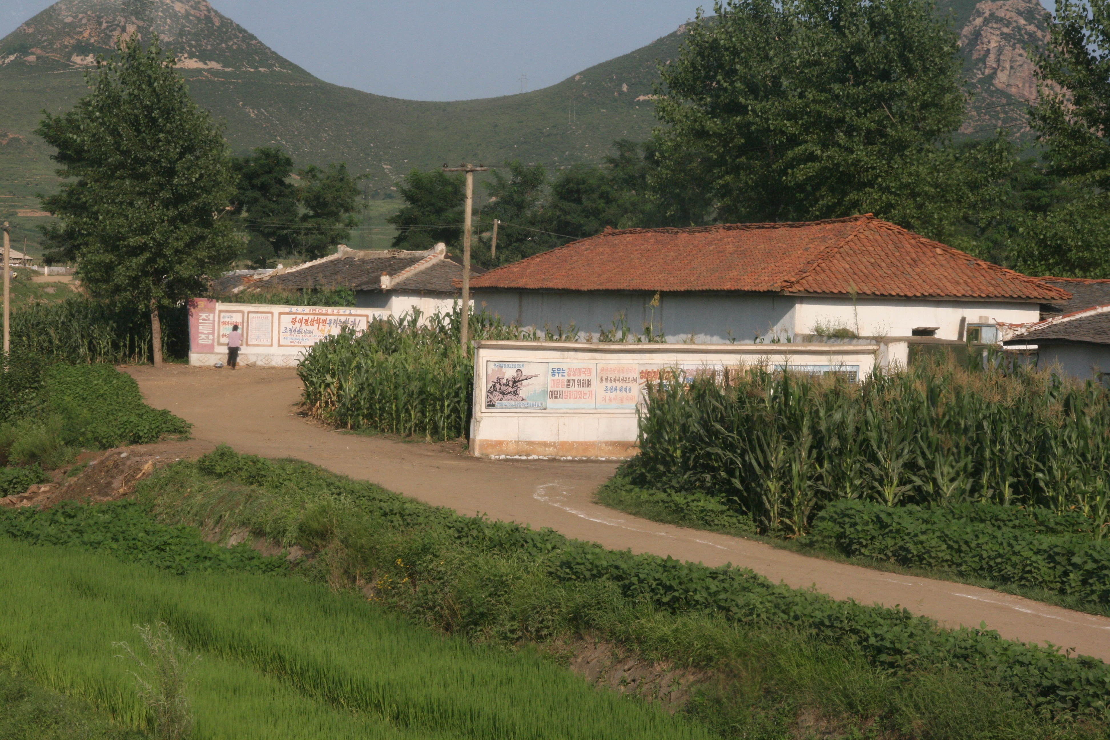
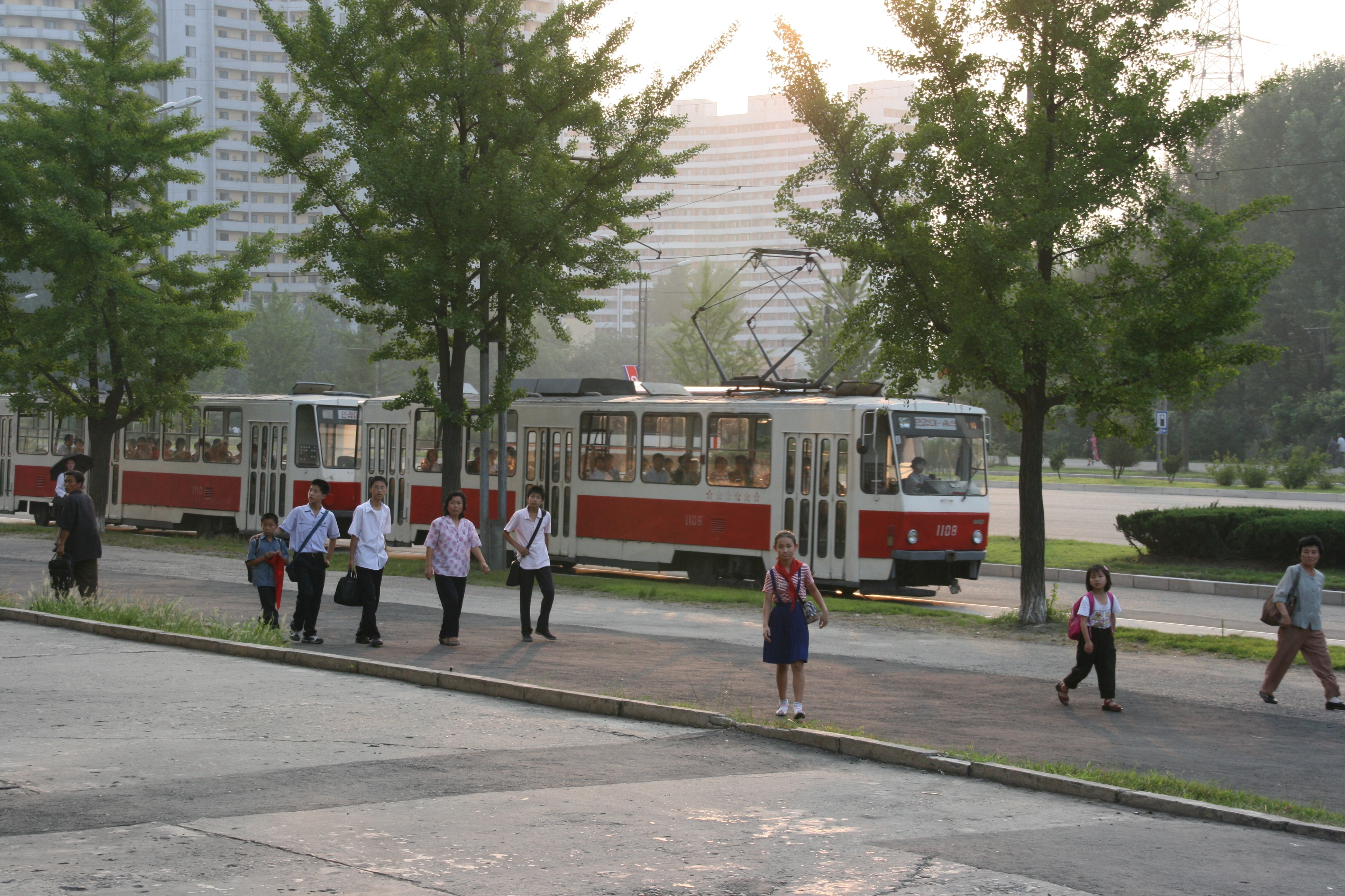
Our early start was necessary as the main destination of the day was the border with South Korea at Panmunjom, 160 kilometres to the south. Panmunjom is connected to Pyongyang by a 4-lane expressway called the Reunification Highway. The road is designed to serve as the main road between Pyongyang and Seoul after reunification, and the signs near the city of Kaesong do say “Seoul 70 kilometres). Needless to say, the road is severely under-used at the moment. One section of the Reunification Highway was under repair, requiring us to take a fairly long, bumpy, dusty but fascinating diversion through some beautiful rural countryside and small towns that are not usually seen by foreign visitors. Some of the houses were a little dilapidated, but not disastrously so, and no more than the normal differences one finds between living conditions in any country’s capital city and rural farming areas.
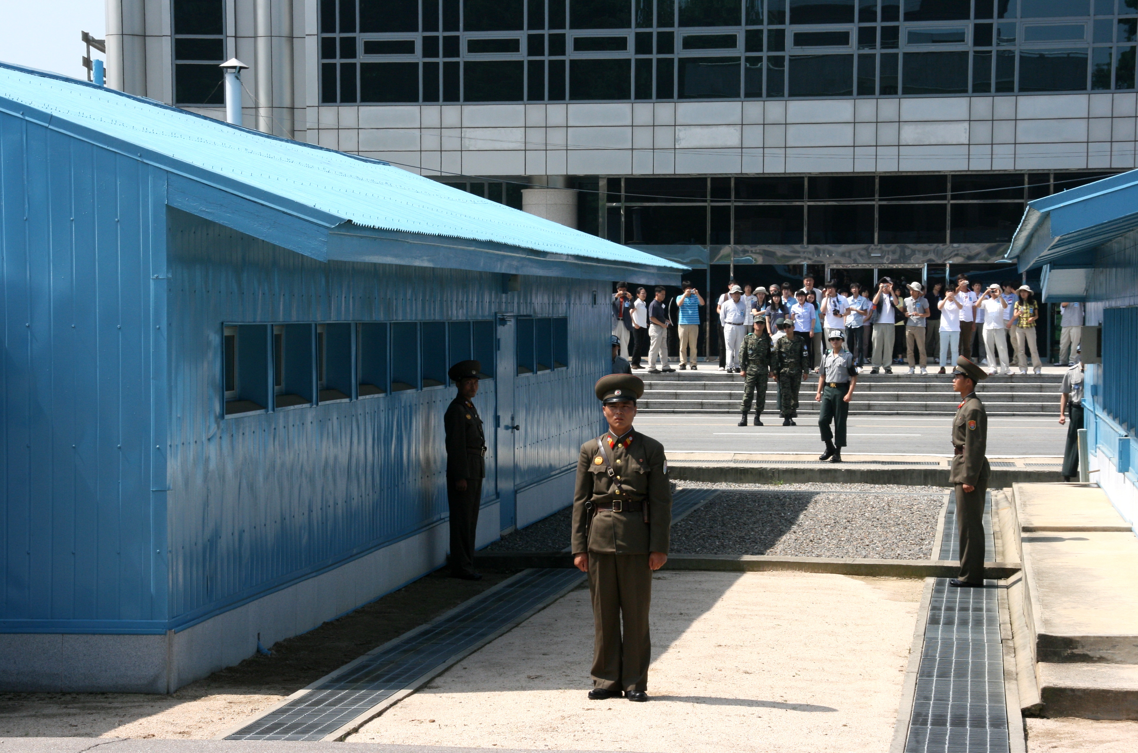
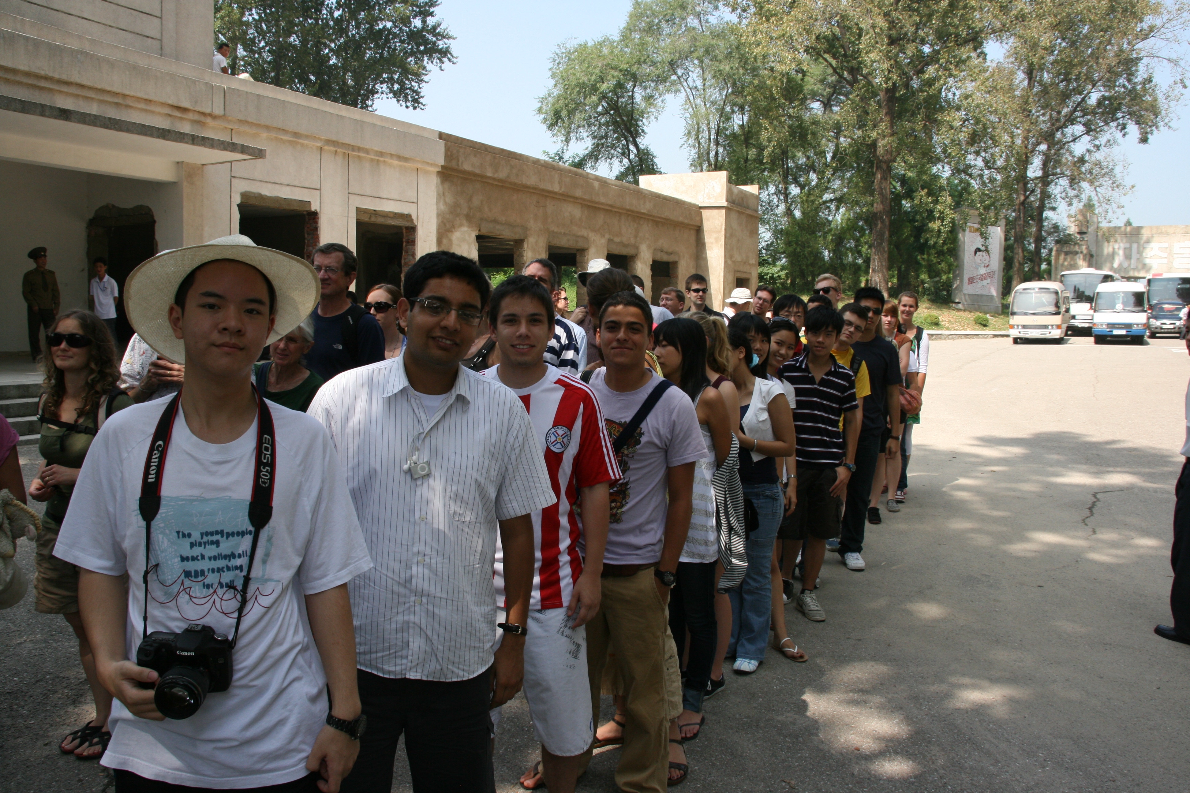
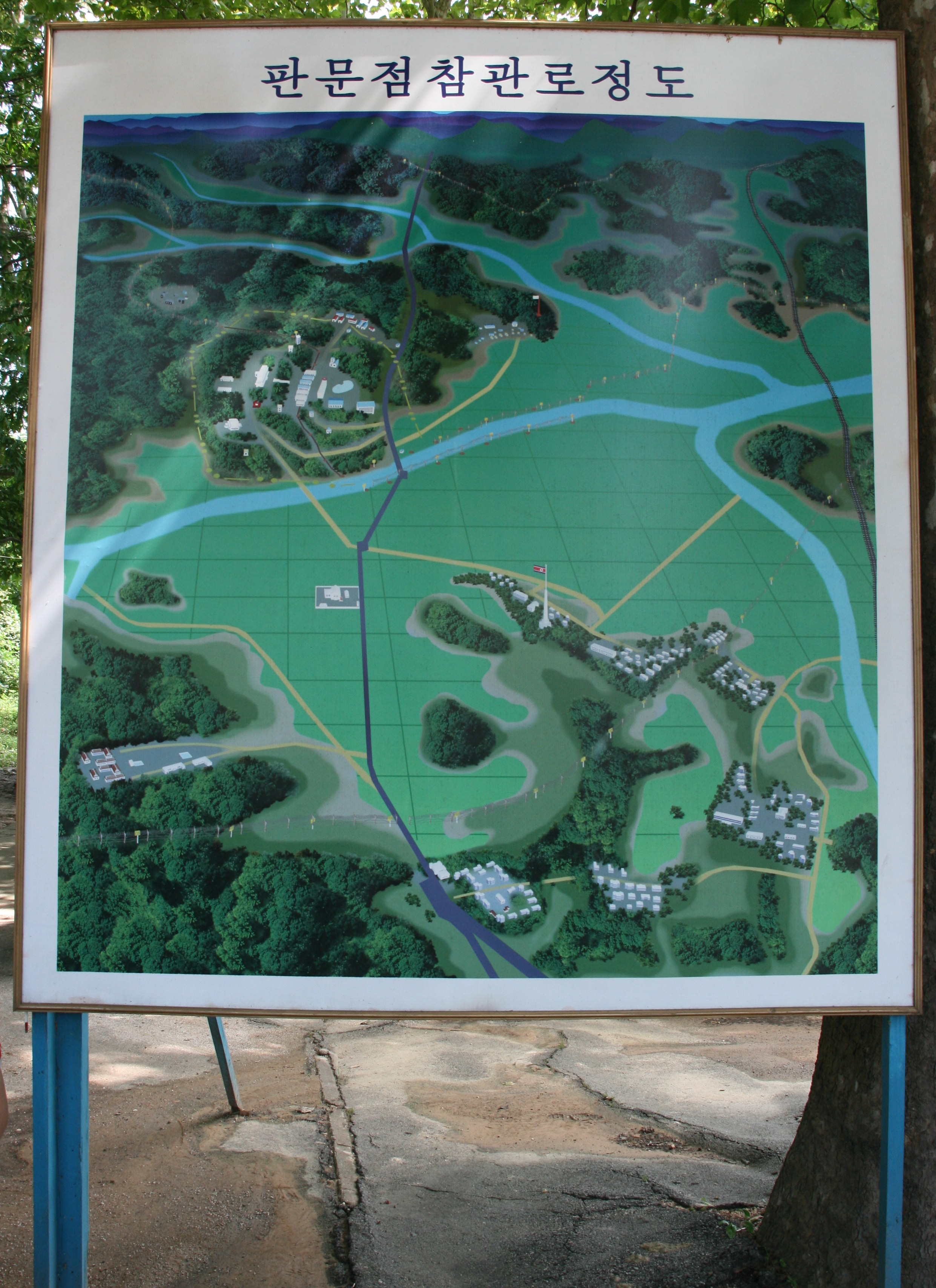
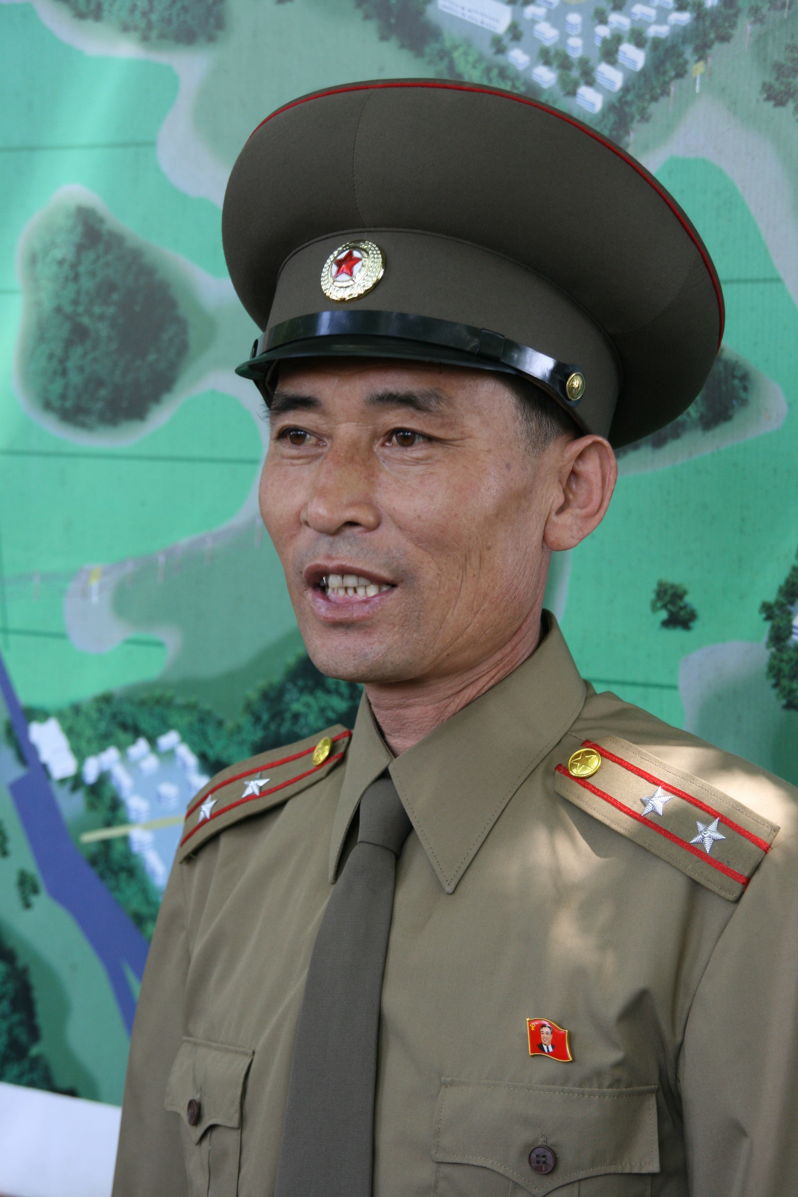
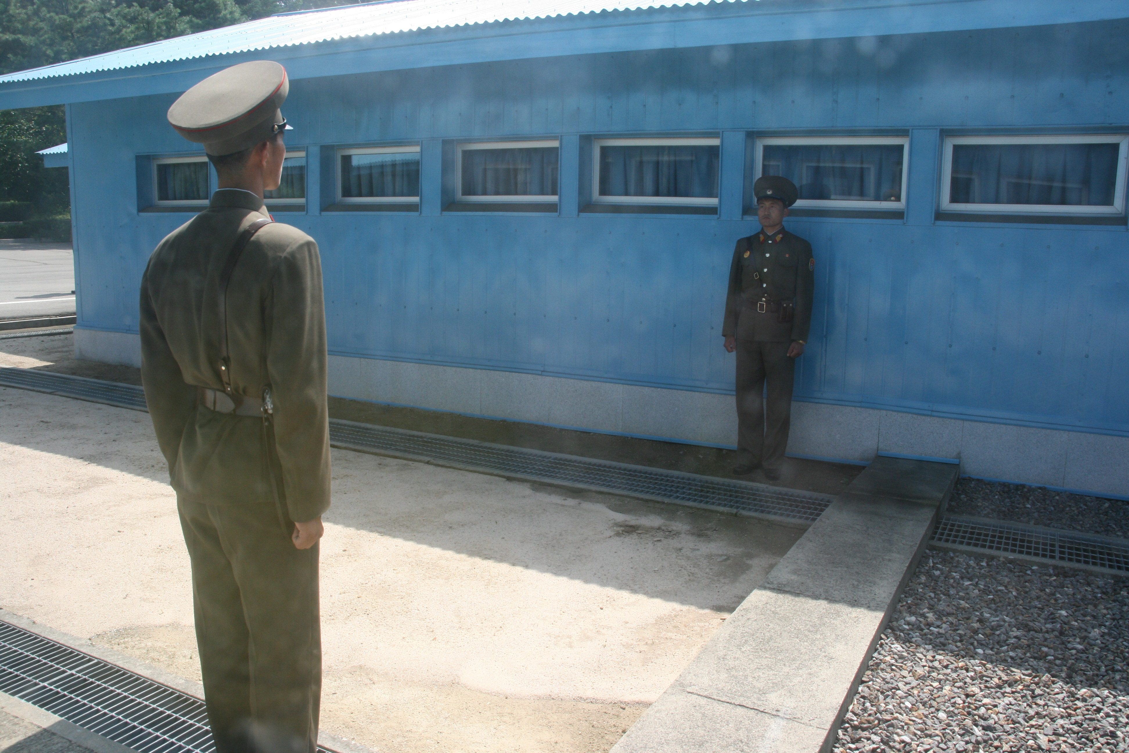
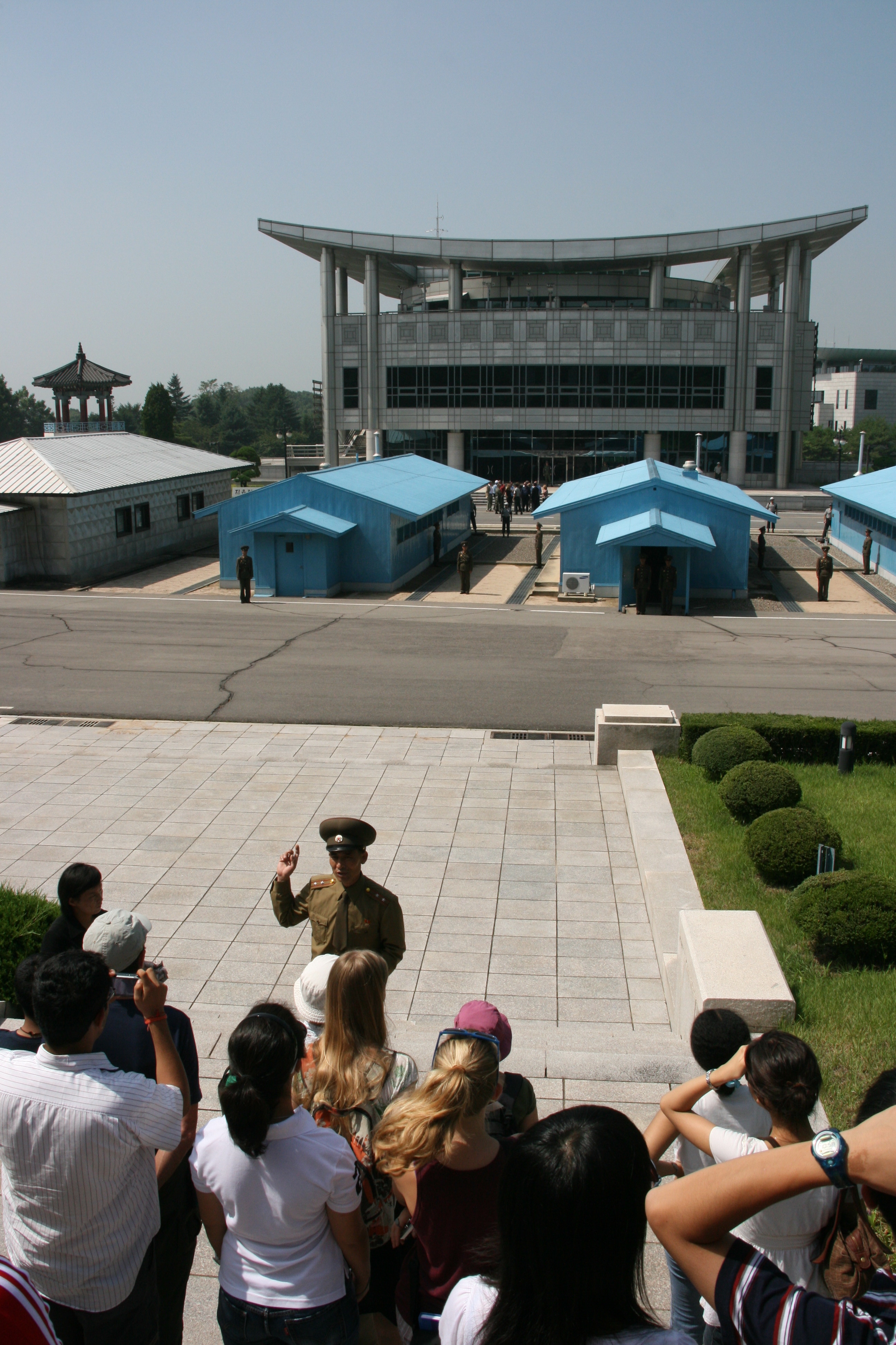
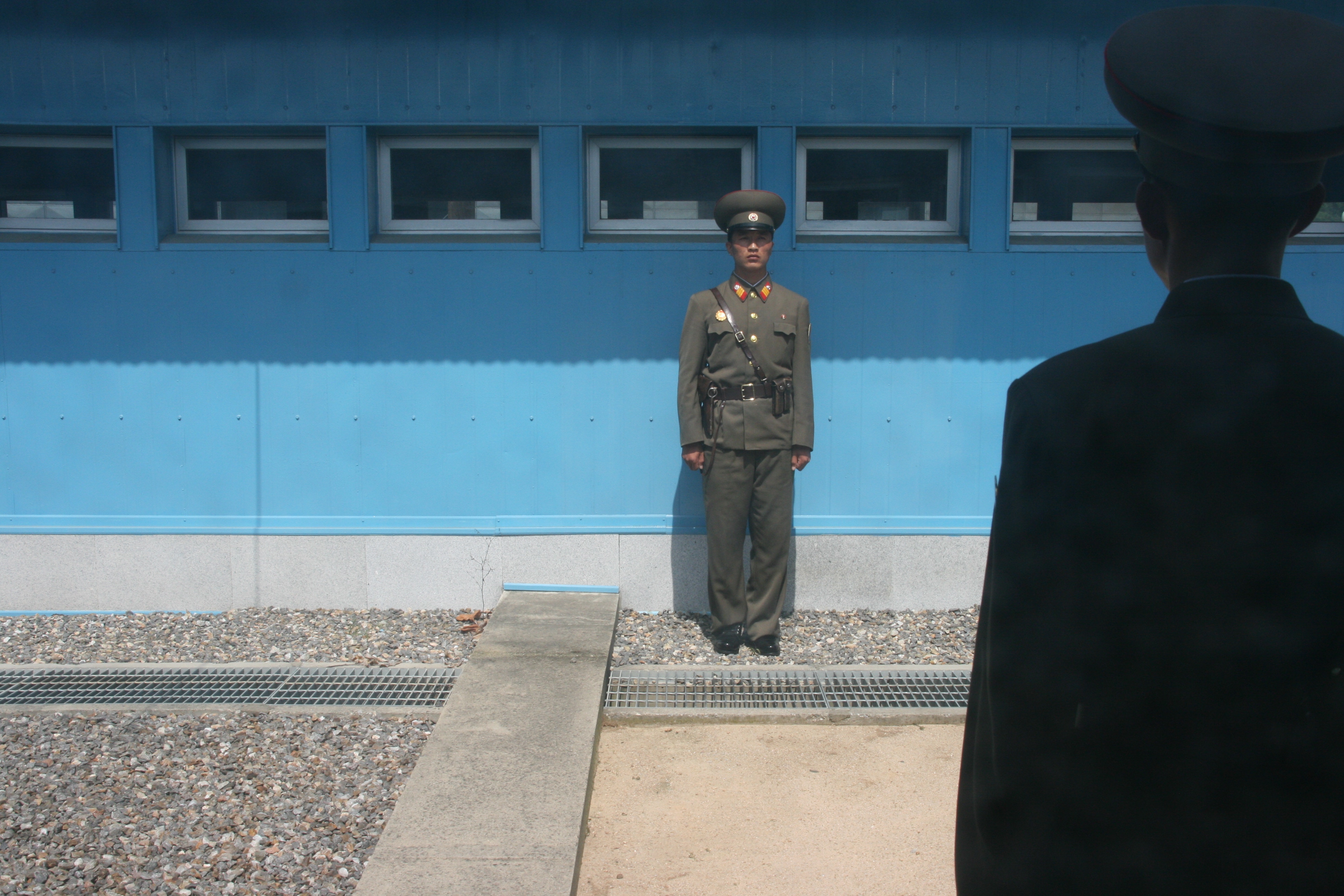
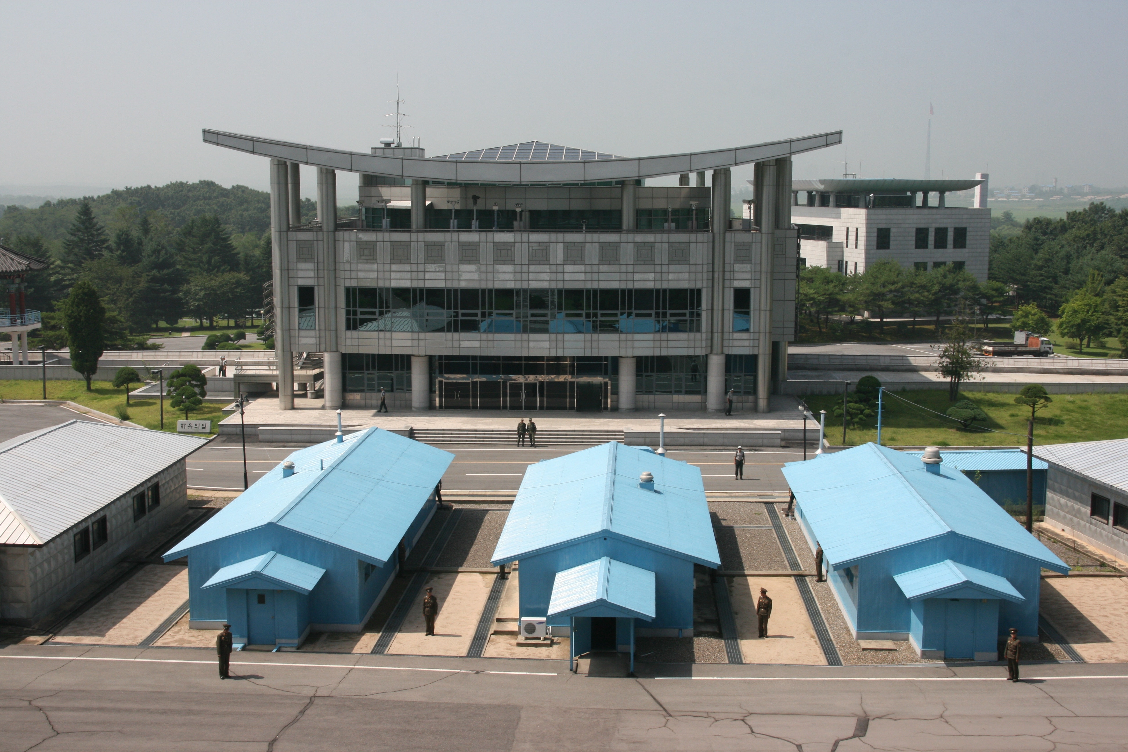
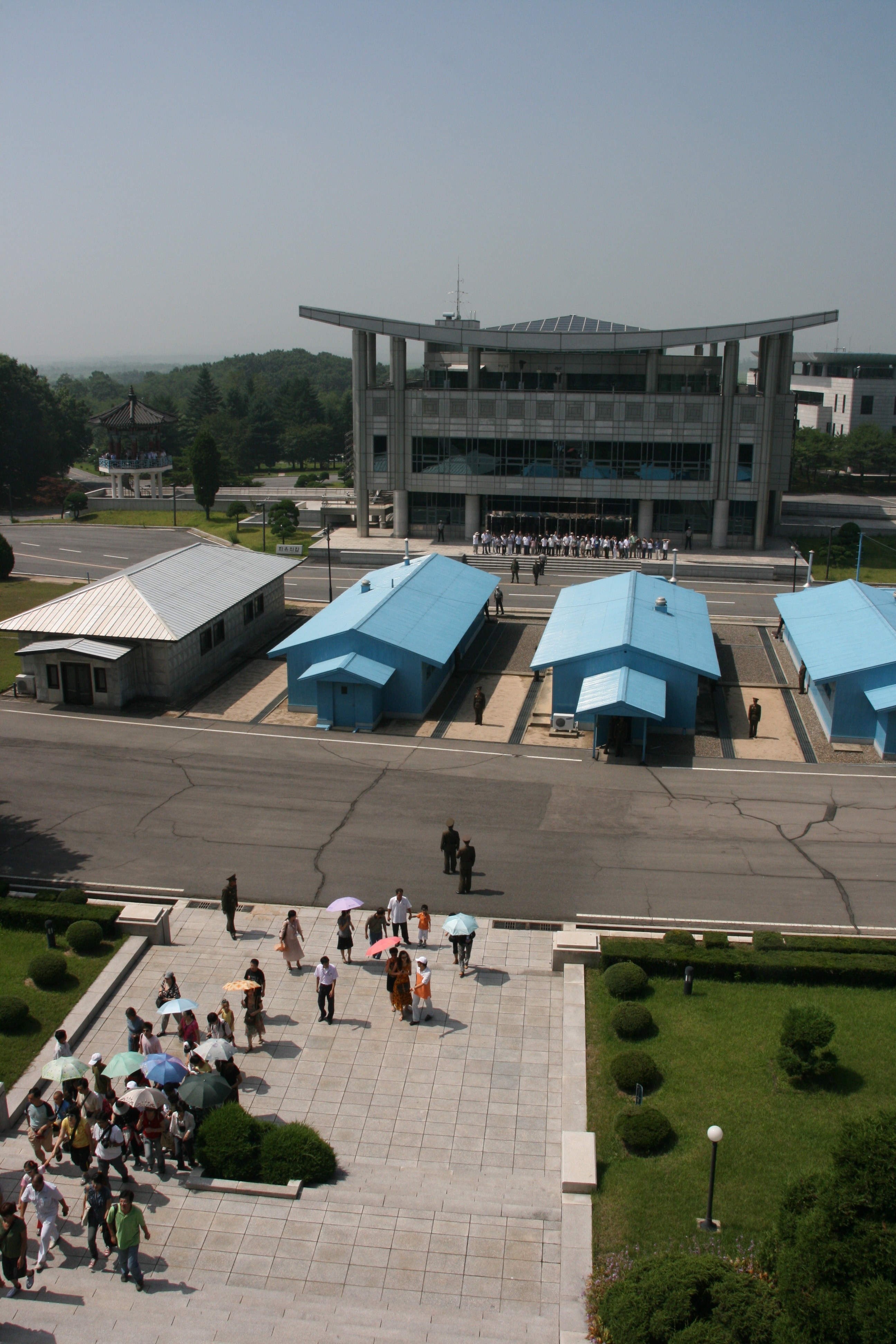
We arrived at Panmunjom a little after 10:30 am, having left the hotel at 7:15 am. Upon entering the Demilitarised Zone (DMZ), we received a briefing from a KPA (Korean People’s Army) officer, after which we lined up and walked into the DMZ in a single file line. The DMZ is really mis-named; it is the world’s most heavily armed and militarily tense area. It is 4 kilometres wide, comprising a northern two kilometre wide zone administered by the DPRK and a southern two kilometre wide zone administered by the ROK. In the middle of the DMZ at Panmunjom is the JSA (Joint Security Area), which is where a line of negotiating huts straddles the border, with half of each building in North Korea and half in South Korea. Provided a person stays within the building and exits through the same door that they used to enter it, it is the one place on the Korean peninsula where a person can walk freely between North and South Korea.
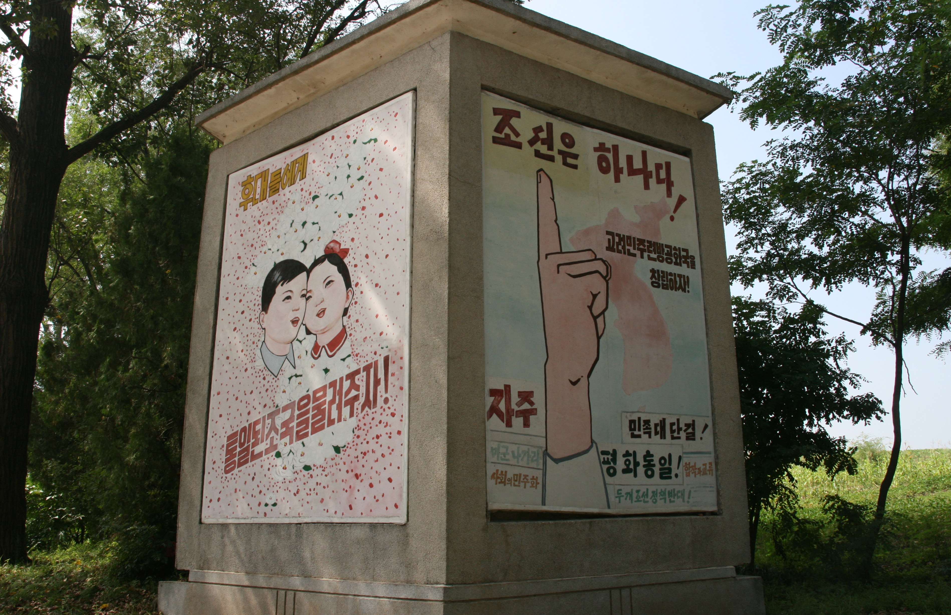
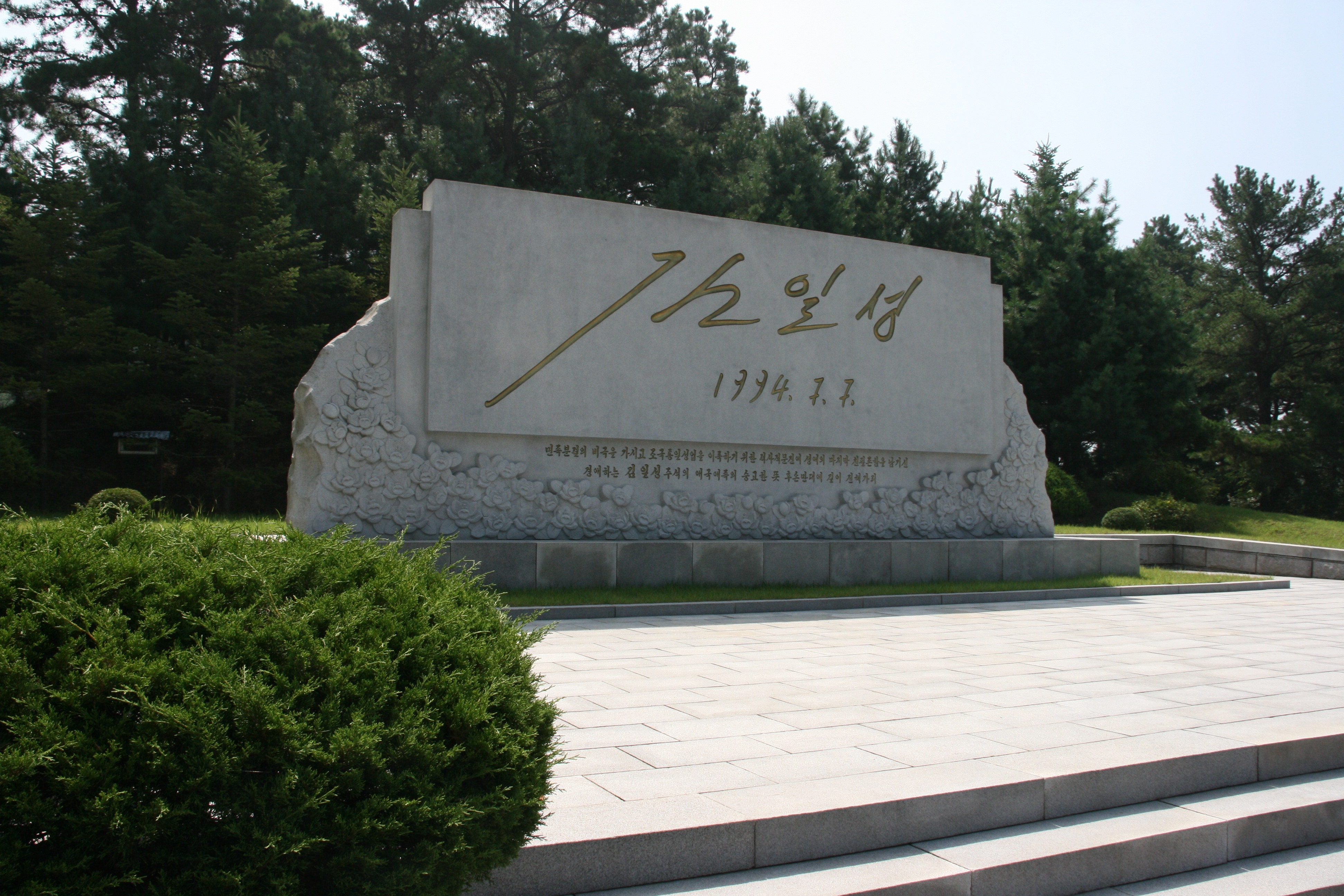
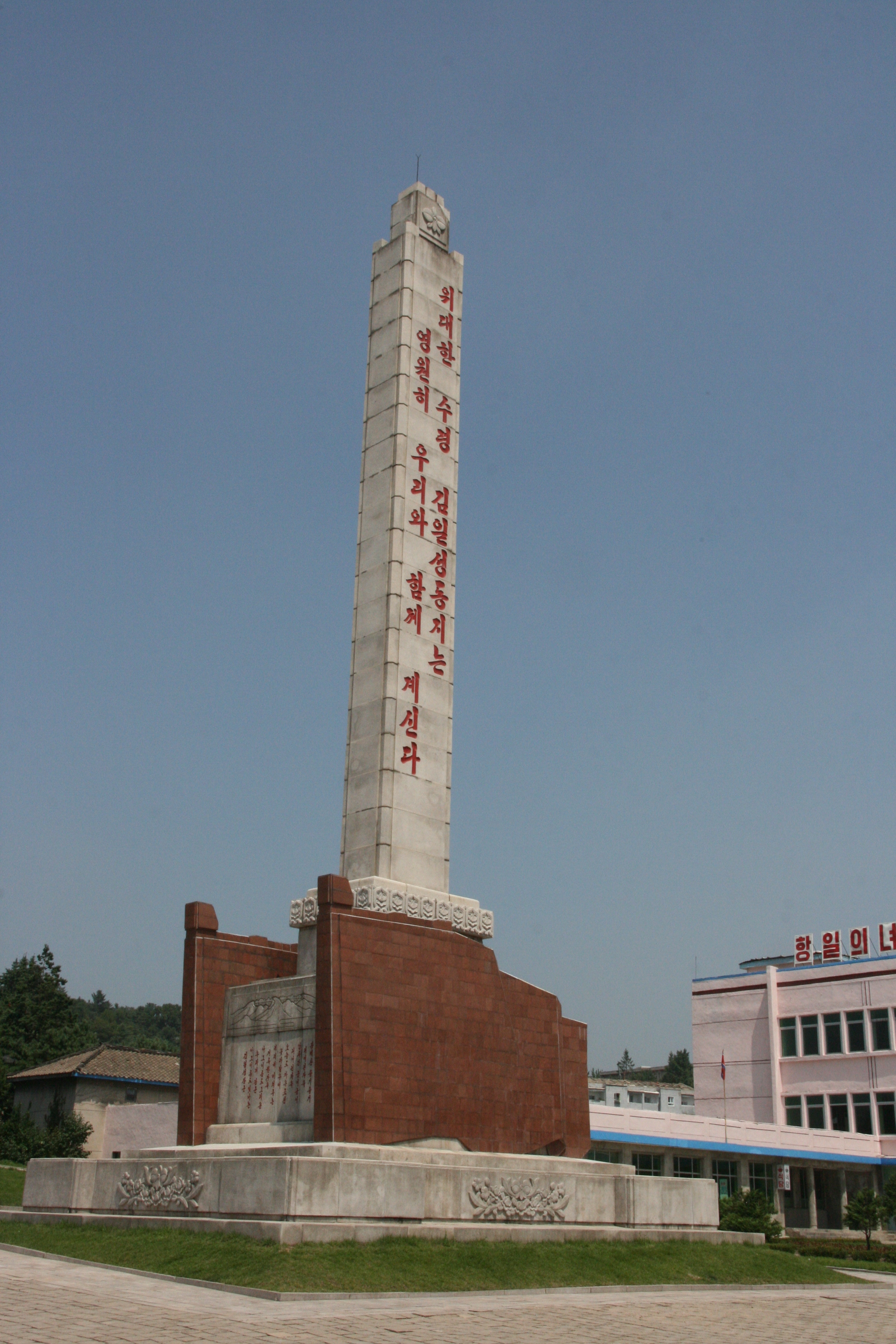
On 7th July 1994, President Kim Il Sung proposed a 3-point charter for the national reunification of Korea. Essentially a “one country - two systems” model, he proposed a Confederation of Koryo that would allow the North and the South to retain their respective social, political and economic systems under a single umbrella national government to handle foreign relations, the armed forces, and so on. He proposed that this be done by Koreans without outside influence, and that there would be freedom of movement within the country for all its citizens. After unification, the Korean people could then vote over time on various aspects of the details for a unified system. Sadly, the day after he signed the document outlining this plan, Kim Il Sung died suddenly from a heart attack - the unification document was his final item of work. As a result, the North Koreans have erected a large monument with Kim Il Sung’s 7-7-94 signature very close to (but not facing) the border, and this monument was our first stop upon entering the JSA at Panmunjom.
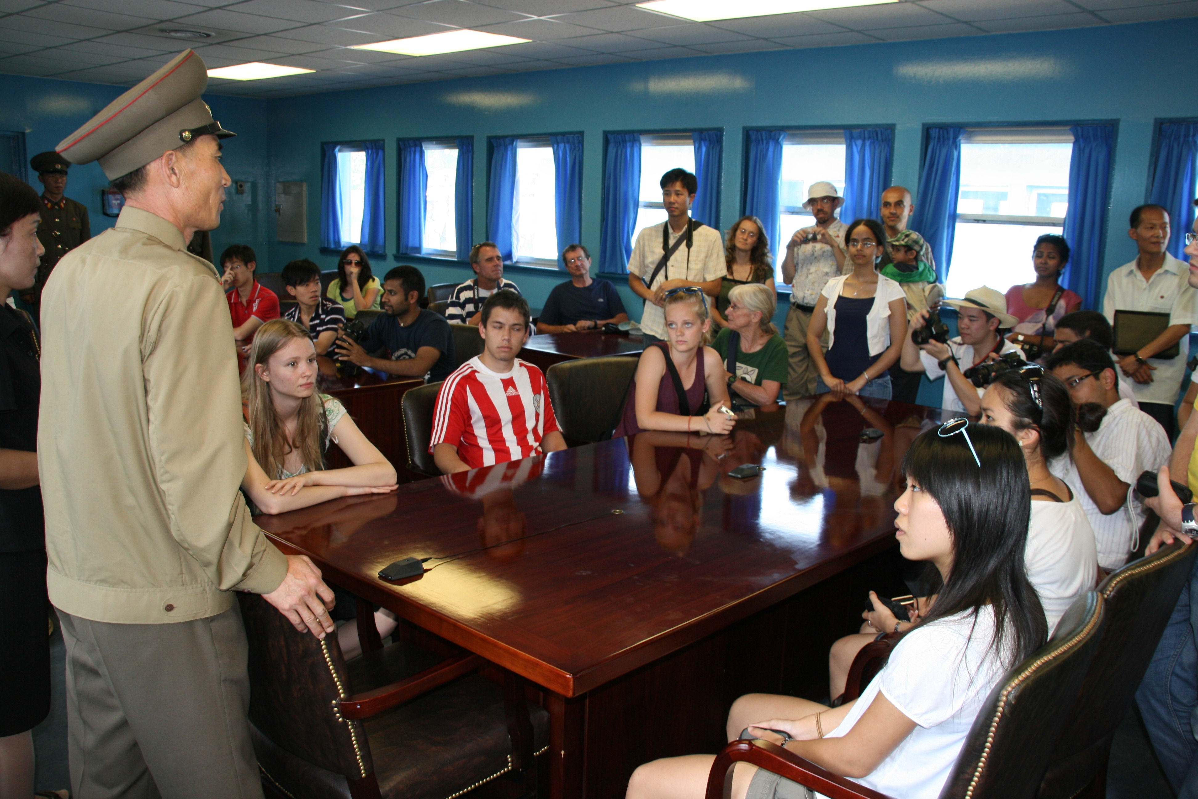
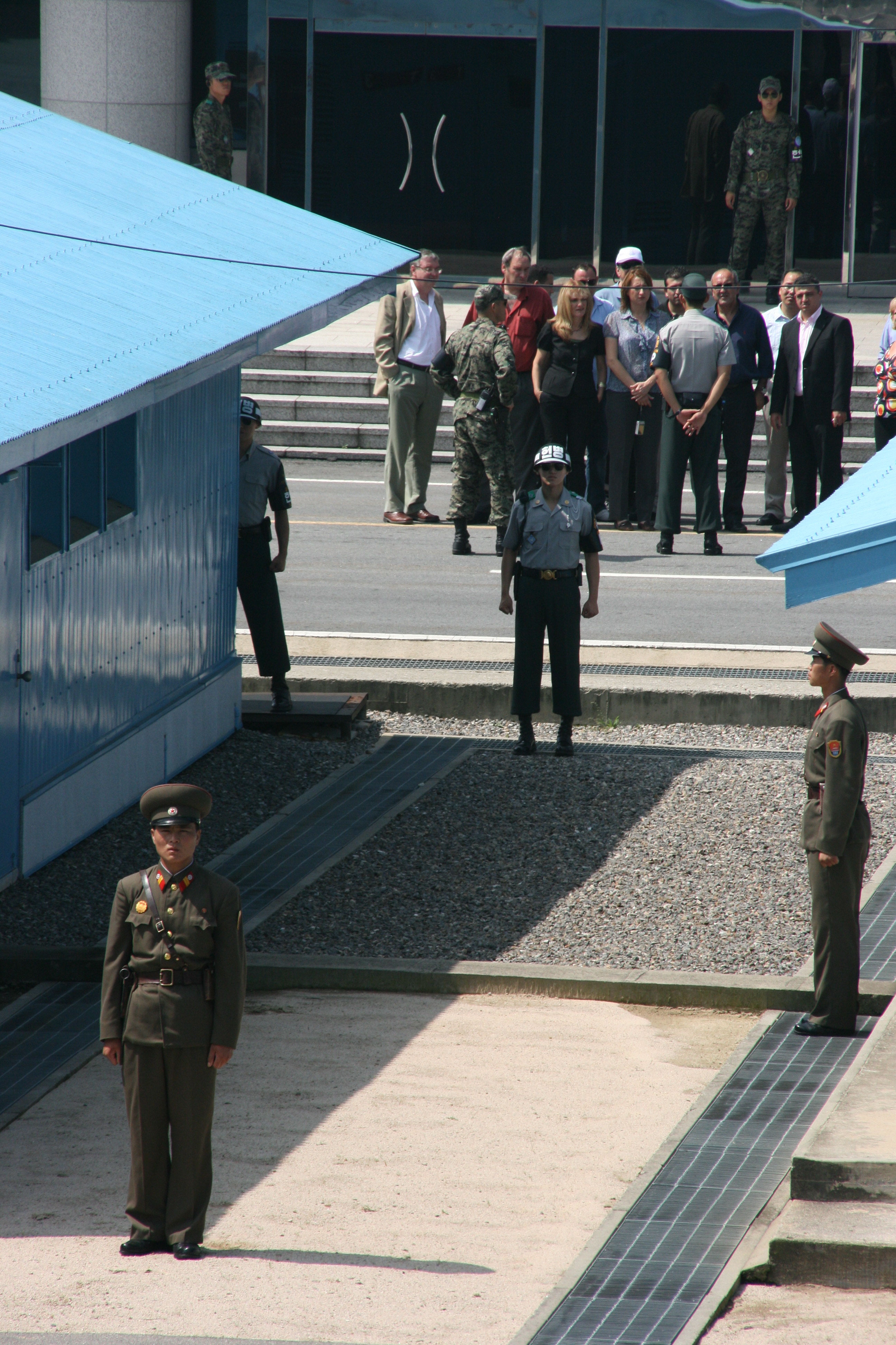
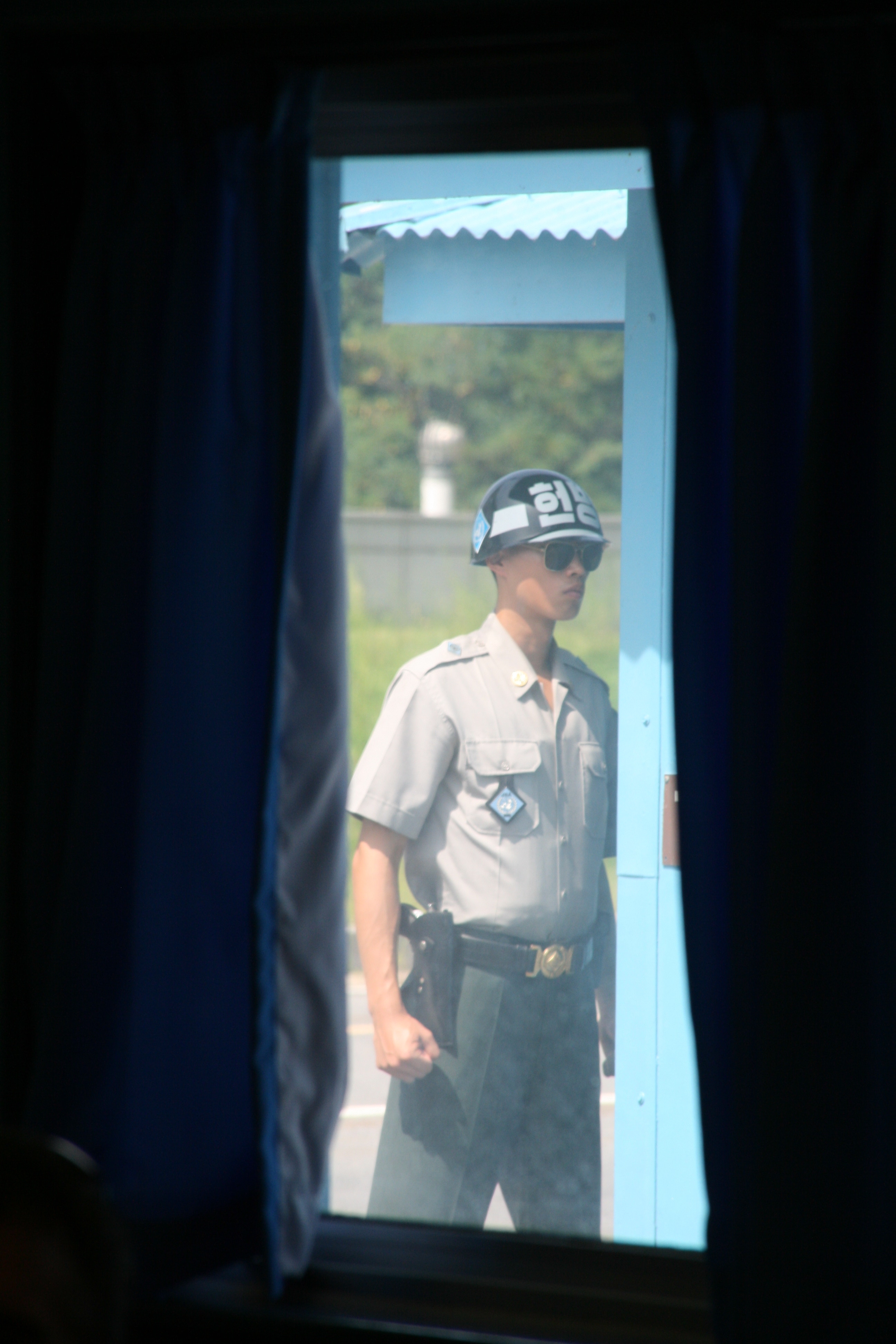
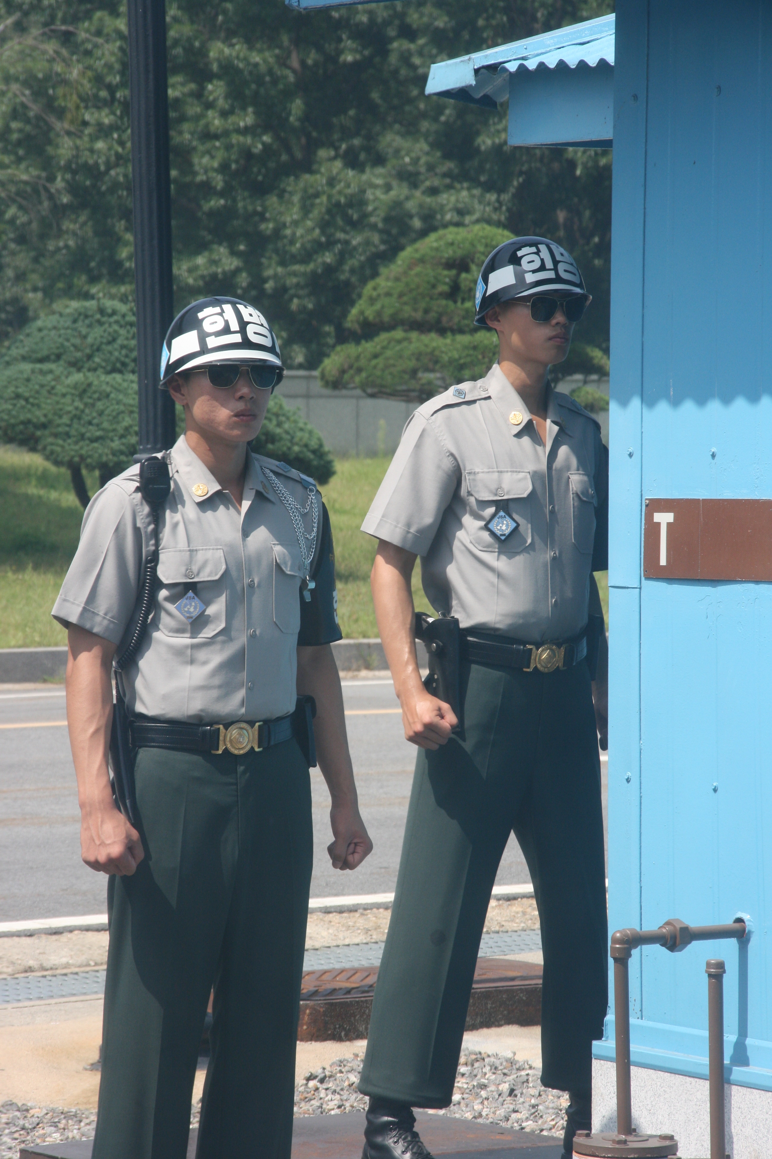
After inspecting the monument, we proceeded into the main negotiating hut. The central negotiating table is positioned right on the North-South border, and several of my students seemed to quite enjoy sitting briefly in the negotiators’ seats. Some of my students were very surprised to see the flag of their country on the wall of the room, having previously been unaware that their country had sent forces in support of the US during the Korean War of 1950 to 1953. Unlike some of my previous visits to Panmunjom, there was a large presence of soldiers from both sides on patrol, the combat helmeted South Korean soldiers adopting especially aggressive postures with clenched fists and grim, determined faces.
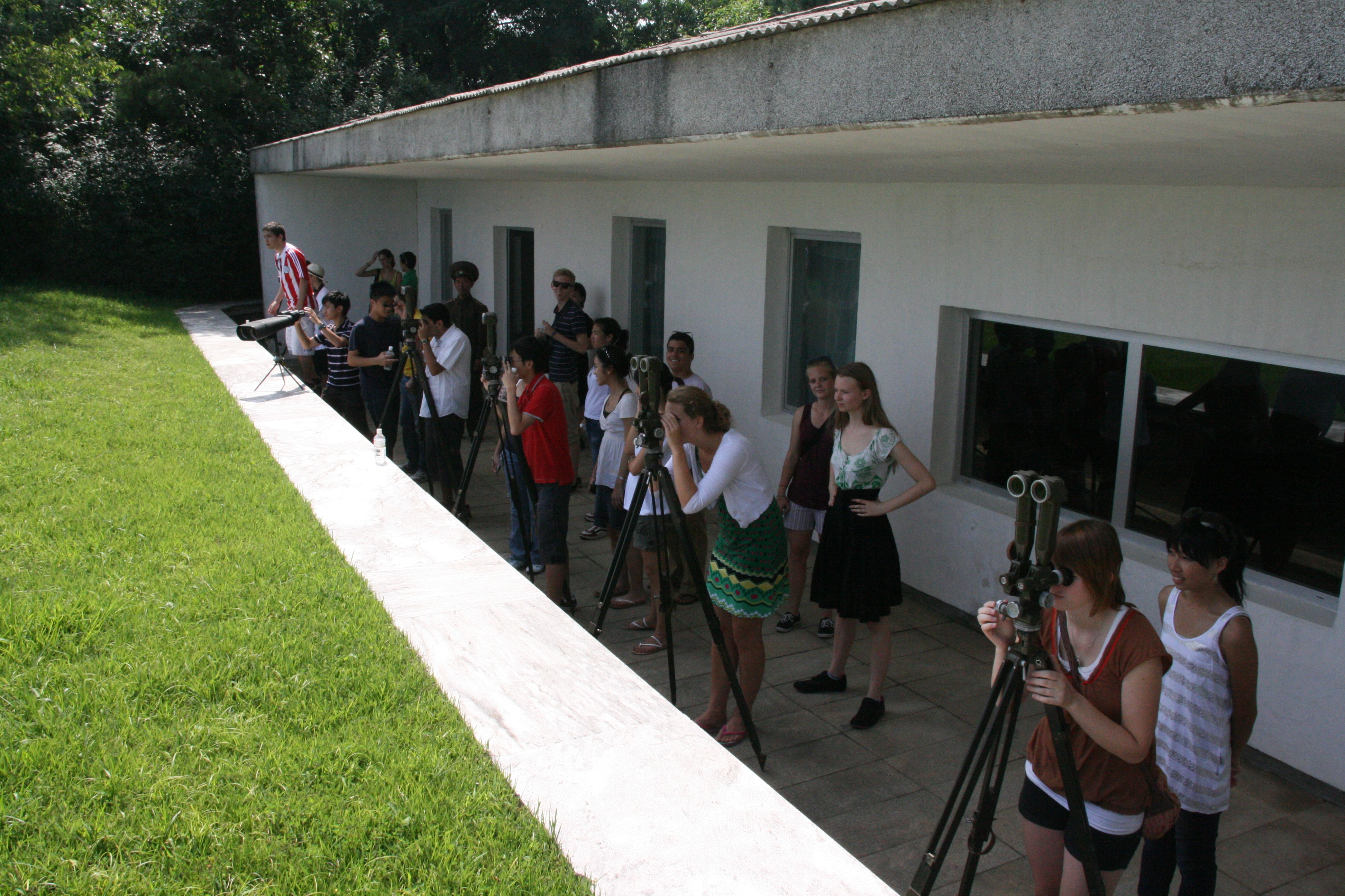
Our time in the negotiating hut was limited, so we exited and went up to the balcony of a multi-storied building that looks down on the border and negotiating huts. Especially interesting was the view of some groups of tourists arriving on the southern side of the border; it was obvious that they were under much stricter control than we were by their dress code, the identification badges they were wearing, the prohibition on pointing, the tightly disciplined lines that were maintained by the soldiers, and the prohibition on getting an elevated view from the southern side. By comparison, we enjoyed quite a relaxing and certainly illuminating experience.
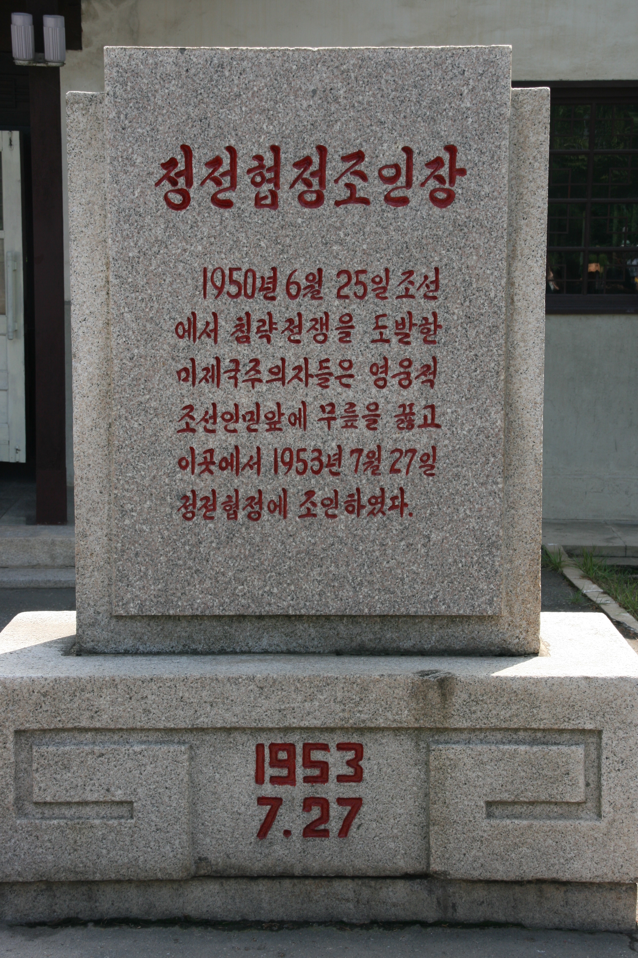
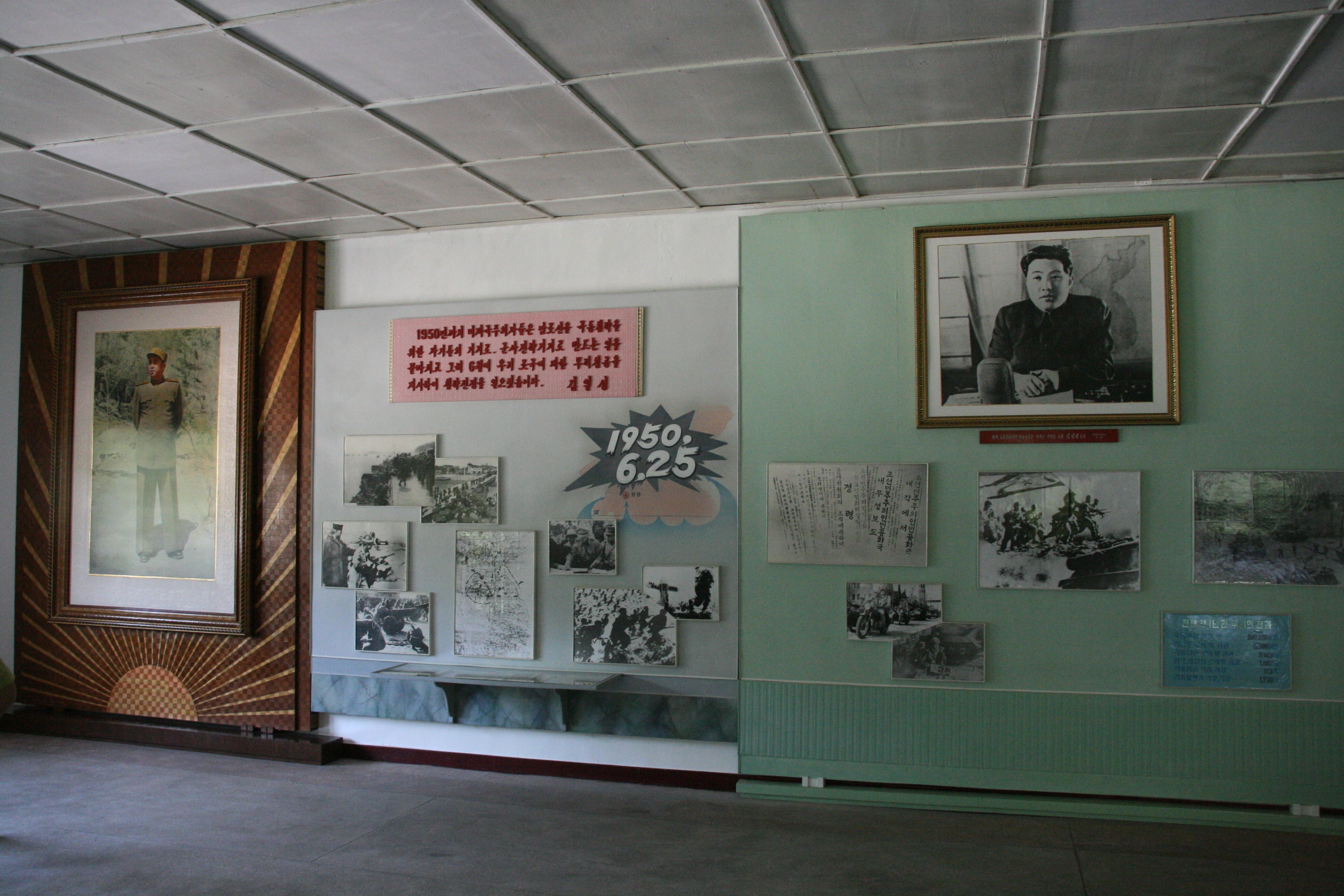
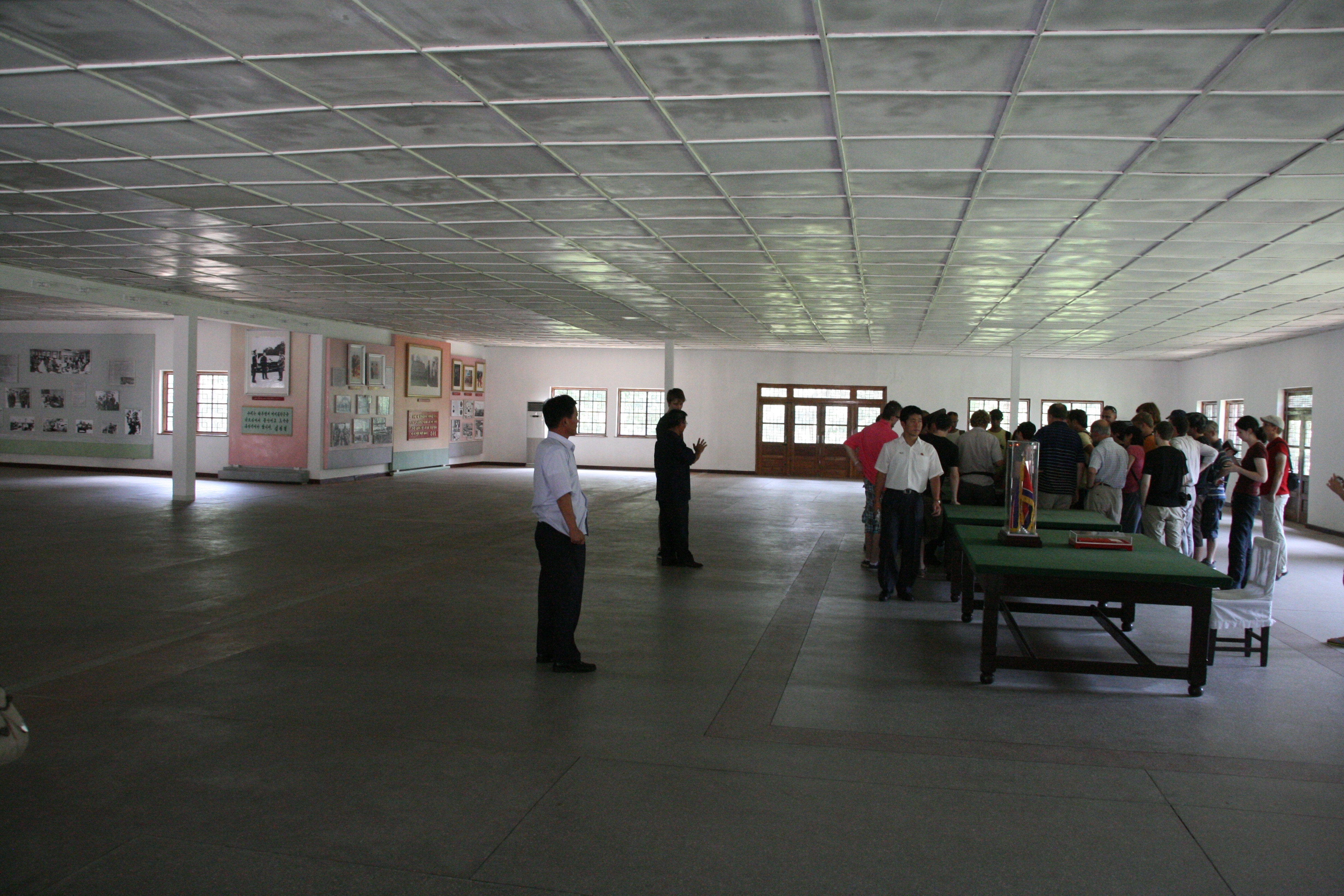
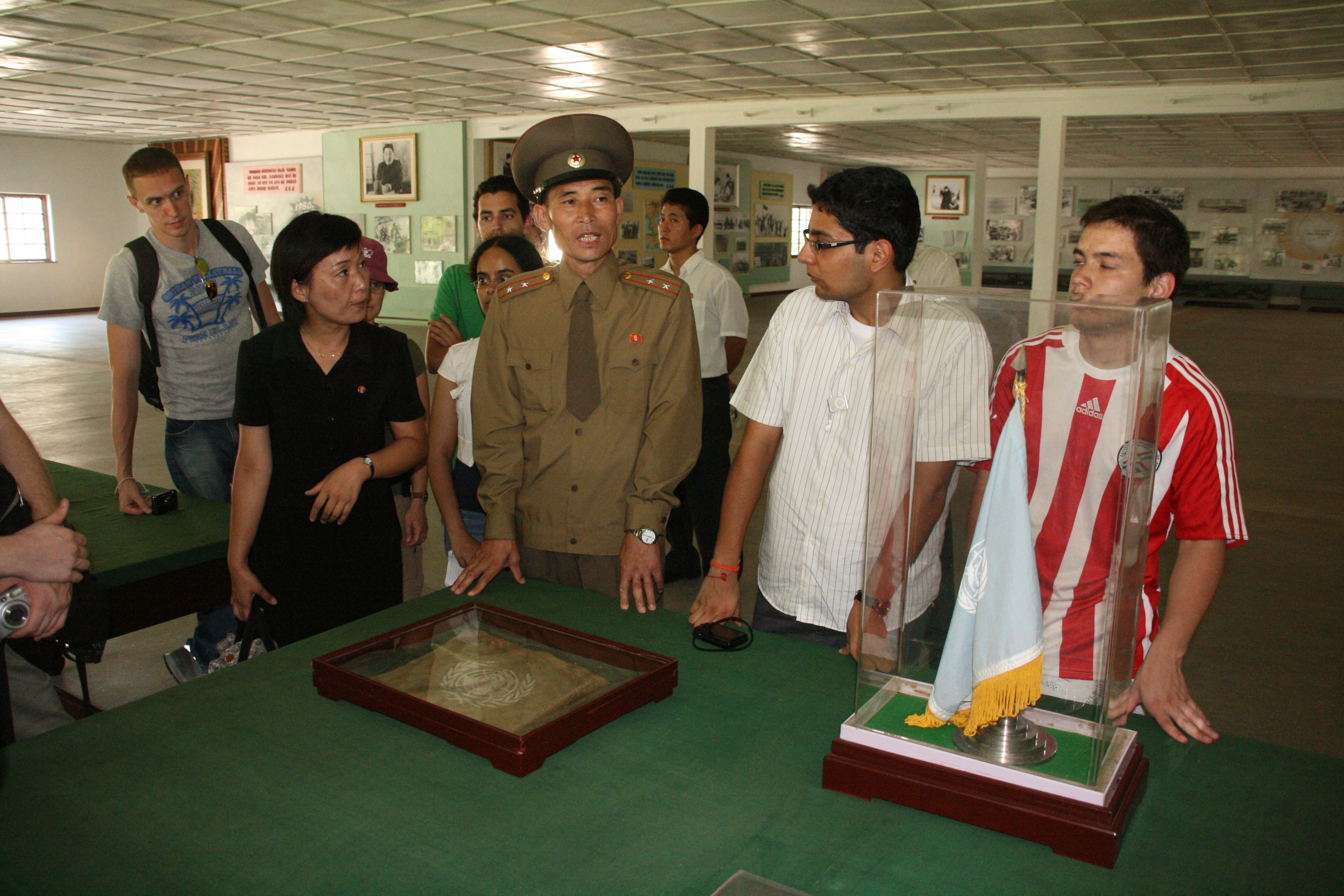
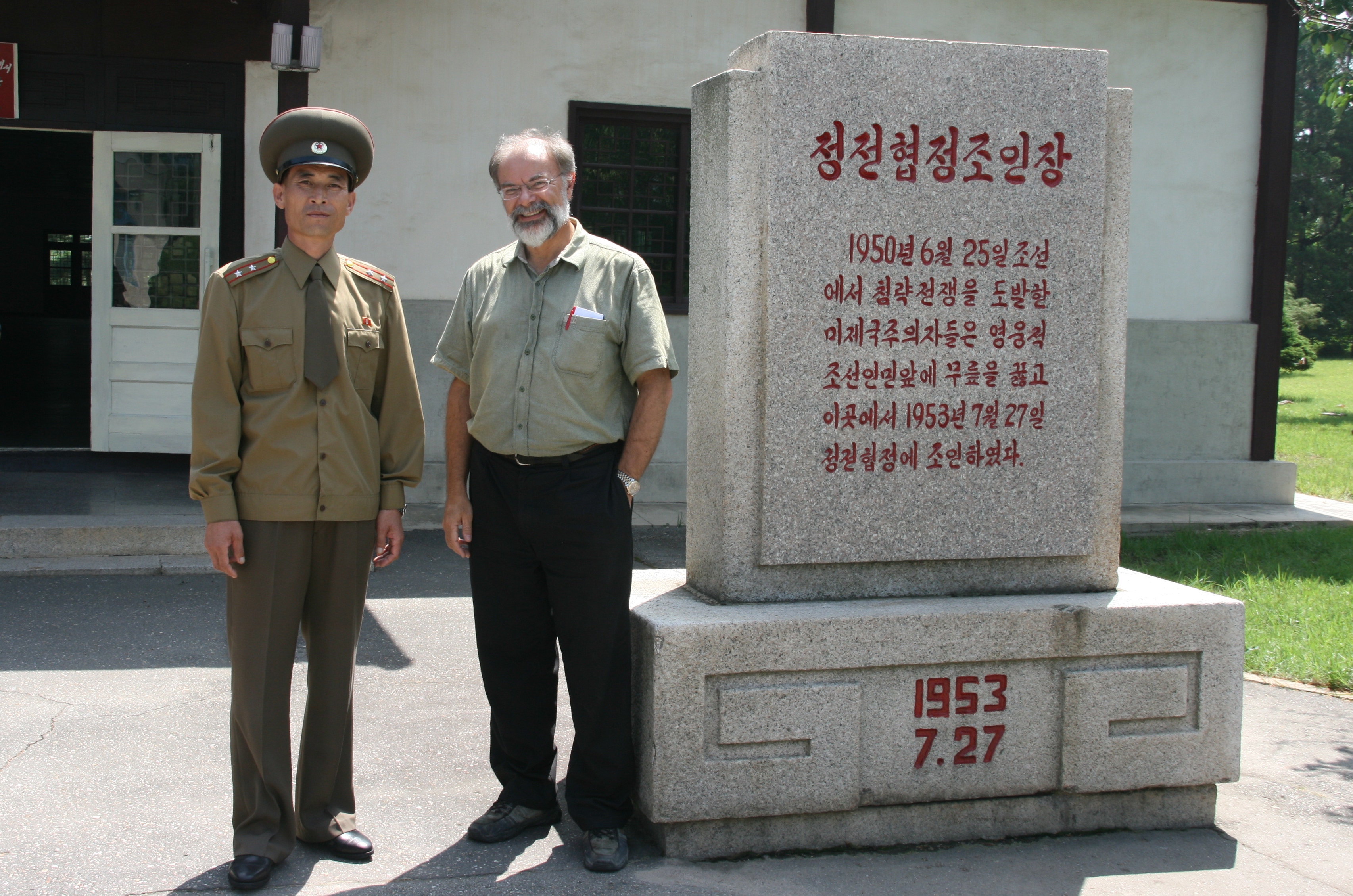
Having inspected the negotiating huts, we left the JSA (but not the DMZ) and headed to the building where the Korean War negotiations were conducted between 1951 and 1953. We then proceeded to a larger 1000 square metre building next to it, which is where the armistice was signed on the day I was born, 27th July 1953. We were told that the Americans wanted to sign the armistice in a tent so there would be no lasting memorial to their surrender, but soldiers from the KPA constructed the building in just three days. In addition to the desks and chairs, the flags and the armistice documents, the building houses a display of the history of the Korean War.
Interestingly, when I visited Panmunjom on the southern side a few weeks ago and the broad layout of the JSA was described, there was no mention that the armistice had been signed in this building, and we were told simply it was a small museum that the North Koreans had built. In front of the building is a small stone monument noting that the US imperialist aggressors had started the war on 20th June 1950, but under the onslaught of the KPA, the US “knelt down before the Korean people” to plead forgiveness and surrender, with the armistice being signed on 27th July 1953. Given the personal significance of that date for me, I had my photo taken with the KPA officer beside the monument.
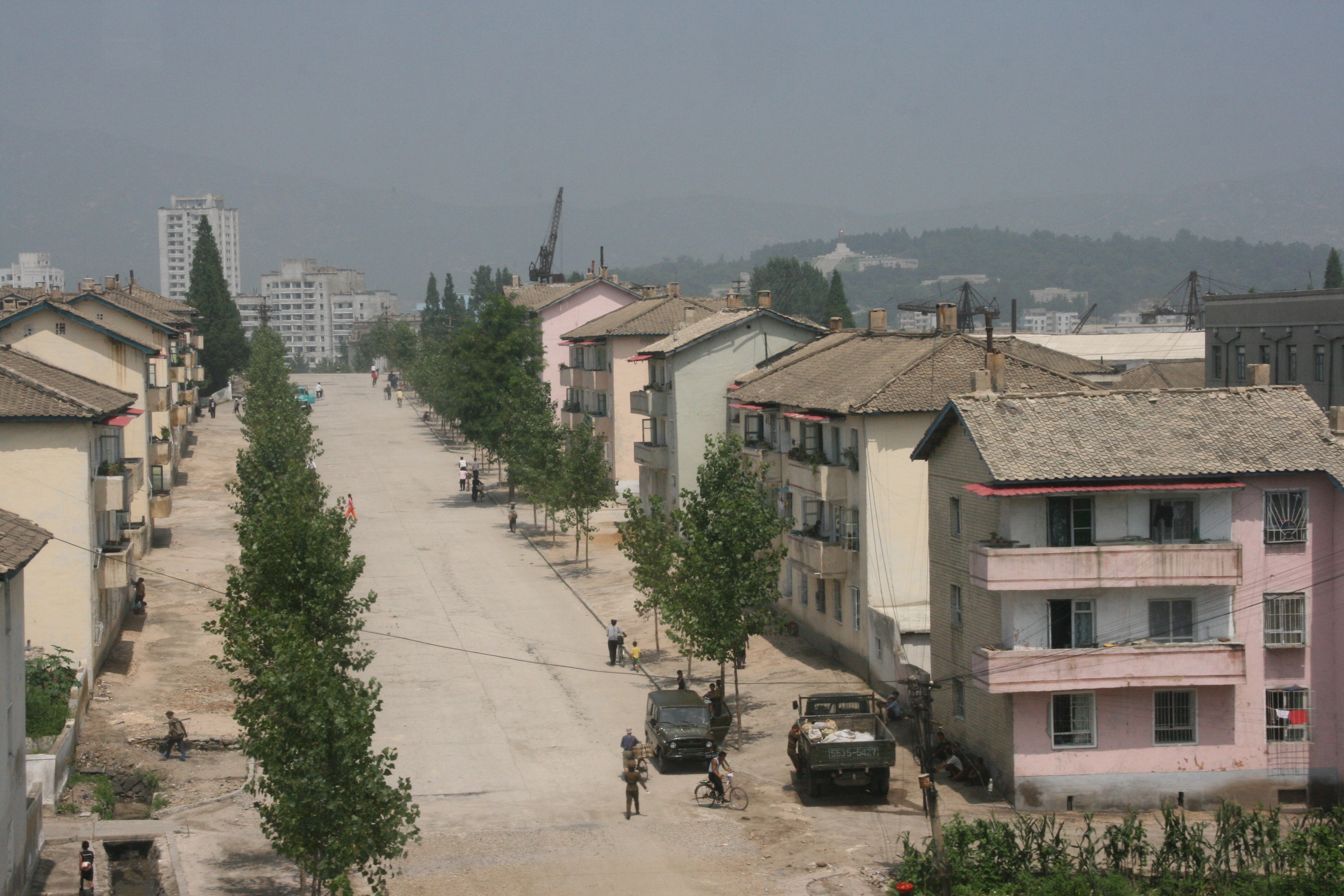
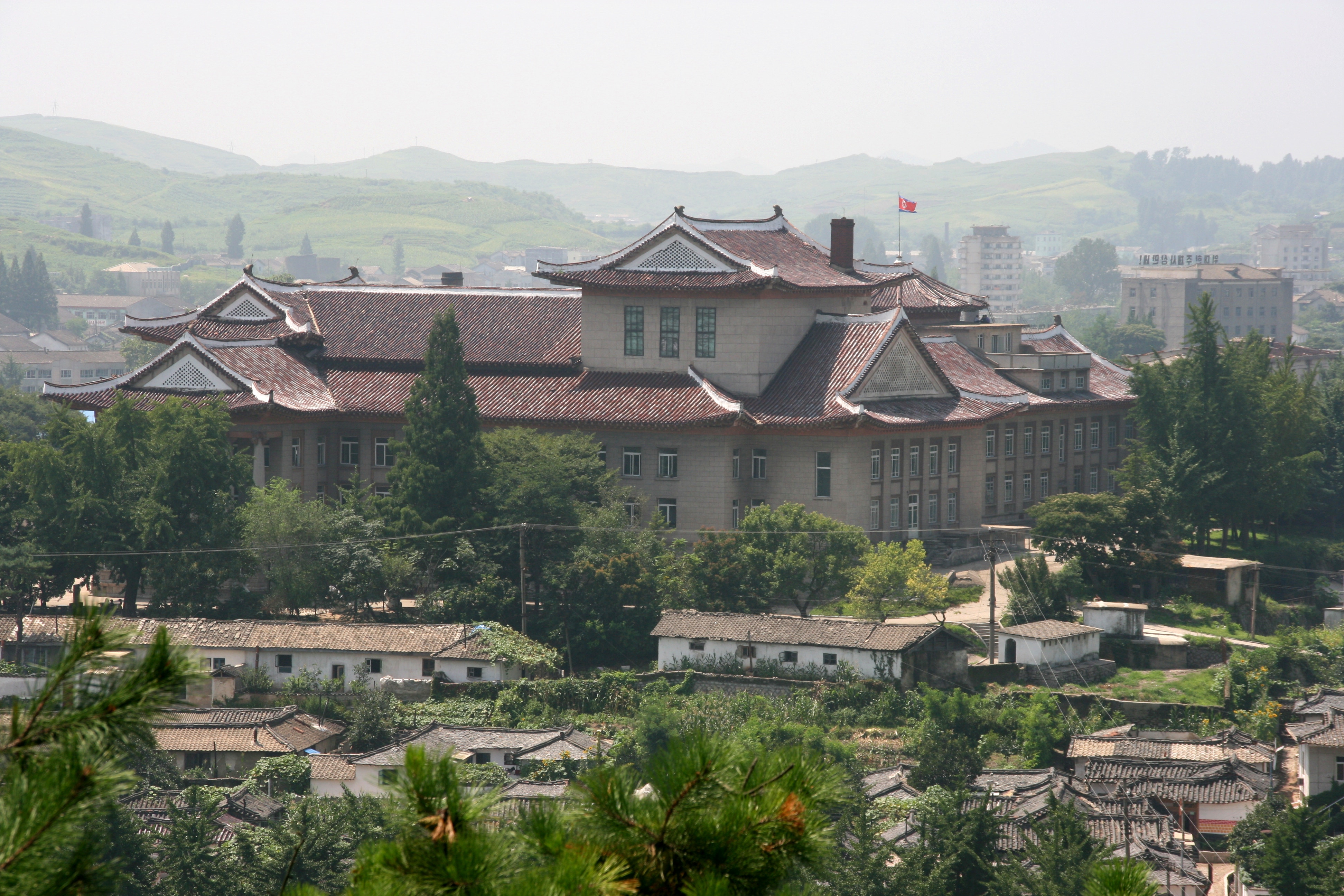
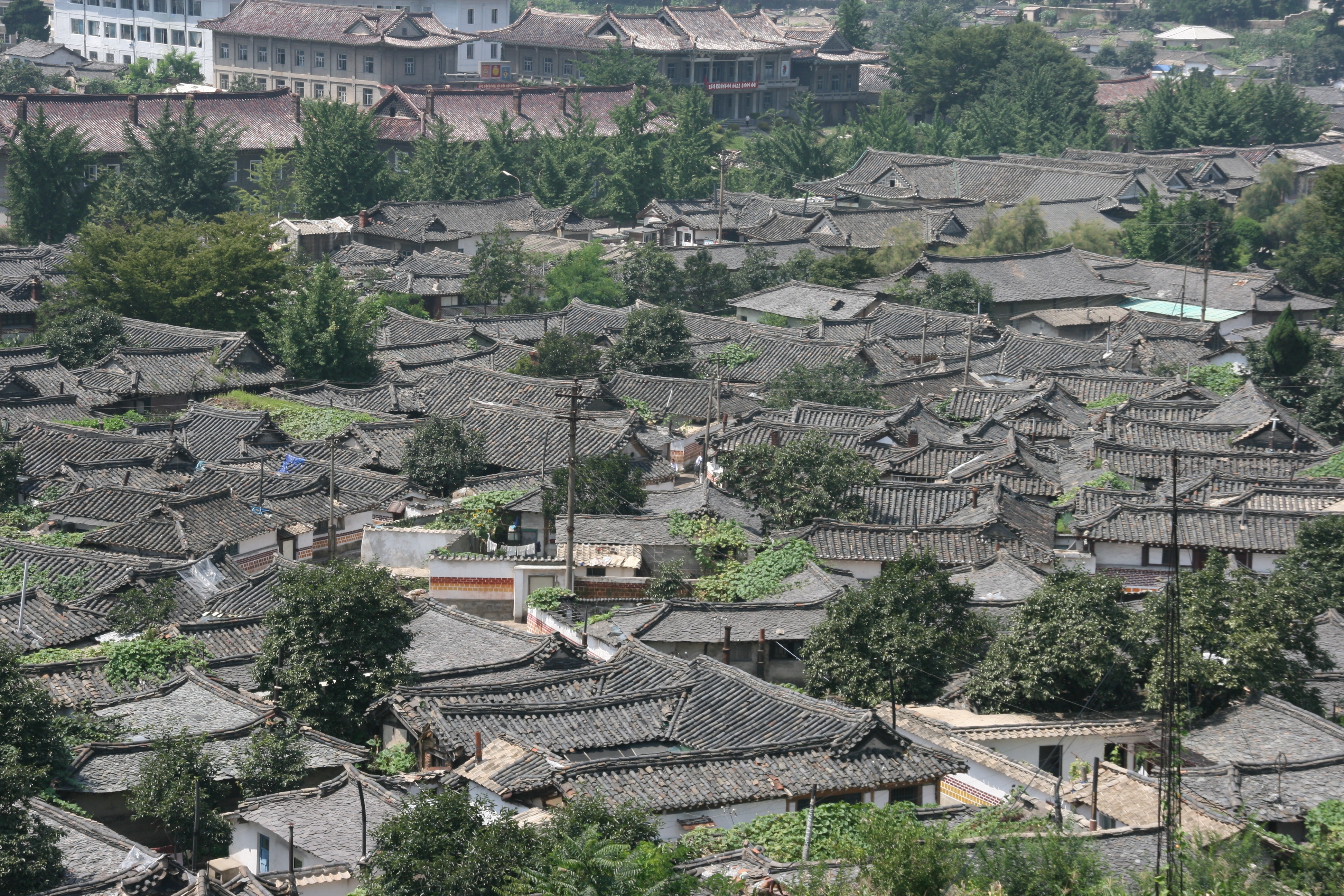
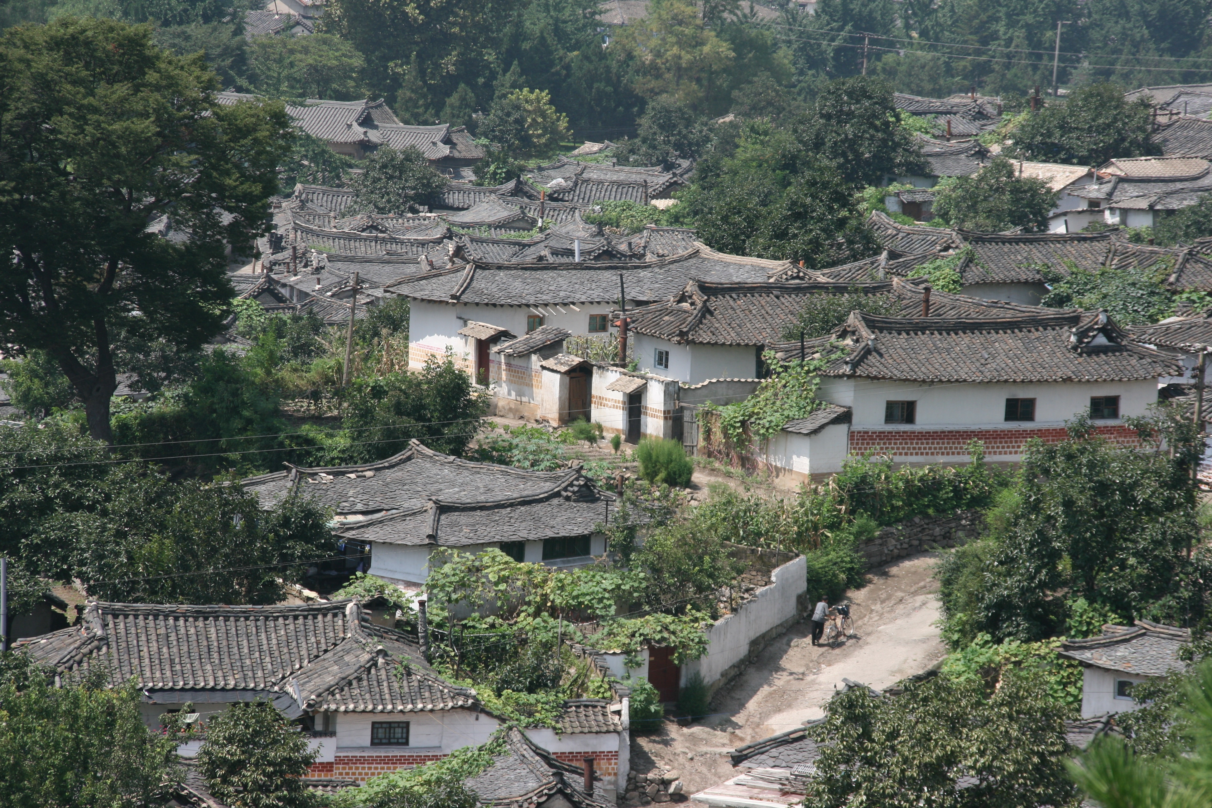
We had an early start that morning, so although it was midday we headed into the nearby city of Kaesong (just 7 kilometres away) for a lovely Korean style lunch. After lunch, we climbed the nearby hill for wonderful views over the city of Kaesong. Kaesong is almost the only city in Korea still to have a large number of old buildings; this is because negotiations were also carried on in that city and so it avoided the carpet bombing that most of the Korean Peninsula suffered between 1950 and 1953.
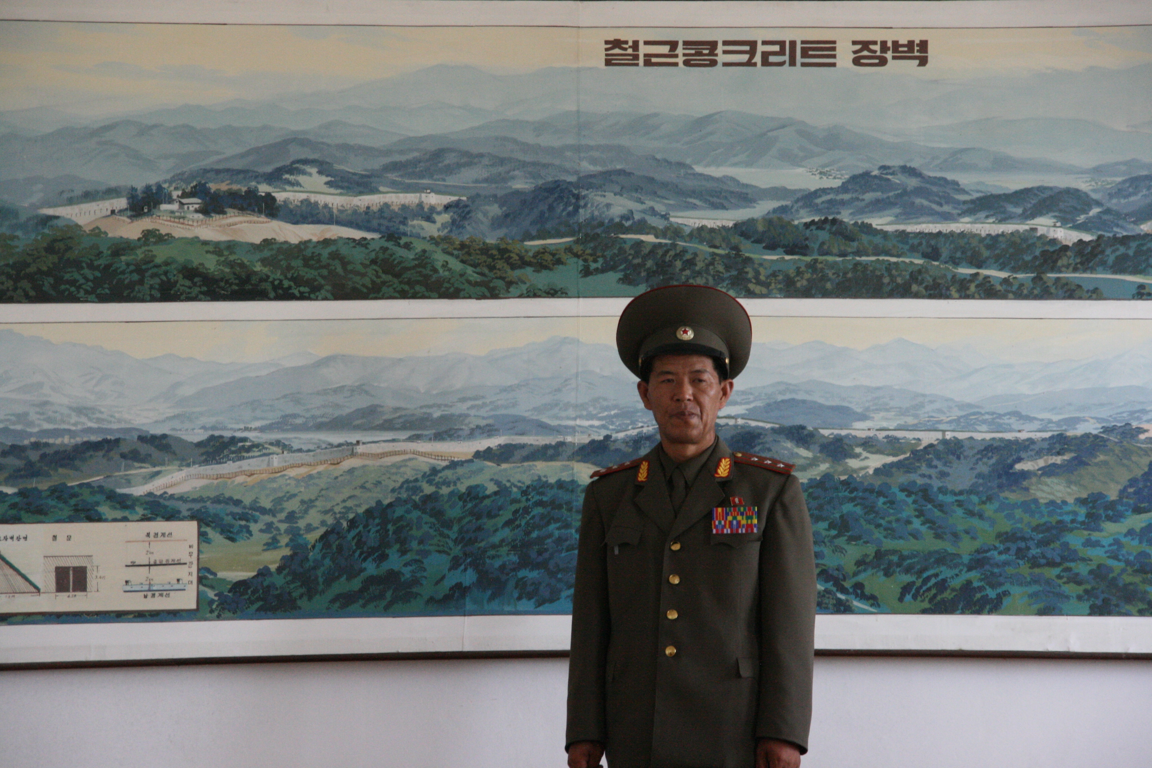
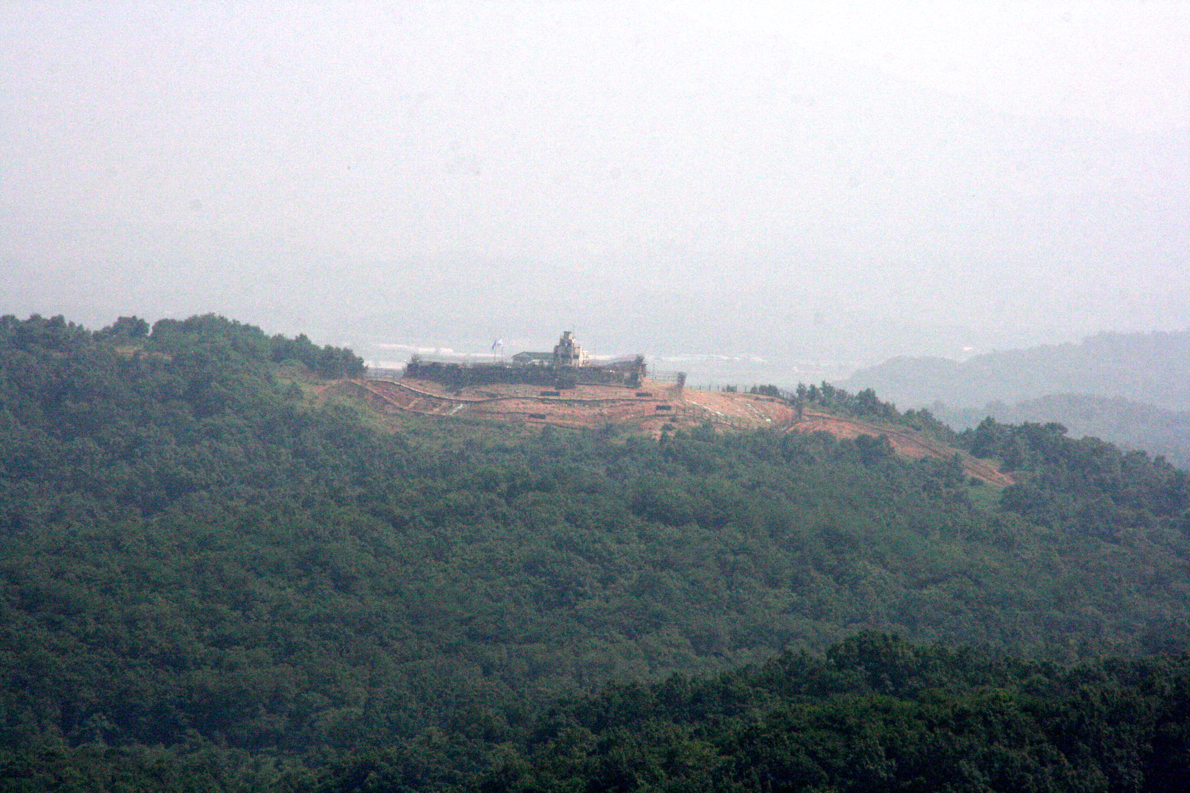
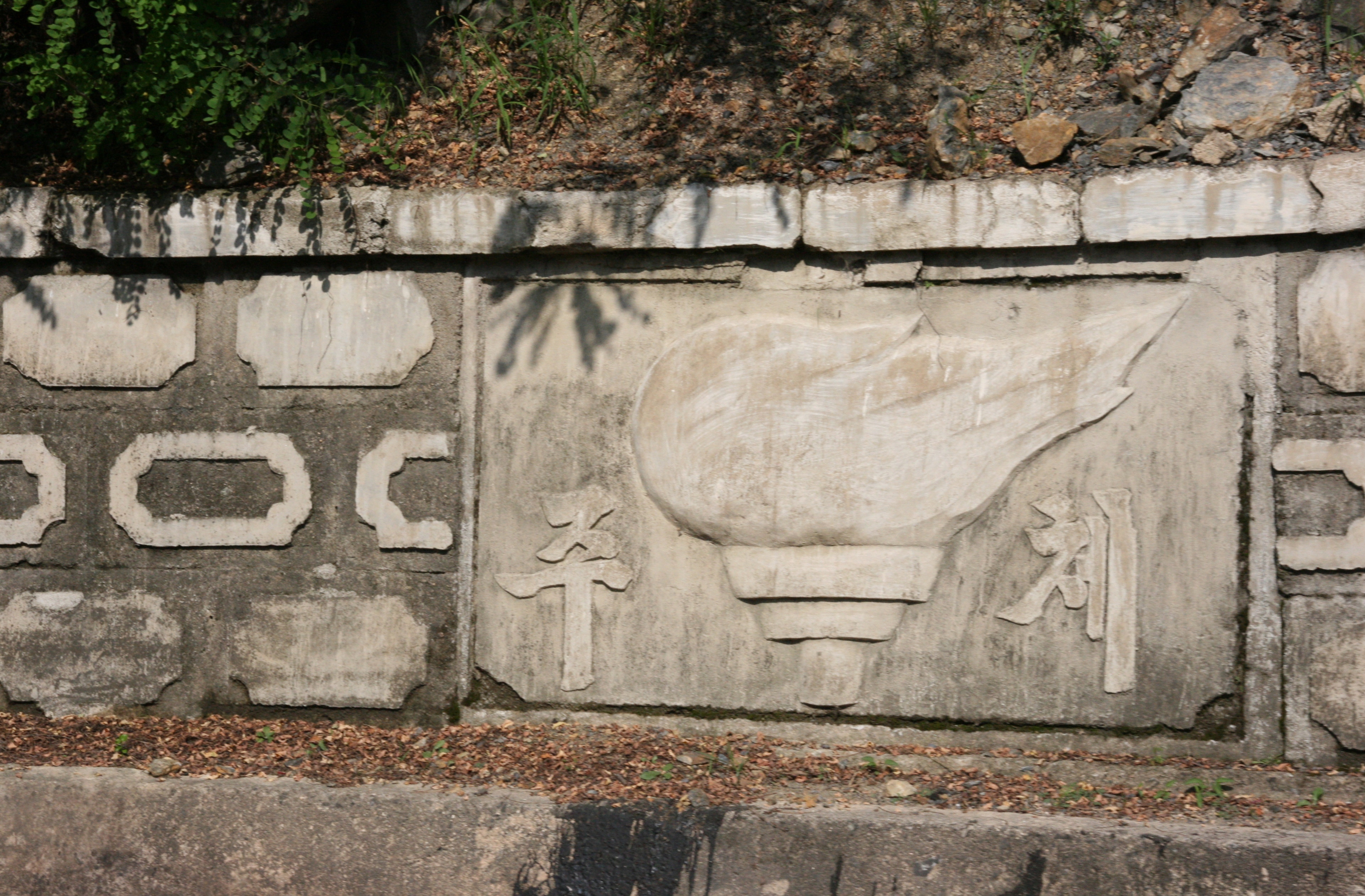
Our next stop took us back to the DMZ, although much further from Kaesong - in fact, about 30 kilometres to the east. Our destination was the Concrete Wall (also known as the Korean Wall). Built across the entire Korean Peninsula (except for the JSA and its immediate surrounds) by the US in the southern part of the DMZ in 1979, the Wall comprises a vertical face between 5 and 7 metres in height that faces north, backed by a gentle grass slope that looks like a natural hill from the south. It is basically an anti-tank wall that also allows for an aggressive attack as it is said to house vast numbers of tanks, trucks and weapons. Although most people in North Korea know about the Wall, it is almost unknown in South Korea or the US, and indeed, several websites deny its existence claiming it is a ‘figment of communist imagination’. The North Koreans criticise the Wall because it makes the division between North and South permanent, and was built by the Americans at the same time as they were demanding that the Soviet Union tear down the Berlin Wall.
A KPA colonel accompanied us to the Concrete Wall, and after describing its layout and construction he called it “the tragedy and cancer of Korea”. He reiterated a common North Korean slogan, which is “let’s hand down a unified Korea to the new generation”. He outlined why North Koreans see the US presence in South Korea as the enemy to reunification. As he explained, the presence of US troops in Korea cannot be justified as necessary for the defence of the US, but it is clearly an aggressive act. As he said, “imagine if there were 50,000 North Korean troops in Mexico on the border with the US. Would the US allow that? Would they agree it was necessary for the DPRK’s own defence, or would they see it as an act of aggression? That is how we see the US troops on our border”.
After this stimulating discussion, we were taken outside to look at the Concrete Wall four kilometres to the south through powerful field glasses. When I went to the Concrete Wall last year, conditions were a bit hazy, and a few students were not even sure whether they had seen it or not. That was not an issue this year - conditions were clear and everyone was quite certain they had seen the Wall, together with several well defended observation towers flying the UN and South Korean flags.
It was a long drive back to Pyongyang, first through the beautiful farming scenery east of Kaesong, and then back along the Reunification Highway. We had been to one of the world’s most tense locations - the front line of the old Cold War - and in doing so had enjoyed some stimulating and challenging insights to a range of issues - peace, truth, history, propaganda and contemporary global politics to name just a few.
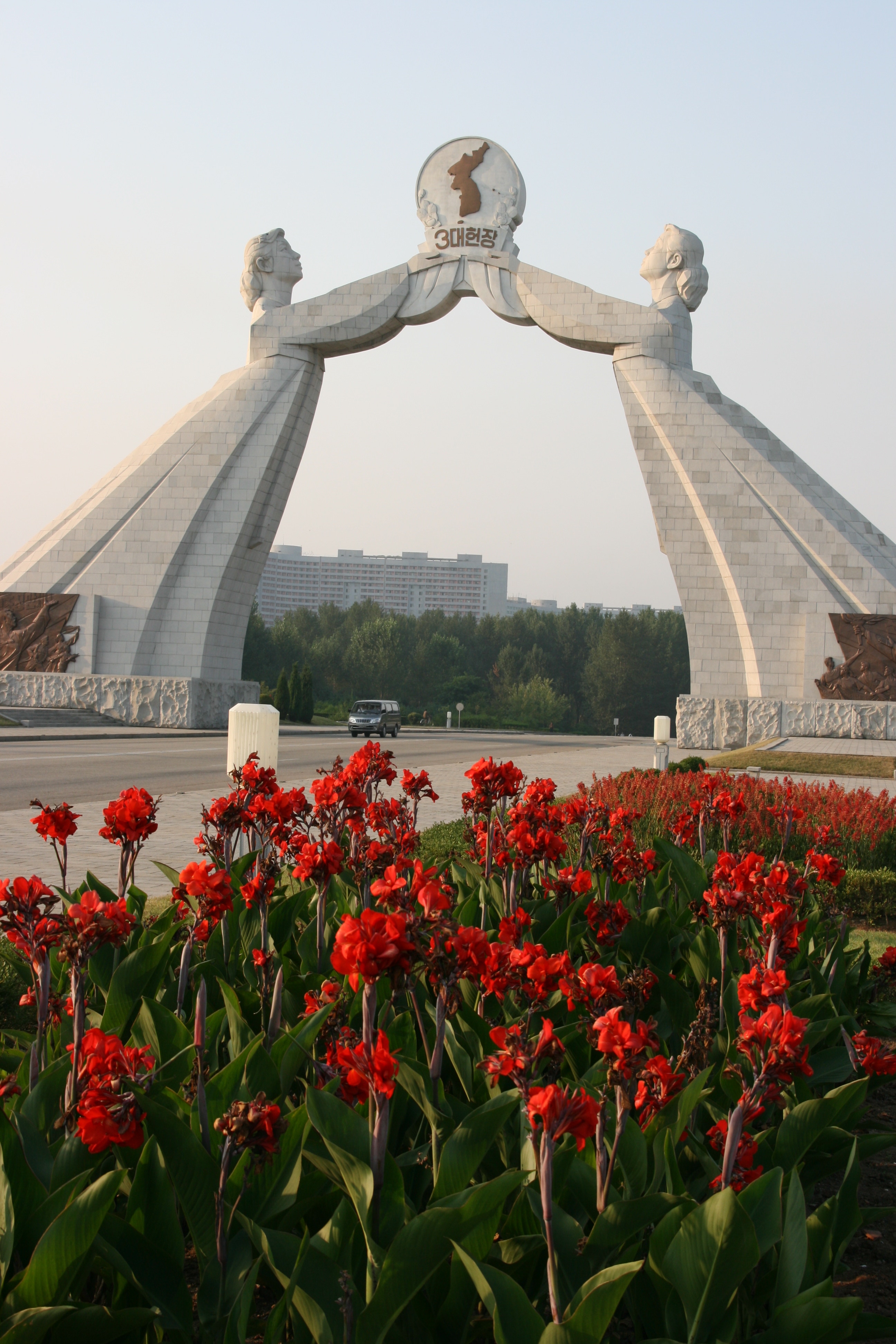
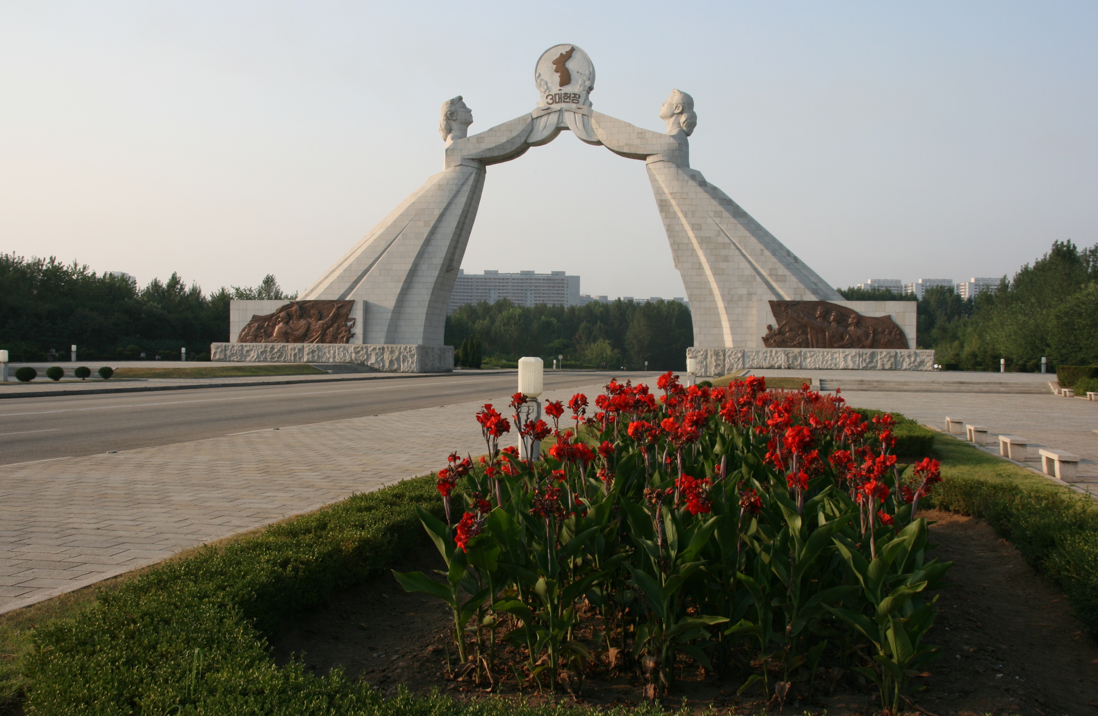
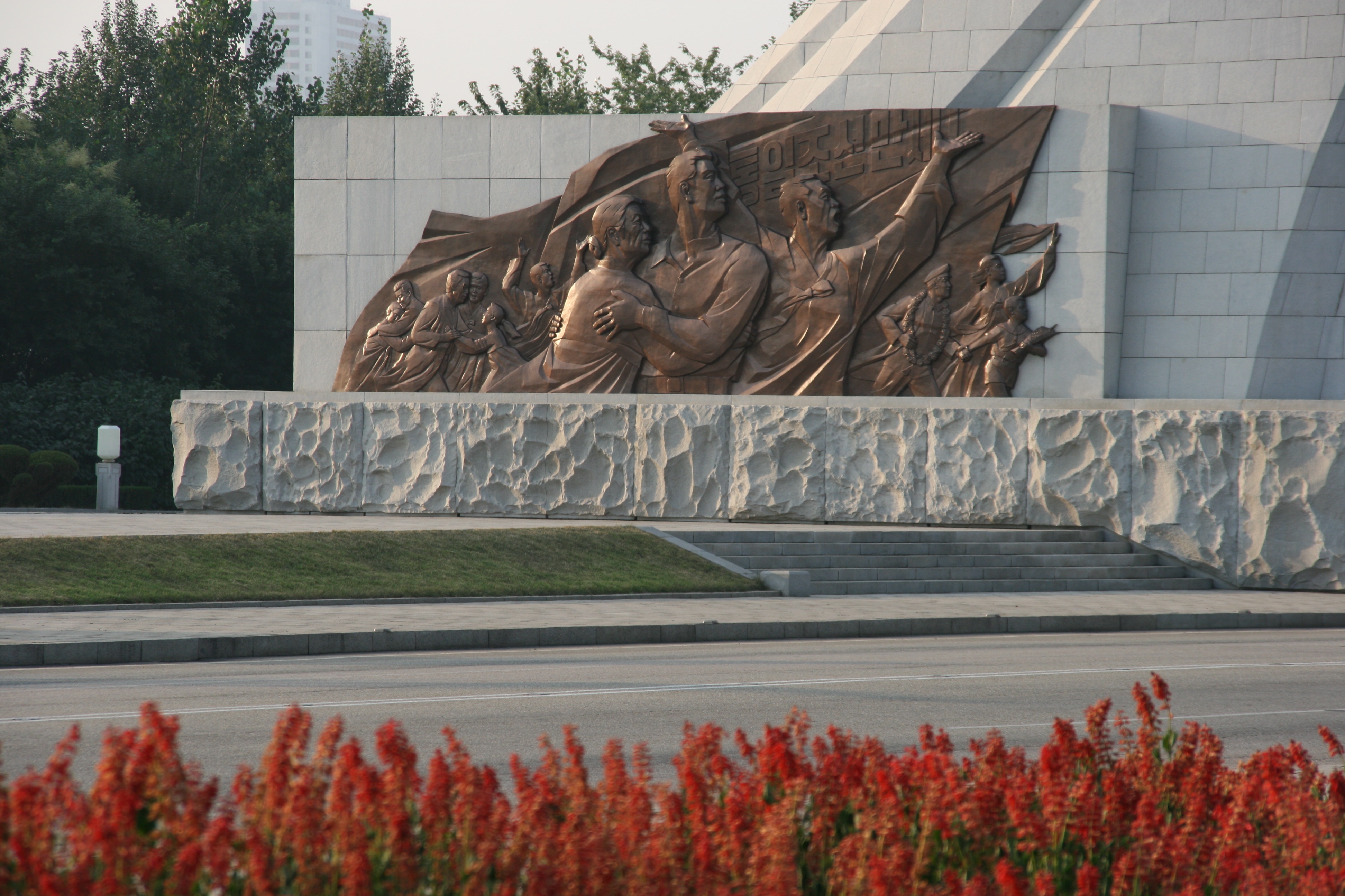
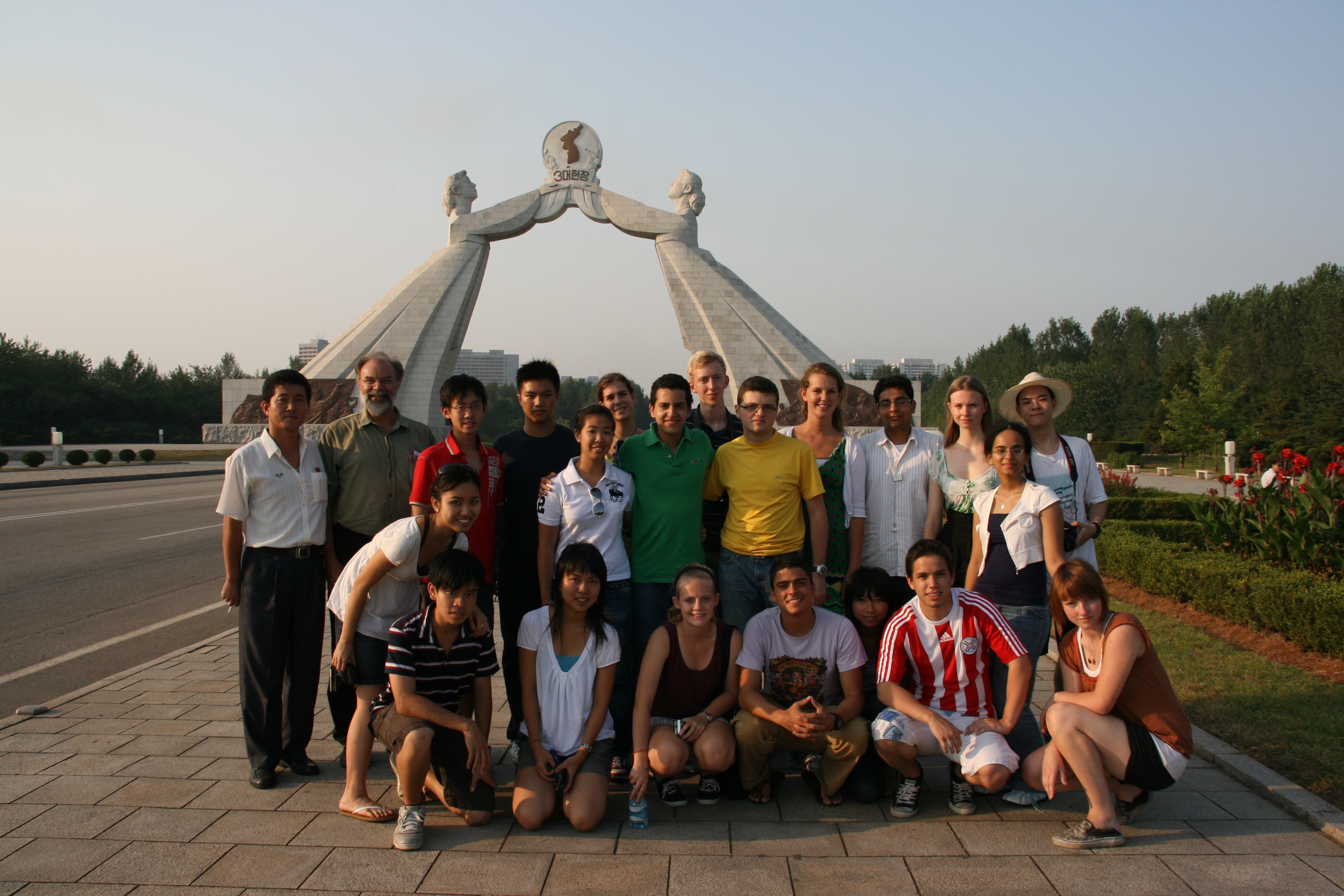
As entered the southern outskirts of Pyongyang, we stopped at the Monument to the Three Charters for National Reunification. This was a huge but elegant arch spanning the wide road in the form of two Korean women in traditional dress - one representing the north and the other the south - reaching out with their arms for each other. It is perhaps Pyongyang’s newest monument, having been completed in August 2001 following very productive talks between the governments of North and South Korea. In the words of the ‘Pyongyang Times’, “Against a background of the ever-growing mood for achieving independent reunification, peace and prosperity by the concerted efforts of the Korean nation itself, the monument serves as the banner encouraging the fellow countrymen to further efforts for reunification”.