
Braşov
Distance travelled = 0.9 kilometres by cable car and 15.7 kilometres walking (20,910 steps).
I planned my day in Braşov around the day’s fairly pessimistic weather forecast – cloudy with intermittent sunny breaks in the morning, turning overcast around midday followed by rain from mid-afternoon. The forecast was broadly correct up to mid-afternoon, but rather than rain falling in the afternoon, the overcast conditions lightened and there were even a few brief sunny breaks.
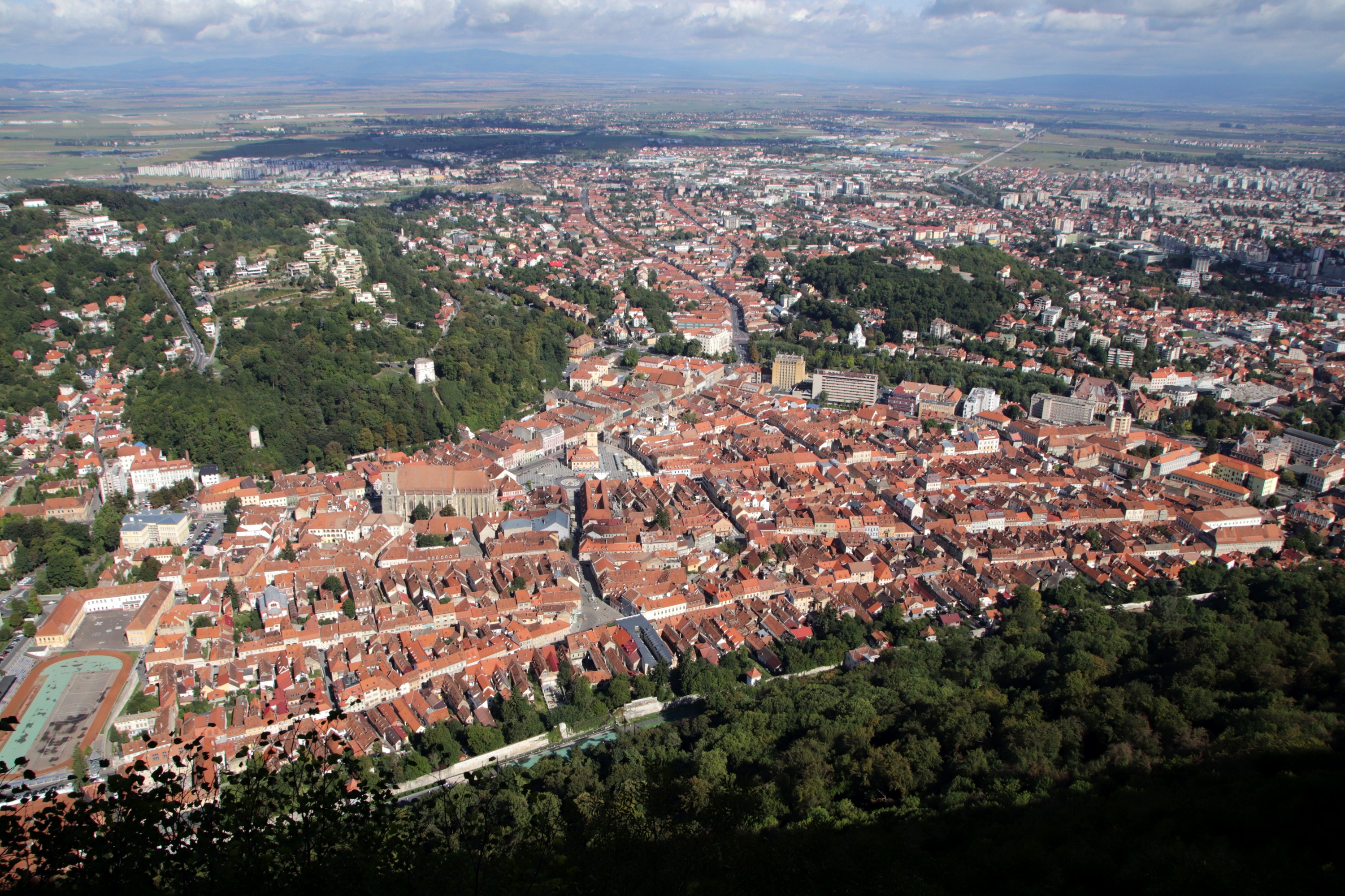
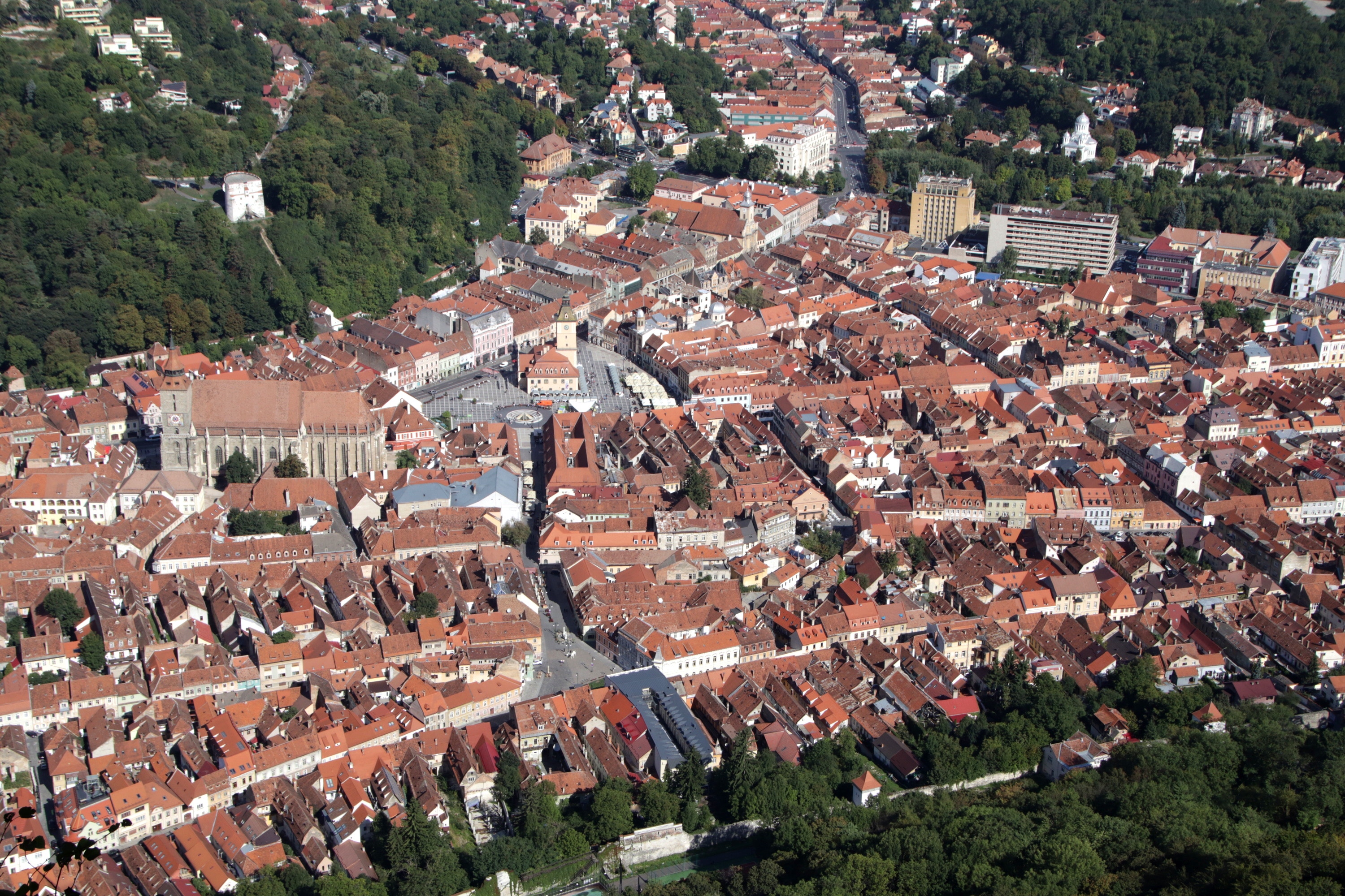
My first priority for morning visits was Mount Tâmpa, the 930 metre high peak immediately east of Braşov’s historic centre. Although the peak can be reached by a steep, winding trail, most people choose to use the old Italian cable car instead – the return journey of 450 metres each way cost me just 25 lei ($7.50 Australian). Even walking up the steep hill to the base station for the cable car provided me with a vigorous cardio workout – the first of four that I experienced today in this hilly city.
When I visited Braşov with my family in 1987 we also took the cable car ride (having driven to the base station rather than walking). However, that day was somewhat hazy, and because of the pressure of time (we had to drive to the Black Sea cost of Bulgaria by that evening), we had to take the cable car down again almost as soon as we had arrived at the top and taken a few poor quality photos.
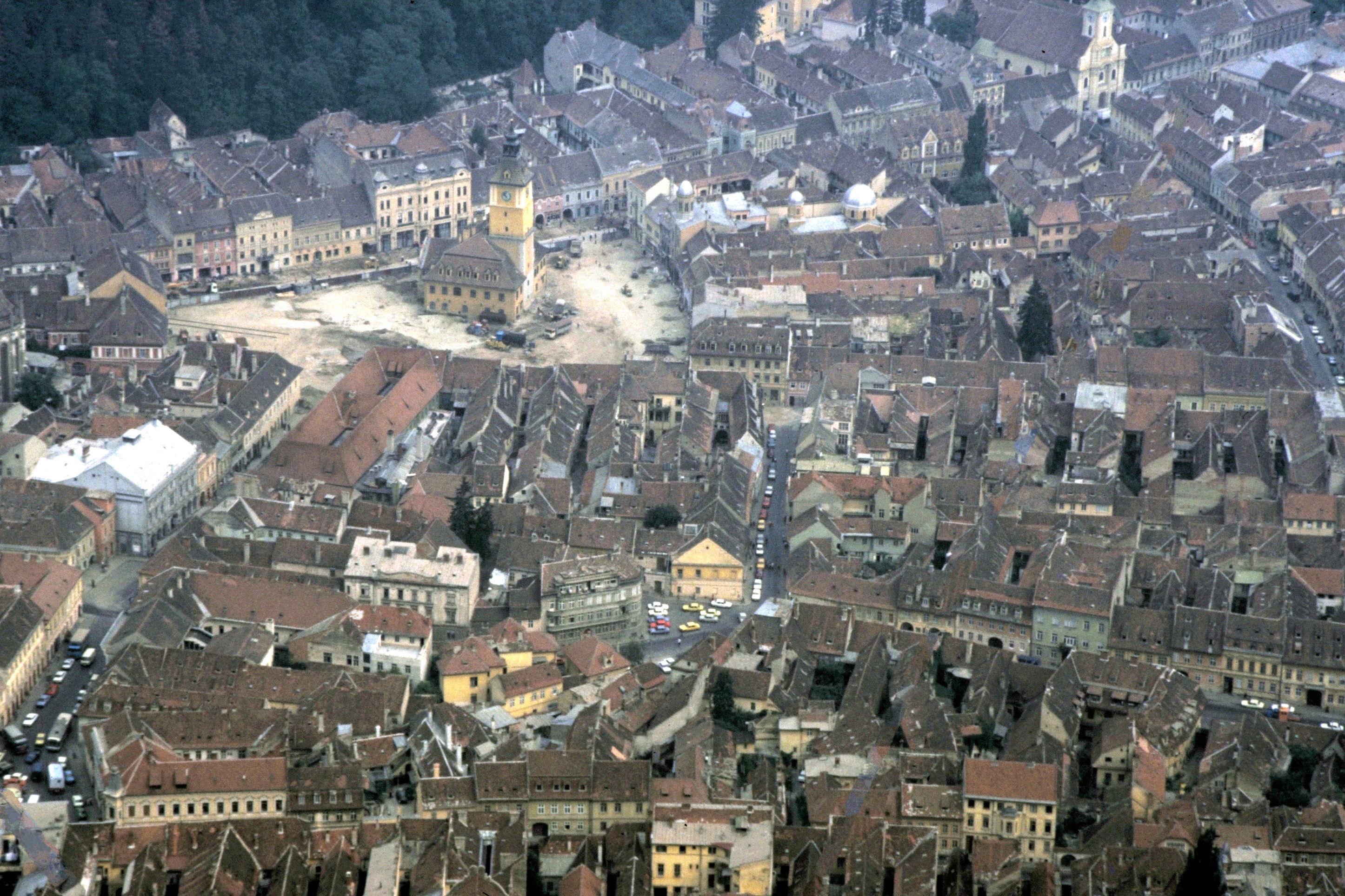
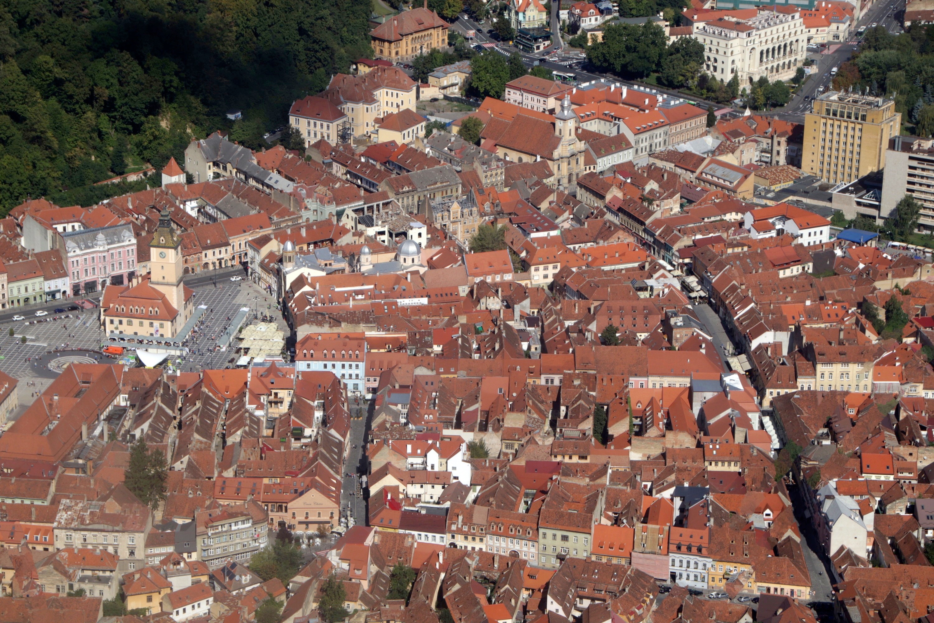
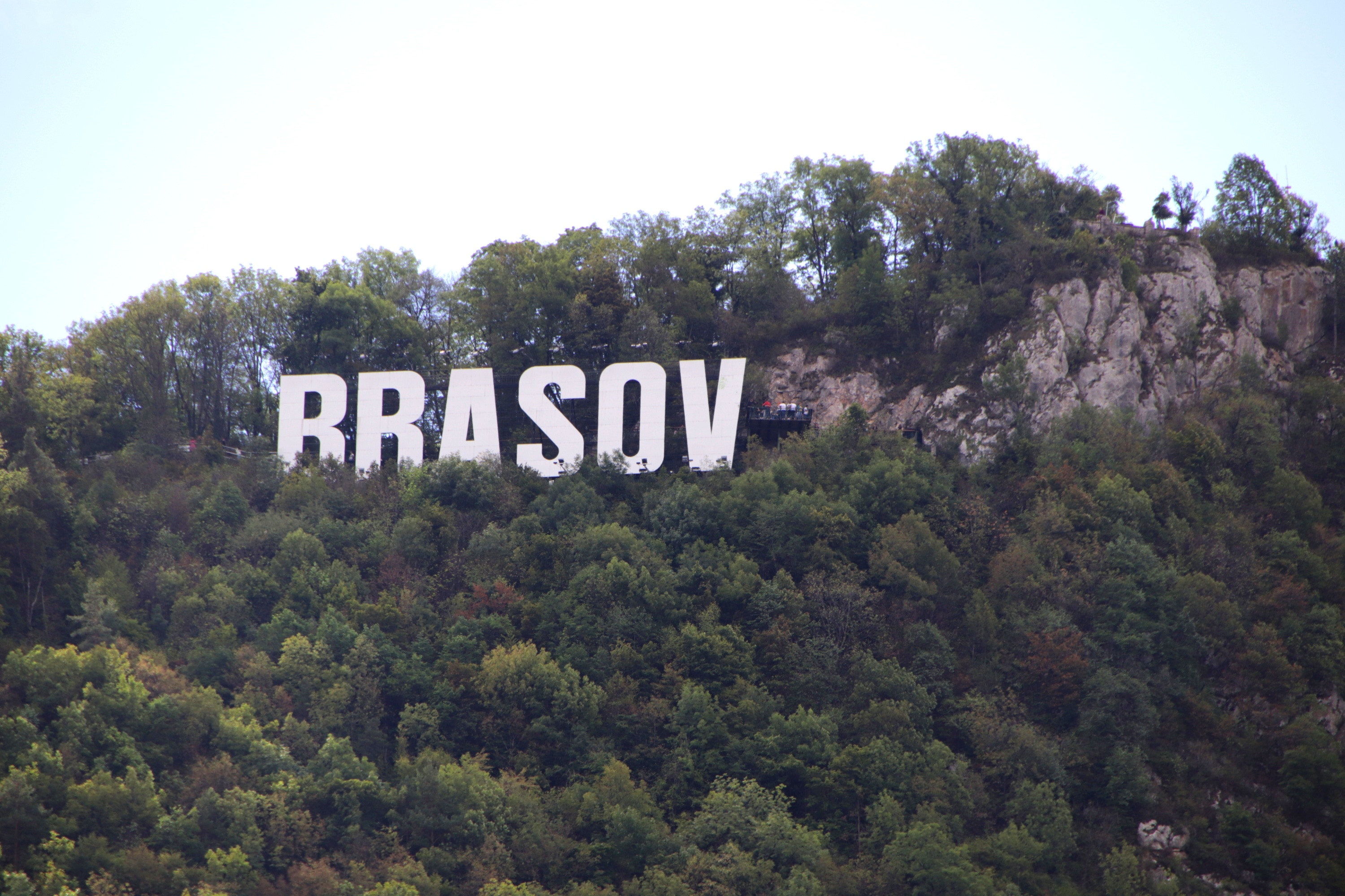
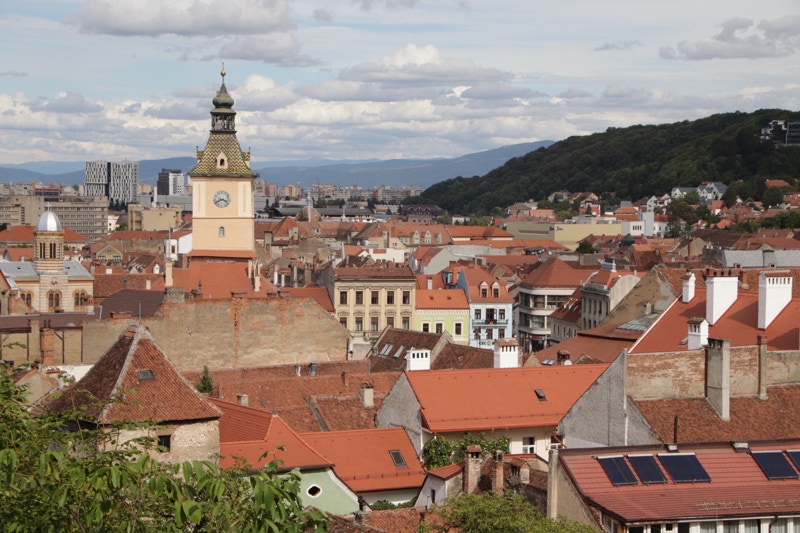
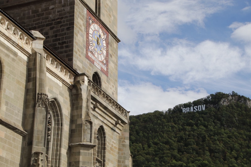
With more time available today, I was able to take the 10 minute (each way) walk along the rough limestone track across the ridge to the lookout platform beside the huge Hollywood-style “BRAŞOV” sign that adorns the top of Mount Tâmpa. I had to wait quite a while for the heavy clouds to clear, but they eventually did so and the view was superb – well worth the wait. I have included my 1987 photo from Mount Tâmpa (with the red frame) to use as a comparison with today’s views.
As I took the cable car down I recorded a two minute video (that’s how quick the journey is), so if you want to see my video of the descent, click HERE.
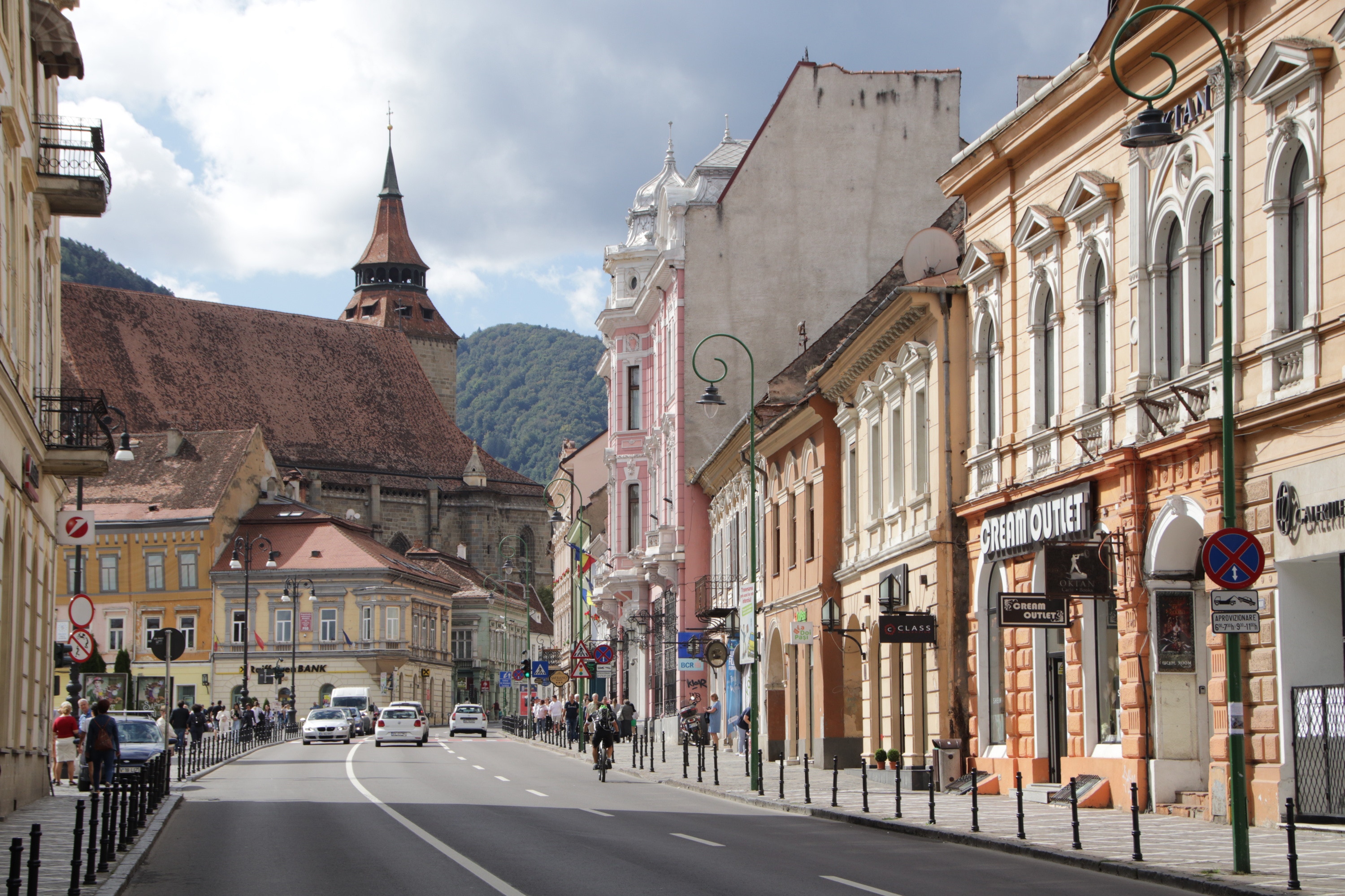
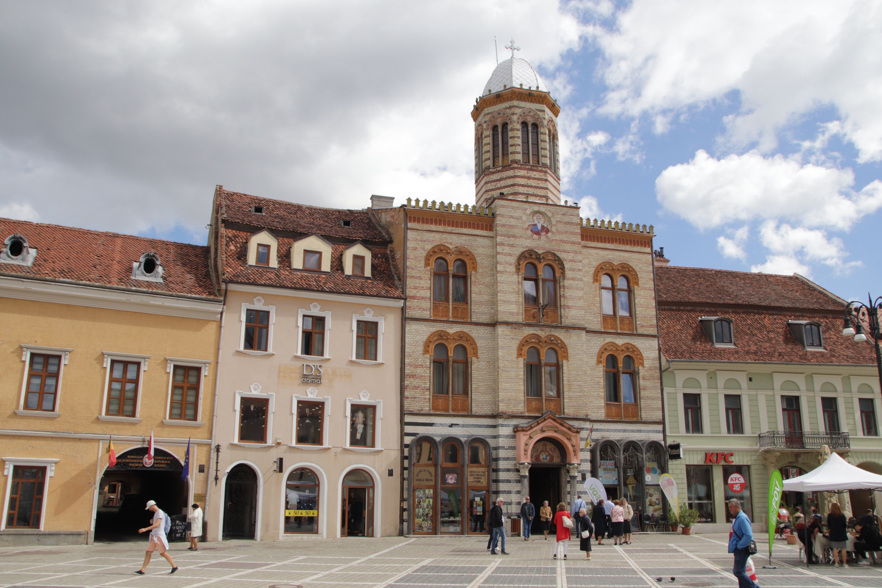
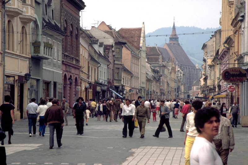
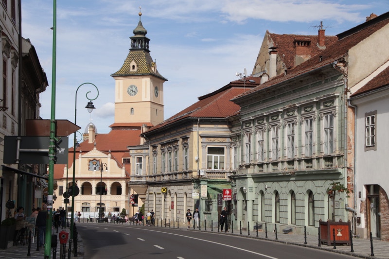
The sun continued to shone as I wandered through the narrow laneways and streets of old Braşov. As I just enjoyed taking in the sights, sounds and smells (mainly the aroma of breakfasts cooking in the cafés), I thought it might be interesting to find some of the places I had photographed in 1987. I hadn’t brought printed copies of those photos, but with my Vodaphone SIM card installed I was able to get immediate access to the relevant day’s diary on my website of the 1987 trip. Having done so, it was surprisingly easy to locate the places I had taken the two 1987 photos I had uploaded in that diary – easy in part because they were both taken within a few metres of each other at the same corner (Strada Michael Weiss and Strada Republicii). I wasn’t able to duplicate one of the locations precisely as the place where I took the photo in 1987 is now part of an outdoor eating area of a restaurant and covered in view-obscuring umbrellas. I have included the comparative images of the place I could duplicate with the 1987 view having a red frame for identification.
I spent some more time wandering through the old part of the city for some time, and then as the patchy clouds started to become less patchy and more continuous I began exploring some other parts of Braşov beyond the focus of the historic centre.
The first such destination was to the south of the historic centre – the site of Romania’s first school. (It would seem unthinkable to spend a lifetime in education and ignore such a site). Established in the late 1500s, the old school is now a museum in the grounds of St Nicholas’ Cathedral. Although Sunday’s opening time was clearly displayed as 12:00 noon (and it was 12:20pm when I arrived), the building was firmly padlocked closed, with no sign of any action – unlike the Cathedral beside it. Judging by the School Museum’s exterior advertising, I may have been spared a fairly sterile experience, unlike the Cathedral which is apparently quite spectacular inside – but obviously difficult to explore when mass is underway.
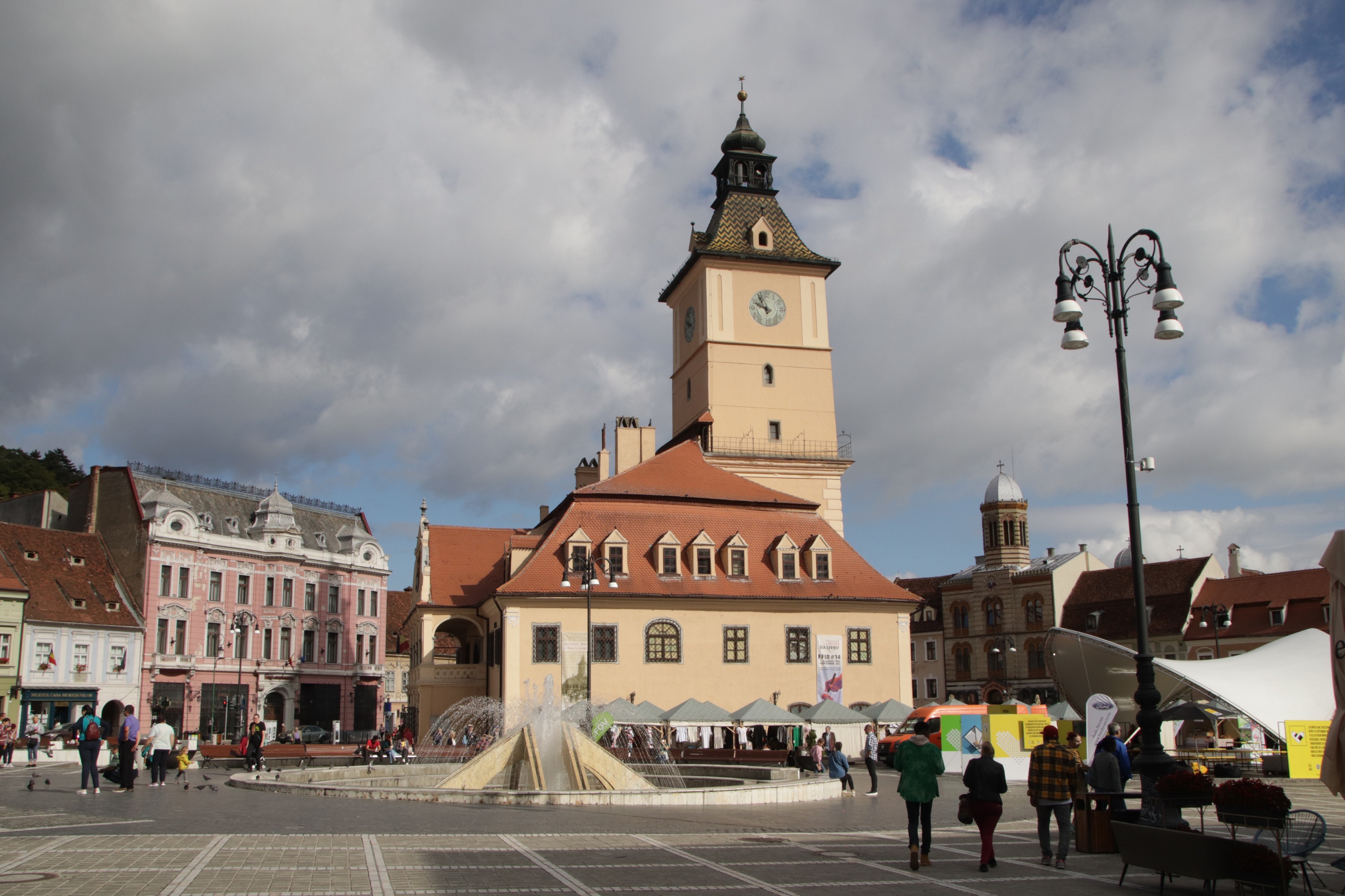
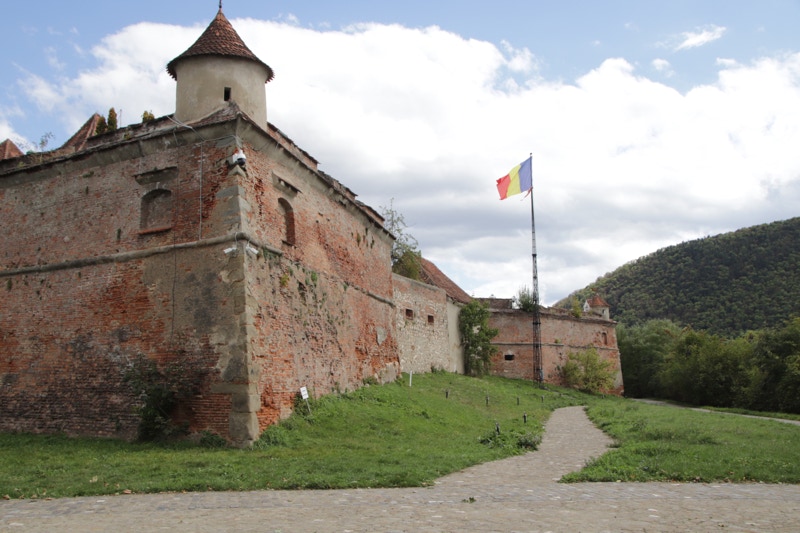
With the sun still shining more often than not, I returned to Piaţa Sfatului (the main open square in the centre of the historic centre), and after a short diversion to leave some bottled water I had bought from a small supermarket in my room, I walked past the nearby Memorial to Victims of the 1989 Uprising in front of the District Council building, and then climbed the long, steep hill to the Citadel (cardio workout no.2 for the day).
The citadel is visible from my hotel room. Built in the 16th and 17th centuries to replace an earlier wooden structure, I knew I would find the citadel to be closed for renovations (or more accurately from what I saw, closed for interminable inaction), but it is well known for its fine views across the city. That may be the case when the citadel’s towers are accessible, but any potential views were obscured by a thick forest of trees today.
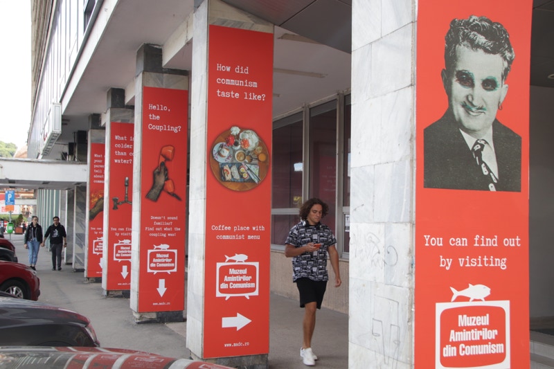
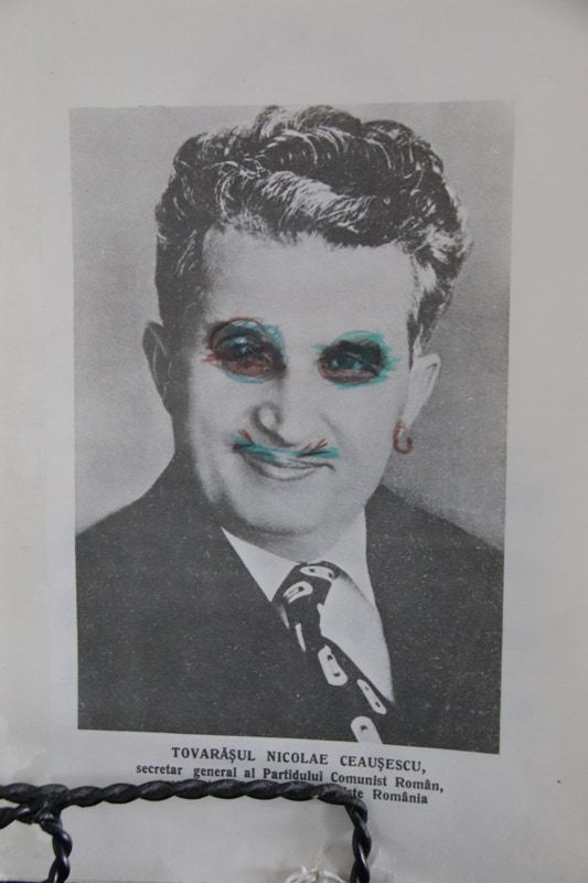
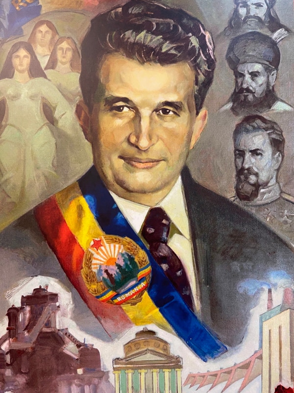
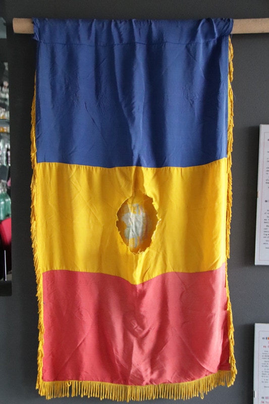
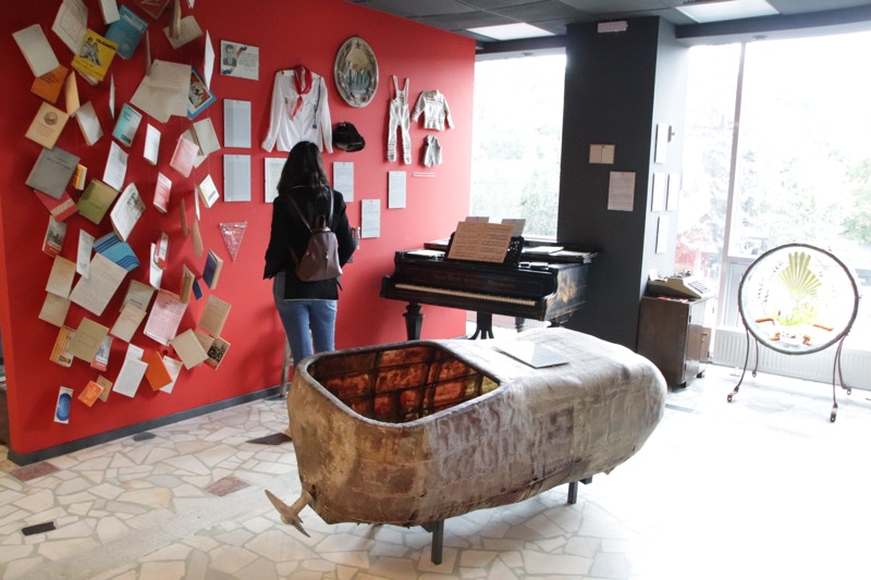
Having descended the steep hill once again I noticed signs promoting what promised to be an interesting museum. Known as the Muzeul Amintirilor din Communism (Museum of Memories of Communism), this is a small but very well executed private museum that displays artifacts from the Ceauşescu era with very moving descriptions in both Romanian and English. It was interesting to see how many Romanian people were visiting the museum to re-live and/or share their experiences of the Ceauşescu era with their children and grandchildren. It was a very worthwhile if unplanned stop.
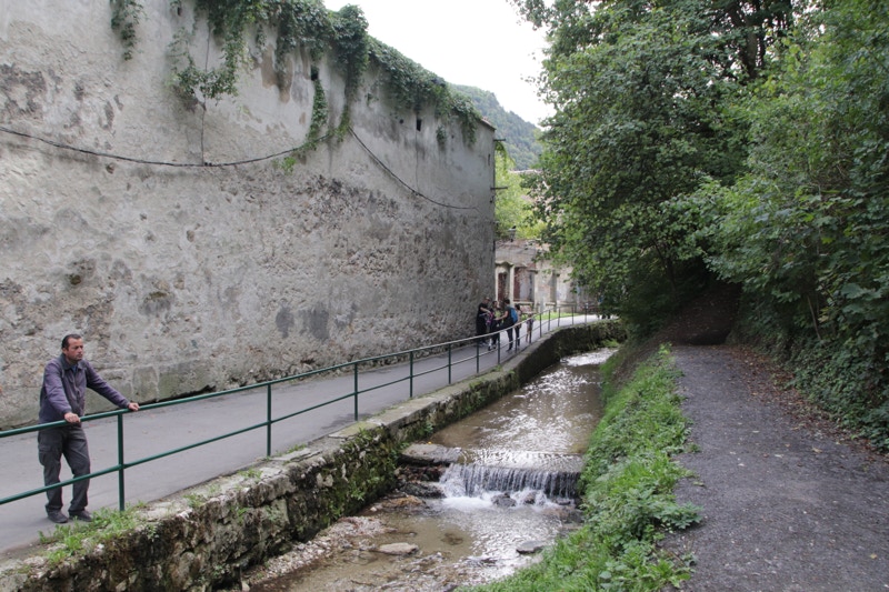
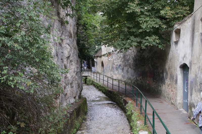
My final visits for the day centred on exploring the remains of Braşov’s old city walls, the best sections of which lie to the west of the historic centre along a small stream that flows beside a pathway known as Strada După Ziduri. Braşov used to be surrounded by walls that were 12 metres high and over 3 kilometres in circumference.
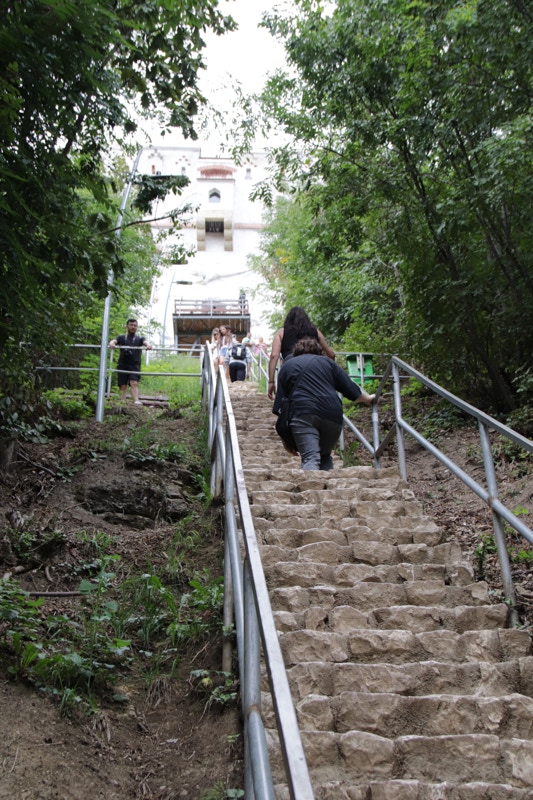
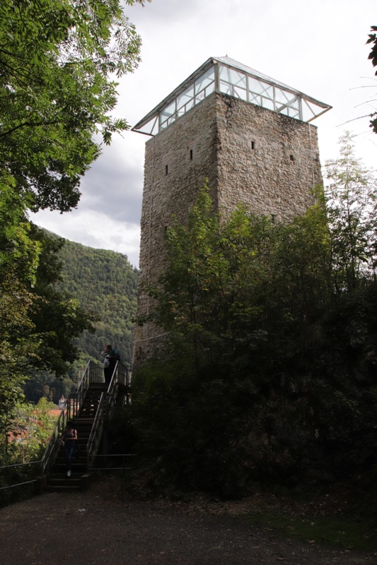
While exploring the walls, I made two diversionary stops. The first was a long, steep climb to the base of the White Tower (cardio workout no.3 for the day), so named because it has white walls. Apparently there are great views from the top of the tower, but as it is closed for long-term renovations, I had to be satisfied by the still-quite-good views from the base of the Tower.
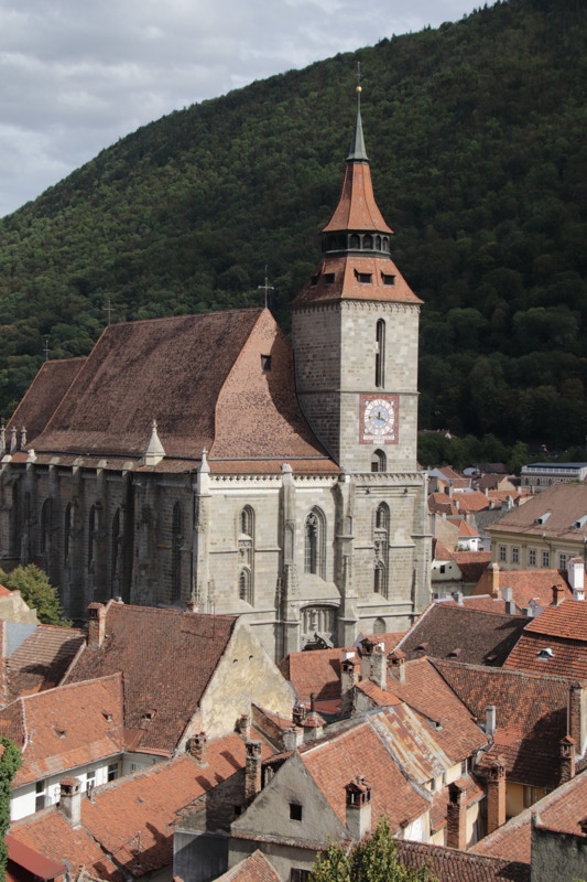
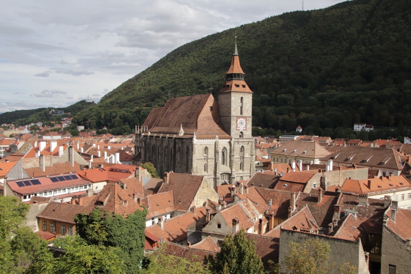
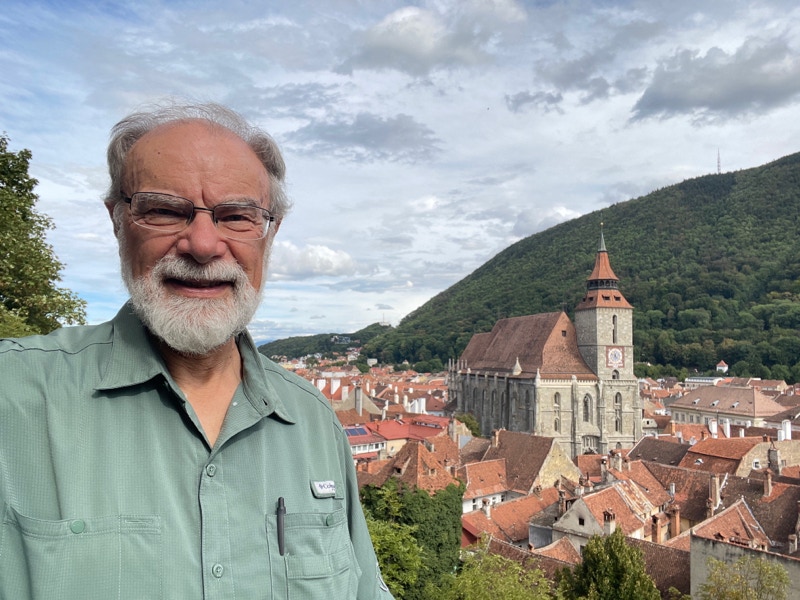
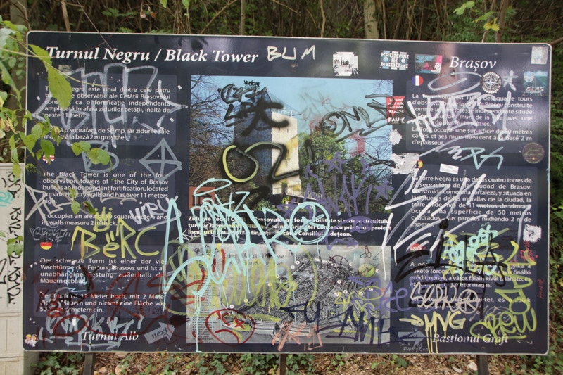
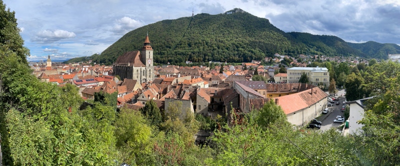
My second diversionary stop was at the Black Tower, named because its walls are … a light greyish-tan colour – yes, the naming logic breaks down at this point. Apparently there are great views from the top of this tower too, but as it is closed for long-term renovations (are you catching a theme here?), I had to be satisfied by the still-quite-good views from the base of the Tower. Actually the view, which focussed on the Black Church and its immediate surrounds, was somewhat dull because of the heavily overcast conditions – the buildings seemed to be absorbing light like blotting paper absorbs liquids. However, I decided to take a rest after the long, steep climb (cardio workout no.4), and to my surprise, the clouds parted for a while and bathed the scene in glorious afternoon light. The rest proved to be very productive.
Overall, it has been a really enjoyable day – not always predictable, and with considerably more cardio exercise than I had anticipated. That may not be a bad thing, though, as the focus tomorrow will be a long drive that will take most of the day.