Oman is an Islamic country, and therefore Friday is the official day of rest and the first day of the two-day weekend. Therefore, no work was scheduled for me (or almost anyone in Oman). I made the most of my free day by using the rental car that had been delivered yesterday afternoon to make what became a 447 kilometre day trip exploring the Sharqiya region to the south-east of Muscat.
The daylight hours of the winter days are short at the moment, so make sure I time to see everything I set my alarm for 6:00am hoping to shower and get dressed in time to get breakfast soon after the hotel’s restaurant opened at 6:30am. I almost made it; I had to attend to a few work-related e-mails so I arrived for breakfast at 6:40am.
When I first woke up and looked out my window I saw a very rare sight for Oman – heavy grey clouds, wet ground and falling rain. Rain is always welcomed by the residents of this arid country, so I didn’t think it would be appropriate to feel too disappointed by its obvious damaging impact on photo taking. I learnt many years ago that you have to use the weather that has been dealt to you when you are travelling.
I was on the road and headed to the south-east, wisely I felt given that all five of my planned destinations were in that direction.
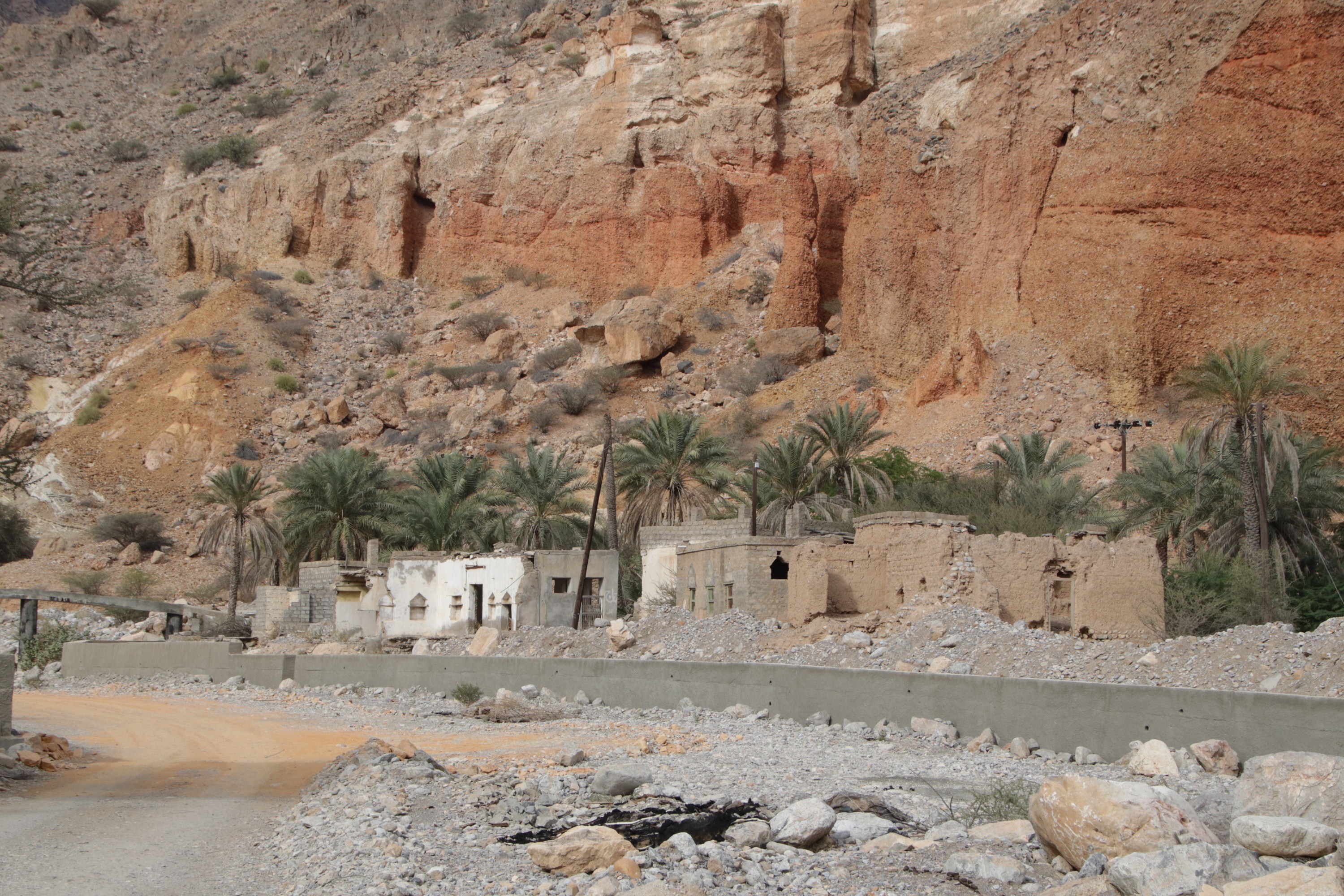
The drive to my first stop took a little over an hour. Turning off the excellent main road I drove into the tiny village of Mazara’. In the period before the highway was opened about ten years ago, the only to drive through the Sharqiya region was by 4-wheel drive vehicle using wadis (dry river beds) for roads. During that period, Mazara’ was on the route, being located beside a major wadi. Today, it is almost unknown for outsiders to visit.
I decided to visit Mazara’ for two reasons. The first was to see a small (now) remote village, and the second reason was to see some examples of Oman’s traditional system of farm irrigation. Known as the ‘falaj’ system, or sometimes the ‘aflaj’ system if the plural is used, the system has been in use for at least 2,500 years. The essence of the system is using a network of gravity-fed channels that are split, divided and blocked as required to distribute water among farms in the same way that the ‘subak’ system operates on the Indonesian island of Bali. The word ‘falaj’ means ‘split into parts’ in classical Arabic, but these days it is also synonymous with the channels that make up the system
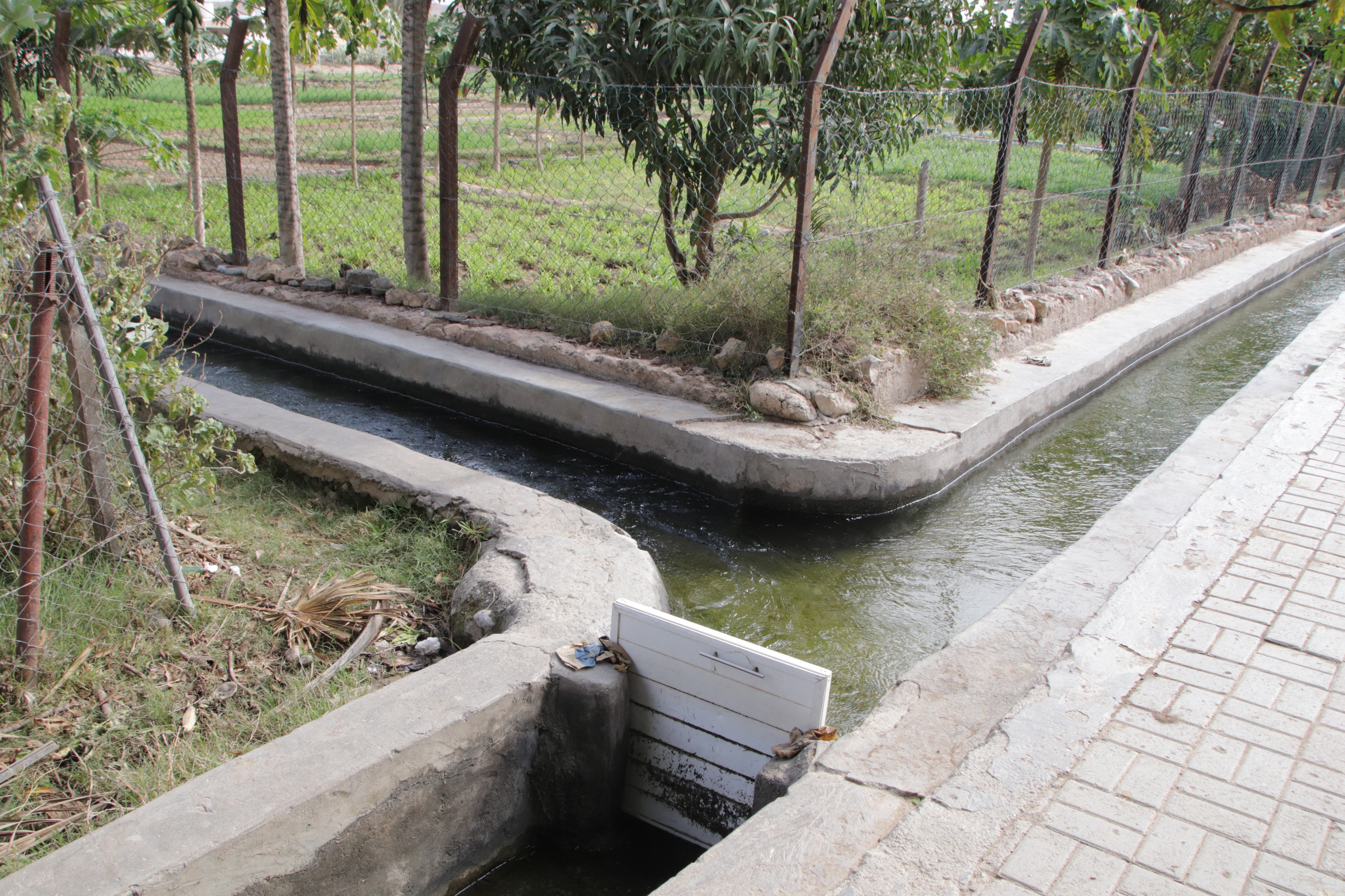
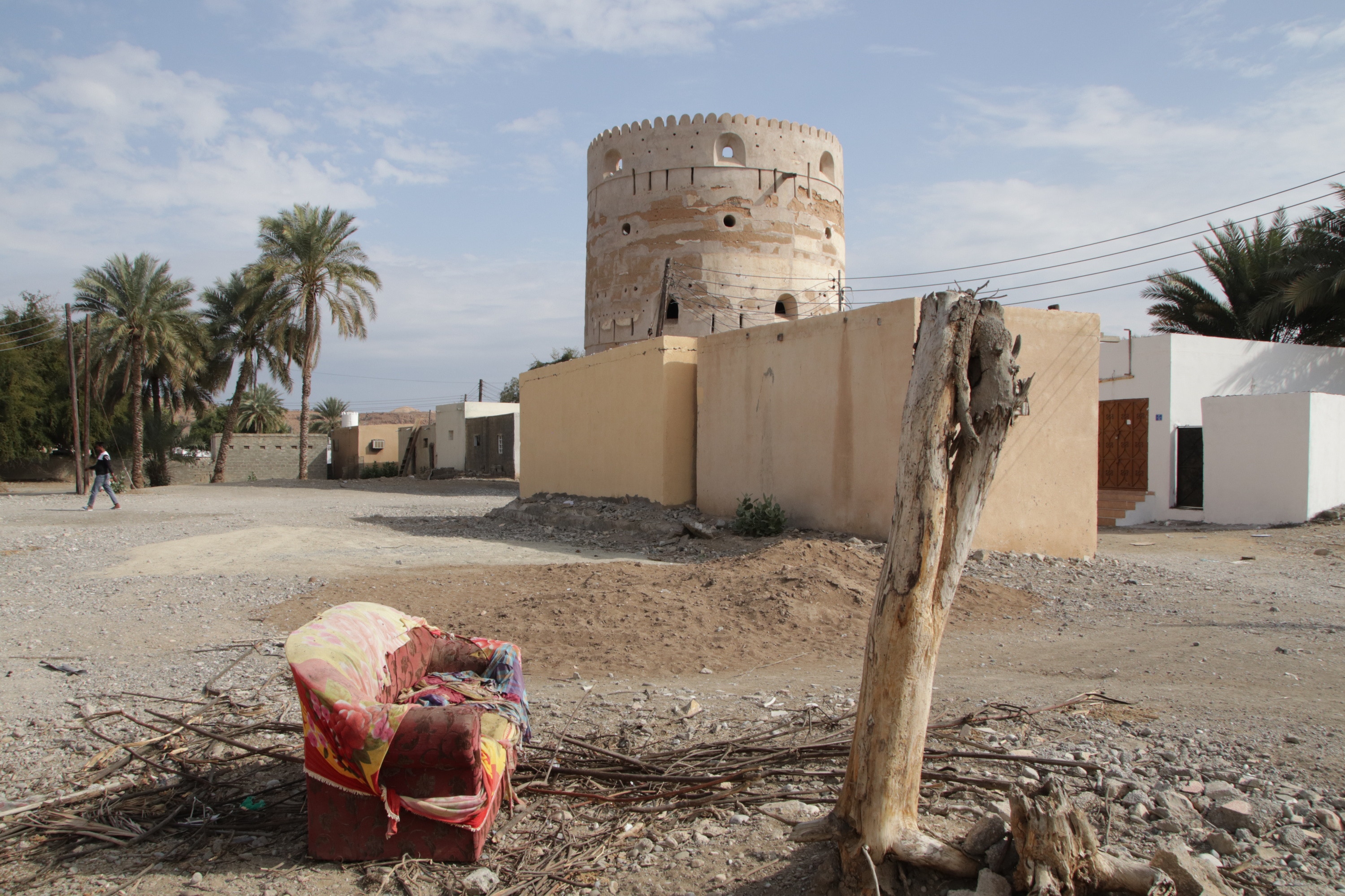
My second stop was just a few kilometres away, the larger town of Hayl al Ghaf. When I was researching this trip using the satellite image filter on Google Maps, I saw that Hayl al Ghaf seemed to have a very extensive system of well developed aflaj, so I was interested to see it at ground level. I was not disappointed. The channels were well formed, well maintained, and functioning effectively as shown by the obviously very productive farms the channels were servicing.
I spent some time looking through the irrigated farming areas as well as the old part of town with several mosques and watchtowers. As I was nearing the end of my explorations, I was wandering along a falaj and I saw a group of men who were sitting in the shade of a huge tree. More precisely they saw me and rather insistently invited me to join them, share some coffee and have a halting conversation. The Arab reputation for welcoming travellers was well and truly justified by their heartfelt hospitality; I think they would have been happy if I had stayed all day.
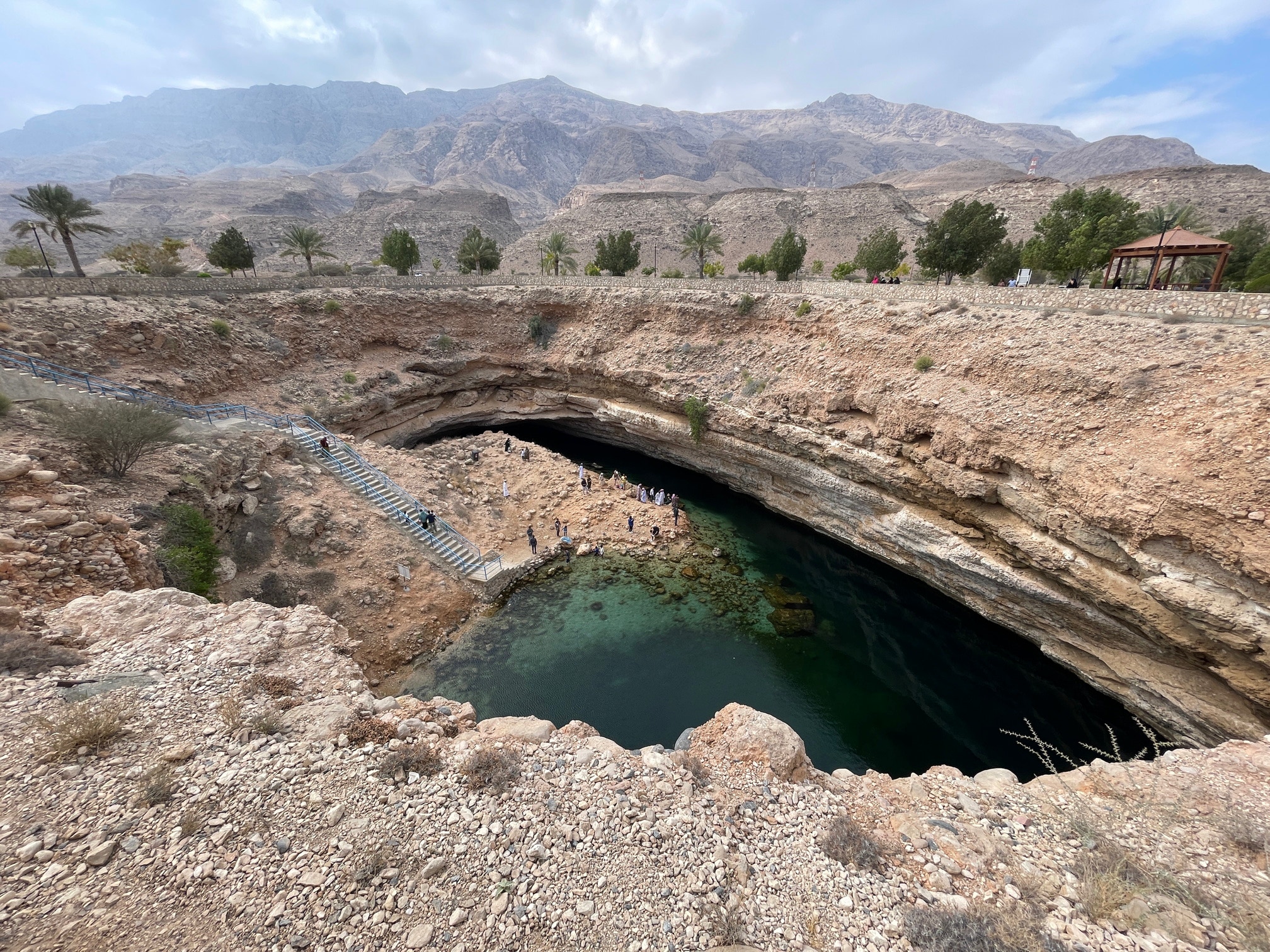
I returned to the main highway and continued my drive southwards. For most of the rest of my drive away from Muscat, the highway followed the coastline very closely, making a beautiful drive along the largely undeveloped, natural coastline with its clear azure water despite the grey clouds overhead. About half an hour from Hayl al Ghaf I arrived at my third stop, the Bimmah Sinkhole. Located about a kilometre inland from the coastline, the sinkhole measures about 40 metres in diameter and is about 20 metres deep.
Stairs lead down to the pool of water in the bottom, and although no-one was swimming today (it was simply too cold) it is apparently a popular swimming location. Although it was quite windy while I was there, I did get some brief splashes of sunshine for photos. Nonetheless, I felt I had seen everything within about a quarter of an hour, and I continued my drive to my fourth and southernmost stop, the small city of Sur (pronounced much more like “sewer” than “sir”).
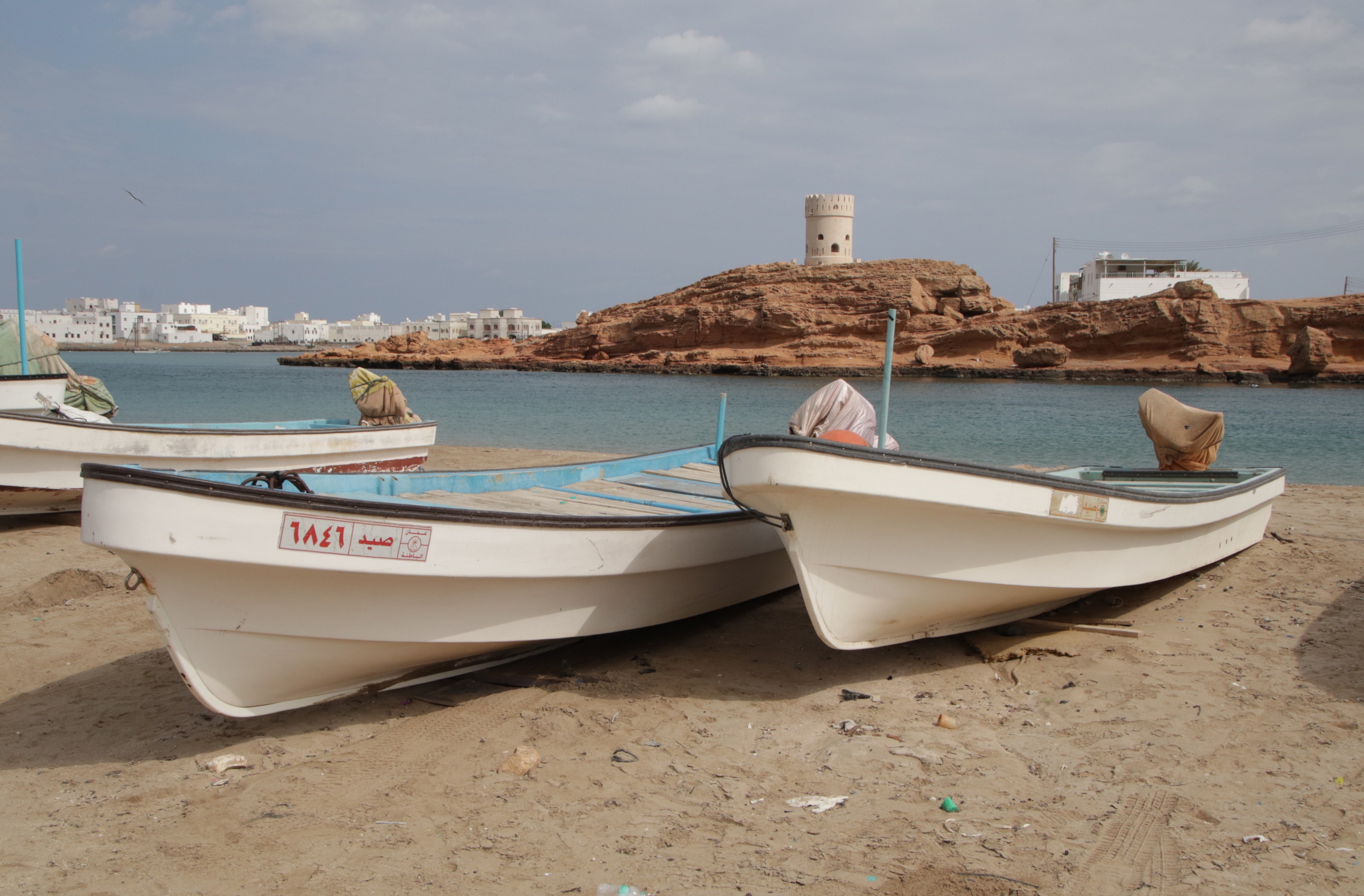
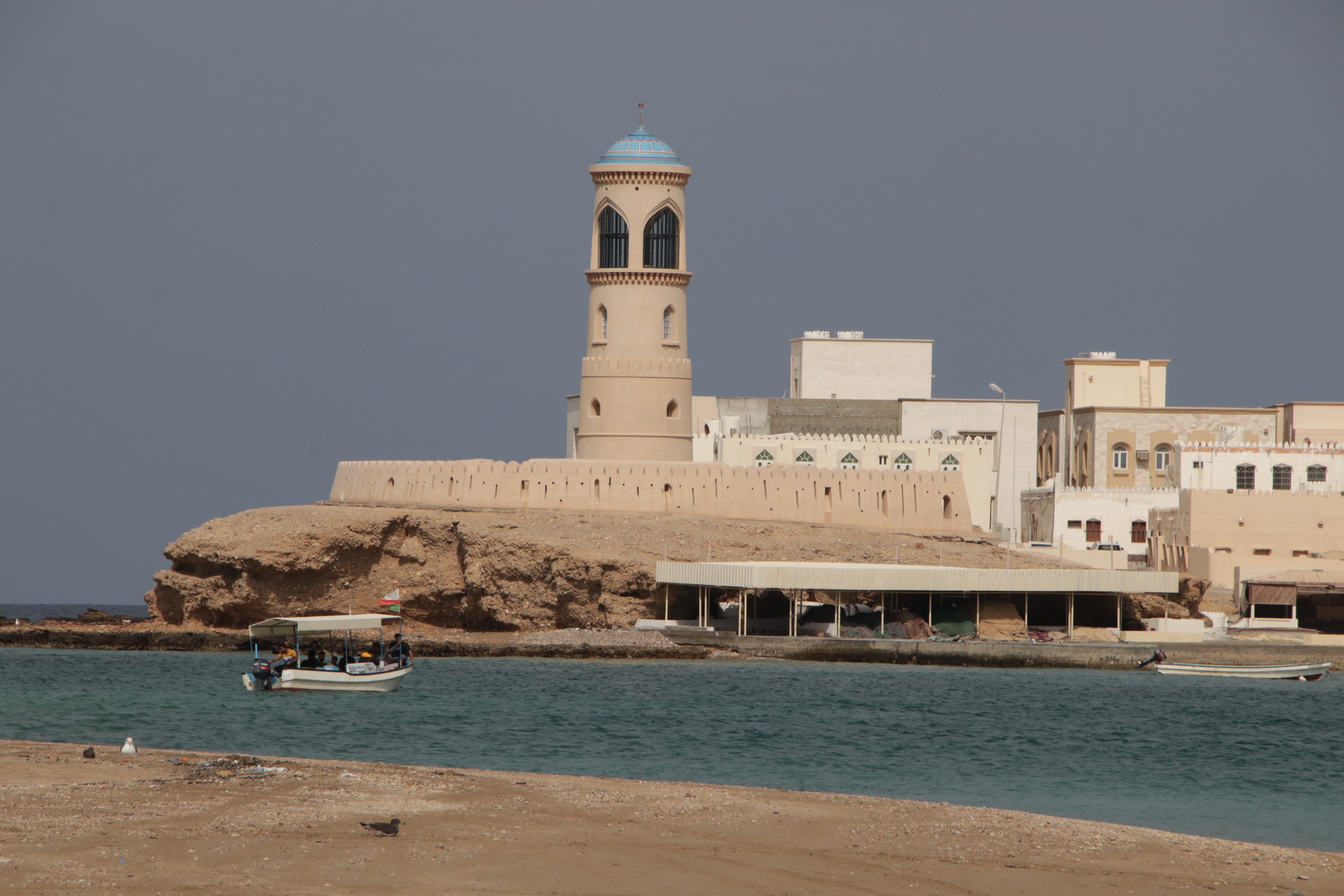
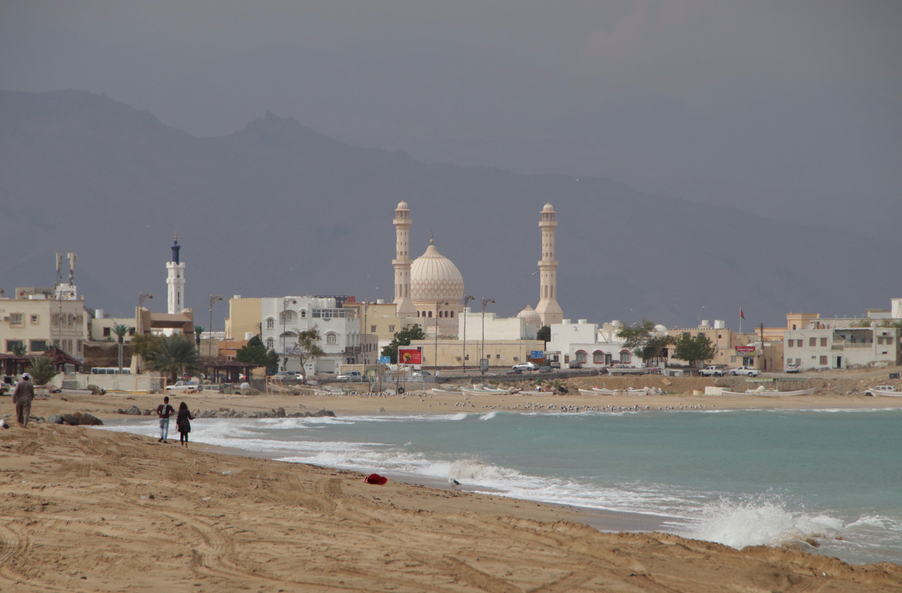
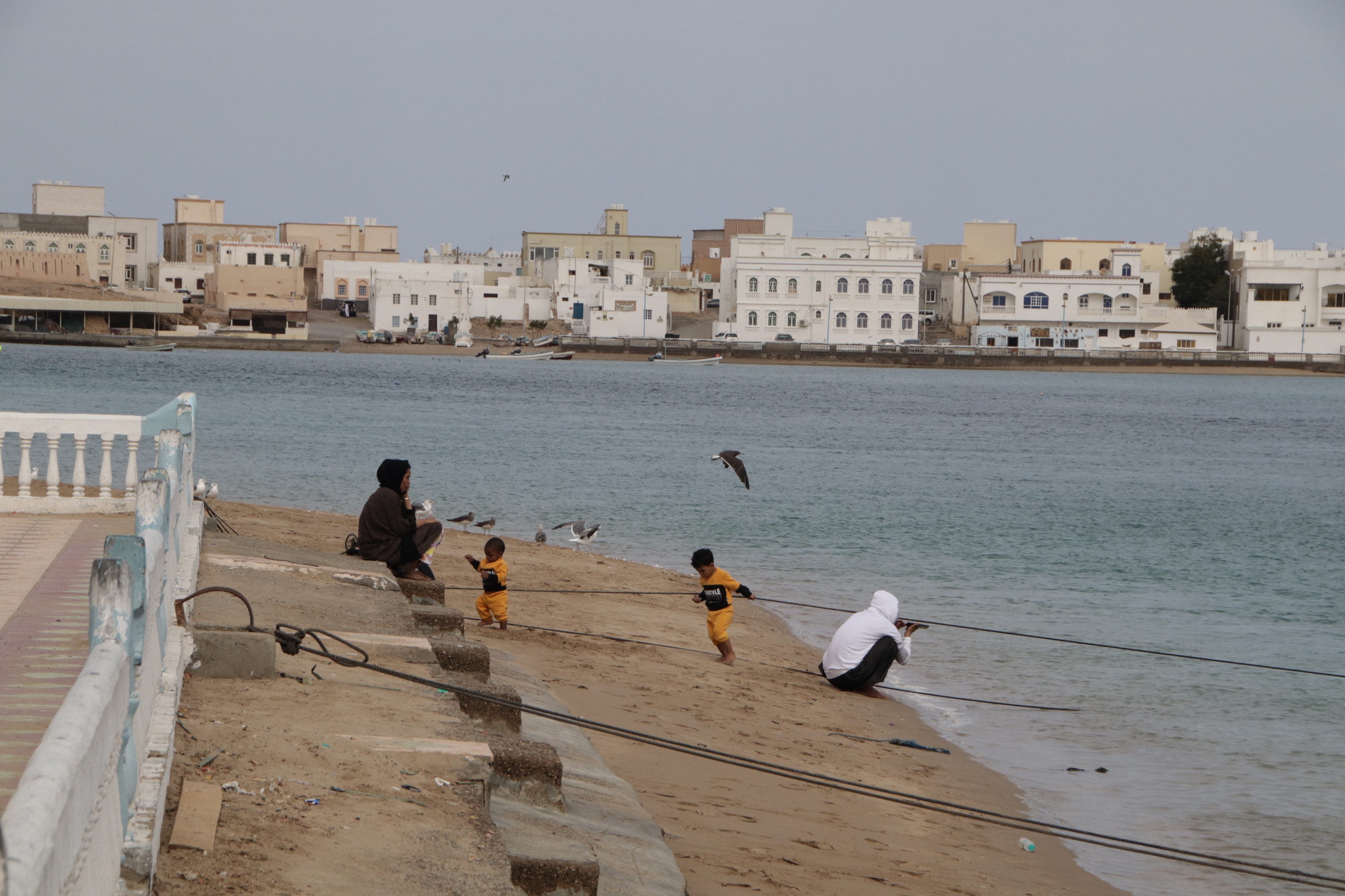
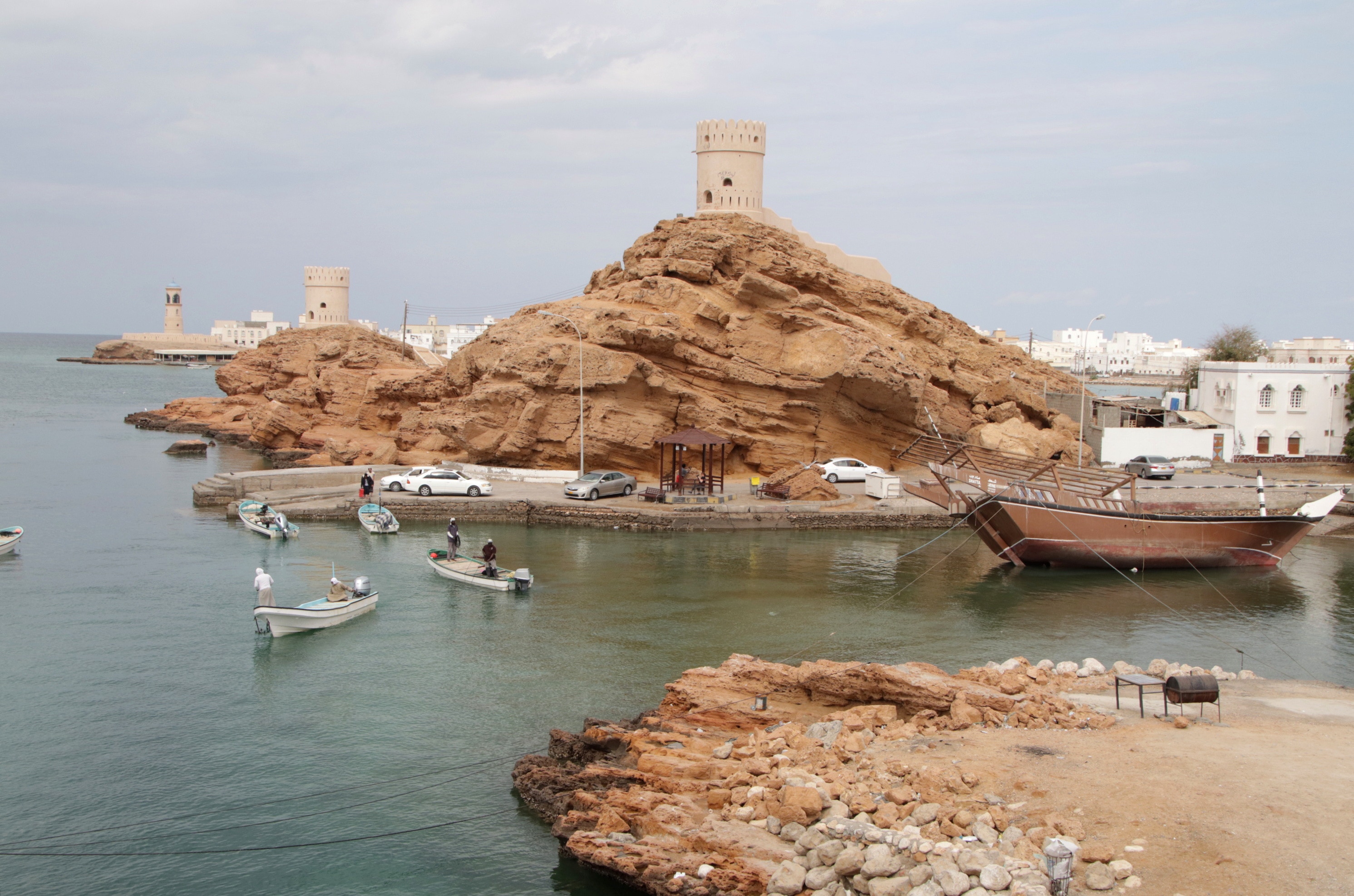
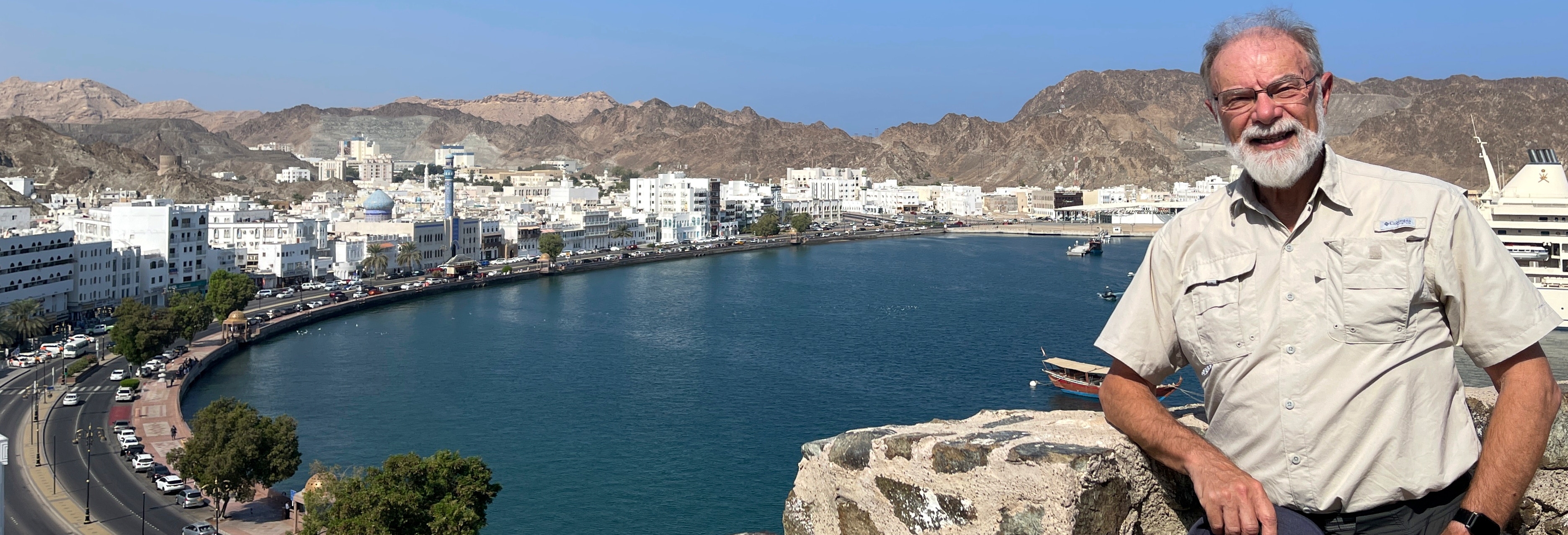
Located on the coast, Sur’s interesting sites are all concentrated along (or visible from) its Corniche, the wide street that proceeds in a long, wide curve along the back of its main beach. I approached the Corniche from its western end, and it was immediately obvious that this end of the beach is the centre of the local fishing industry. Several tens of fishing boats were sitting on the beach, although being late Friday morning, no fisherfolk were to be seen – I suspect they were all in one or another of the two mosques on the Corniche that were both broadcasting their imam’s Friday homily across the city on loudspeakers, seemingly (but I’m sure not really) in competition with each other.
I continued to the eastern end of the Corniche, which really is Sur’s scenic highlight. Two forts and mosque rose sharply just across a small body of water at the end of the beach, while a lighthouse and neat line of white and pastel historic buildings in a village named Ayjah lined the water of the lagoon. When the sun shone briefly but brightly, it was a picturesque scene that embraced many of Oman’s unique characteristics and history.
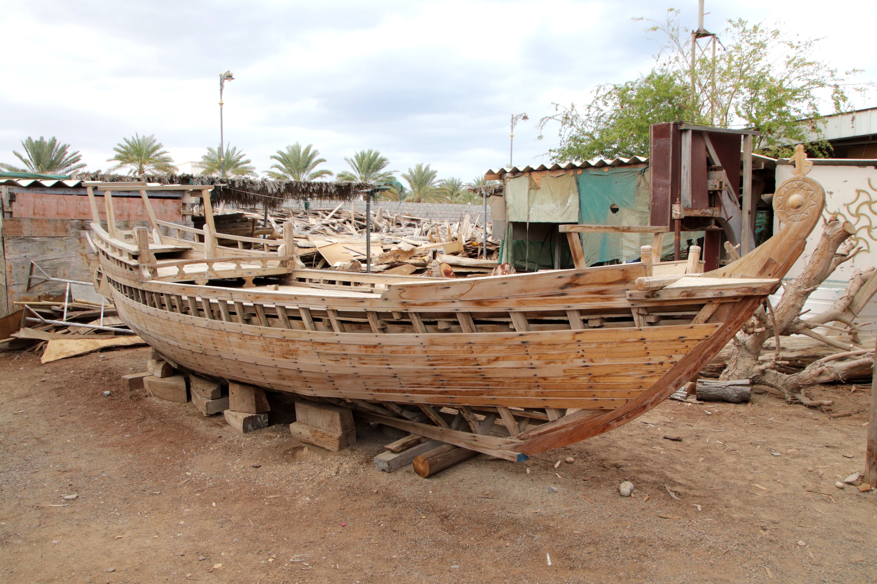
A little further along the Corniche, almost at its southern extremity, was Sur’s dhow building yard. Dhows are the traditional Arab trading vessels that helped Oman to establish its empire along much of the east coast of Africa. These days more modern vessels dominate trade, but there is still some demand for dhows. As I suspected, no workers were present because it was Friday, but I was still permitted to go into the boat building yards and have a good look around. With the exception of one huge vessel that I suspect has been under construction for several decades, there was surprisingly little construction being undertaken – just a few small boats. It was all VERY quiet.
My fifth and final stop for the day was just outside the pretty coastal village of Tiwi. Located about half an hour’s drive north of Sur on the way back to Muscat (about half way between Sur and Bimmah Sinkhole), my destination was Wadi Shab (sometimes called Wadi al Shab).
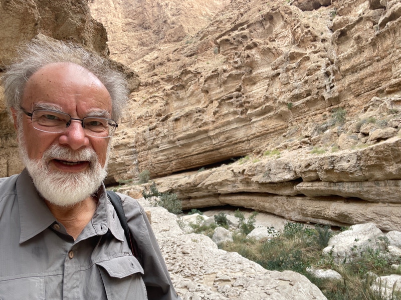
Although it was raining as I drove from Sur to Wadi Shab, the clouds (almost) cleared for a while soon after I arrived, and indeed I had some of the best bursts of sunshine all day while I was there.
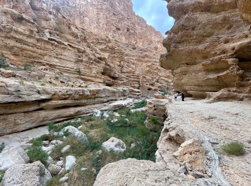
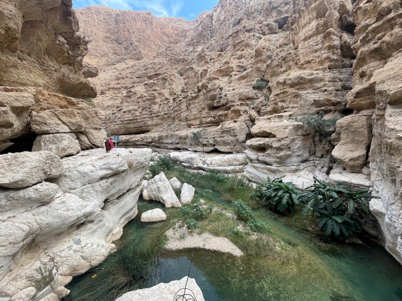
Wadi Shab’s name in Arabic means “the gorge between cliffs”. The name is apt. Unlike most wadis in Oman, Wadi Shab is a small creek that flows through a deep, steeply sided gorge, and a walking track that follows the gorge is a popular (and fairly easy – mostly) with visitors.
In order to get from the parking area to the start of the track, a two minute boat trip is required; there is no charge to walk through the gorge, but the return boat trip costs one rial ($Aust 3.65) per person. The track begins by passing through some small farming plots, but these quickly give way to more natural scenery – first a section of cobble stones that form the river bed, and then increasingly spectacular turquoise pools, overhanging rocks, vertical cliffs, and so on.
Overall, I think Wadi Shab was probably the highlight of my day. Although the end of the track is marked by a waterfall that is reached by swimming/squeezing through a tiny orifice in the rocks, most walkers (like me) enjoy the scenery and then turn around when the smooth rocks start to become excessively challenging; I completed a round trip of about 3.6 kilometres.
Very satisfied with the day’s explorations, I started the drive back to my hotel just after 4:00pm. The return drive to Muscat was slower than the morning’s drive from Muscat, partly because of some torrential falls of rain. In one particularly heavy fall, every car on the road slowed to a crawl with hazard lights turned on, and indeed many drivers pulled off to the side of the road and parked until the rain eased.
I reached the hotel just after 6:00pm. I had been out for almost 10 hours, but what a satisfying day it had been.