Kyrgyzstan and Tajikistan 2018
Kyrgyzstan and Tajikistan 2018
Kyrgyzstan and Tajikistan
2018

Day 7
Langar to Khorogh
Wednesday
22 August 2018
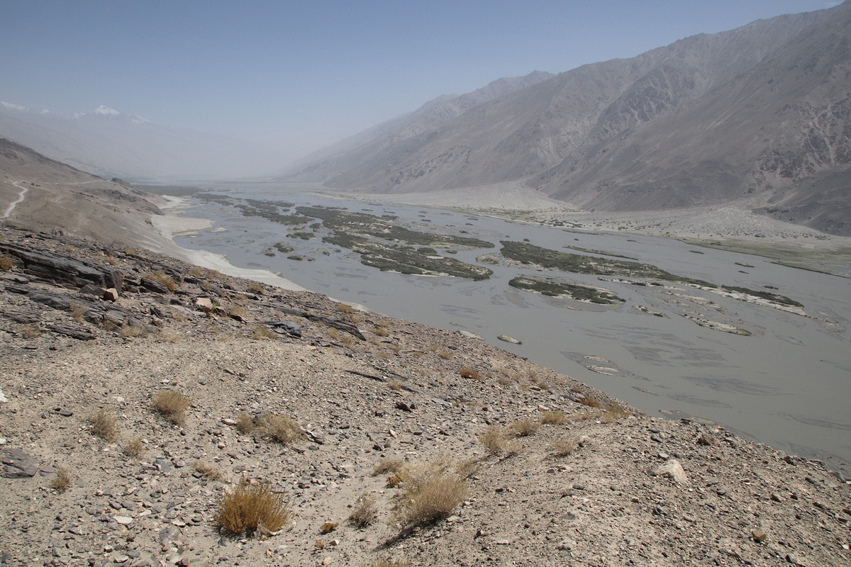
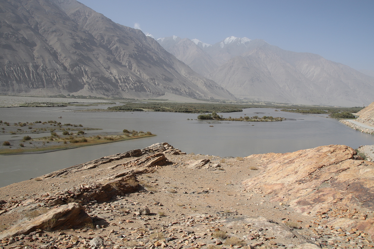


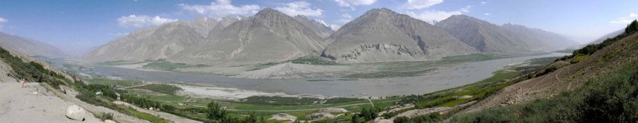
Today involved another long drive, this time of eleven and half hours (setting off at 7:30am and arriving in Khorogh at 7:00pm. The day was long but the scenery was fabulous, and quite different to yesterday. Although the day was spent (like yesterday afternoon) following the Panj River that forms Tajikistan’s border with Afghanistan, the lower altitudes meant that there were small villages, irrigated farming and trees for most of the day.
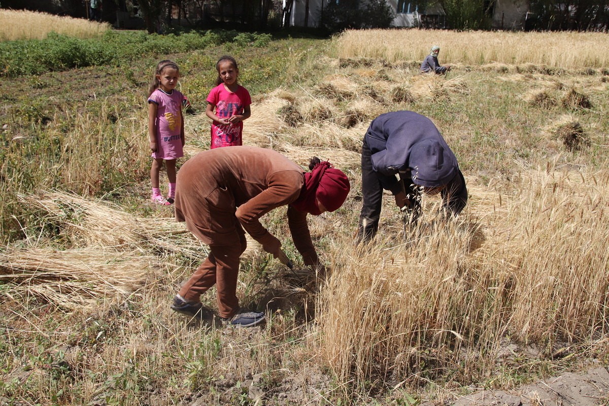
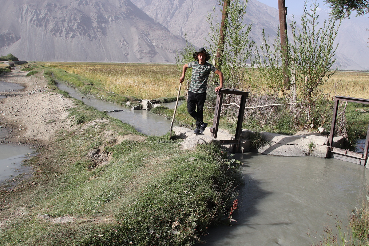
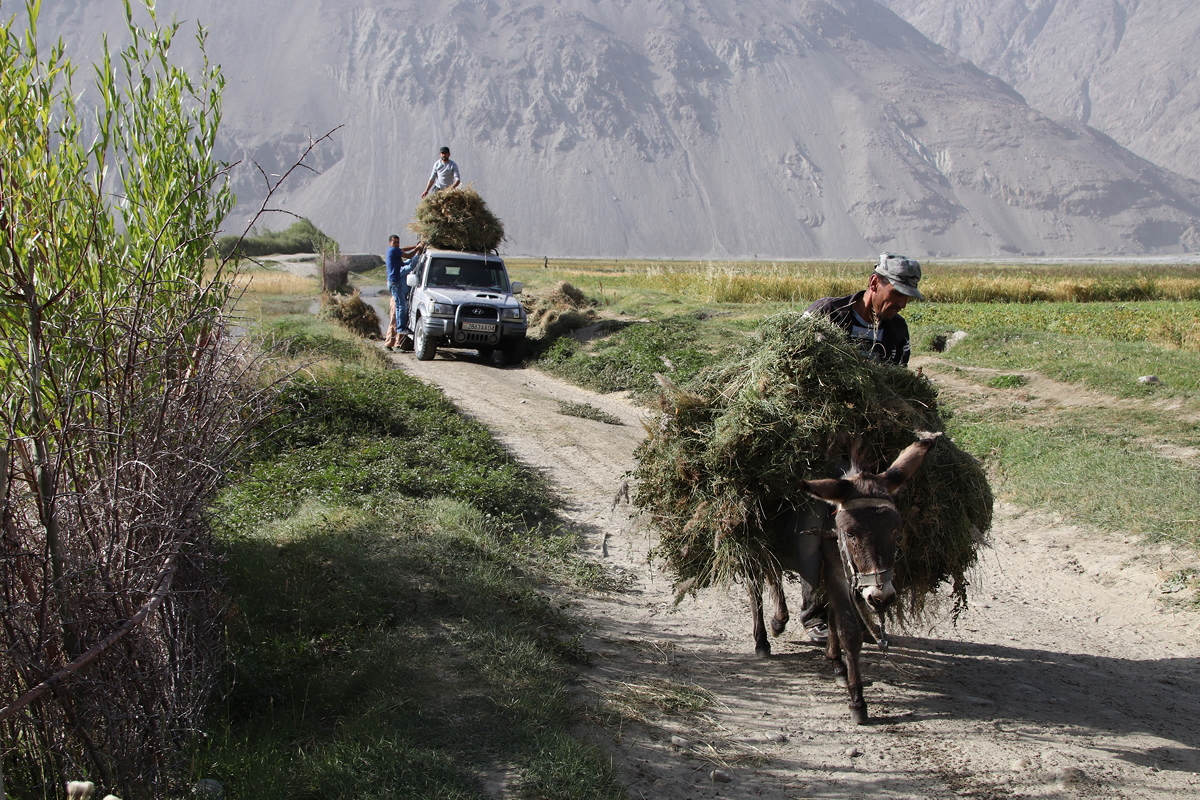
Our group had been split in two different guesthouses last night, so our first stop was to collect the people from the other guesthouse, which was a few kilometres west in Langar. This stop proved fortuitous, as it was opposite a farming area with active irrigation canals which were being managed by local farmers at the time we were there. Moreover, some hay was being loaded onto donkeys and, in stark contrast, the roof of a Toyota Landcruiser. It was wonderful to experience these aspects of typical farming in the early morning light.
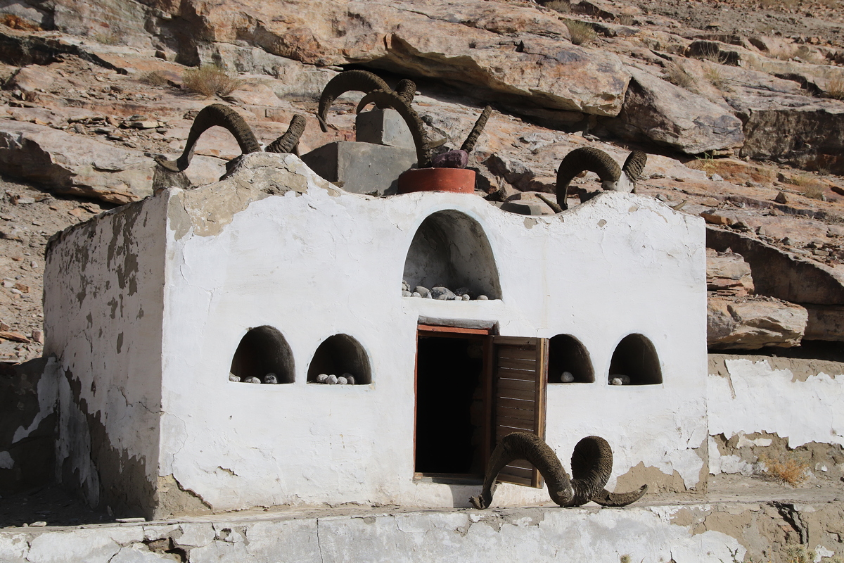
Our next stop was just a few kilometres away, and still within Langar village. Surrounded by high white walls topped with the horns of Marco Polo sheep and Ibex, this was a mosque of the Ismaili sect of Shi’a Islam that came to the area in the 10th and 11th centuries, and continues to be very influential in the valley of the Panj River. Shi’ite Islam is the minority form of Islam in Tajikistan where 95% of the population are Sunnis. The Ismaili sect combines the original religion of the region, Zoroastrianism, with Islam in ways that would be forbidden to most Muslims, such as the use of fire in worship. It was an informative introduction to a branch of Islam that I knew very little about before this visit.
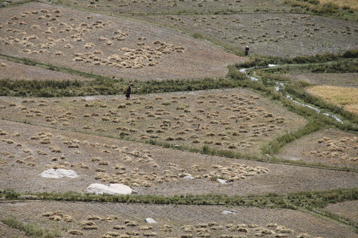
Leaving Langar village we continued along the unsealed road, admiring the dramatic scenery of Afghanistan just a few tens of metres across the river on occasions, until we reached the village of Vrang. This was an even better location than Langar to see typical farming operations as the harvest was underway. We walked on the bunds carrying the irrigation canals through the fields to see teams of men and women working together with tiny sickles to harvest the wheat, rye, barley and oats.
Much as I loved watching the harvesting operations and interacting with the farmers, the ‘real’ reason for the stop in Vrang was to climb a nearby hill to see an unnamed Buddhist stupa dating from the 7th century, and the nearby ancient cave dwellings of the Buddhist monks as they lived on the fringes of the late Buddhist empire.
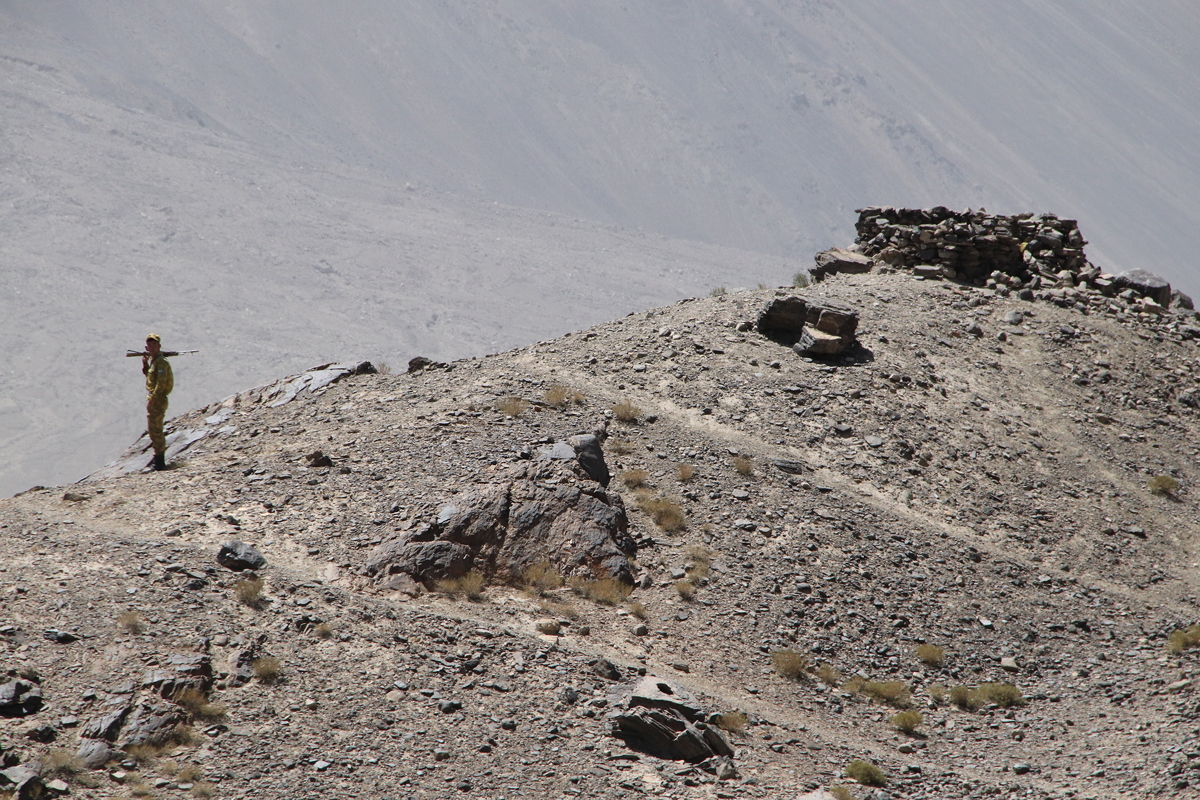
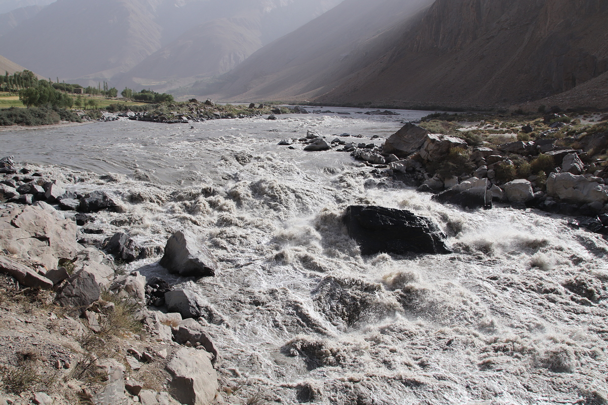
Our drive continued in a south-westerly direction, passing some interesting aid-sponsored projects such as dredging of river channels, slope stabilisation and tree planting. As we descended in altitude, the air became progressively more misty, presumably because of the rising humidity. At times, this partially obscured the dramatic mountain and river scenery through which we were passing. Reflecting the politically sensitive nature of the Tajik-Afghan border, we passed several observation points on high summits overlooking the Panj River where armed Tajik soldiers were patrolling the border zone, on the lookout for unauthorised intruders.
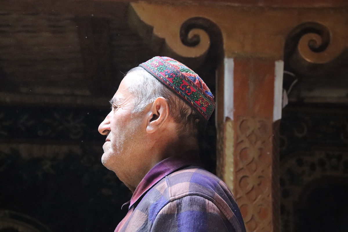
Further driving brought us to the village of Namadgut where a small museum, the Osorkhonai Abdullo Ansori, was run by an 82-year old former teacher named Odinamamadi Mirzo. The museum’s displays were fairly uninspiring, although he did explain a portrait of Lenin done by local women by saying that Tajik people in the Wakhan Valley have a high respect for Lenin because he brought them roads, schools and medical clinics for the first time. Attached to the museum was a room laid out as a typical traditional home in the region, which he explained, even down to the goats’ horn decorations that adorn the traditional five pillars of each room. Odinamamadi Mirzo has written a book on the geography of the Wakhan region, and when I bought a copy to learn more about this fascinating region (for just 40 somoni, about $Aust.5.75), he was delighted to sign it when requested, after which he insisted on having his photo taken with me.
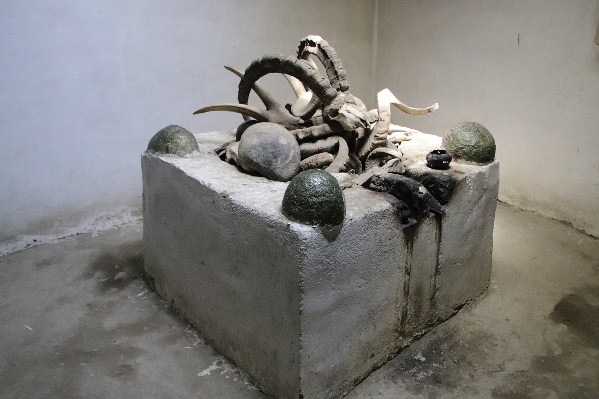
It was just a short walk from the museum to another small Ismaili sect mosque, and we entered this one to see inside. The interior was very simple, being a square room with a square altar-like structure in the middle, adorned by sheep horns. As we were leaving, four local women came to pay their respects, a quick and simple process that took less than a minute.
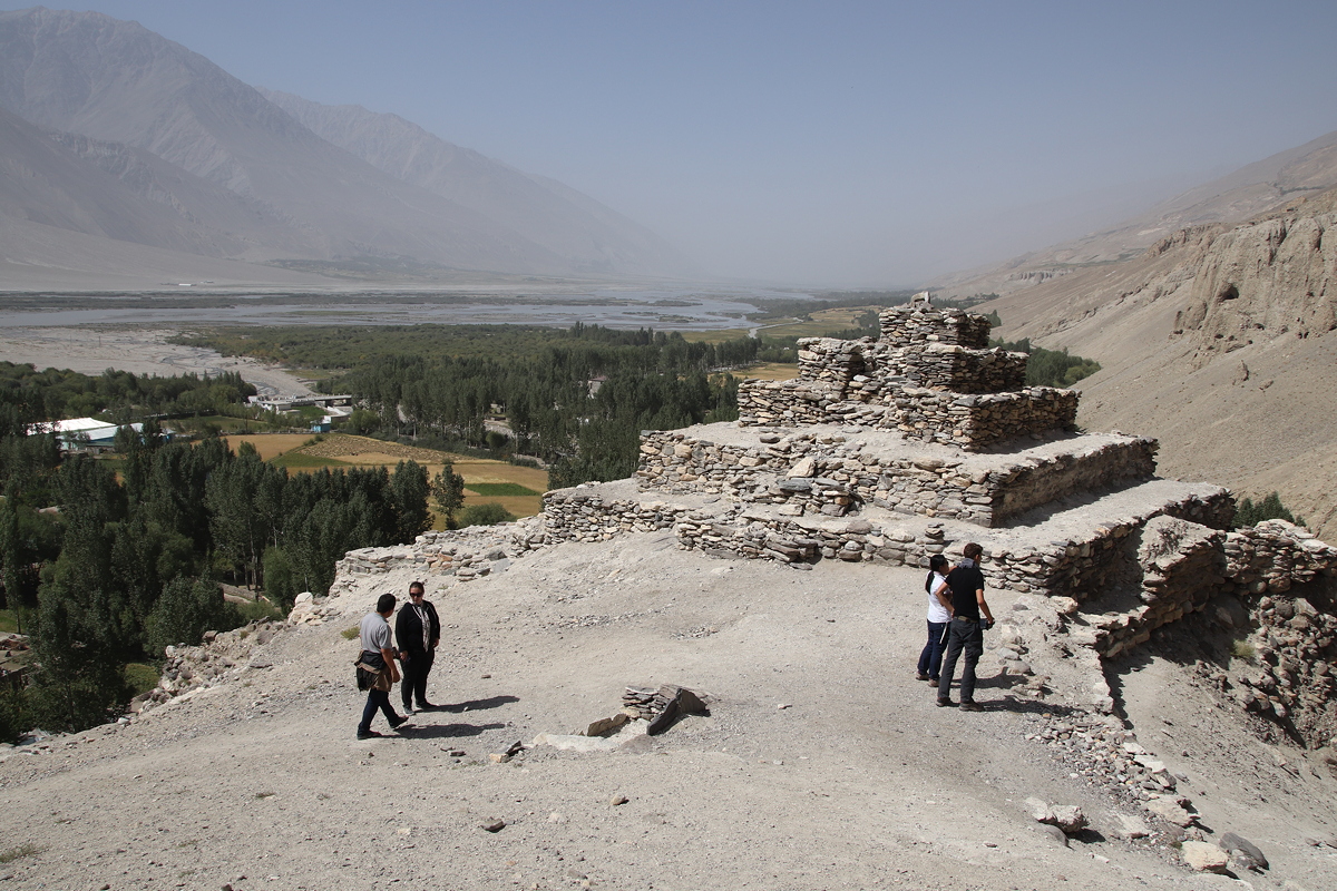
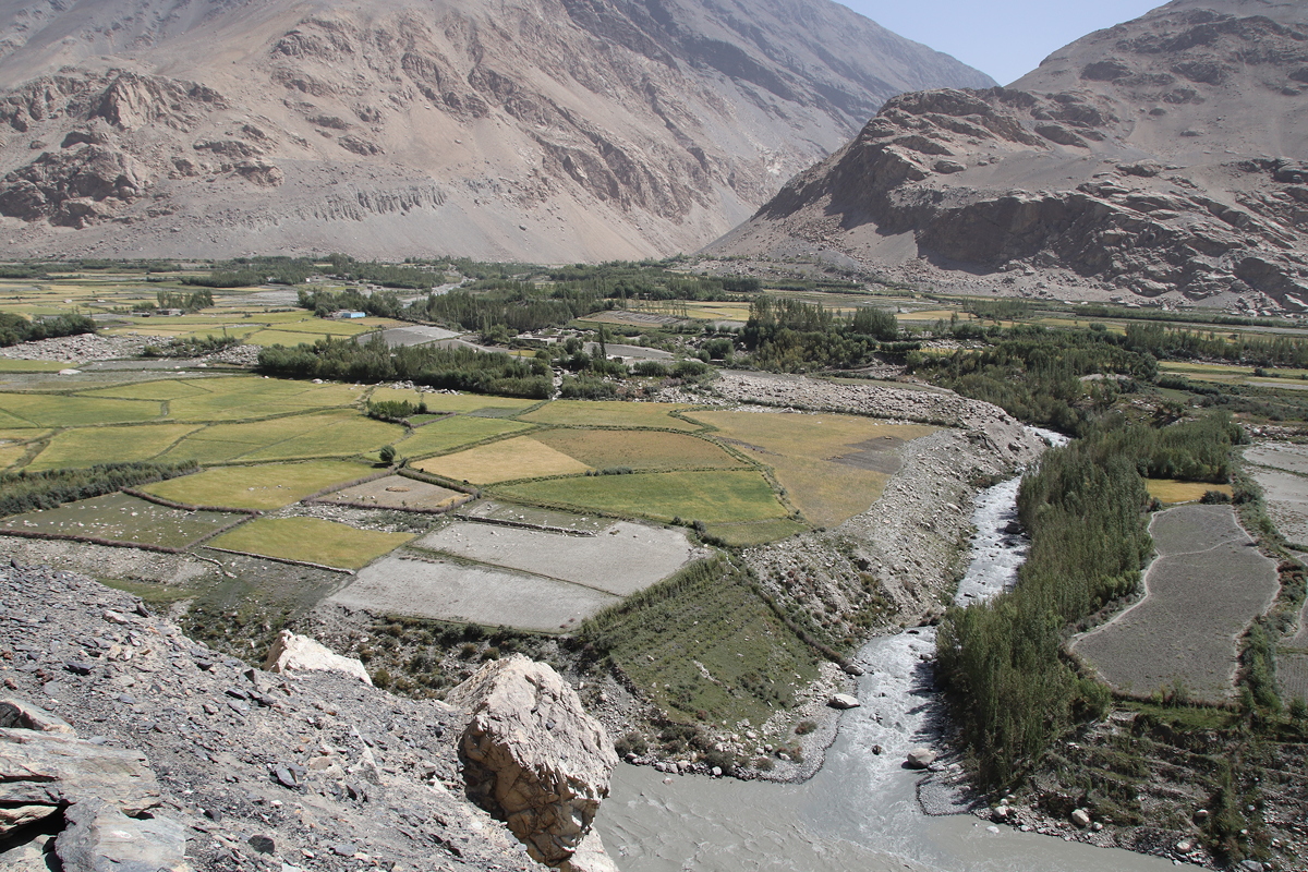
Another short walk from the mosque brought us to the Kahkaha fortress, one of the oldest fortresses in central Asia. This once great, clay-built fortification with 28 towers is said to be named after a legendary epic hero, a king of fire worshippers. Set on a high hill overlooking the Panj River, the fortress is now used by the Tajik Army as an observation point, so permission was needed to enter the site. This was happily given with the proviso that we could not take any photos of the fortress structures from within, but we were free to take as many photos as we liked of Afghanistan (across the river) and the surrounding countryside. This I did, as the views were sensational, looking down on Afghan farming.
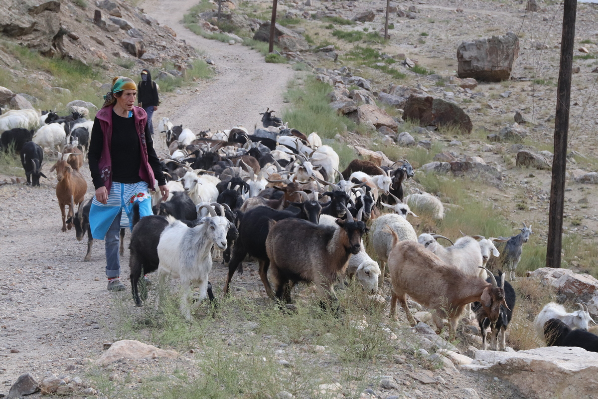
Much of the rest of the day’s drive involved observing the remarkable scenery of the region – huge scree slopes, turbulent streamflow, massive alluvial fans (some of which had been truncated by the rushing waters), small villages, and irrigated farmlands. As the day’s light faded, we stopped to watch a herd of goats being driven by two women who would clearly have benefitted from the simple innovation of a sheepdog. One of our local Tajik guides jokingly asked one of the women if he could buy one of the goats. The reply was surprising: “You can one for free if you like”. Our Tajik friend queried this response, to be told “I don’t mind; they’re not mine”.
Driving into Khorogh in the dusk of evening was like returning to civilisation of sorts. With a population of 28,000 people, Khorogh was the biggest urban settlement (by far) that we had seen since Osh. It is the regional capital of the GBO area (Gorno-Badakhshan Autonomous Region), and it even boasted a set of traffic lights (that worked) and an airfield (disused). The hotel could not accommodate everyone in the group, so two people were asked to volunteer to stay in a different hotel. After an extended silence, I offered to stay in the other hotel (sight unseen), and I was followed by one of the other members of the group.
Our hotel is about three kilometres from the main hotel, and although the rooms are new and adequate, it is in a dark, somewhat sleazy part of town, unlike the main hotel which is near the town centre. We returned to the main hotel for dinner at 8:00pm, and it was somewhat disheartening to hear about the lovely river views the others were enjoying, the workable internet (ours is woeful – so slow it is inoperable), and the lovely warm showers (ours were cold). I guess you win some and you lose some, and to be fair, the staff at our hotel are lovely and very willing to please.
Our late arrival, late dinner and repeated 10 minute trips between hotels has meant that this is a very late night, even by the standards of this trip. The good news is that tomorrow’s departure is a little later than the past few days, being scheduled at 8:50am.


And now for an update on my missing luggage. I heard a couple of days ago that my luggage had been found in Moscow and would be shipped to Dushanbe. I’ve since heard it may or may not be there, which implies it may have been lost again. I hope to find out in three days when I reach Dushanbe.
