Kyrgyzstan and Tajikistan 2018
Kyrgyzstan and Tajikistan 2018
Kazakhstan 2018
I really shouldn’t be surprised that the weather in Astana was so overcast, bleak, windswept and, at times, drizzling with rain today. After all, Astana is on the same latitude as London (51°N), and being located so far from the ocean, lacks the moderating effects of London’s maritime location.
Astana is a relatively young city, being founded less than 200 years ago (in 1830) as a small defensive fortification for Siberian Cossacks. Over the years, it had various names – Akmoly, Akmolinsk, Tselinograd – but it remained an insignificant backwater throughout its Soviet history. When the Soviet Union collapsed and Kazakhstan emerged as an independent country in 1992, the city reverted to its original name of Akmoly.
In 1997, the city’s fortunes took a dramatic change for the better when Kazakhstan’s President announced that Akmola would replace Almaty as the country’s capital city. Almaty (then named Alma-Ata) had been Kazakhstan’s capital city throughout the Soviet period, and was by far the largest city in the country (as it still is). In the following year, 1998, Akmola was re-named Astana, which is Kazakh for “capital city”.
Since that time, Astana has grown substantially and today it has a population of just over one million people. Like Canberra, Brasilia and Washington DC, Astana is a planned capital, with the grand scale and orderliness, as well as the sterility, that seems to be a necessary constituent element of over-zealous urban planning.
Given the elegance, good infrastructure, easy accessibility and pleasant climate of Almaty, one has to wonder why the decision was made to build a new capital city, especially in such an extreme location as Almaty. In winter, temperatures fall to below -30°C as icy winds blast across the flat steppes surrounding the city. In summer, temperatures regularly exceed +35°C. Overall, Astana is the world’s second coldest capital city (after Ulaan Baatar in Mongolia), displacing Ottawa for the dubious honour when it became Kazakhstan’s capital. The area was previously used for gulag camps and nuclear weapons testing, which in many other countries might be seen as reasons to exclude consideration as a national capital.
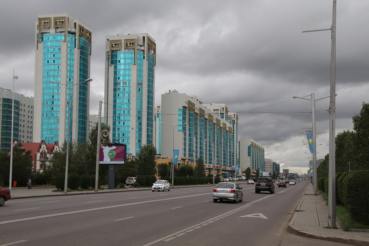
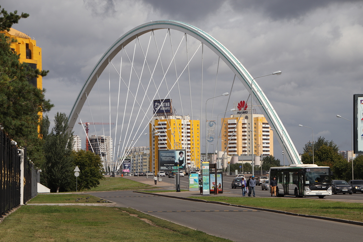
Since becoming Kazakhstan’s capital city, huge investment funds have poured into Astana to make it showcase city of Kazakhstan’s economic development and wealth. Walking around the streets today, there was no sense whatsoever that this was once a Soviet city – there was not a five-storey concrete housing block to be seen, and in my five and a half hour walk today, I only saw one Lada on the streets, but lots of Audis, BMWs, Toyotas and Hyundais. If I had to describe Astana’s urban landscape, it is a mix of Canberra and Pyongyang on a major dose of steroids (with a strong blast of cold wind added to the mix).
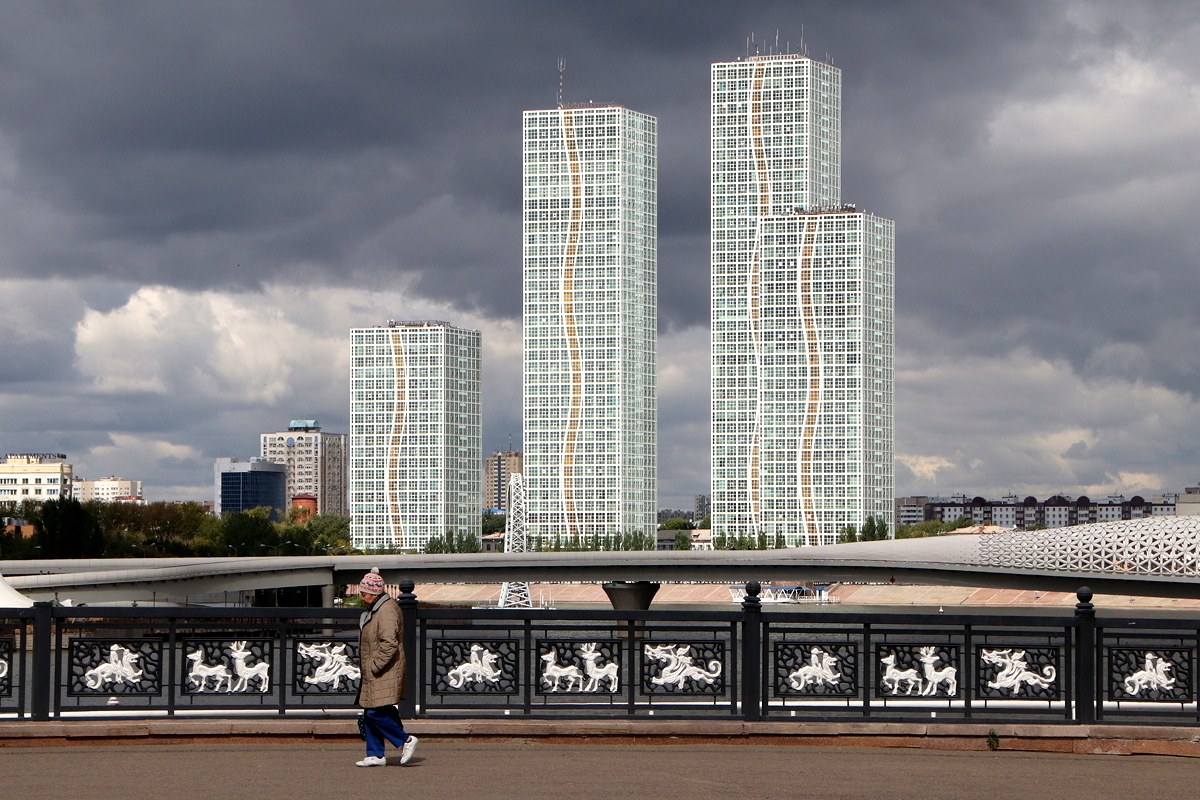
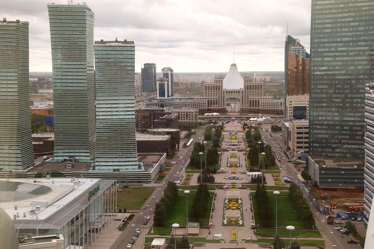
Today, much of Astana comprises extravagant, futuristic, glass and metal skyscrapers and government buildings that look like a competition between young architects that has gone wild. No expense seems to be spared in creating large buildings that are clearly designed to impress visually around streets that are wide enough to land a medium-sized airliner with footpaths that are sometimes almost as wide.
I spent five and a half hours today on a walk of twelve and a half kilometres, braving the grey skies and icy winds to explore the major area of planned urbanisation which were located, not coincidentally, quite close to the hotel I chose (the Garden Inn). I was wearing almost every item of clothing I have with me to keep warm.
Everything appeared to be on a larger-than-life scale, with buildings, plazas, streets and pathways scaled up in all three dimensions seemingly to make the individual as small and insignificant as possible. The fact that so few people were out and about amplified the feeling of insignificance within the surroundings – maybe it was the bad weather, maybe it was because it was Sunday, maybe it’s just that the population density of Astana seems very low – whatever the reason, walking around Astana is a somewhat lonely experience.
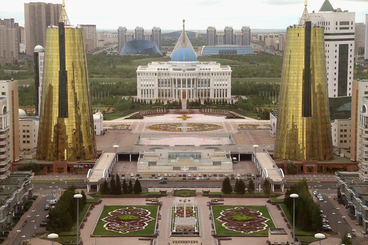
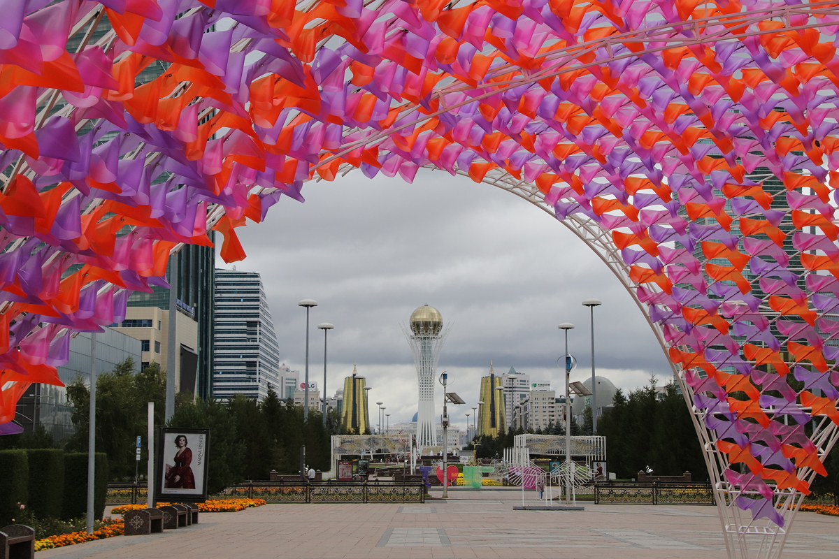
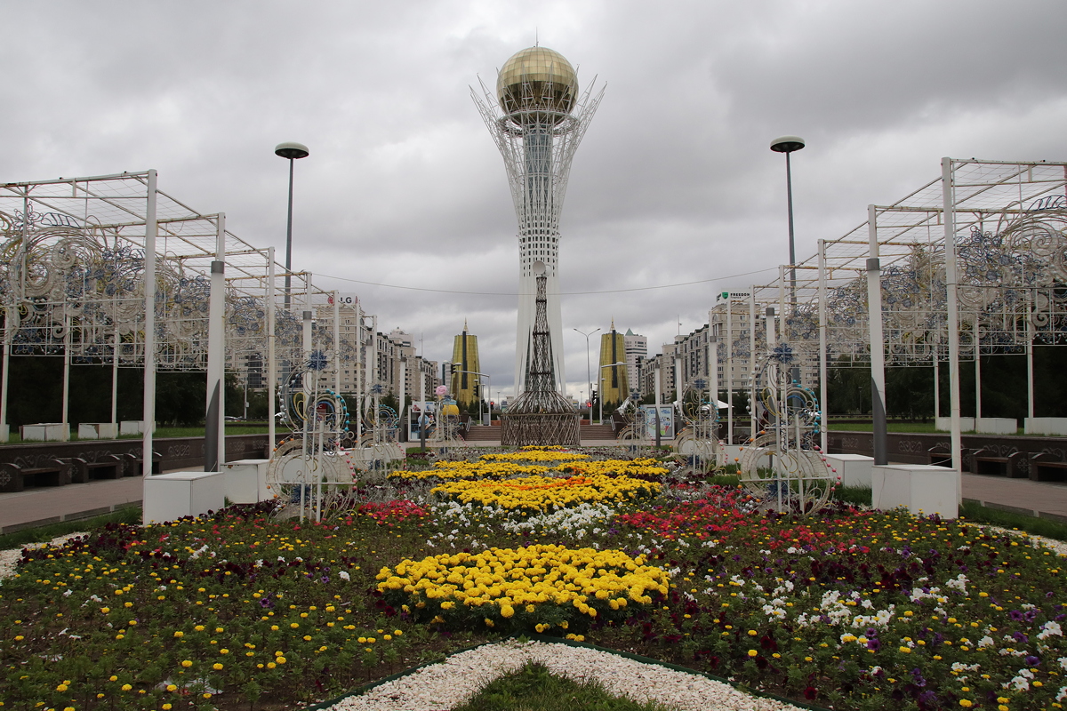
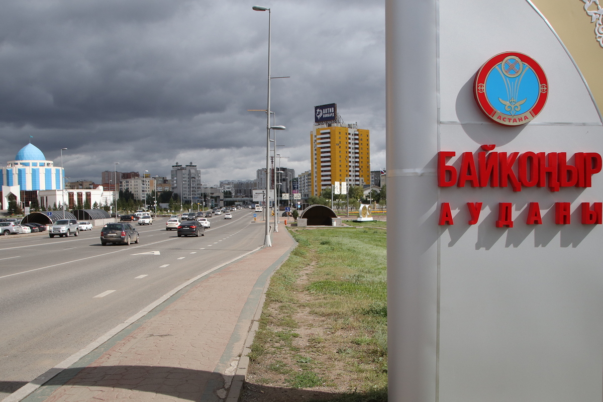
My first destination was Bayterek Tower, an iconic symbol of new Astana located within a very wide, ornate pedestrian plaza that demanded lots of stops for photos. “Bayterek” means ‘tall poplar tree’, but the tower is definitely not shaped like a poplar to my eyes. In theory, the tower is supposed to celebrate a folk story about a mythical tree of life and a magic bird of happiness that laid its egg in the gap between two branches of a poplar tree. More significantly for me than the folk story was that the 105 metre high tower afforded the opportunity for some good views over Astana, and with an entry price of just 700 tenge (Aust.2.68) it seemed too enticing to refuse.
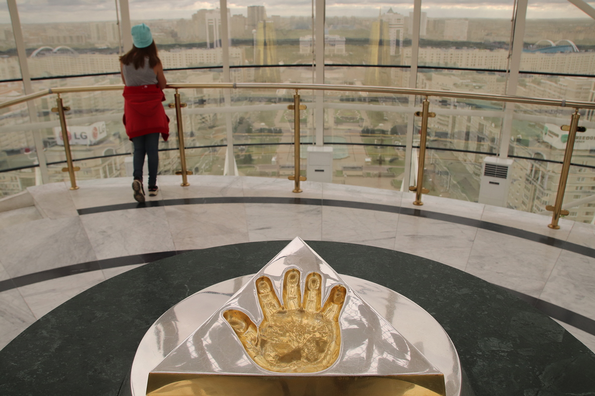
The views from the observation bubble were indeed impressive, although from a photographic perspective marred by the dirty windows and the heavy yellow reflective tinting on the glass that made getting good images something of a challenge. For local people, one of the highlights of visiting the top of Bayterek Tower is seeing the gilded imprint of the right hand of Nursultan Nazarbayev, Kazakhstan’s first President, mounted on an ornate pedestal and pointing somewhat creepily towards the Presidential Palace below. A plaque invites visitors to place their hand in the imprint and make a wish, which from my observations today, might perhaps appeal to local people more on weekdays.
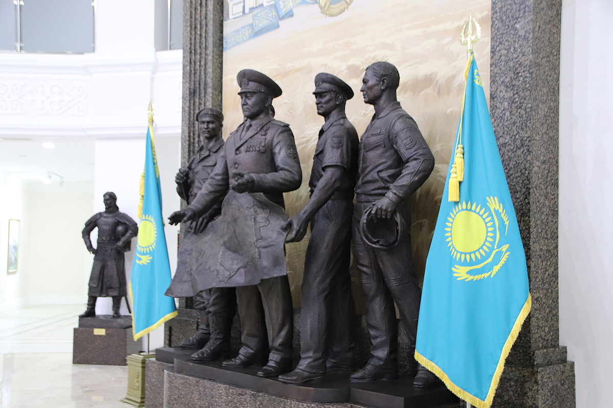
Descending from Bayterek Tower, I bravely took a long walk towards the north (even though I knew that would bring me closer to the polar ice cap) across the Ishim River to visit the Kazakhstan Military History Museum. Housed in a new (of course) blue and white domed building, the Military Museum allowed free entry and had quite an interesting display of Kazakh military prowess. Interestingly, it emphasised historic Kazakh military victories using horses and traditional weapons from many centuries ago, as well as Kazakhstan’s present-day military might and international peace-keeping efforts, but only one room in the five-storey examined the Soviet period, and this focussed exclusively on the Great Patriotic War and the defeat of Nazi Germany in 1941-1945.
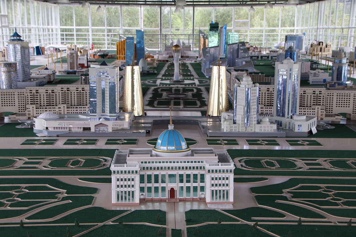
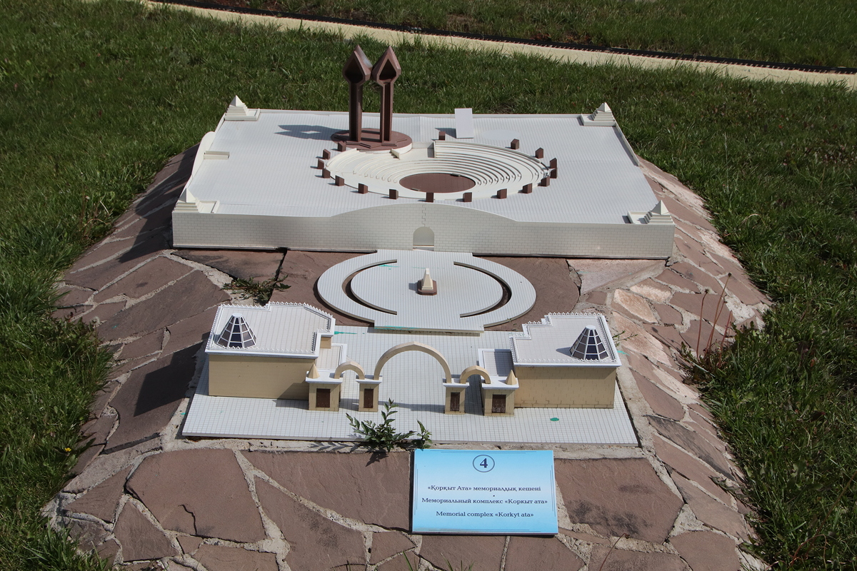
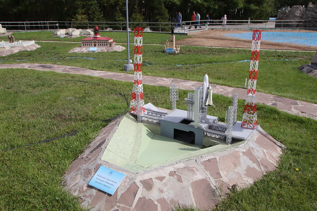
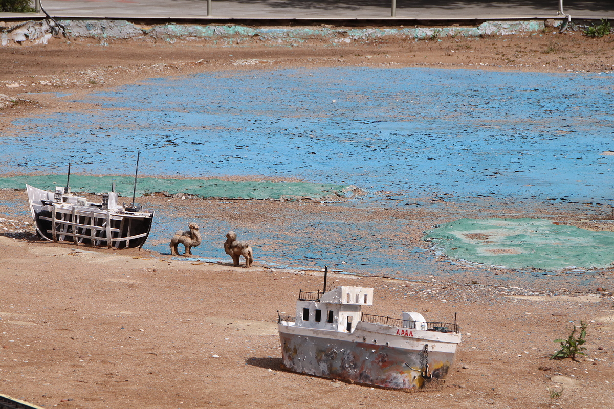
I then proceeded south, crossing the Ishim River again, to visit Atameken, an open-air park of miniature recreations of significant buildings and landscapes from all parts of Kazakhstan, laid out roughly according to a miniature map of the country. My initial impression upon entering the park and seeing a large blue-tiled pool that was said to represent the Caspian Sea didn’t impress me, and indeed many of the miniatures were tacky in the extreme.
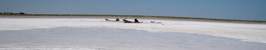
However, there were enough interesting exhibits to justify the 400 tenge entry fee plus 300 tenge camera fee. The representation of camels and abandoned ships beside peeling blue paint on a concrete surface representing the shrinking Aral Sea was little short of comical, but the representation of the Baikonur Cosmodrome showed me what this area looks like (if you can get the security clearance to visit), and the model of the Korkyt-Ata complex gave a good idea of the layout of the place I had visited a few days earlier.
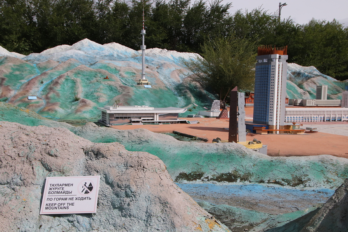
Unquestionably, however, the highlight was found inside a large shed-like building – a model of the high-rise area of Astana I had walked through earlier in the day. This was by far the best part of the museum, and it showed the layout of the urban planning to perfection.
I leave Kazakhstan on an early flight tomorrow morning to spend a couple of weeks in the Caucasus (which are described in a different trip diary - see HERE). I will return to Kazakhstan (and Astana) on 19th September, so my next diary entry should appear on that date.

Day 7
Astana
Sunday
2 September 2018