Kyrgyzstan and Tajikistan 2018
Kyrgyzstan and Tajikistan 2018
Caucasus 2018
Having spent yesterday exploring urban Baku, today’s explorations made quite a contrast, being in essence two half day trips – south of Baku in the morning and north of Baku in the afternoon. As things turned out, the two ‘half days’ were somewhat uneven, with the morning trip lasting from 9:00am to 2:00pm, and the afternoon trip from 3:40pm to 7:15pm after allowing an hour and 40 minutes for a lunch break.
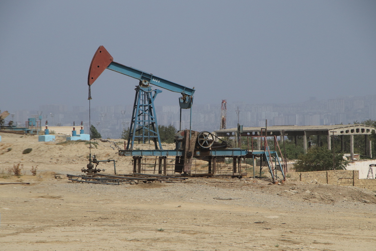
The destination for the morning was Qobustan (also often transliterated as Gobustan), about 70 kilometres south of Baku. The drive to Qobustan, which was in a bus (with air conditioning) on excellent wide smooth roads until the last few kilometres, showed a different side of Azerbaijan, as it followed the coastline along a narrow, quite arid coastal plain through fields of oil wells, port facilities and industrial zones – interesting in its own specialised kind of way rather than scenic.
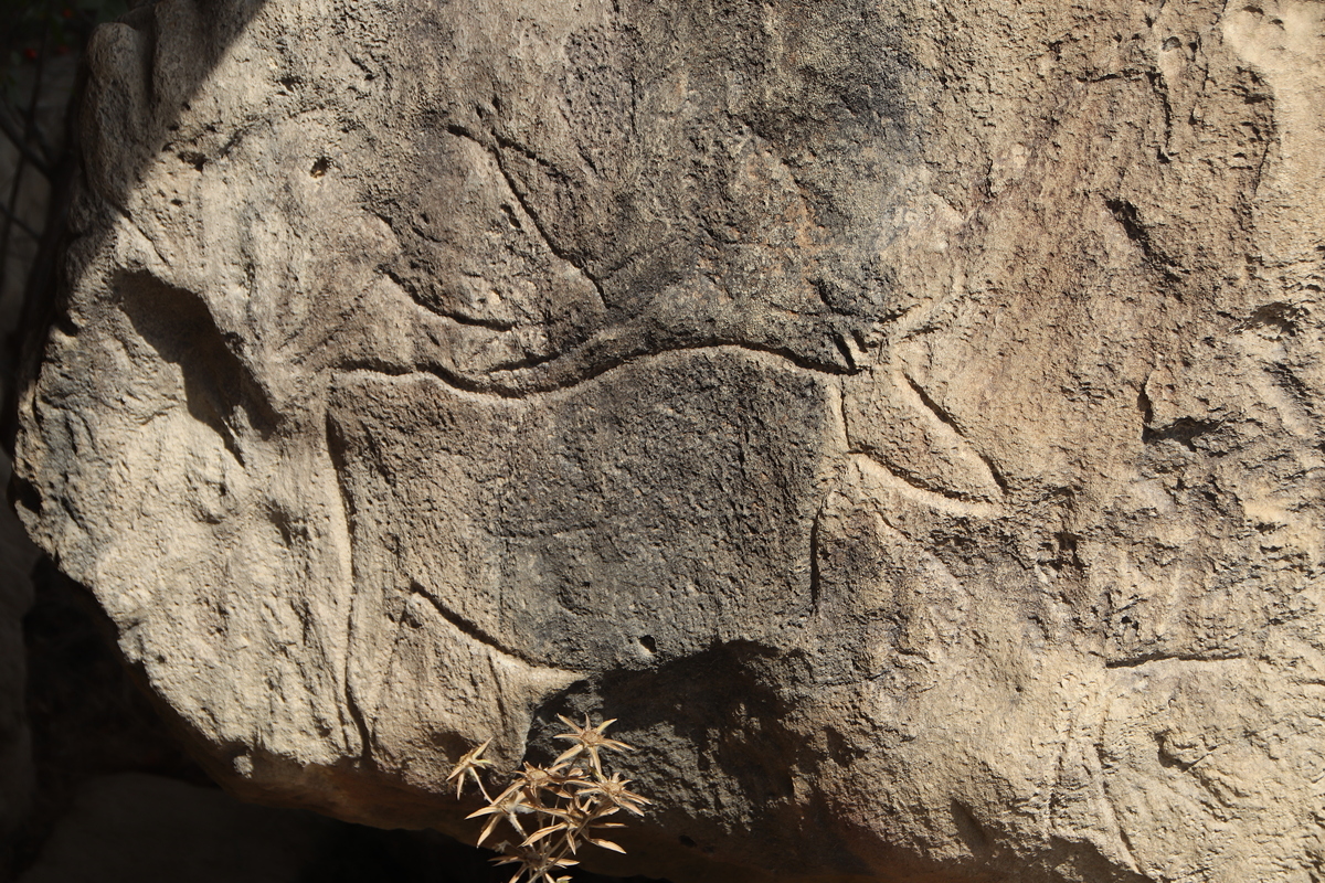
There were two main reasons to drive to Qobustan, petroglyphs and mud volcanoes. Qobustan’s petroglyphs are prehistoric rock carvings from the Palaeolithic, Mesolithic, Neolithic and Bronze Ages, and the collection of them on open rock faces is impressive for their quantity, scale, quality, variety and good state of preservation. They date from times when the Caspian Sea was higher (it is currently 40 metres below sea level) and the area was better watered with lush vegetation.
An initial visit to a dimly lit but otherwise very informative, well presented museum gave some excellent background information to help understand the carvings, but of course the real highlight was seeing the pertroglyphs themselves. Considering they are exposed to the elements, carved into limestone (a fairly sift rock) and located in an area where frequent earthquakes occur, their state of preservation was very impressive. To see the petroglyphs on the rock faces and in several rock crevasses, a walk across and through rocky terrain was required, but it was not excessively rough or slippery and was certainly worth the effort required.
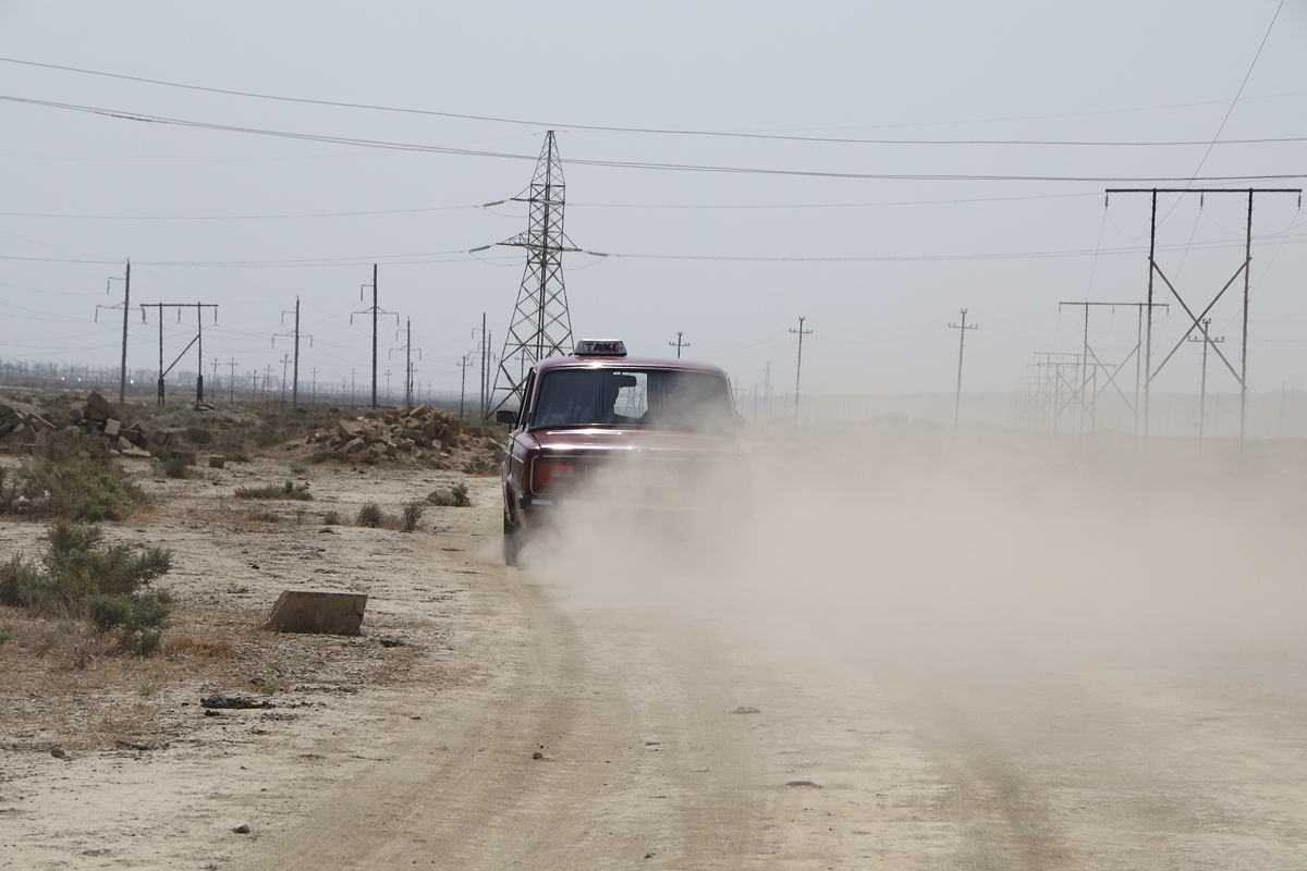
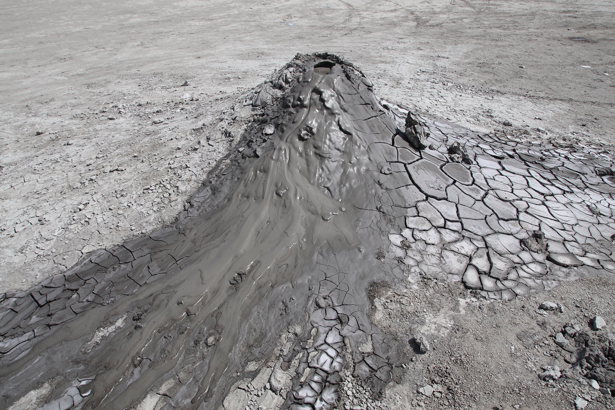
To get to the mud volcanoes, a change of transport was required. About 40% of the world’s mud volcanoes are found in an area about 12 kilometres south of Qobustan, but they can only be reached by travelling on rough, dusty, unsealed roads that our bus could not handle. To make the trip, a fleet of five Ladas taxis was hired, as Ladas seem to be the only cars tough enough to handle the conditions. As Sǝmor (pronounced “Say More”, our local guide, who is not known for his pro-Russian stance on life) commented: “Ladas are the best Russian cars; that’s because they’re not really Russian, but Italian Fiats from the 1960s”.
Once in the car, our driver decided to show off his expensive sound system by putting on some Az-Pop music at full blast (and full bass) before slipping the car into top gear and hurtling across the dusty plain on the rough track at speeds that sometimes tipped 115 kilometres per hour. The driver’s style might have underwhelmed me (and perhaps terrorised me too), but I have to say that the little Lada handled the conditions brilliantly.
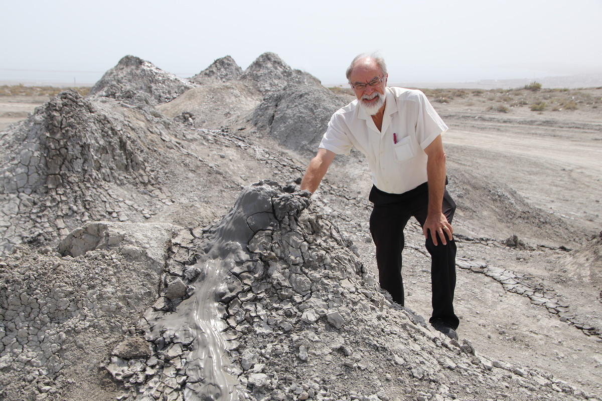
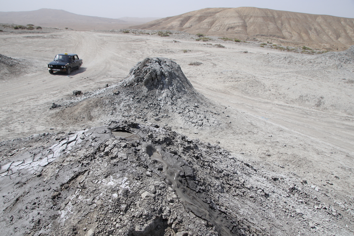
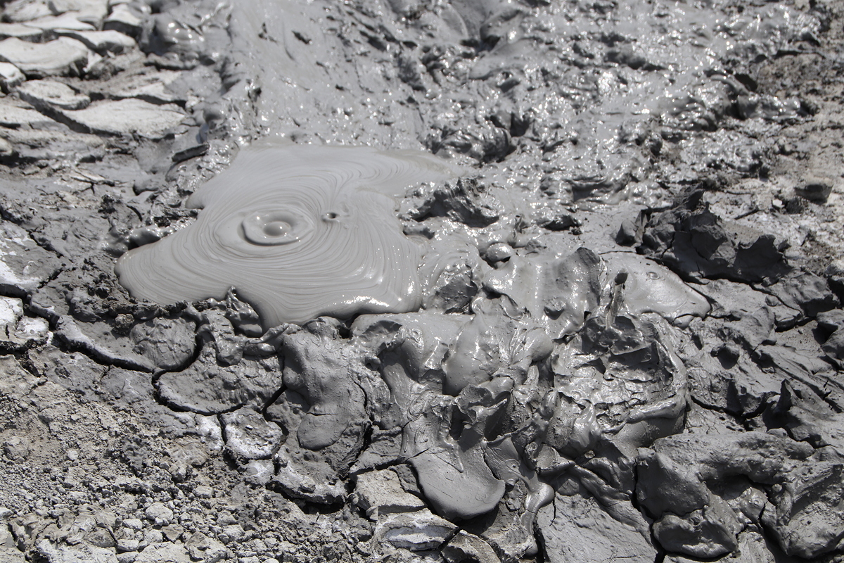
For me, the mud volcanoes were the highlight of my day (and seeing them was one of the reasons I had decided to include Azerbaijan on my research itinerary). There is a large field of mud volcanoes, varying in height from less than a metre up to about four metres. They are in varying states of activity, but today about half the volcanoes were doing their duty by gurgling, spluttering and oozing their cold, grey mud.
Although they resemble geothermal features, there is no geothermal activity in the area. The mud volcanoes form from an underground supply of naturally occurring methane gas which becomes lubricated by a supply of underground water through aquifers that carry it from nearby hills. The downward pressure of the water places pressure on the diapir containing the methane, forcing it upwards to the surface as a bubbling supply of cold, sticky oozing mud. A short video of the mud volcanoes that I took during today’s visit can be seen at HERE.
We returned to Baku for our a scheduled (but late) one and a half lunch break, and then set off again at 3:40 for a circular drive around the Abşeron Peninsula (also transliterated Absheron) to the north of Baku. During the drive, we made two stops.
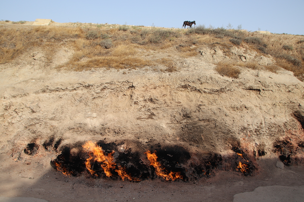
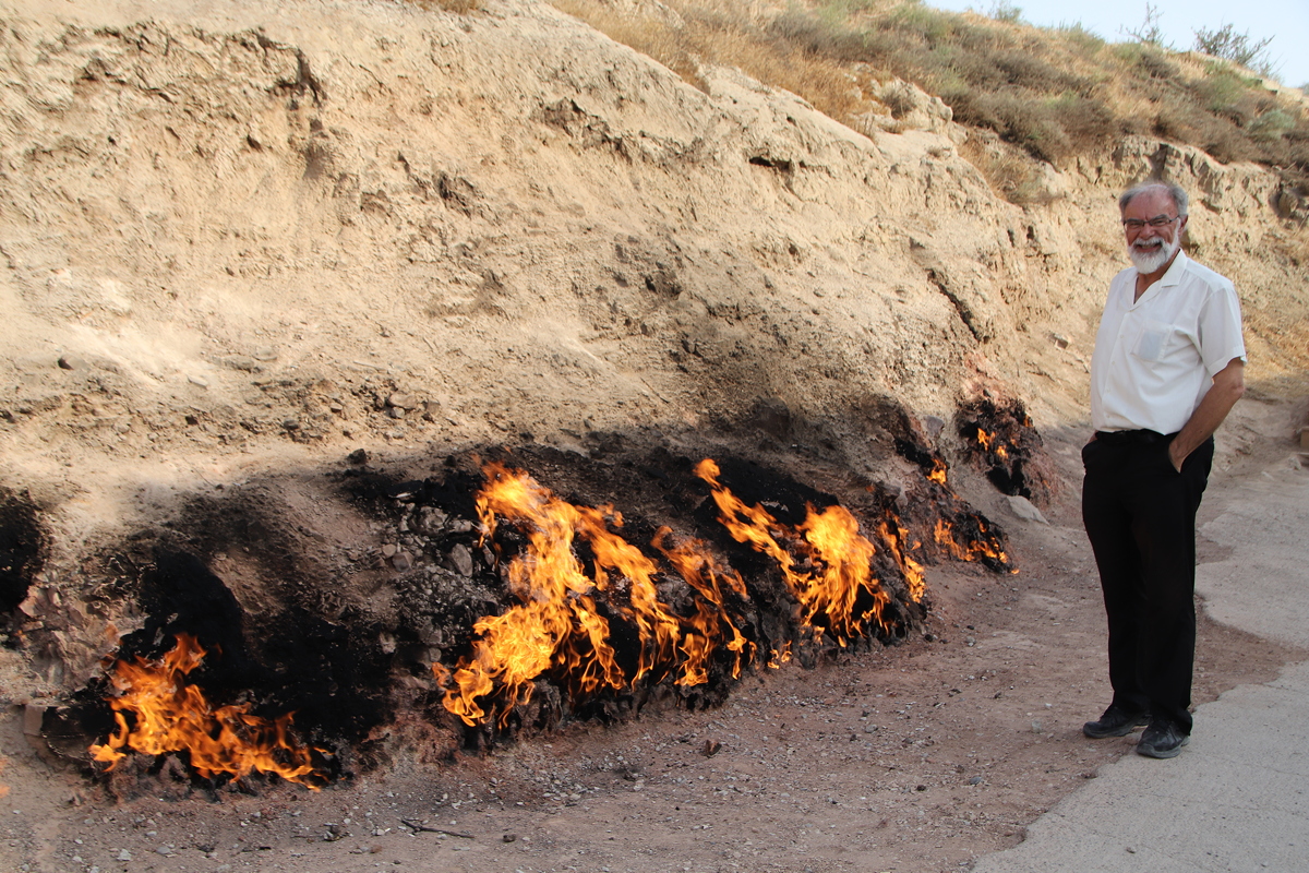
The first stop was Yanar Dag, a name that literally means “Fire Mountain”. Yanar Dag is in fact just a small hill, and at the base of the hill a 10 metre long fire burns continuously as gas escapes from the ground. Apparently the flaming hill was mentioned by Marco Polo in his travels, and historical records indicate that the flames have been burning for at least 5,000 years. The name Fire Mountain conjures expectations of a mountain that is on fire, and so the actual phenomenon is somewhat underwhelming – the common reaction was “is that it?”. Having said that, the fire emits strong heat, and as I stood about a metre from the flames to have a photo taken, the hairs on my arm began to singe uncomfortably.
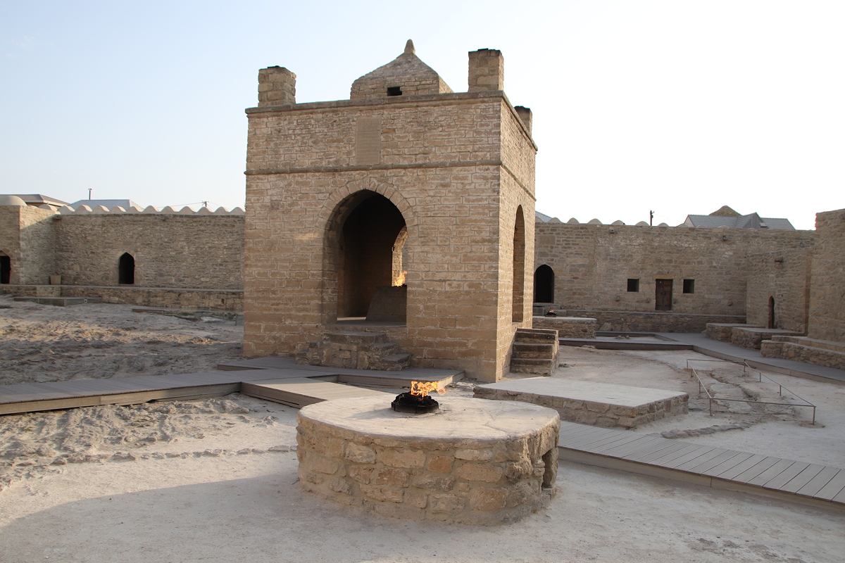
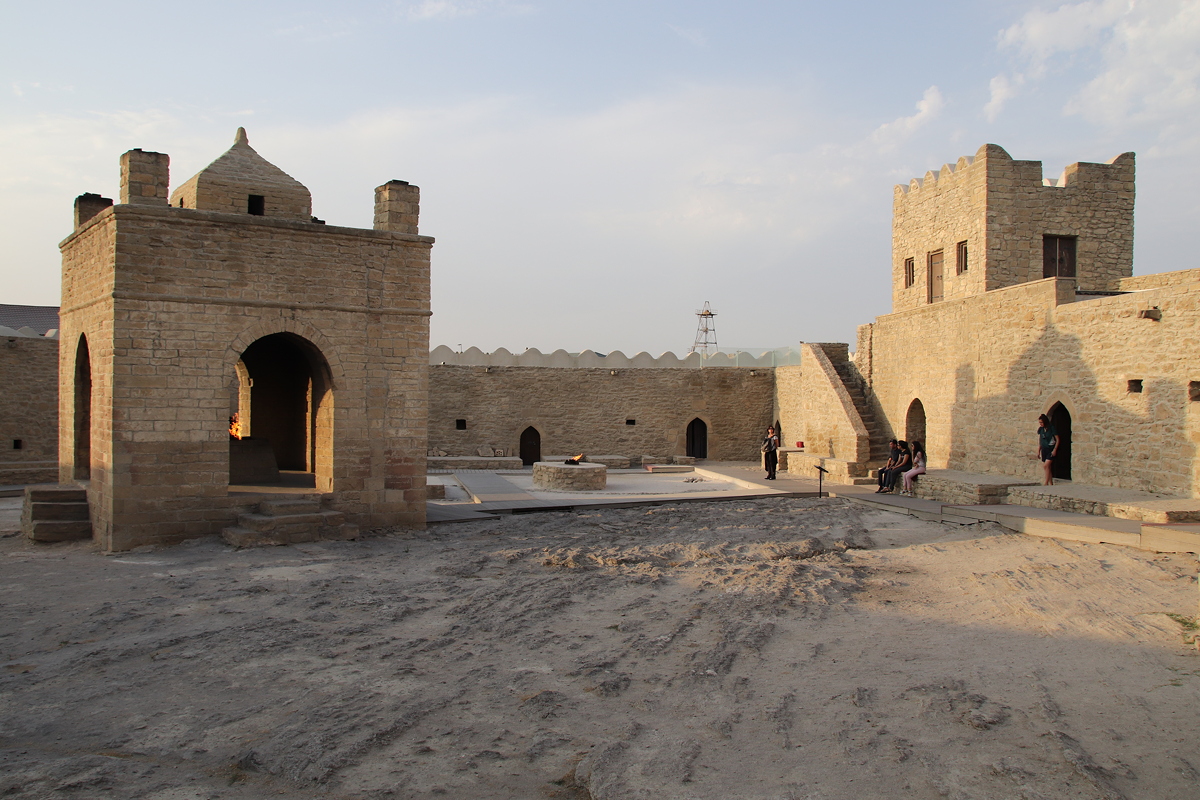
We took a long circuit from Yanar Dag around the northern and eastern coastline of the Abşeron Peninsula to reach our second destination, a reconstructed Zoroastrian fire temple known as Ateşgah (or Ateshgah) in the village of Suraxani (or Surakhany). A Zoroastrian temple stood on the site from the third century BC, making use of a natural gas vent, although the reconstructed present structure dates from 1912. No Zoroastrians remain in Azerbaijan, so the reconstructed temple is really museum rather than an active place of worship. Nonetheless, the reconstruction is well done (apart from the filling in of the pit that was formerly used to place dead bodies to be eaten by the birds), and provided a very insight into the sometimes eccentric practices adopted by Zoroastrians.


Day 3
Qobustan and the Abşeron Peninsula
Wednesday
5 September 2018