Northern South America Travel Diary
2012
Northern South America Travel Diary 2012
Colombia Ecuador Guyana Panama Suriname Trinidad
Before sharing the wonderful day I have had today, I must apologise that today’s diary entry is being uploaded a little later than I had hoped. When I returned to my room at the end of the day’s explorations, there were several work-related e-mails requiring my attention, plus a request for a phone call with a lawyer, and finally, a work-related report to digest that amounted to 101 pages. It might be summer break, and I might be in Ecuador, but some work carries on regardless.
When I checked into my hotel in Quito a couple of nights ago, the very helpful fellow on the front desk suggested that I make the time to see the countryside north of Quito during my visit. He offered to arrange a car and driver for me at half the cost that any of the tour companies would provide a bus tour, with the additional promise that I would see places that most travellers don’t get to see. That last promise could be taken in two ways – either a great opportunity to get off the beaten track, or a great opportunity to get beaten up. Hoping it was the former, I accepted his offer.
And so, we set off this morning at 7:30 am and headed northwards, through Quito’s morning traffic congestion and into the mountains beyond. Apart from a couple of brief stops beside the road to see the scenery, our first ‘real’ stop was at the equator.
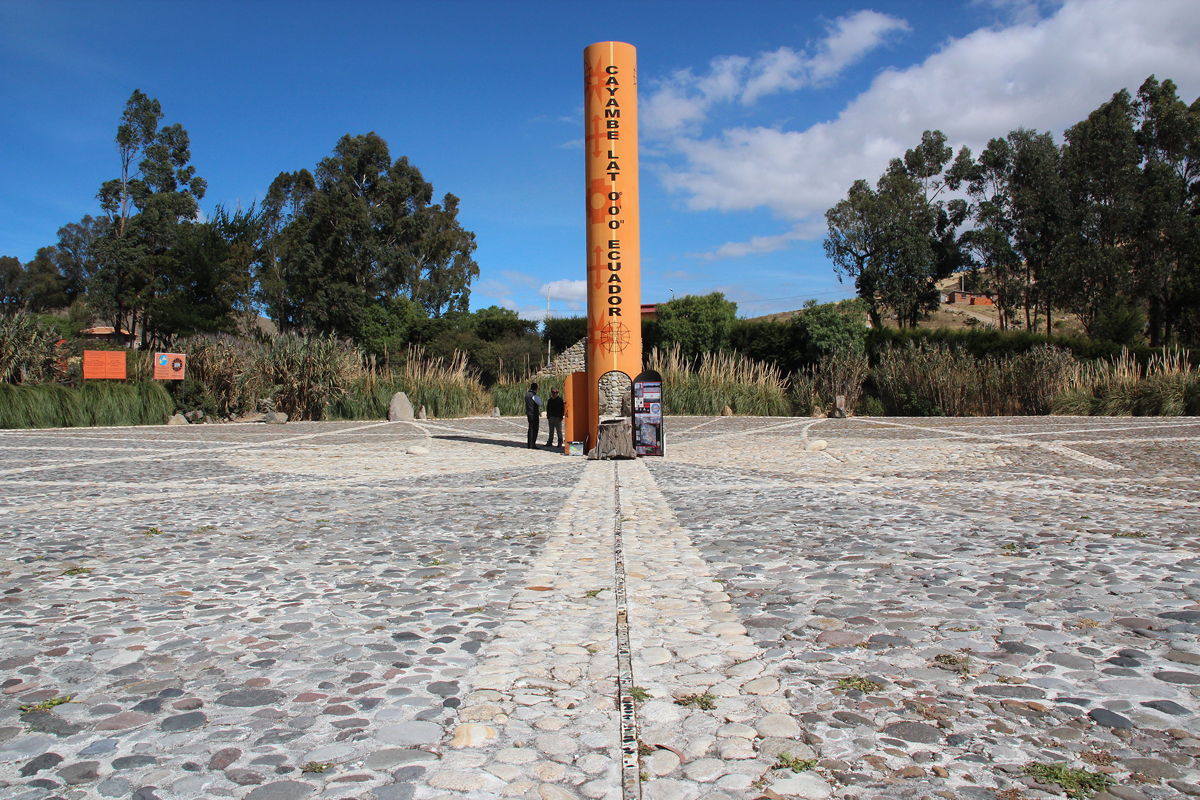
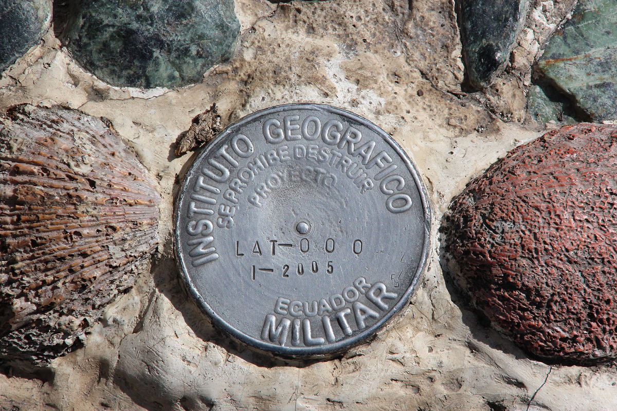
The guidebooks mention a place on the equator called Mitad del Mundo (Middle of the World), 22 kilometres north of the centre of Quito. The guidebooks also say that it is very touristy, that is actually 300 metres away from the actual equatorial line, and that it is over-priced. My stop at the equator, by contrast, was fabulous – and had none of the drawbacks of Mitad del Mundo.
My stop was on a different road, about one kilometre north of a small village called Cangahua. Right on the equator (with an official survey disc to prove it), local people had constructed a large sun dial, with stones marking the position of the sun at different times of the year. As we arrived, a representative of the Quitsato Project (who had build the sun dial, and which also ran a number of primary schools for girls from impoverished backgrounds) drove up to give me an explanation. His information was clear and excellent, and I was more than happy to support Quitsato’s work with the purchase of a disk and pamphlet of information.
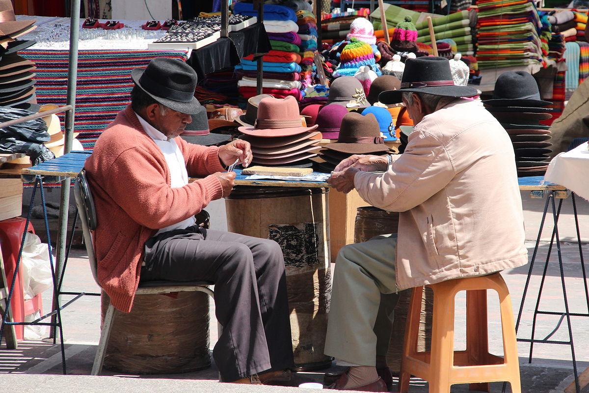
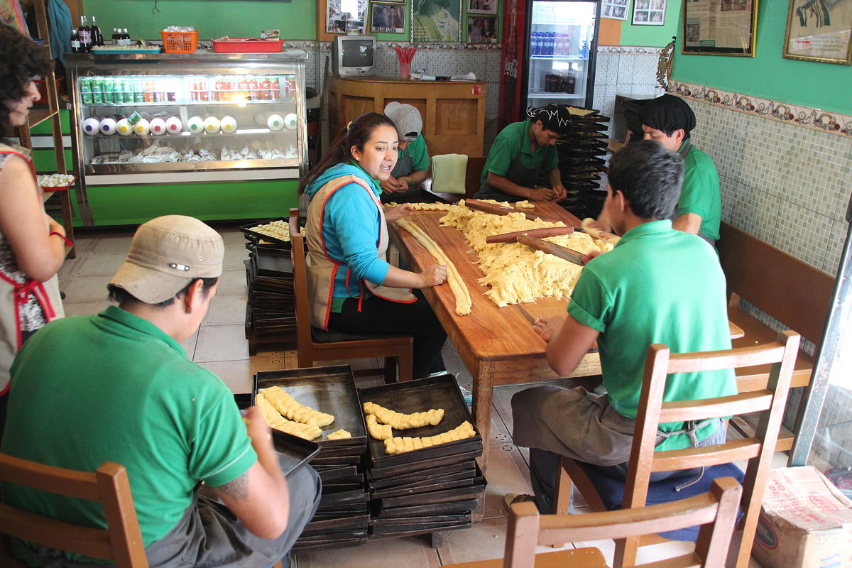
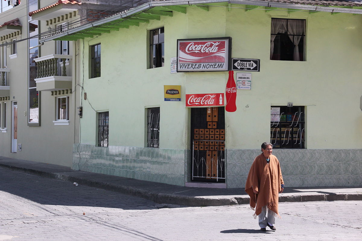
Our next stop was in the town of Cayambe – not to see the beautiful church, or the bull-fighting ring, but a small café where Ecuadorean bread (which also has a local that I didn’t catch – sorry) was being made and baked in the traditional way. It was both labour-intensive and very fast, as well as being an activity that brought together several members of the family for a great time of conversation.
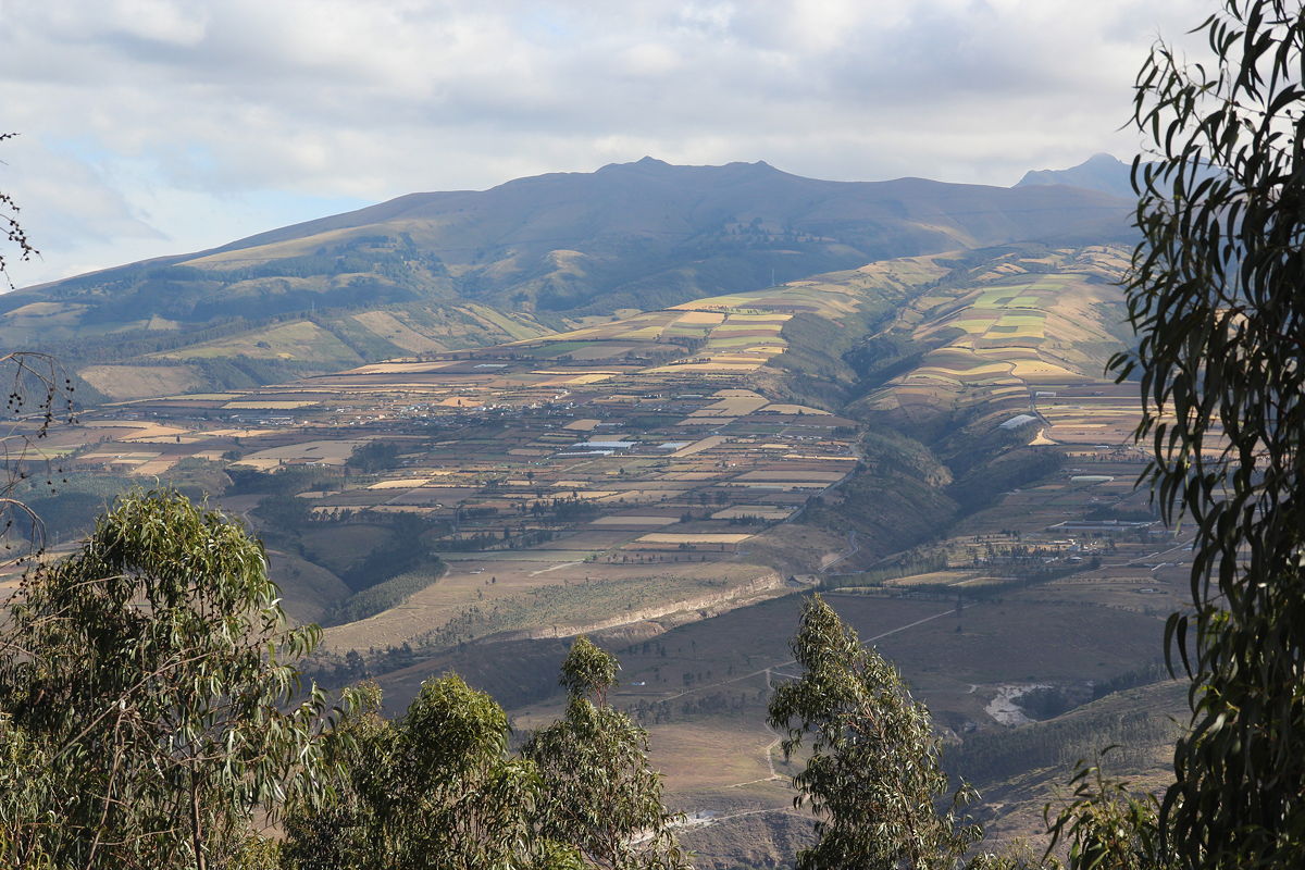
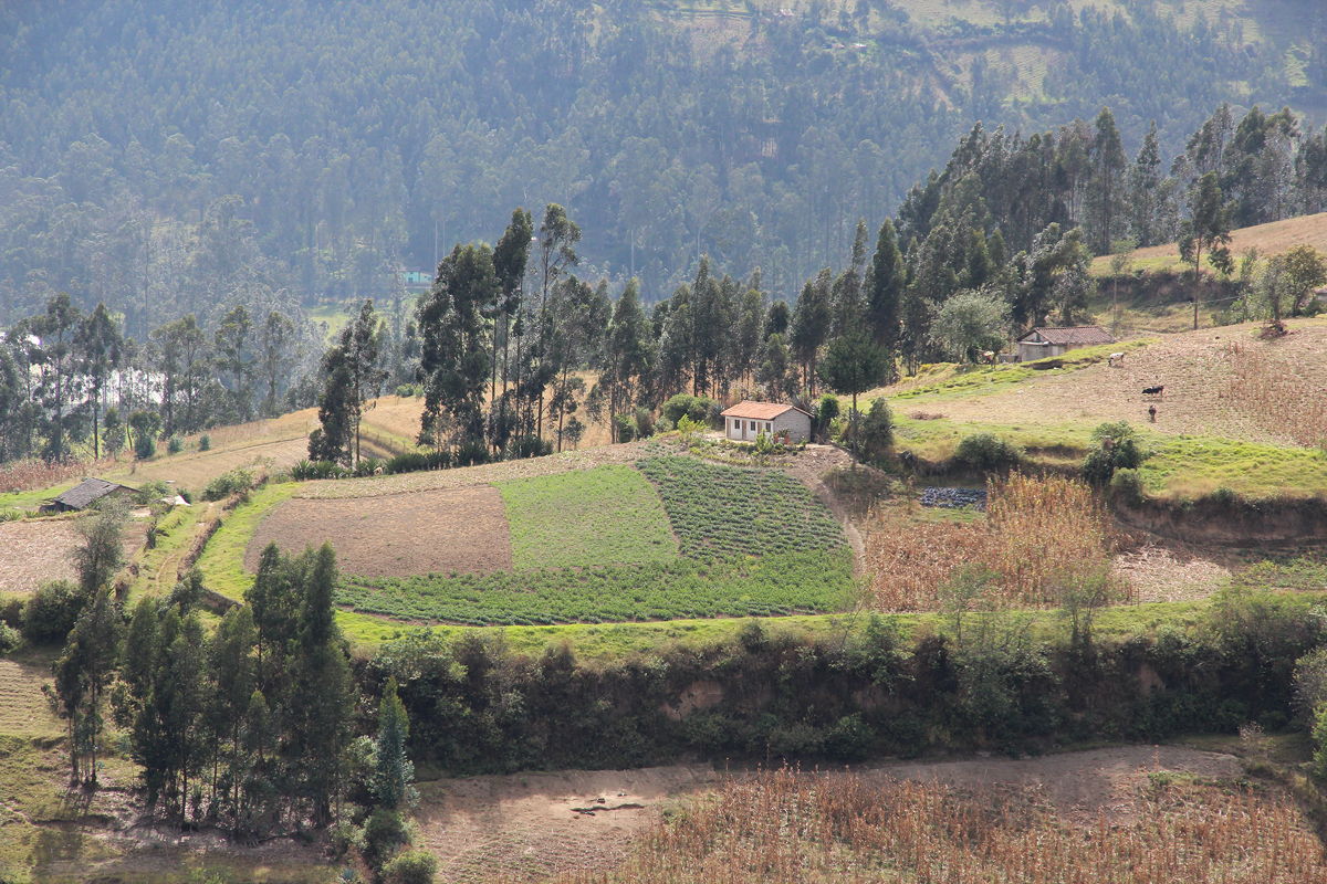
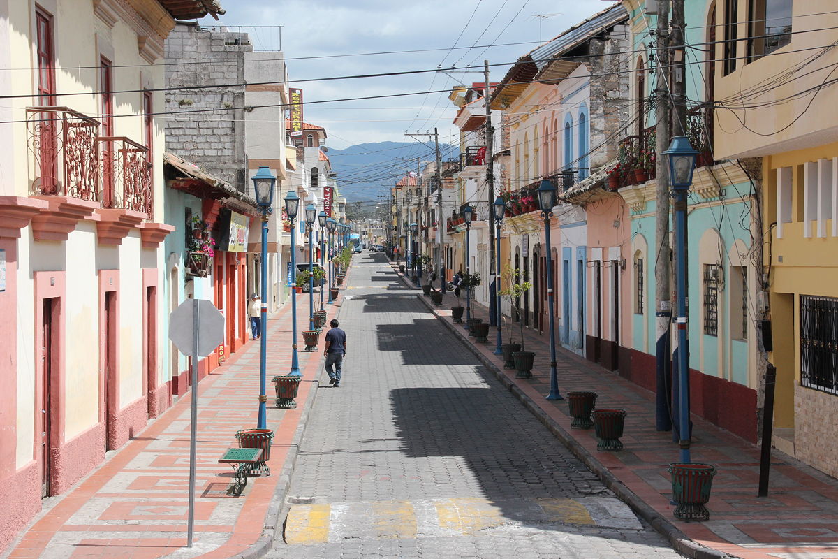
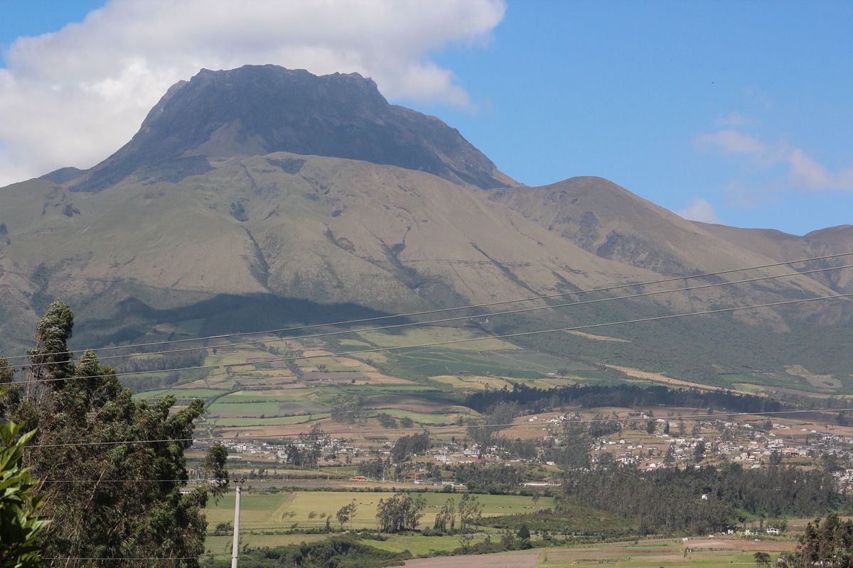
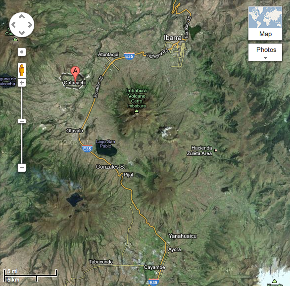
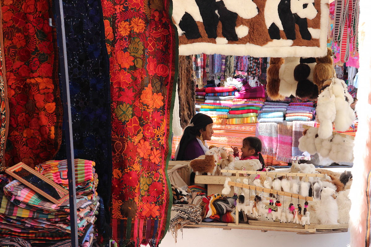
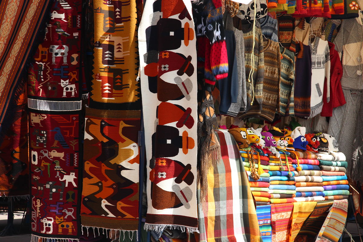
As we continued northwards along the Pan American Highway into the next province of Imbabura, the landscape became even steeper, dominated by the tall peaks of several volcanoes. We stopped in a large town called Otavalo where, at an altitude of 2550 metres, Ecuador’s largest Amerindian market is found. Apparently the market is at its largest on Saturdays, but even today it covered an entire city block – quite a sight with the tall peak of the Imbabura Volcano hovering behind as a backdrop. I think the local traders were disappointed rather than impressed by consumer resistance, although I did succumb to a postcard and two black leather belts, the latter being something that I have needed for a while.
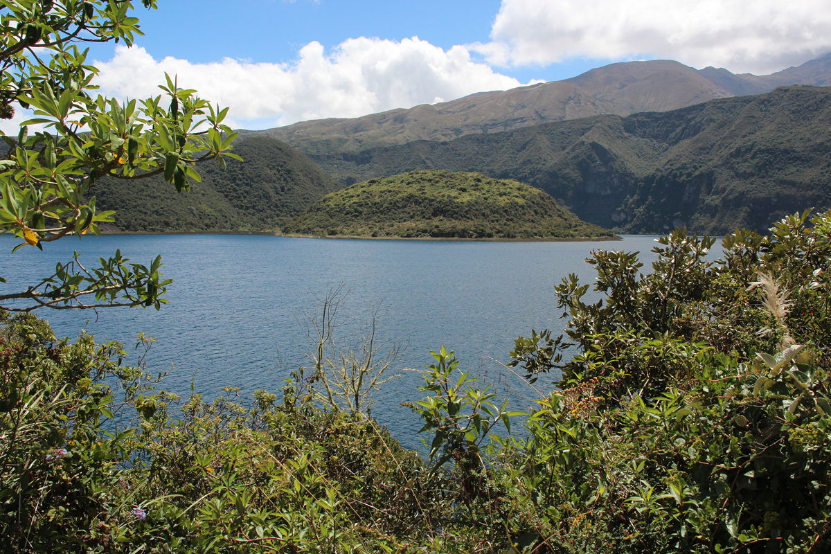
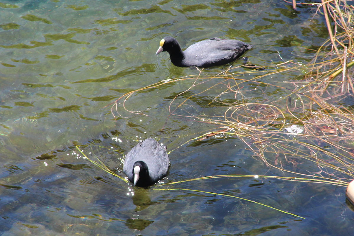
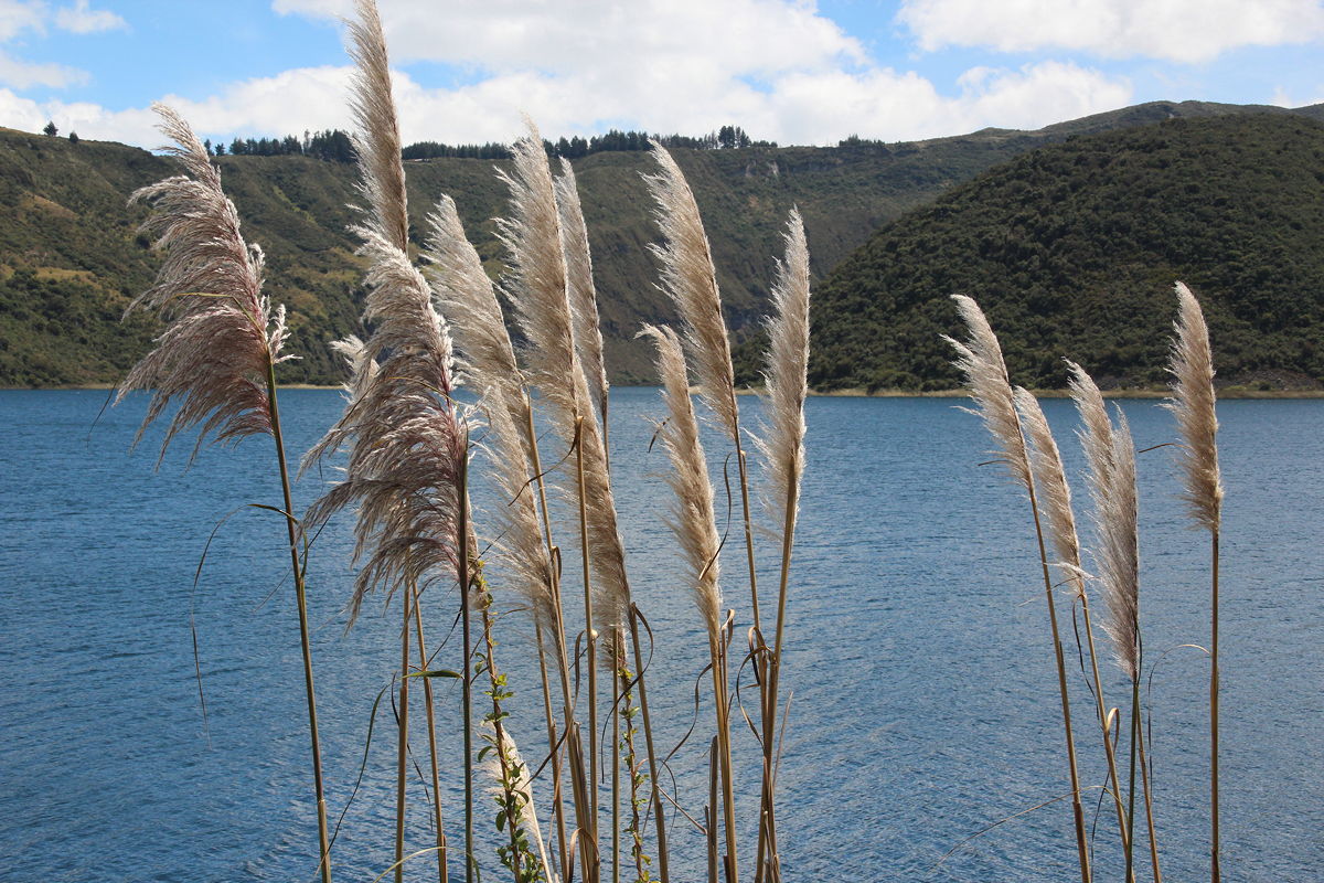
From Otavalo, we headed north-west off the Highway (and off the normal sightseeing route) to Cotacachi – a destination in two parts. There is Cotacachi the town, and there is Cotacachi the volcano. Driving first through the town, we headed up to the summit of this allegedly dormant volcano at an altitude of 3200 metres, where a beautiful vista opened up of a brilliant blue crater lake with two domed islands in the middle. Measuring about 3 kilometres in circumference, the lake forms the centrepiece of an ecological reserve which, like all parks in Ecuador, the government has recently made entry free of charge to encourage more people to appreciate their natural environment. It was lovely to see the diverse vegetation, and swimming in the late below what I first thought were two black ducks but which were, in fact, coots (Spanish: gallareta).
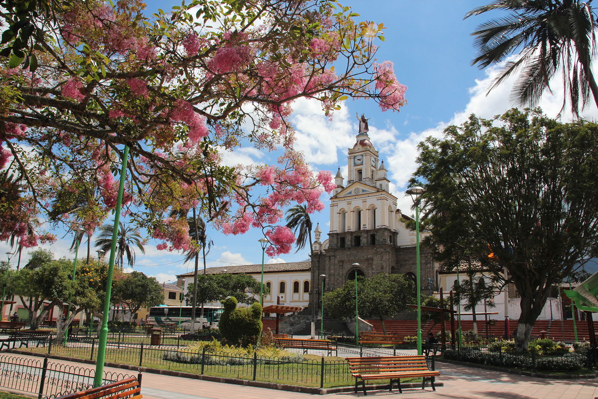
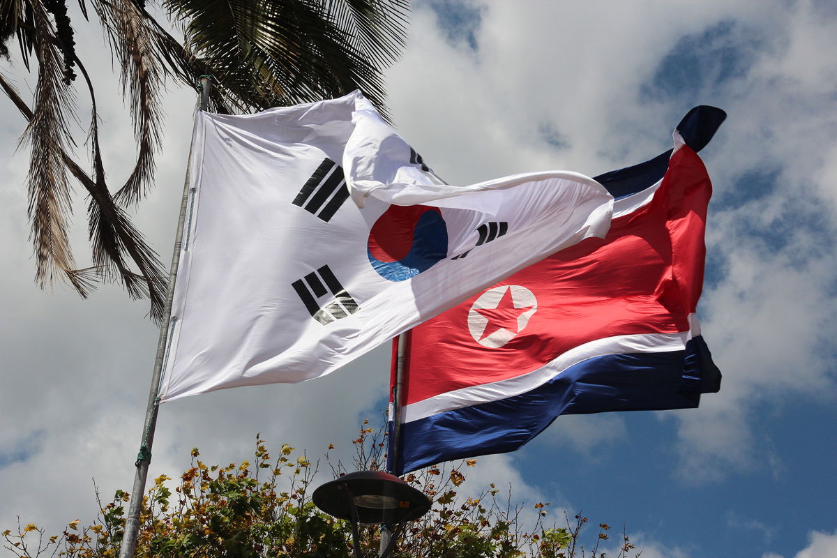
Returning back along the same road, our final stop was in Cotacachi town. This beautiful little urban centre is apparently attracting large numbers of retirees, including from the US. At its centre, the town boasts a beautiful church in Spanish colonial style that is almost large enough to be classified as a cathedral. In front of the cathedral is a beautiful park that seems to have the theme of peace and conflict. On one corner, the North and South Korean flags fly side-by-side, near the Japanese and Bangladeshi flags. Other flags in the park belong to Israel, and various separatist states that I was not able to identify.
Cotacachi was almost exactly 100 kilometres north of Quito, and because of the hilly terrain, winding road and maintenance work on the Pan American Highway, we didn’t get back to Quito until a little after 4:00 pm. That’s when I started attending to my e-mails.
It has been a great day. The weather was fine and sunny with just a few patchy clouds. The temperature was in the low twenties (Celsius), making walking and exploring most enjoyable. And it is not often that one gets the chance to cross the equator twice in one day.

Day 10 - Cotacachi, Ecuador
Tuesday
3 July 2012

Today’s extra bonus images