North Korea 2015
North Korea 2015
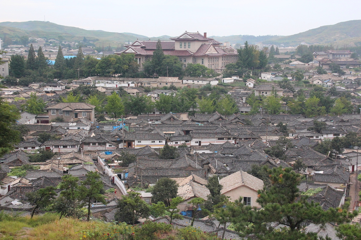
Situated just 7 kilometres north of the border with South Korea, and part of South Korea before the Korean War, Kaesong was the capital city of the Koryo Dynasty, which ruled Korea and much of north-eastern China from 918 to 1392. Today, it has a population of 300,000 people, and has by far the best preserved old city centre of any city on the Korean peninsula. This is because negotiations to end the Korean War took place periodically in Kaesong between 1951 and 1953 while most other places on the peninsula were being carpet bombed into oblivion, and therefore neither side fired upon the city.
Kaesong was our destination for the day, and we left our hotel in Pyongyang at what seems to have become the standard departure time, 8:30 am. The drive to Kaesong was 160 kilometres and took a little over three hours along the Reunification Highway that proceeds southwards (theoretically) to Seoul.
As we left Pyongyang, we drove around the Reunification Arch, one of Pyongyang’s most beautiful monumental structures. About 60 metres high, it is shaped like two traditionally dressed Korean women, one representing the north and one representing the south, reaching to each other and joining hands, holding up together a map showing a unified Korea and some words from the Three Point Reunification charter issued by Kim Il Sung shortly before his death in 1994.
During our drive to Kaesong, one of our guides (Mr Kim) helpfully explained the essence of the reunification plan. The three main points of the plan were that (a) the matter should be decided by the Korean peoples themselves without outside interference, (b) reunification should be peaceful, and (c) the two halves should come together to form one country under the name of the Democratic Federal Republic of Koryo. Because of the strong differences in the social and economic systems that have emerged in the two parts of Korea, he proposed that both sides should tolerate and respect the other’s system, and to speed up the reunification process, each side should retain their social and economic system while allowing the population to reside wherever they wish. The federal republic would be governed by a parliament with equal representation from the north and the south.
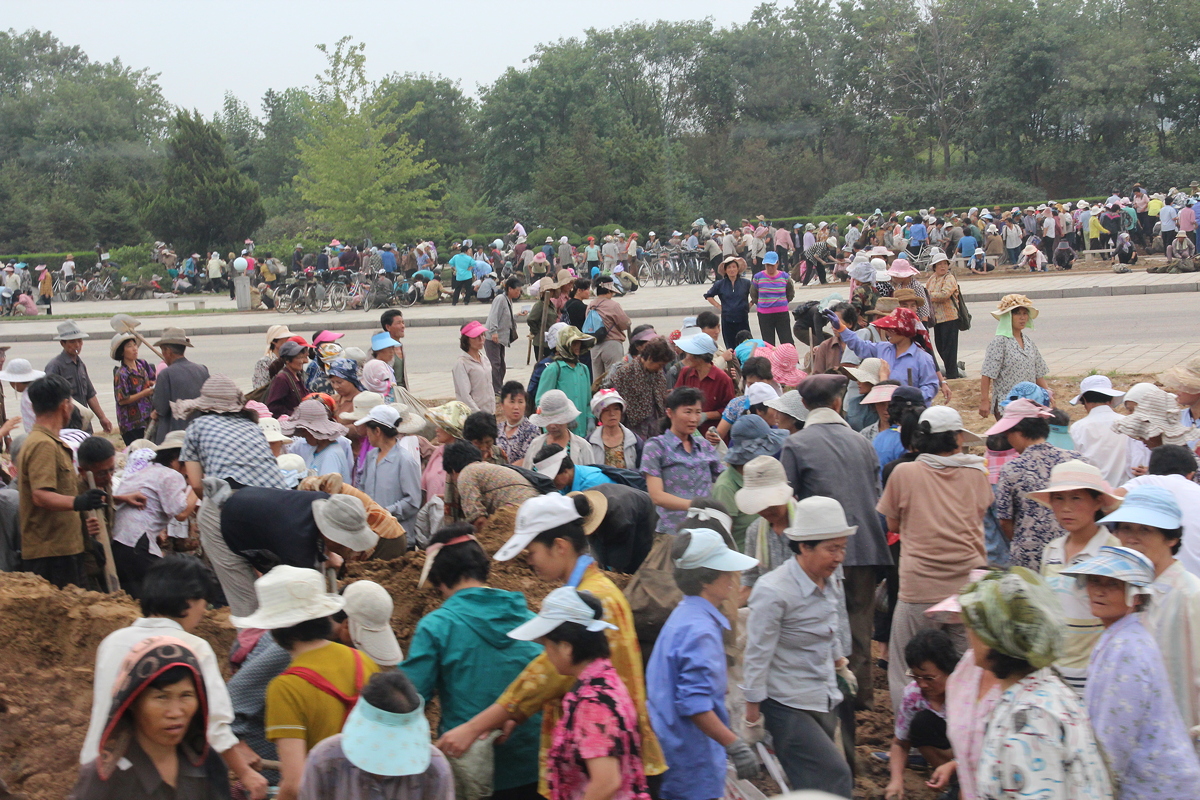
We did not stop at the Reunification Arch, so there are no photos to show today, but we have been promised a stop when we return to Pyongyang. We did, however, witness a fascinating sight at the arch as thousands of workers were there replanting the grass. The density of people was so great that it was hard to imagine a blade of grass fitting between them. North Korea can certainly mobilise the masses when it wishes to do so!
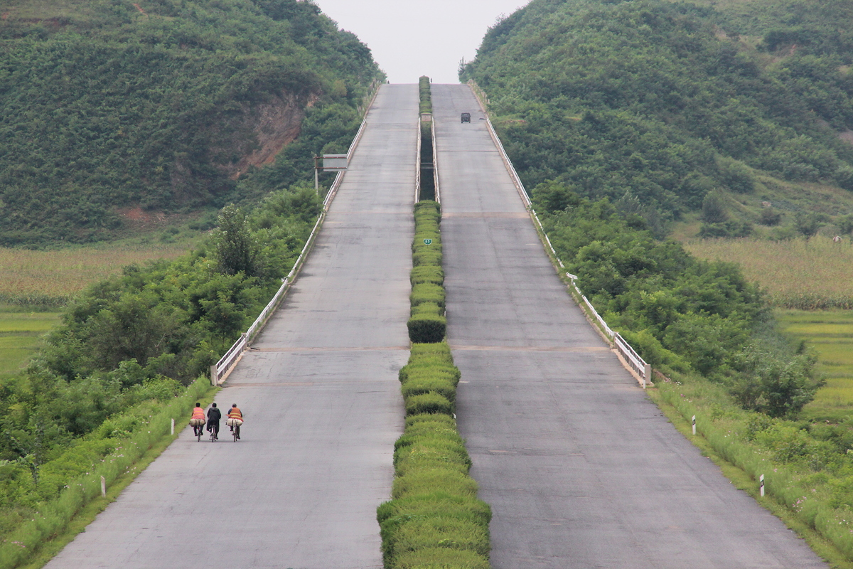
The Reunification Highway is a broad freeway. Because so few vehicles travel between Pyongyang to Kaesong, the highway was almost devoid of other vehicles. We passed perhaps 20 other vehicles during our 160 kilometre journey to Kaesong. At the halfway point, we stopped at a teahouse which provided excellent views of the highway from above; we probably could have safely assembled for a group photo in the middle of the freeway if we had wished to do so.
We reached Kaesong at a little after 11:30 am, and proceeded immediately to the west of the city to visit two significant historical sites from the Koryo Dynasty, both of which were recently designated as UNESCO World Heritage sites.
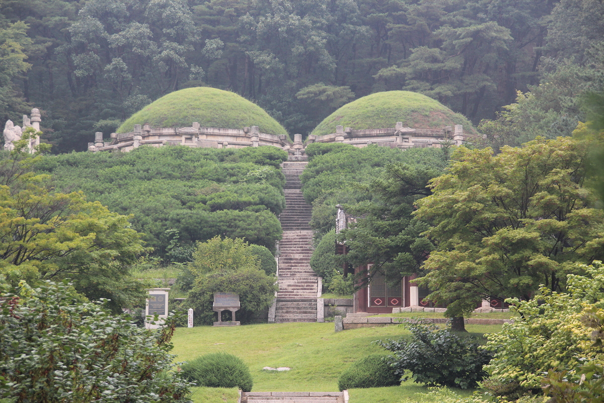
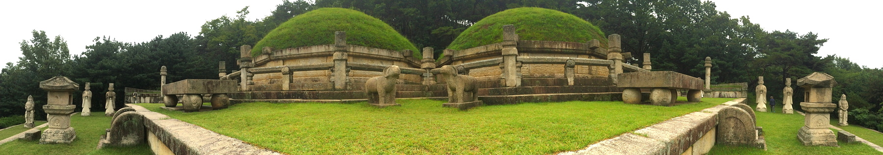
The first site visited was the tomb of King Kongmin, the 31st king (of 32) of the Koryo Dynasty who died in 1374. This was the first twin tomb in Korea, as his wife is buried beside him, having died in childbirth nine years earlier in 1374.
The location of the tomb at the head of a valley was very picturesque, and this was not accidental. King Kongmin had sought help from the top geomancers in Korea, with the threat that if they suggested a location he didn’t like, he would wave his handkerchief as the means of ordering his troops to execute the geomancer on the spot. When the king climbed the hill facing the site selected by the top geomancer, he was thrilled with the decision - but he was also sweaty from the climb up the hill. Forgetting his order to the troops, he took out his handkerchief to wipe his brow. Later, when he came down to congratulate the geomancer on his excellent choice, we was informed that he had already been executed. King Kongmin was heard to exclaim “Oh Dear!”, and the hill on which he stood is still named “Oh Dear Hill” in memory of the incident.
Our second stop was at the tomb of the first ruler of the Koryo Dynasty, King Wanggon, who died in 943. Despite its age, this tomb was in excellent condition, having been renovated in 1993 for the 1050th anniversary of his death. Indeed, the guardian figures looked as though they could have emerged from the Mansudae Arts Studio earlier this year, such was their pristine condition.
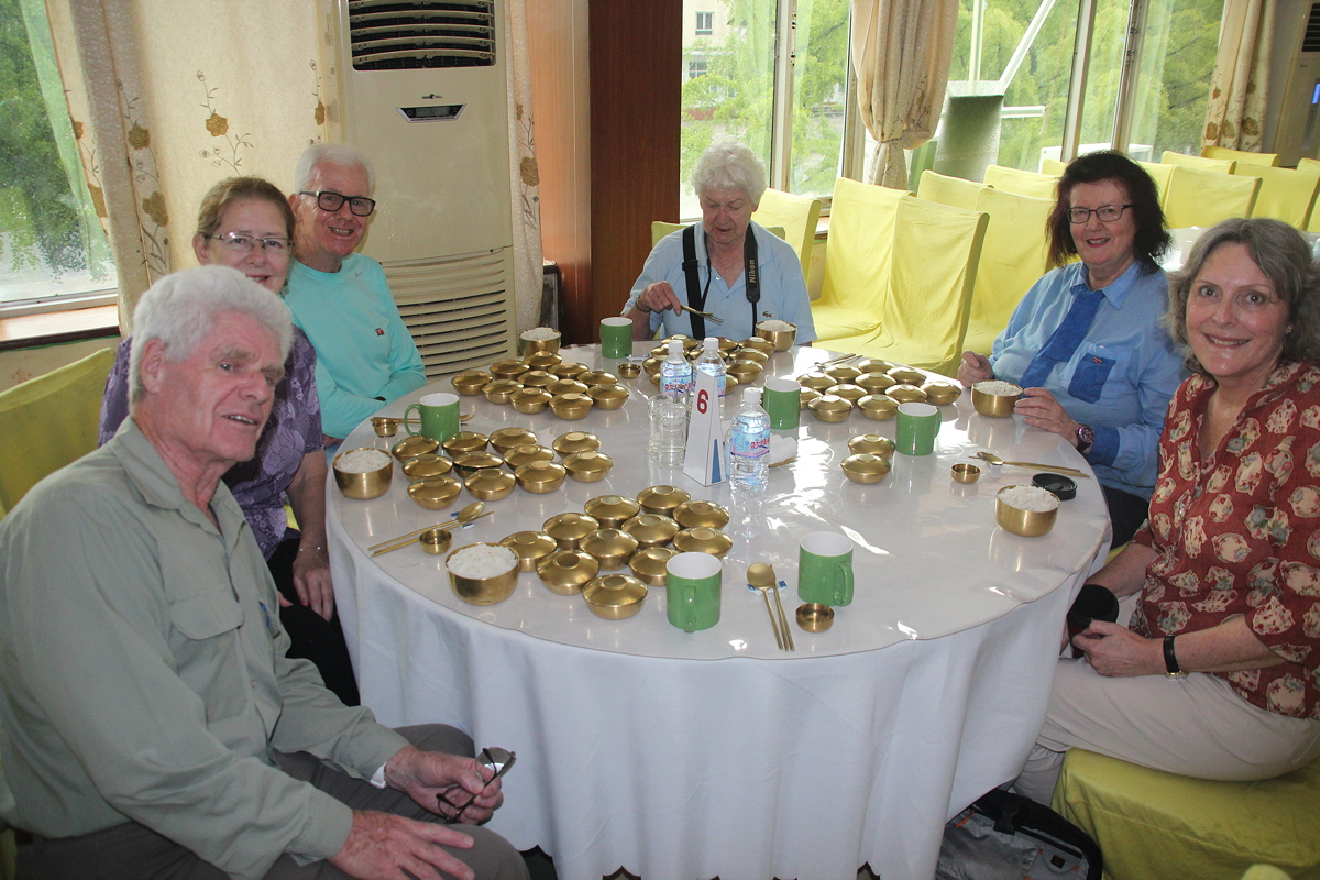
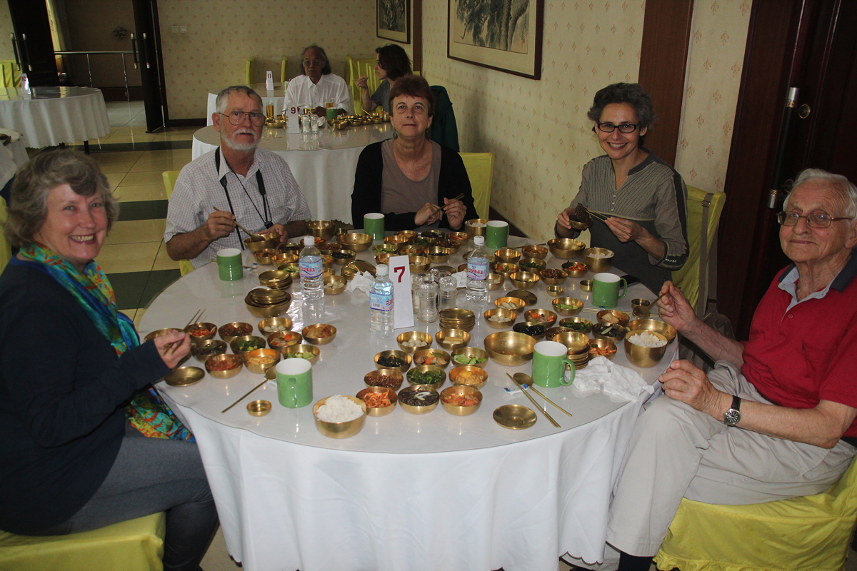
Lunch was something of a special treat as it comprised a Koryo banquet. Served in small golden pots, we each received assorted servings that included rice, soup, tofu, salted dried fish, pork with vegetables, seaweed, bean sprouts, two forms of kimchi, cucumber and rice cake balls. It is fair to say that no-one struggled find something that they enjoyed in this vast array.
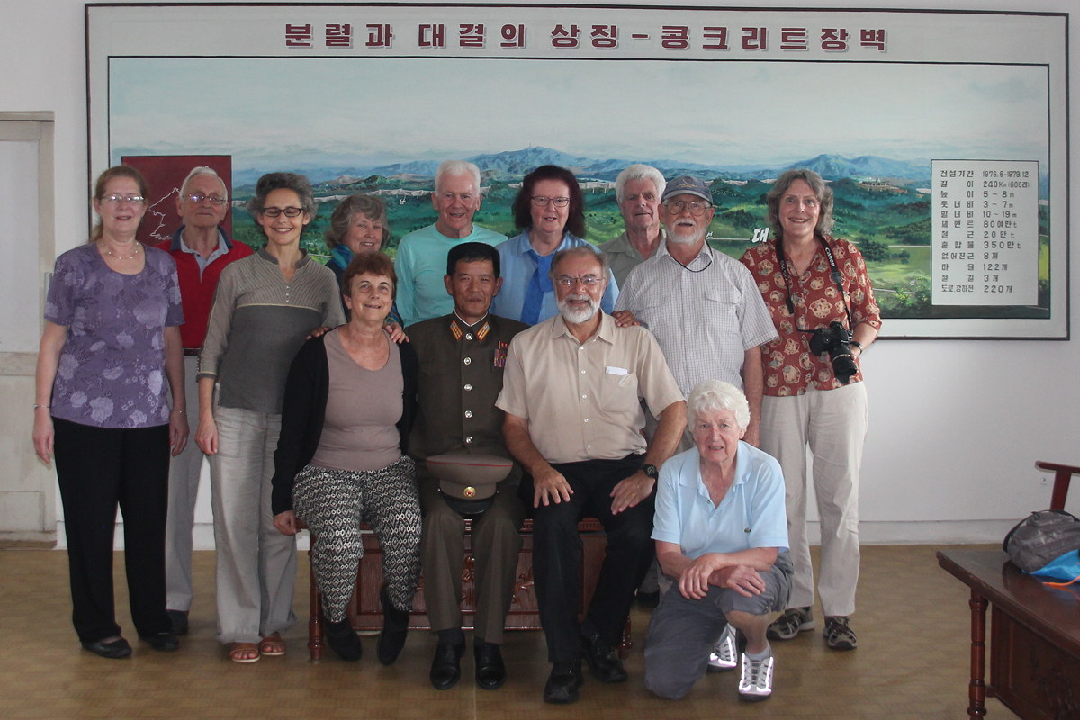
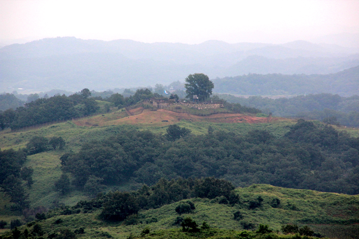
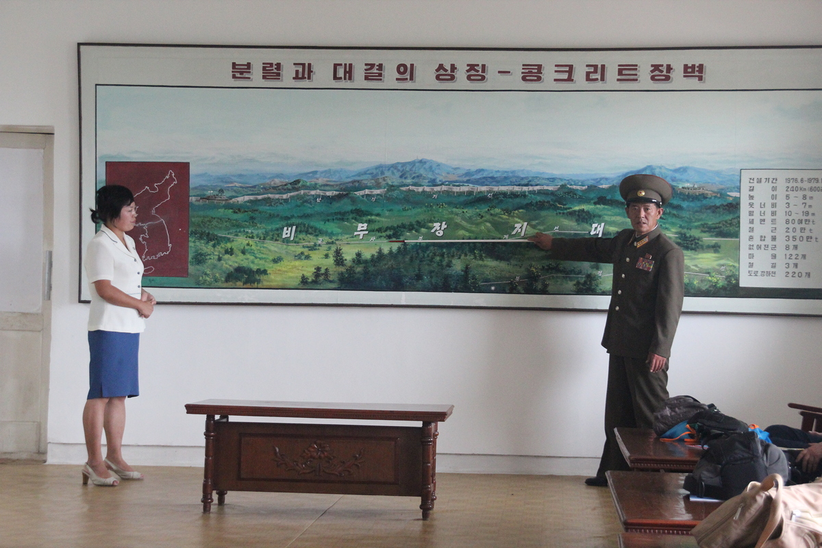
After lunch, we took a 27 kilometre drive (each way) to the edge of the Demilitarised Zone (DMZ) at Sasiri to see the Concrete Wall. Much more interesting than the name suggests, the 240 kilometre long Concrete Wall spans the width of the Korean Peninsula in the southern half of the four kilometre wide DMZ that is controlled by the South. It was built between June 1976 and December 1979 by US and South Korean forces, the same time (as was pointed out to us) as the Americans were demanding that the Soviet Union tear down the Berlin Wall.
The wall is between 5 and 8 metres high, between 3 to 7 metres wide at the top and between 10 and 19 metres wide at the bottom. It is designed so that a vertical wall faces the north, but the southern side is sloped and planted with grass to look like a natural hill when viewed from the southern side. There are gun posts and watchtowers every 100 metres or so.
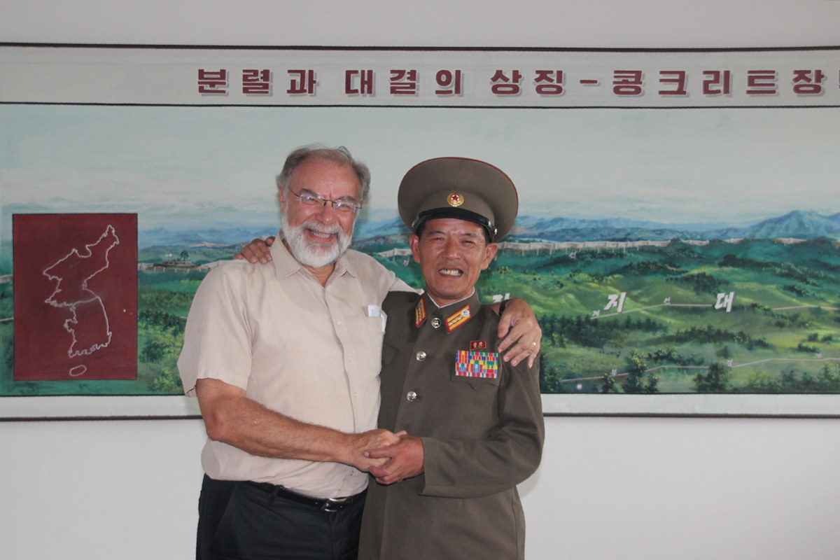
Following an introductory briefing by a lively 61 year old retired Korean People’s Army colonel, we went outside to look across the DMZ into South Korea, and to see the Wall, the watchtowers and gun emplacements through field glasses. I was a little sorry that we had not been there in yesterday’s crystal clear weather, as today’s weather was more hazy with some light drizzle.
By the time we returned to Kaesong, it was about 5:20 pm - too late for our planned visit to the Koryo Museum (which we will do tomorrow morning instead). We thus took the climb up Jannam Hill to get a good view over the old city of Kaesong. For historical reasons, this is now a unique view in all Korea, and the closely packed houses with their grey tiled curving rooflines reminded several of us of the old town of Lijiang (China).
Our hotel in Kaesong - the Jannamsan Hotel - is more basic than the one we left in Pyongyang. It claims to have hot water for one hour in the evening and one hour in the morning, but the reality is far more meagre. It also suffers from frequent blackouts. The food served for dinner was, however, excellent, and it is is serving as an excellent base point from which to start tomorrow morning’s explorations of the DMZ at Panmunjom.

Day 6 - Kaesong
Saturday
5 September 2015