Nauru Travel Diary
From Houston to Sydney 2013
From Houston
to Sydney
2013
Going to Nicaragua and back in a day is not a quick exercise, even when your starting point is the neighbouring country of Costa Rica.
Nicaragua has been on the list of countries I have been wanting to visit for many years. For a long while it was regarded as an ‘off-limits’ destination because of the savage civil war between the ruling socialist Sandanistas, under General Daniel Ortega but supported by the Soviet Union, and the Contra rebels, supported by the US during the presidency of Ronald Reagan.
The hostilities finished a couple of decades ago, not with a victory by the Contras, but Ortega’s defeat in a legitimate election. Interestingly, Ortega and the Sandanistas are now back in back in power, having won a subsequent election, although the regime today has a much milder complexion than it did during the 1980s.
Some of the most able and competent students with whom I had the pleasure of working when I was Head of the United World College in Hong Kong were from Nicaragua. Without exception, they encouraged me to visit their home country, promising that I would not be disappointed (and that I would be safe!). Today I finally managed to get there, and true to my students’ promises, I loved it, and there was absolutely no sense of any insecurity or danger.
Unfortunately, it was not possible to get as far as Managua (the capital city) on a day trip. However, we were able to see a wonderful variety of cultural and natural features in the southern part of Nicaragua.
The most efficient and cost-effective way of getting into Nicaragua (and back again) was for Di and I to book places on a group tour that left from Liberia. That meant leaving our hotel in Tamarindo at 4:30 am, which in turn meant getting up to the sound of the alarm at 3:40 am. As I said, it was to be a long day.
We arrived in Liberia at 5:30 am, but then had to wait for the other 28 people to arrive from various hotels and towns before we could leave in our quite modern Chinese-made bus (a Yutong) at 6:00 am. We arrived at our first destination at 6:10 am, a small restaurant in Liberia where we had breakfast – a choice between Costa Rican style (Di’s choice), American style (my choice) and continental style (almost no-one’s choice).
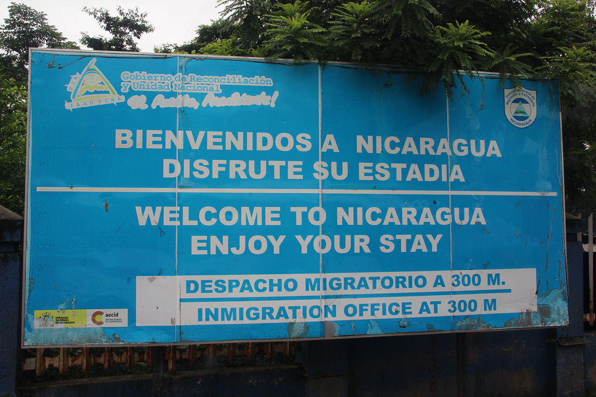
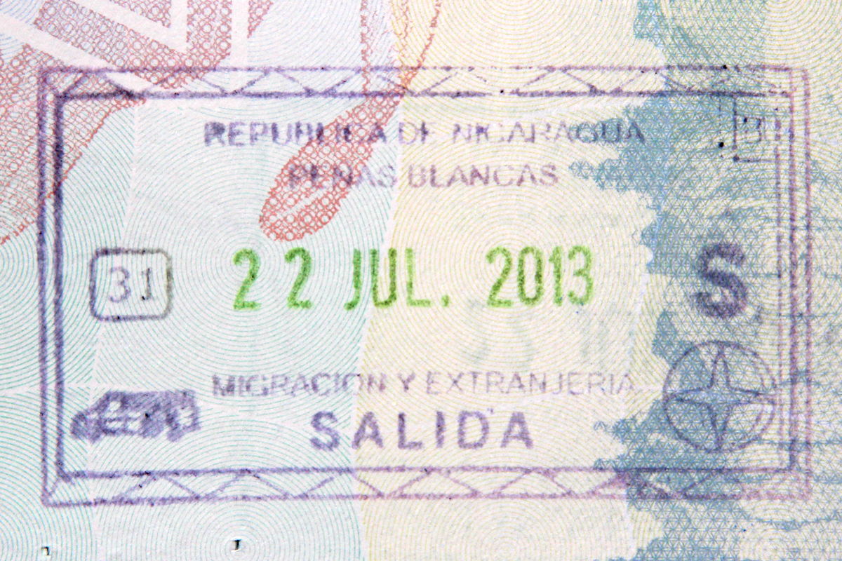
By 6:45 am we were on the road, and after an hour and a half drive, we arrived at the border crossing. The border crossing involved two stages, which were to leave Costa Rica (this meant lining up individually for our passport stamps) and then after a short drive of a few hundred metres, entering Nicaragua. This was a slower process, requiring our tour guide to collect all the passports for the group and have them processed collectively by the immigration officer (good to see that socialism still requires some collectivist processes!). We were finally able to leave the border and start driving in Nicaragua at about 9 am.
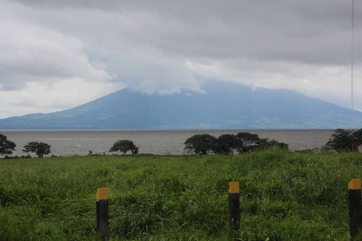
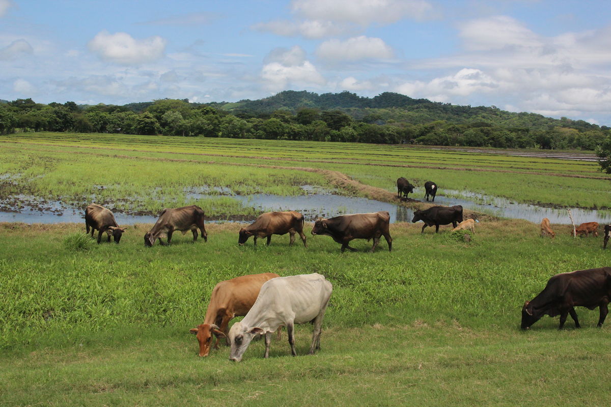
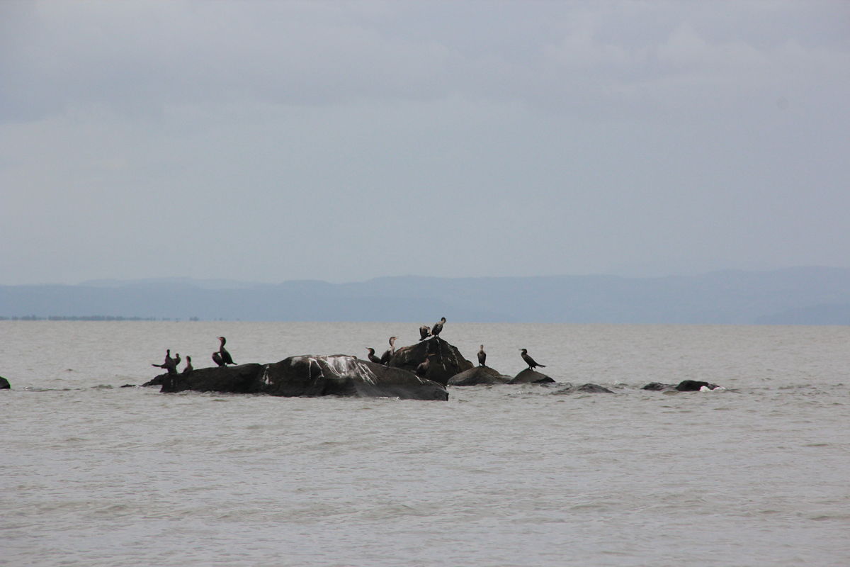
The initial drive northwards followed the western side of Lake Nicaragua, the second largest lake in Latin America (after Lake Titicaca, which lies between Bolivia and Peru), through areas of cattle raising and cultivation of sugar cane, rice, corn, banana plantations, and various other tropical fruits.
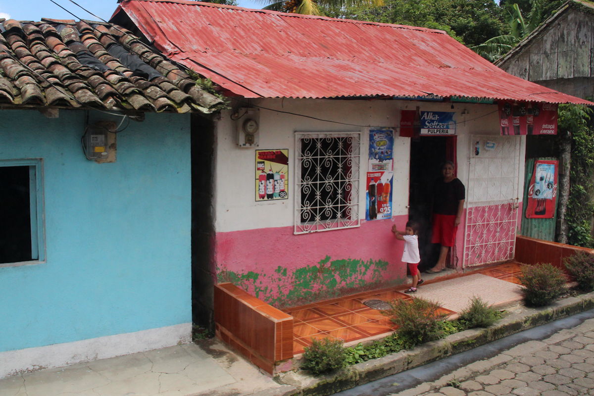
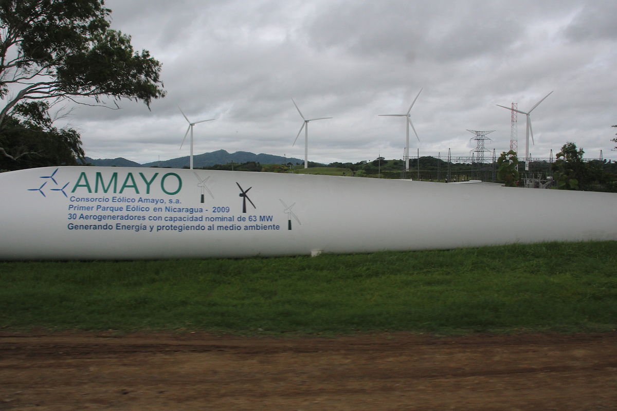
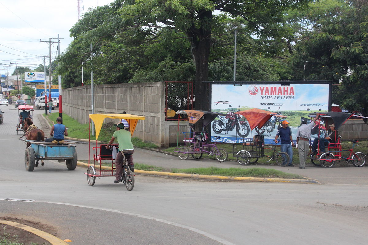
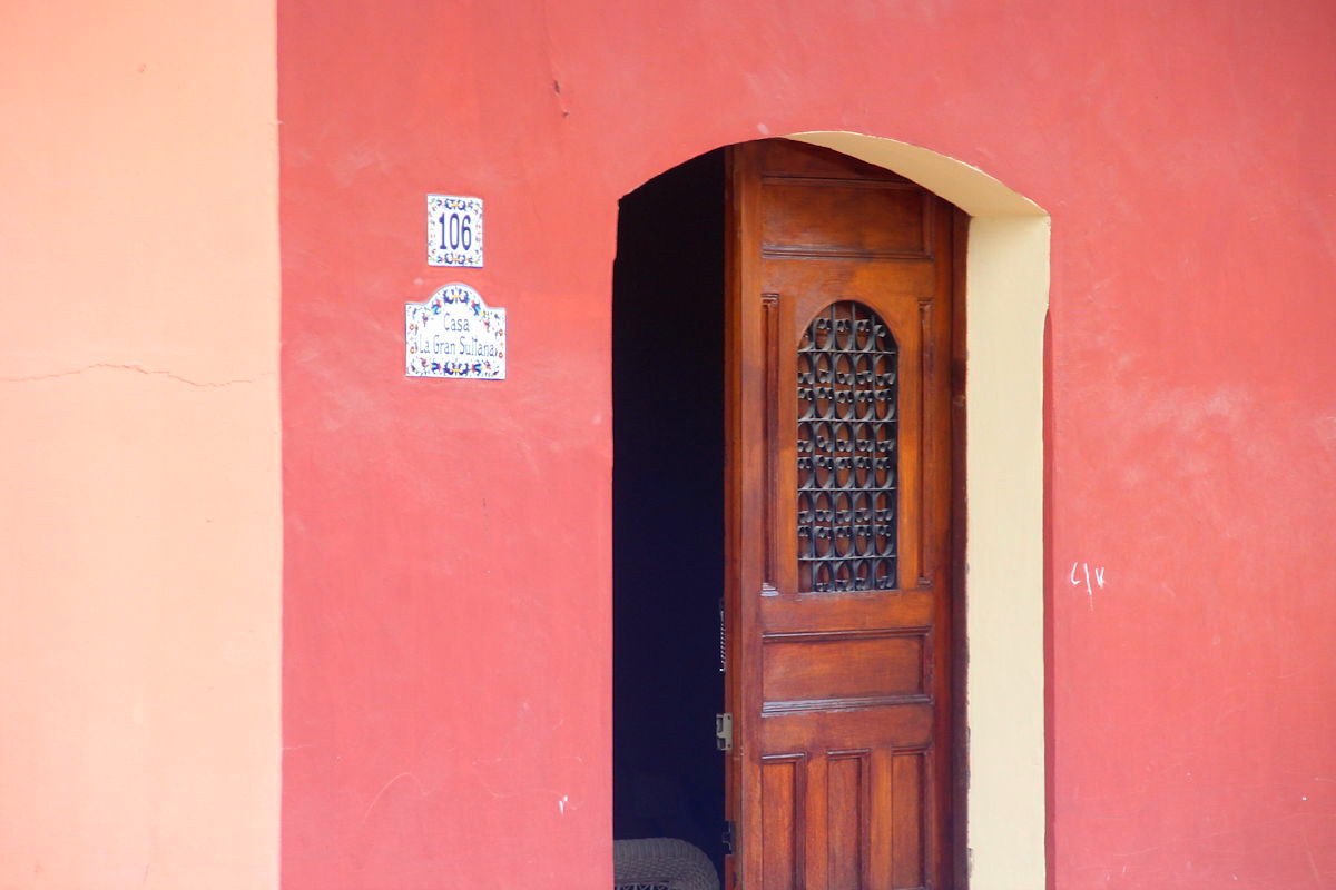
It was immediately apparent that Nicaragua is a poorer country than its neighbour, Costa Rica. Houses were smaller and less affluent, there was more emphasis on human power (including pedal-powered taxis), and infrastructure was less well developed. To some extent, this can be explained by the effects of the civil war a couple of decades ago, but Nicaragua is actually more typical of Central American countries than Costa Rica, which is unusually affluent (and thus expensive). This can be partly explained by Costa Rica’s decision in 1947 to abolish its army and use the funds that would have been used for the military to develop national infrastructure and invest in industries. That process is now starting to occur in Nicaragua, as we saw evidenced by a wind power plant beside Lake Nicaragua comprising about 30 huge wind tower generators built with European assistance. On the far side of the lake, it was possible to make out the shape of several volcanic cones, topped with layers of low clouds.
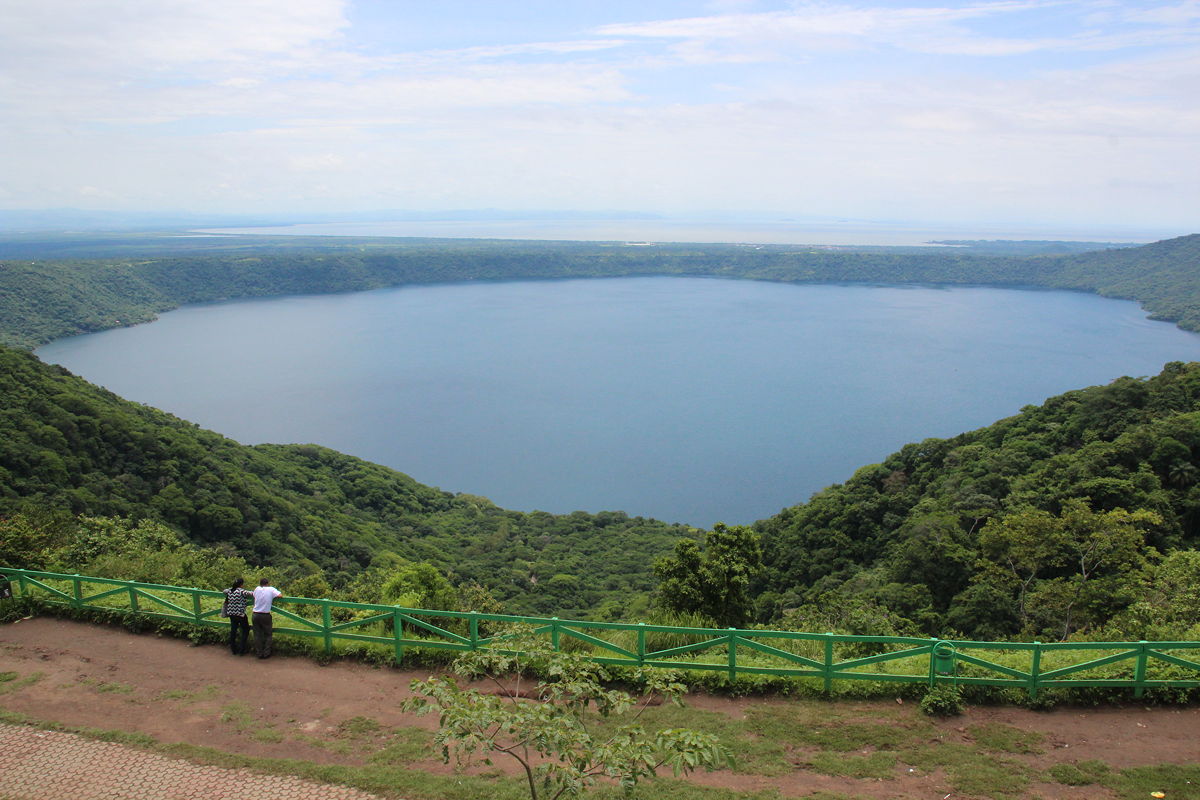
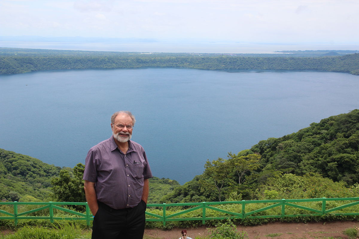
By 10:30 am, we reached our first destination, Apoyo Lake near the town of Santa Catarina. Apoyo Lake was a beautiful sight, being the blue waters in the collapsed crater (i.e. a caldera) of an extinct volcano. Nicaragua lies in a tectonic zone and like Costa Rica, experiences frequent earthquakes and volcanic eruptions. In that context, we were promised the sight of an active volcano later in the day.
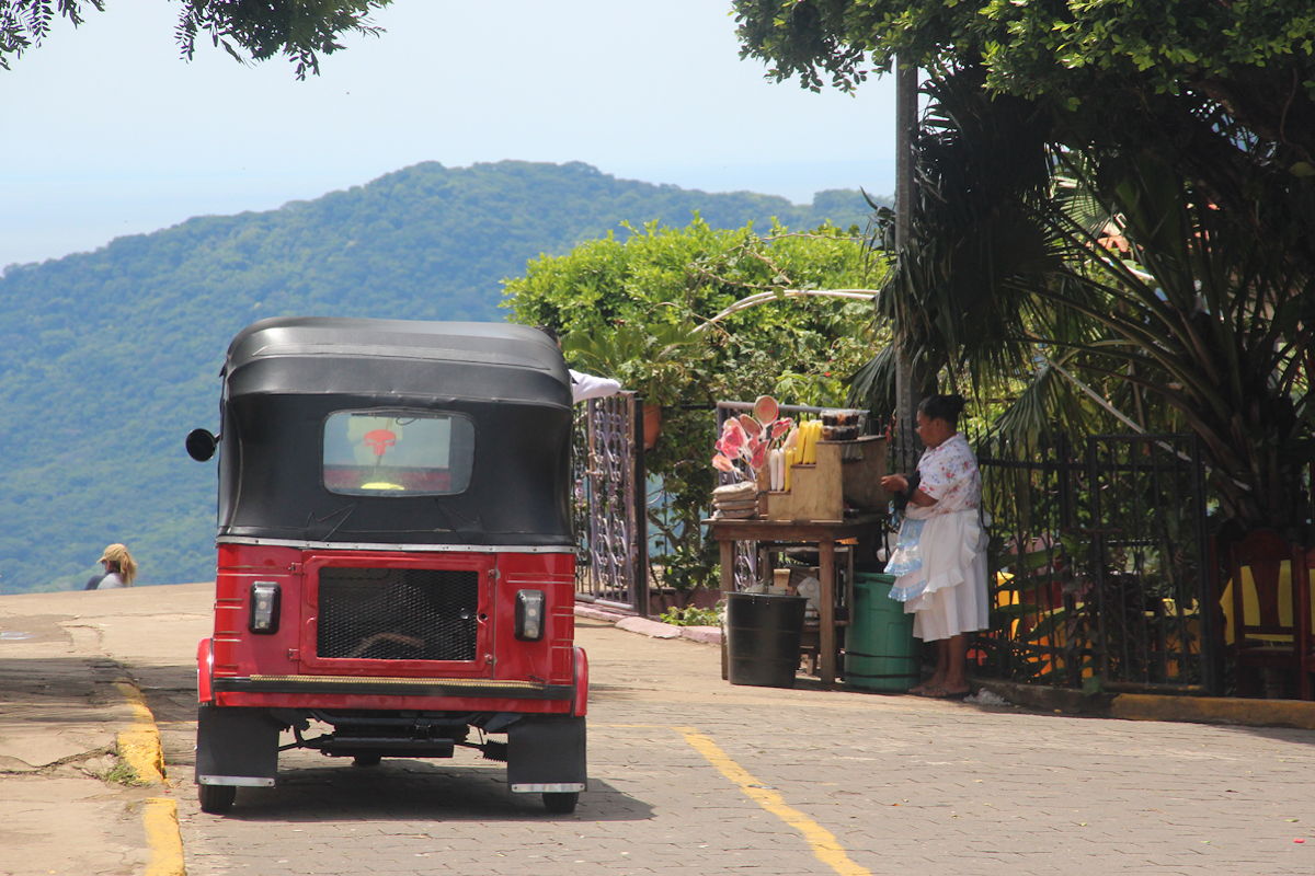
After spending 20 minutes at Apoyo Lake, we drove to the nearby town of Masaya. This was a fairly typical Nicaraguan town, but our target was not the interesting streets but a large market in the town centre, interesting surrounded by the historic walls of what seemed to be an old fortress. Our schedule required that we spend an hour at the market, which disappointed Di considerably less than me.
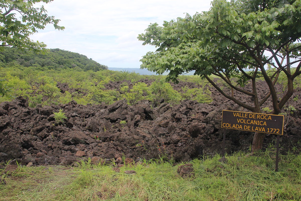
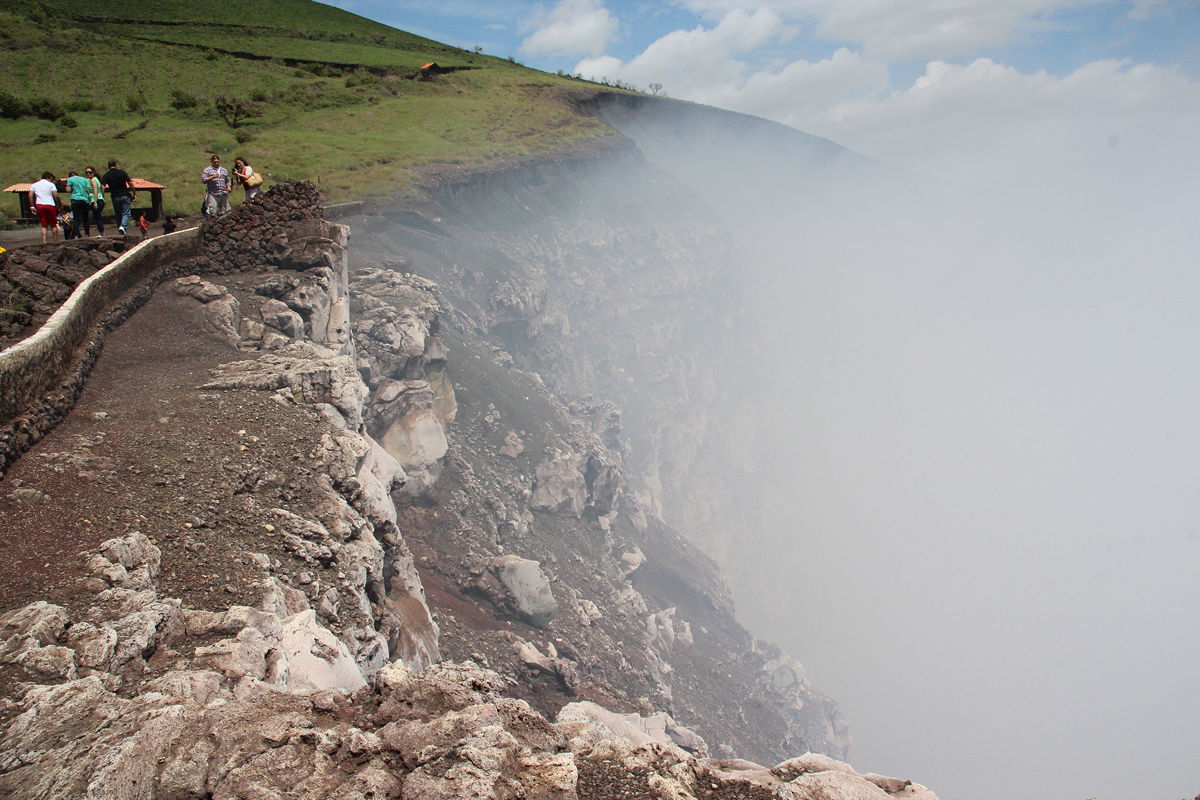
Having fulfilled our implied obligation to support a struggling LEDC economy (I bought a belt and Di purchased a small leather bag – or more precisely, I purchased a small leather bag for her), we proceeded to the north-west of Masaya town to Masaya Volcano, the promised active volcano, and the only active volcano in Nicaragua at which it is possible to drive to the summit rather than endure an arduous 7 to 9 hour climb.
This was an interesting visit. We stopped first at an overlook of the lava flow of the 1772 eruption, which I was fascinated to see still largely comprised jagged bare rock with only the early traces of a vegetation succession with ferns and small trees being evident.
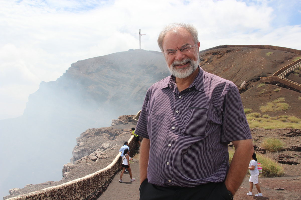
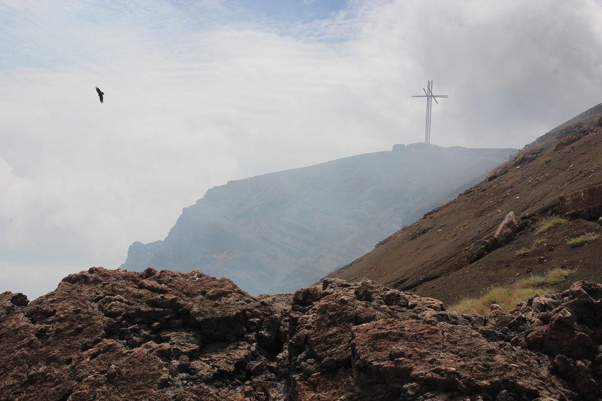
After that brief stop, we drove through various lava flows to the crater rim, a climb that was reported to be about 2,000 feet. As the volcano was an active one with liquid magma in the crater, we were counted before we began the ascent and we were instructed that we could remain at the summit for only 10 minutes.
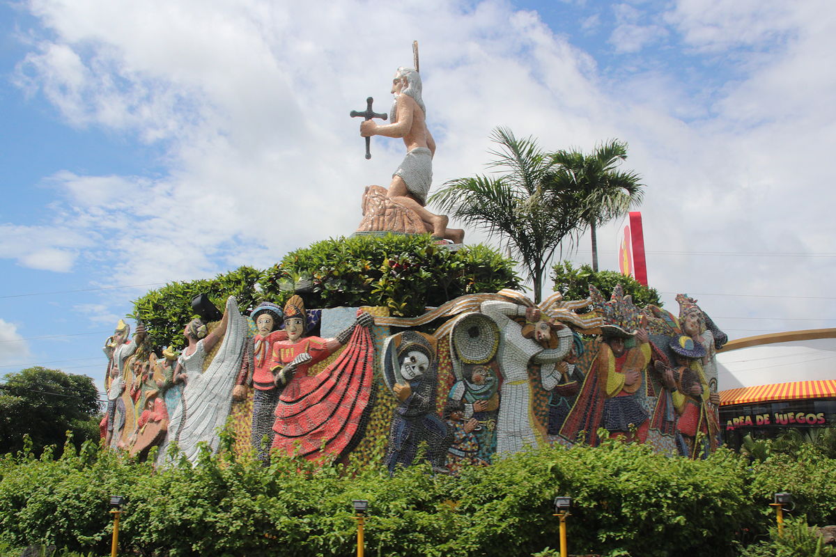
As it apparently always does, the volcano was producing thick white clouds of steam mixed with sulphur, so it was not possible to see down to the liquid magma. On a peak at the rim of the crater was a high cross, apparently erected by a priest who believed that Masaya Volcano was the gateway to hell, and therefore conducted an exorcism of the area to cleanse it of demonic spirits.
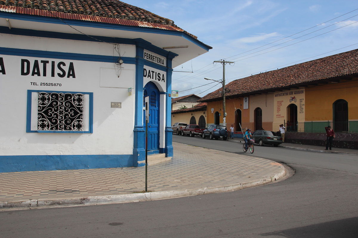
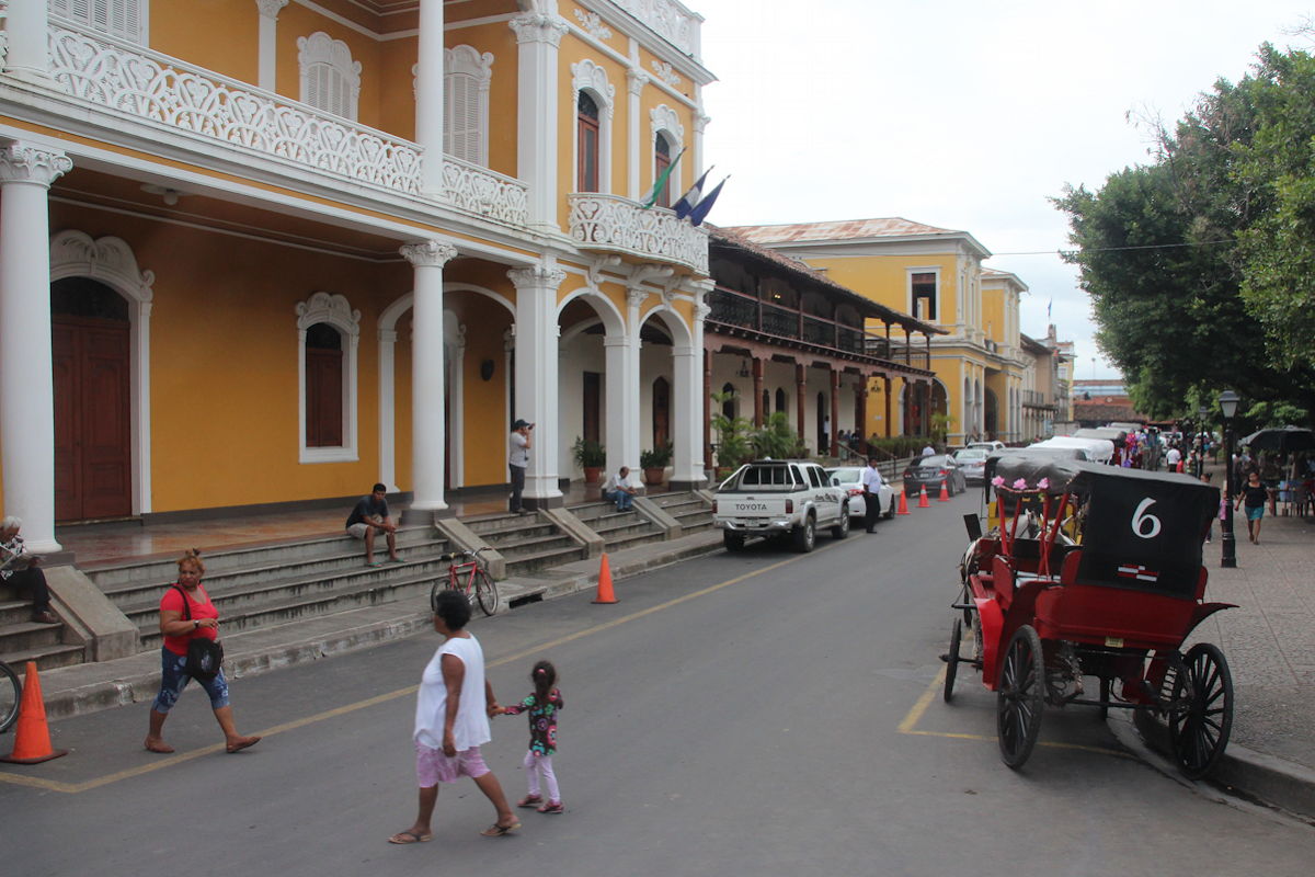
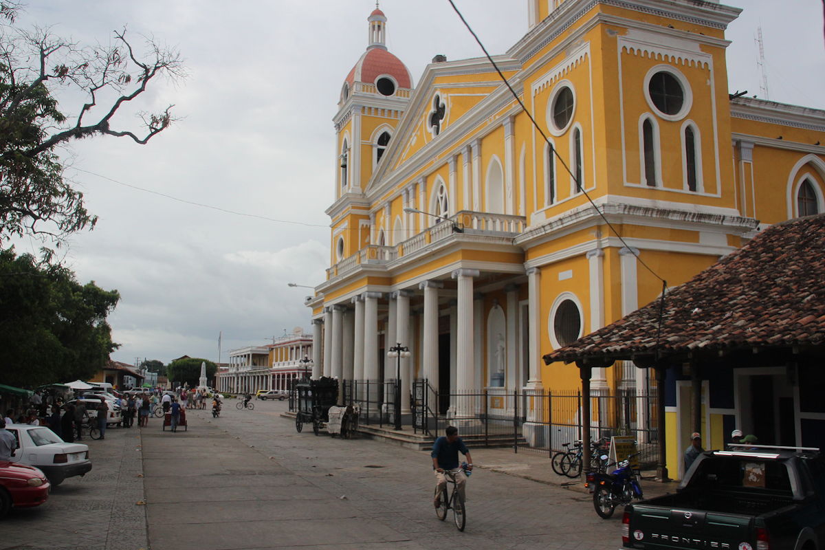
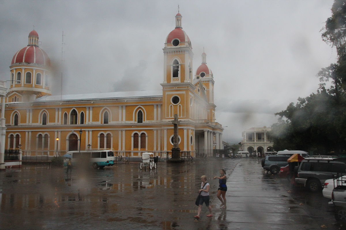
Having somewhat exceeded our allotted ten minutes, we descended the volcanic cone and took the short 20 minute drive to Granada. Granada was the first European settlement in the Americas, having been founded in 1524 by Francisco Hernández de Córdoba. The opportunity to see its Spanish colonial architecture was one of the main reasons I had wanted to visit Nicaragua.
Frustratingly, our first stop was not the town centre but a stop for lunch, which was in a 300 year old building just a few blocks from the main cathedral. After lunch, which took about an hour, the tour guide decided to postpone the walk around the colonial centre because rain was forecast and he wanted to make sure we could undertake a boat trip on Lake Nicaragua.
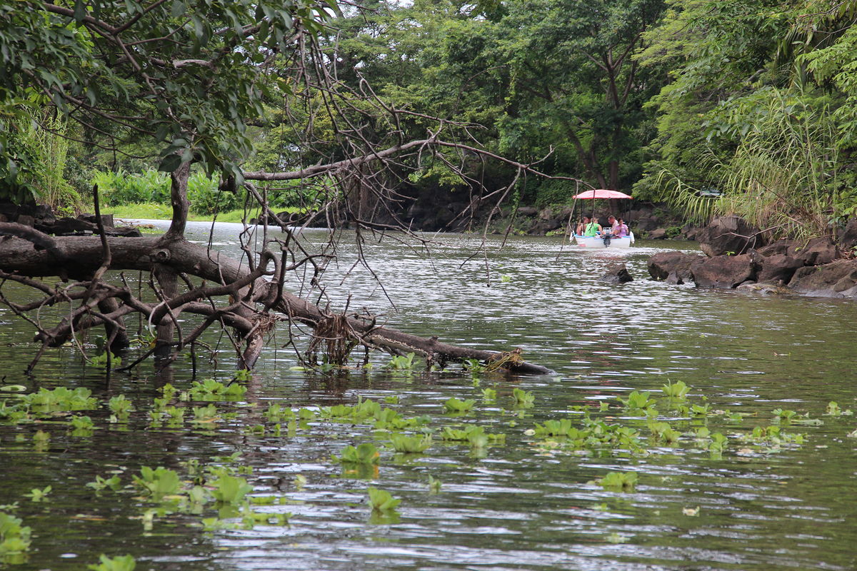
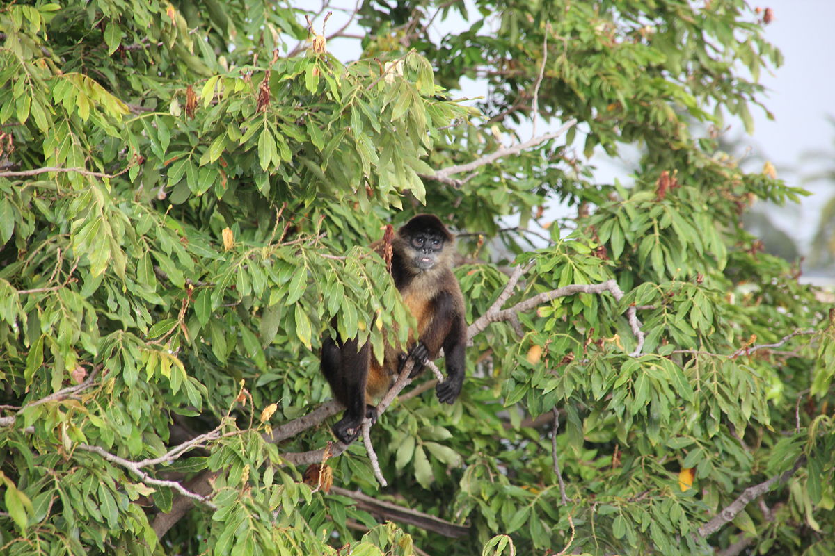
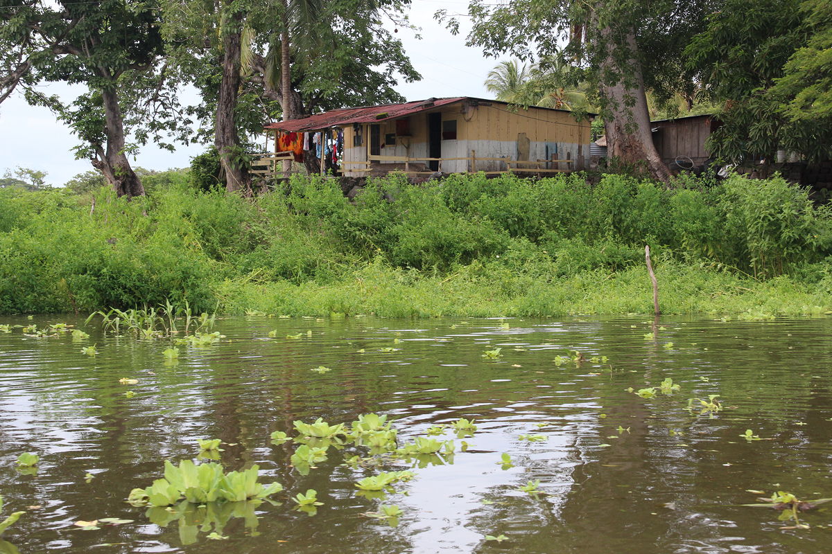
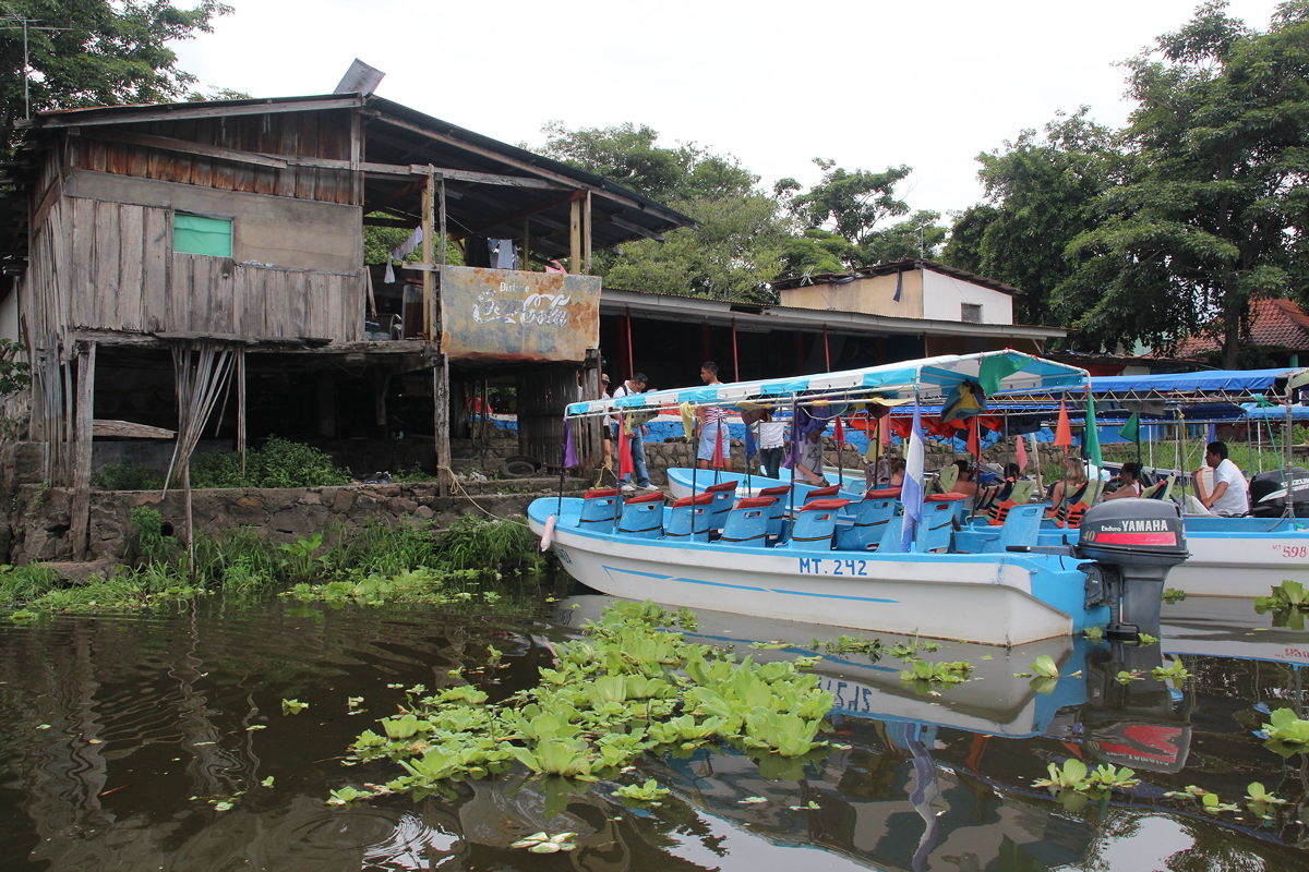
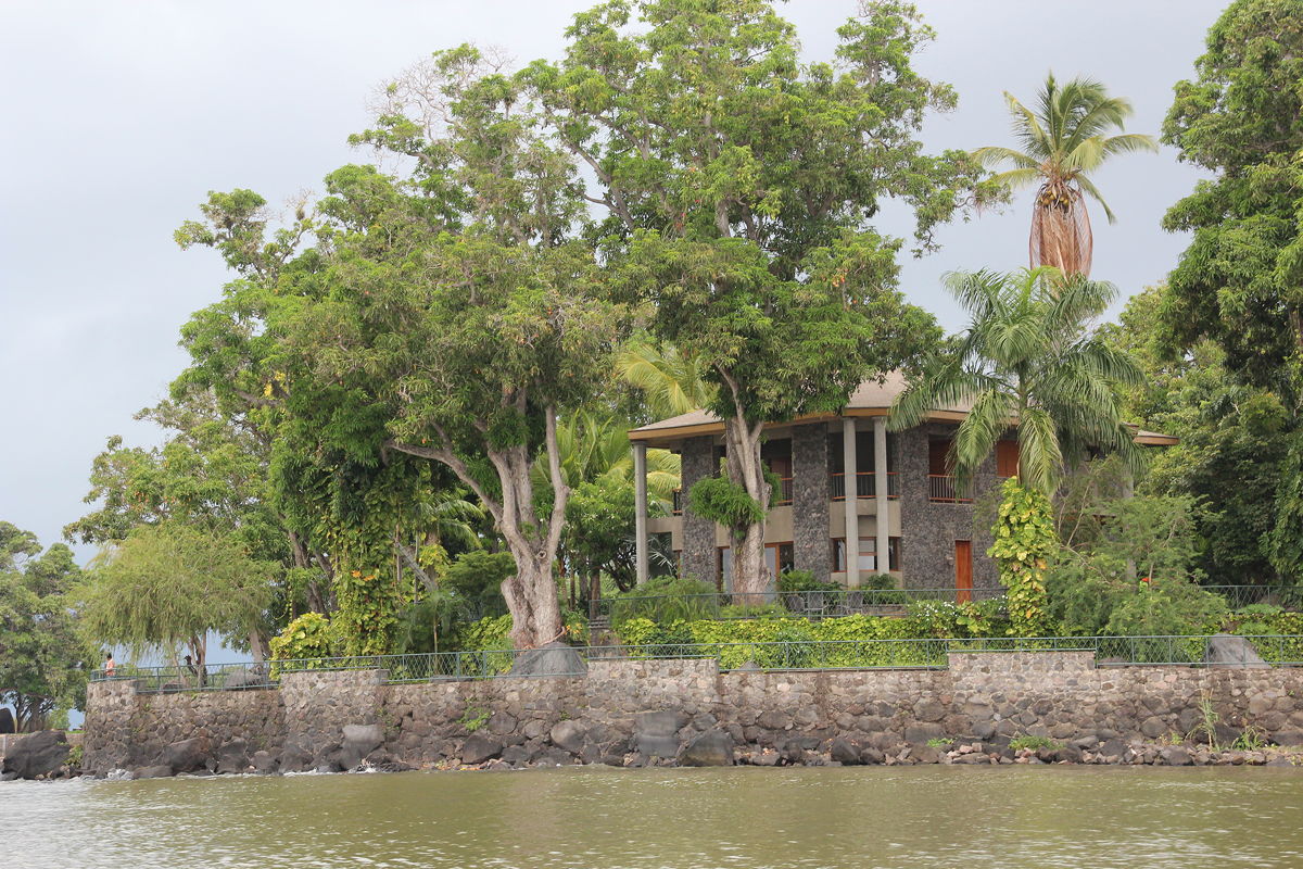
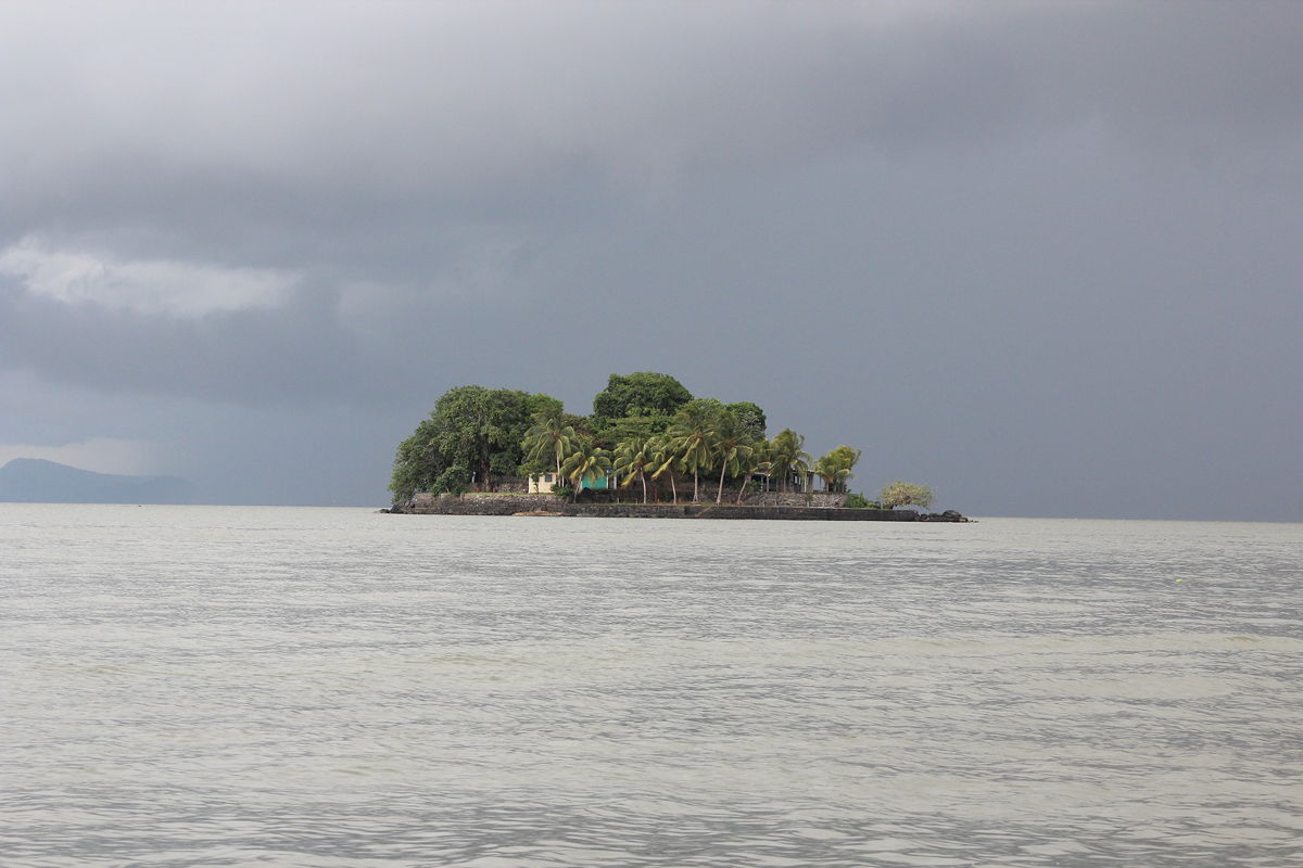
We therefore drove to the shoreline and boarded two small boats and headed out. The guide told us that Lake Nicaragua has 365 islands and he wanted us to see them all, as many were owned by very wealthy Nicaraguan families who had built some extravagant houses on them. He also excitedly told us that we would see some spider monkeys.
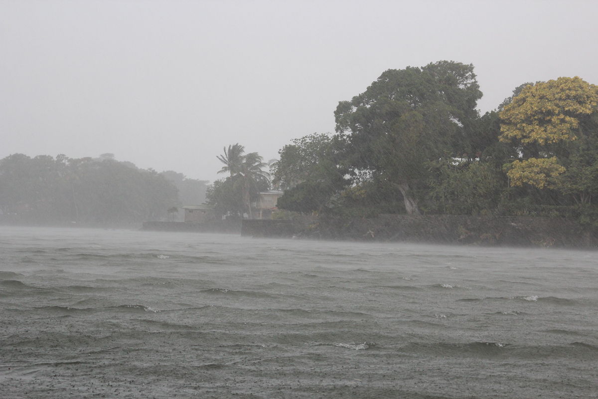
The trip did indeed include some pretty sights despite the towering dark grey clouds that were gathering overhead. Just as we reached the island with the spider monkeys the rain began, a torrential downpour with strong winds blowing the rain sideways into our open boat. We found ourselves to be saturated within the first minute, and I quickly came to appreciate that the waters of Lake Nicaragua are definitely a sub-optimal place to find oneself during a tropical downpour.
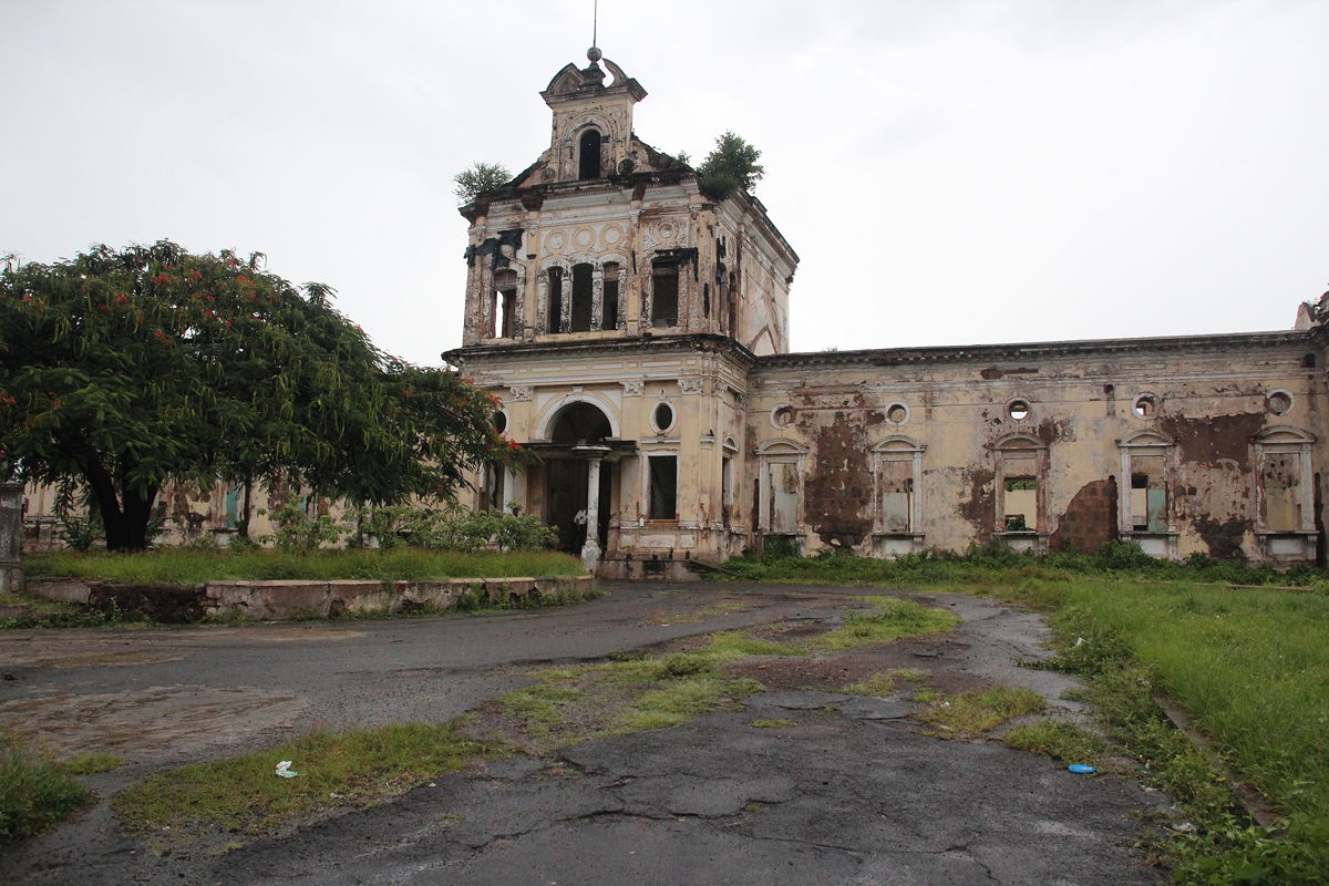
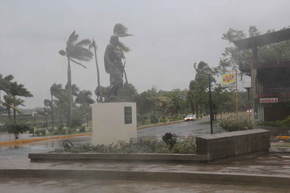
Because of the heavy rain, our walking tour of the colonial architecture of central Granada had to be cancelled, to my understandable disappointment. I tried to get some photos as we drove through the city, but the drops on the bus windows from the driving rain made getting good images all but impossible. We did manage one brief stop at the old hospital that was destroyed in the fighting of the civil war, but that was about all we managed to achieve before starting the hour and a half drive through the heavy rain back to the border.
The border crossings took even longer than they had in the morning. Almost two hours after arriving at the Nicaraguan exit point, we completed our procedures and left the Costa Rican entry point, arriving at Liberia about an hour and a half later, at 8:45 pm. We still had to get to Tamarindo, and this involved a separate minibus trip that delivered us to our hotel at 3 minutes to 10 pm – I noted the precise time because dinner at the hotel closed at 10 pm. We managed to squeeze in just as everything was being cleared away, finding ourselves dining alone apart from the staff who were cleaning up everything to minimize the amount of scraps left behind that apparently encourage nocturnal visits by scavenging raccoons.
We finally managed to get to bed at a little before 11 pm. It was a long day, but a thoroughly enjoyable one despite the frustration of missing the walk around Granada due of the rain.
Perhaps I need to return one day to take my time walking around Granada in fine weather.

Day 17 - Nicaragua
Monday
22 July 2013